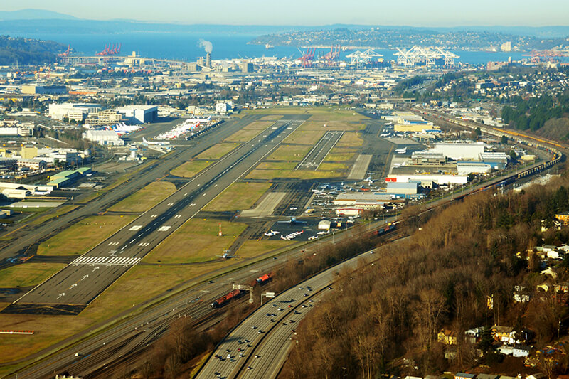
Airport Way S does not, as one might expect, go from the city to Seattle–Tacoma International Airport (known to locals as Sea–Tac), but rather to King County International Airport (better known as Boeing Field). It got its current name in 1931 at the request of the Georgetown-South Seattle Improvement Club, which, according to an article in the April 12 issue of The Seattle Times,
…asked the City Council to merge portions of Seattle Boulevard, Eighth and Ninth Avenues South and Duwamish Avenue, leading from the central business area to Boeing Field, into a new highway, to be known as Airport Way.… [They contended] that strangers are confused in efforts to find the airport by lack of any specifically designated street leading to it.
Seattle Boulevard originated as
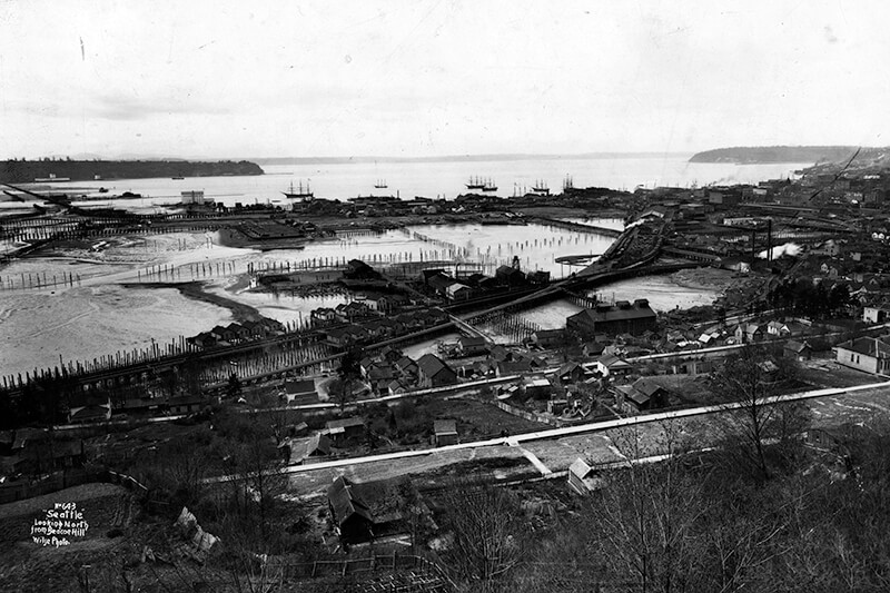
The Beach or River Road… [which] skirted the shore of the bay at the foot of the high Beacon Hill bluff, east of what is now Airport Way, and ran south along the Duwamish.… Built in the early fifties, [it] was a hard road to keep in good condition.… In 1886, a road was built on piling over the mud flats a little west of the Beach Road to avoid the slides and floods. This street became known as the Grant Street Bridge.
Sophie Frye Bass, Pig-Tail Days in Old Seattle
I elaborate in Diagonal Avenue S that
Essentially, there were a series of roads following the semicircular curve of Elliott Bay from Downtown to the Duwamish River before the tideflats were filled in: first Beach Road (or River Road), then the Grant Street Bridge, which in turn became Seattle Boulevard once the fill was complete. Sometime before 1918… the portion of Seattle Boulevard that ran northeast–southwest (the southern third of the semicircle) was renamed Diagonal Avenue. (In 1931, the rest of Seattle Boulevard was renamed Airport Way.)

Once Sea–Tac fully opened in 1949, Airport Way S no longer led to the region’s primary airport, which was more directly reached via U.S. 99, but no further name changes took place.
Today, Airport Way S begins at Seattle Boulevard S and 6th Avenue S and goes 6⅗ miles southeast, then south, then southeast again, ending at Boeing Access Road. Its lower 2½ miles parallel the eastern boundary of Boeing Field.

Born and raised in Seattle, Benjamin Donguk Lukoff had his interest in local history kindled at the age of six, when his father bought him settler granddaughter Sophie Frye Bass’s Pig-Tail Days in Old Seattle at the gift shop of the Museum of History and Industry. He studied English, Russian, and linguistics at the University of Washington, and went on to earn his master’s in English linguistics from University College London. His book of rephotography, Seattle Then and Now, was published in 2010. An updated version came out in 2015.