
This street was named for Carkeek Park, which encompasses 216 acres in the Broadview neighborhood, including Pipers Creek and nearly ½ a mile of Puget Sound waterfront (though the usable beach is much shorter, as the main line of the BNSF Railway cuts off public access to the rest). It was one of the “46 new street names to simplify street addresses” The Seattle Times reported on in its issue November 6, 1960, and was made up of “Sixth Avenue Northwest from West 110th to West 111th Streets, West 111th Street from Sixth to Seventh Avenues Northwest, Seventh Avenue NW from West 111th to West 114th Streets, and West 114th Street from Seventh Avenue NW to West 116th Street.” (Part of this route was once Puget Drive, part of the 1911 View-Lands Addition.)
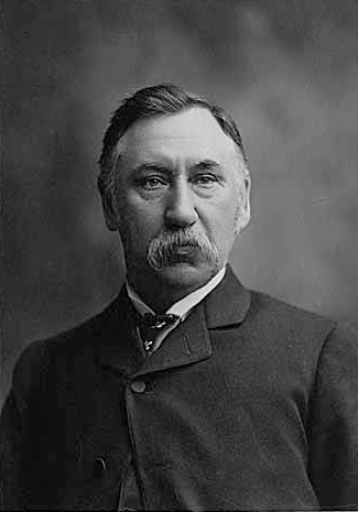
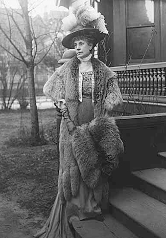
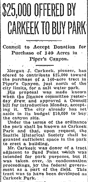
The park itself opened in 1929 and was named for Morgan James Carkeek (1847–1931) and his wife, Emily Gaskill Carkeek (1852–1926). According to the Museum of History & Industry, “Morgan… was an accomplished stonemason and successful building contractor who built several of Seattle’s early stone buildings, such as the Dexter Horton Bank, and large office buildings, including the Burke and Haller buildings.” In 1918, he and Emily donated land to the city for the first Carkeek Park, located along Lake Washington where Magnuson Park is today, but soon thereafter plans were made to develop Naval Air Station Seattle on the land, and the park was taken over by the Navy in 1926. The Carkeeks donated $25,000 to the city to purchase land elsewhere, and with the addition of $100,000 in public funds the city was able to buy Piper’s Canyon.

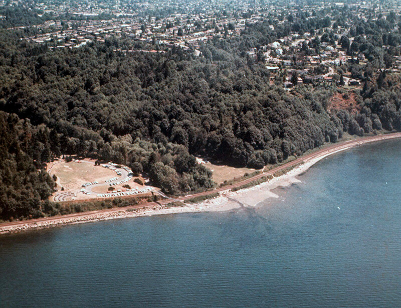
NW Carkeek Park Road begins at NW 110th Street and Puget Drive NW and winds ½ a mile northwest to the entrance to Carkeek Park at NW 114th Street. Within the park, it goes a further ½ mile west, ending at a parking lot, picnic area, and playground. (This portion appears to have once been known as Piper’s Canyon Road or Pipers Road.) From here, there is a bridge over the BNSF Railway tracks to a beach along Puget Sound and the mouth of Pipers Creek.


Born and raised in Seattle, Benjamin Donguk Lukoff had his interest in local history kindled at the age of six, when his father bought him settler granddaughter Sophie Frye Bass’s Pig-Tail Days in Old Seattle at the gift shop of the Museum of History and Industry. He studied English, Russian, and linguistics at the University of Washington, and went on to earn his master’s in English linguistics from University College London. His book of rephotography, Seattle Then and Now, was published in 2010. An updated version came out in 2015.