Puget Boulevard SW

Puget Boulevard is a curious street, for a number of reasons:

  • The paved portions are only a few blocks long — hardly comparable to, say, Lake Washington Boulevard or Magnolia Boulevard;
  • Both east–west and north–south portions are called Puget Boulevard SW, contrary to the rule that directional designations precede street names for east–west streets (this is why Lake Washington Boulevard E becomes E Lake Washington Boulevard when it curves west on its approach to Montlake Boulevard E);
  • Despite its name, it has no view of Puget Sound, sitting as it does in the Longfellow Creek valley in the Delridge neighborhood of West Seattle;
  • And, as it turns out, it isn’t even named for Puget Sound, as might be expected, but rather for the Puget Mill Company (later part of Pope & Talbot and today part of Rayonier).

The Puget Mill Company, which once owned large swaths of land in the city (including what became the Washington Park Arboretum and the Broadmoor Golf Club), made two donations to the city in 1912, according to the Ninth Annual Report of the Board of Park Commissioners:

  • “A rugged tract of logged-off land south of Pigeon Point and Youngstown in the large unplatted area” (20.5 acres — this became Puget Park); and
  • “A strip of land 160 feet in width extending from Sixteenth Avenue Southwest and Edmonds Street (sic) to Thirty-fifth Avenue Southwest and Genessee Street, a distance of 8,500 feet, and comprising an area of about fifteen acres for parkway purposes. Under the conditions of this gift improvement work must be undertaken within five years. This acquisition forms an important link in the contemplated boulevard to West Seattle.”

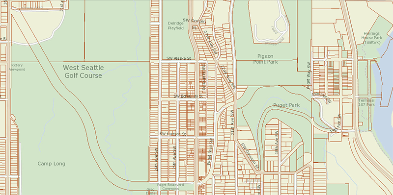
This strip is today’s Puget Boulevard SW. Two things become apparent when looking at the King County Parcel Viewer map of West Seattle:

Map of Puget Boulevard, from King County Parcel Viewer

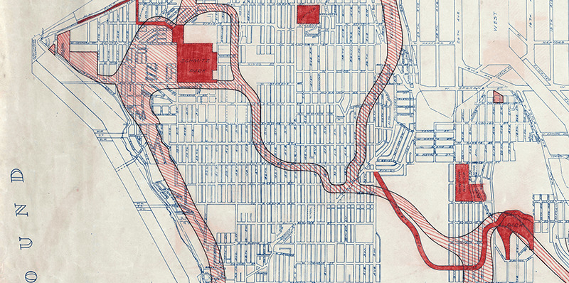
Once past the present site of West Seattle Stadium, the “contemplated boulevard to West Seattle” was to have run, as the Friends of Seattle’s Olmsted Parks puts it,

[Across] California Avenue a few blocks north of [the] present-day Alaska Junction, at that time part of the “Boston Subdivision.” It would have then headed northwest and down a ravine, eventually turning southwest to terminate at Alki Point.

Map of proposed West Seattle Parkway, cropped from a 1928 map of Seattle's park system
Map of proposed West Seattle Parkway, cropped from a 1928 map showing both existing (red) and proposed (red hatched) park features. Puget Park and Boulevard are at lower right. Courtesy of the Seattle Municipal Archives, Identifier 2333.

Returning to the question of the name — the Puget Mill Company was, of course, named after Puget Sound, which itself was named in 1792 by Captain George Vancouver of HMS Discovery for Lieutenant Peter Puget (1765–1822).

Today, the paved portion of Puget Boulevard SW begins at 23rd Avenue SW, about 1⁄10 of a mile north of SW Hudson Street, and goes ⅕ of a mile south to a dead end. After a very short section — not more than 150 feet long — east of Delridge Way SW, which serves as a driveway for a complex of townhouses, it resumes west of a foot path off Delridge and goes about 1⁄10 of a mile west to 26th Avenue SW. Along this stretch, there are houses to the north and the Delridge P-Patch and Puget Boulevard Commons to the south.

Patten Place W

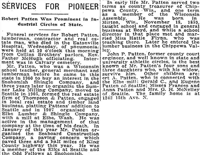
This street was established in 1906 as part of the plat of Patten’s Addition to the City of Seattle, filed by Robert James Patten (1859–1919) and his wife, Harriet (Hattie) Flynn Patten (1866–1959).

According to an article in the October 29, 1905, issue of the Seattle Post-Intelligencer, Robert bought the tract from H.M. Haller for $9,000. According to the obituary reproduced below, he was a “lumberman, contractor, and real estate man,” originally from Wisconsin, who had come to Seattle that very year, though he had been living in Washington since 1900.

Obituary of Robert James Patten, The Seattle Times, October 6, 1919

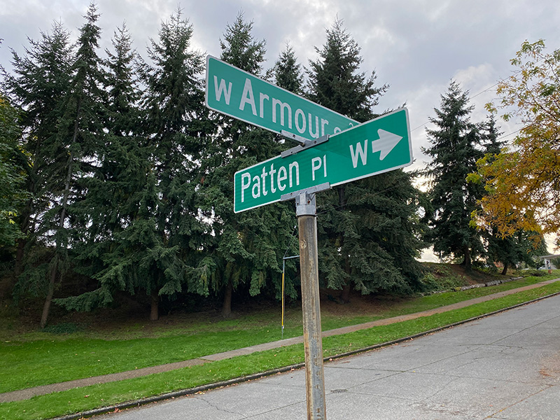
Patten Place W begins at W Armour Street just north of Bayview Playground and goes about 420 feet north to a dead end, though the undeveloped right-of-way continues on for about 250 feet more to the likewise undeveloped right-of-way of W Barrett Street.

Street sign at corner of Patten Place W and W Armour Street, October 17, 2021
Street sign at corner of Patten Place W and W Armour Street. Photograph by Benjamin Lukoff, October 17, 2021. Copyright © 2021 Benjamin Lukoff. All rights reserved.

Point Place SW

This street, which was created in 1936, was named after Alki Point. Alki Avenue SW runs southwest from Duwamish Head to about 450 feet northeast of the point, where it turns south for a block and then becomes Beach Drive SW; Point Place continues another 200 or so feet toward Alki Point.

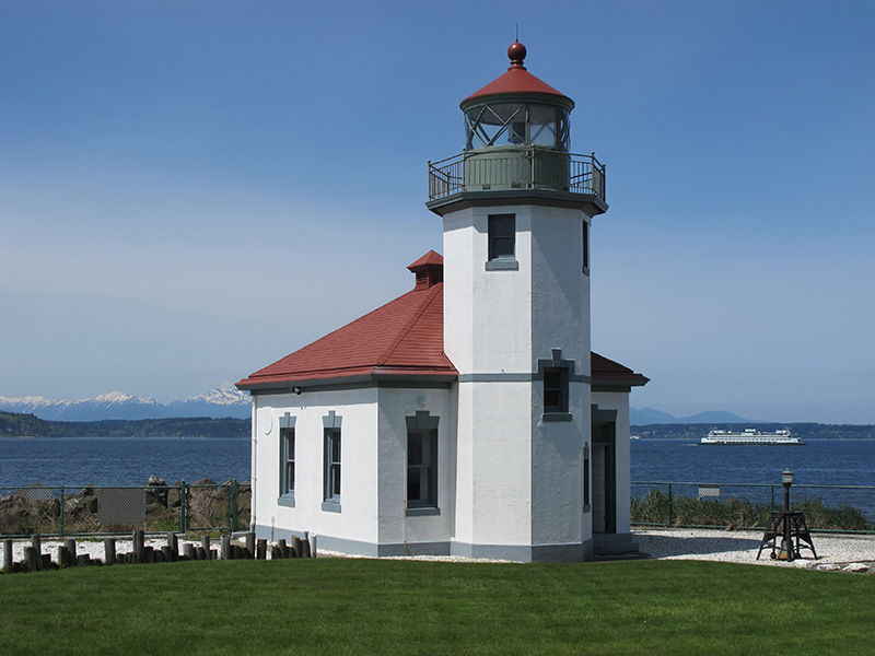
Alki Point Lighthouse, May 4, 2011. The first light here was supposedly hung in the 1870s; the U.S. Lighthouse Board installed an official one in 1887. The present lighthouse was built in 1913 and automated in 1984. Access is from Alki Avenue SW rather than Point Place SW. Public domain photograph by U.S. Coast Guard Chief Petty Officer Robert Lanier.
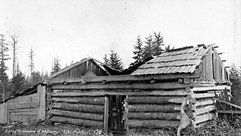
Arthur Armstrong Denny (1822–1899), the leader of the Denny Party that landed at Alki Point on November 13, 1851, helped build this cabin. Most of the party moved to what is now Pioneer Square the next spring. Photograph by Frank LaRoche, no date (though no later than 1891, when the cabin, shown here in ruins, was demolished).
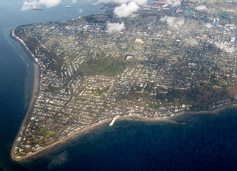
Aerial view of West Seattle, March 17, 2009. Alki Point is in the lower-left-hand (west) corner; Duwamish Head is in the upper-left-hand (north) corner. The green spaces in the foreground, from left to right (north to south), are the Duwamish Head Greenbelt, Schmitz Preserve Park, and Mee-Kwa-Mooks Park. Elliott Bay lies north and east of Alki Point; the rest of the water is Puget Sound. Public domain photograph by Dcoetzee, Wikimedia Commons.

Alki Avenue SW

The settlement at Alki Point established by the Denny Party in 1851 was originally named New York. By a process that is not entirely clear, the name became New York–Alki, and then just Alki. Alki means ‘by and by’ or ‘someday’ in Chinook Jargon, the implication being that the settlement might rival New York… someday. Charles C. Terry officially applied the Alki name to the town plat he filed in 1853, and the point, street, and neighborhood were all named after it.

In the introduction to her 1937 book, Pig-Tail Days in Old Seattle, Sophie Frye Bass writes:

Please everyone, pronounce Alki as the Indians did, as if it were spelled “Alkey.”

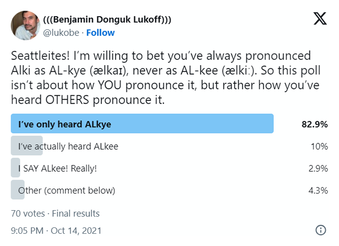
Hardly anyone does this anymore — in fact I don’t think I’ve ever heard someone say /ælkiː/ in all seriousness when talking about West Seattle. /ælkaɪ/ is by far the preferred pronunciation, as shown by this informal Twitter poll I ran:

A screen shot of a Twitter poll by me, asking "Seattleites! I’m willing to bet you’ve always pronounced Alki as AL-kye (ælkaɪ), never as AL-kee (ælkiː). So this poll isn’t about how YOU pronounce it, but rather how you’ve heard OTHERS pronounce it." "I've only heard ALkye" gets 82.9%, "I've actually heard ALkee" 10%, "I SAY ALkee! Really" 2.9%, and Other (comment below) 4.3%

Note: On July 10, 2024, I began converting embedded tweets on this website to screenshots because of issues with how they were integrating with WordPress, which began not too long after Elon Musk purchased Twitter and changed its name to X.

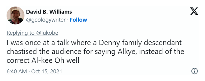
Apparently the Denny descendants (Bass was the daughter of Louisa Catherine Denny, herself the daughter of Arthur Armstrong Denny and Louisa Catherine Boren) still prefer — nay, insist — on ALkee:

A screen shot of a tweet by Knute Berger saying "The Dennys insist on AL-kee"
A screen shot of a tweet by David B. Williams saying "I was once at a talk where a Denny family descendant chastised the audience for saying Alkye, instead of the correct Al-kee Oh well"
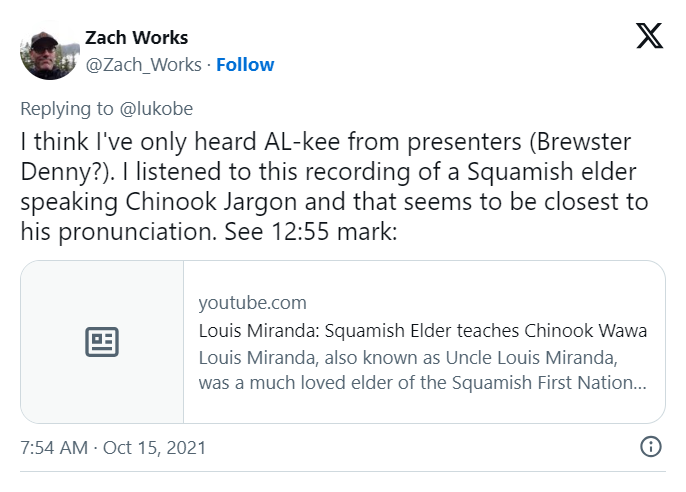
A screen shot of a tweet by Zach Works saying "I think I've only heard AL-kee from presenters (Brewster Denny?). I listened to this recording of a Squamish elder speaking Chinook Jargon and that seems to be closest to his pronunciation. See 12:55 mark:"
Louis Miranda: Suqmish Elder teaches Chinook Wawa on YouTube
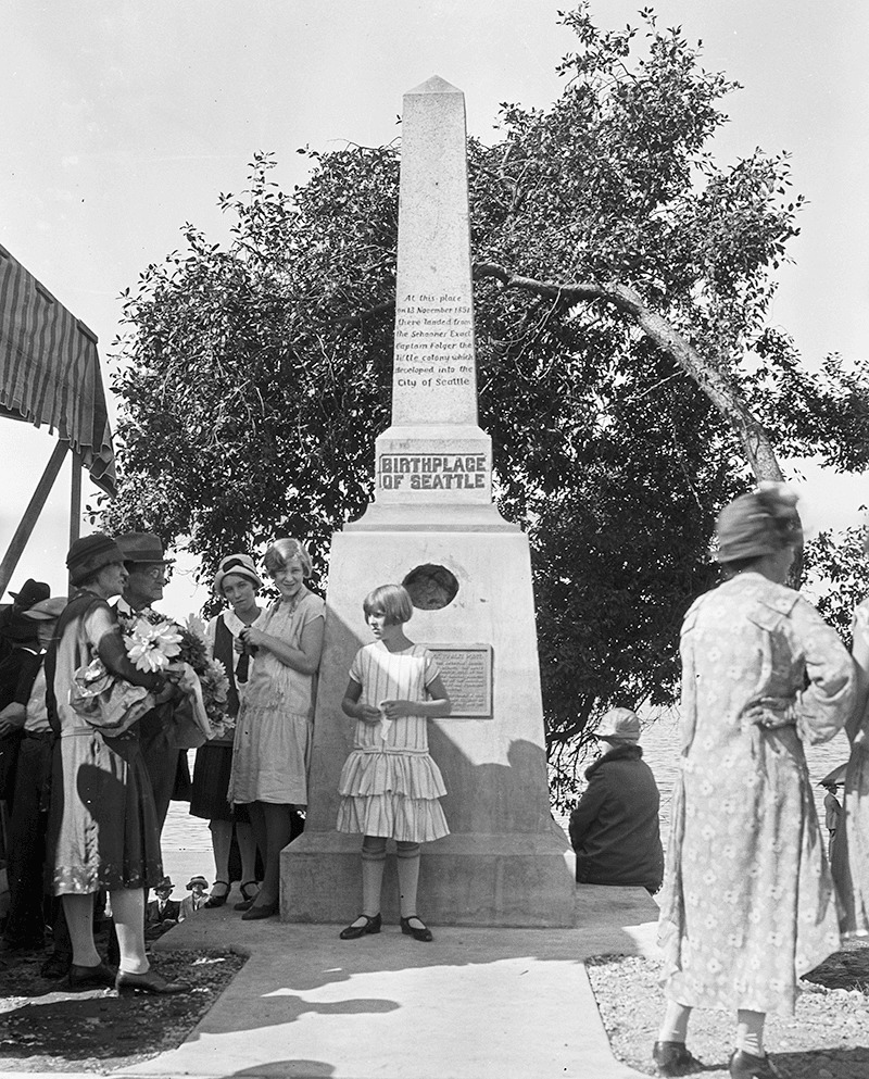
Birthplace of Seattle monument, 1926. Courtesy of the Seattle Municipal Archives, Identifier 46980
Birthplace of Seattle monument, 1926. Originally dedicated in 1905 on the 54th anniversary of the landing of the Denny Party at Alki Point, it reads “At this place on 13 November 1851 there landed from the Schooner Exact Captain Folger [and] the little colony which developed into the City of Seattle.” It was rededicated, with a new foundation, on September 4, 1926 (likely the date of this photograph). A stone from near Plymouth Rock, Massachusetts, was put in the foundation, and the new plaque reads “From Plymouth Rock to Alki Point: Honoring pioneers on the American shores of the Atlantic and Pacific Oceans, the above stone was brought from Plymouth Rock by the First Transcontinental Motorized Caravan, managed by James H. Brown, and endorsed by the American Automobile Association. This tablet was furnished by the Automobile Club of Washington. The unveiling ceremonies on September 4, 1926, was participated in by officers and citizens of. the City of Seattle, the County of King and the State of Washington.” Courtesy of the Seattle Municipal Archives, Identifier 46980

As noted in Harbor Avenue SW and Beach Drive SW, the Alki Avenue name once stretched from Lincoln Park around Alki Point and Duwamish Head to the industrial area near Harbor Island, but sometime between 1912 and 1920 the name was reduced to the portion between Alki Point and Duwamish Head.

Today, Alki Avenue SW begins at Harbor Avenue SW by Duwamish Head and goes 2⅕ miles southwest to Beach Drive SW.

Military Road S

In the late 1850s, the federal government began construction on a road connecting Fort Steilacoom in Pierce County to Fort Bellingham in Whatcom County. By the end of the decade, the military road had been finished (just in time for Fort Bellingham to close). The route it took through Seattle included what are now Beacon Avenue S, 1st Avenue, Dexter Avenue N, Westlake Avenue N, and Fremont Avenue N, among other streets. South of Seattle, much of the road still exists with its original name, but within the city limits, only a bit of Military Road S remains:

  • A 750-foot-long stretch between Beacon Avenue S at 27th Avenue S and Van Asselt Elementary School south of S Myrtle Street
  • A ½-mile-long stretch between S Othello Street just south of the school to the Union Pacific railroad tracks east of Airport Way S, just west of Interstate 5
Military Road on Beacon Hill, circa 1900, from https://digitalcollections.lib.washington.edu/digital/collection/imlsmohai/id/9883
Military Road passing through what may be the Comet Lodge Cemetery on Beacon Hill, circa 1900

Beach Drive SW

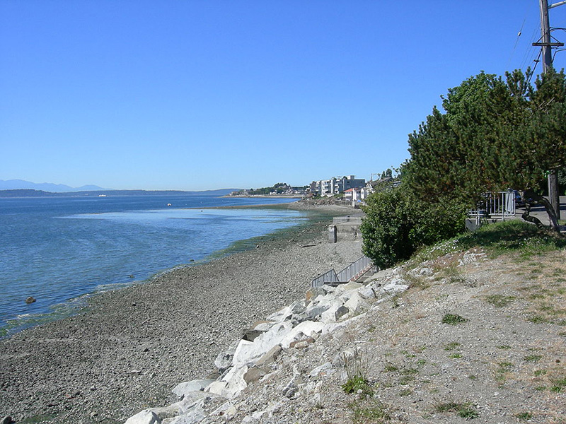
Like Harbor Avenue SW, Beach Drive SW was once part of Alki Avenue SW. It became Beach Drive sometime between 1912 and 1920. In contrast to Alki and Harbor Avenues, most of Beach Drive’s beaches are private, though there is a long public stretch at the Emma Schmitz Memorial Outlook, as well as Lowman Beach Park at the south end.

Puget Sound shore looking northwest along Beach Drive with Alki Point in distance, August 2007
Puget Sound shore looking northwest along Beach Drive toward Alki Point, August 2007. Photograph by Joe Mabel, Wikimedia Commons, licensed under Creative Commons Attribution-ShareAlike 3.0 Unported

Beach Drive SW begins at Alki Avenue SW just south of Alki Point and goes just over 3 miles southeast to Trail #1 at Lincoln Park.

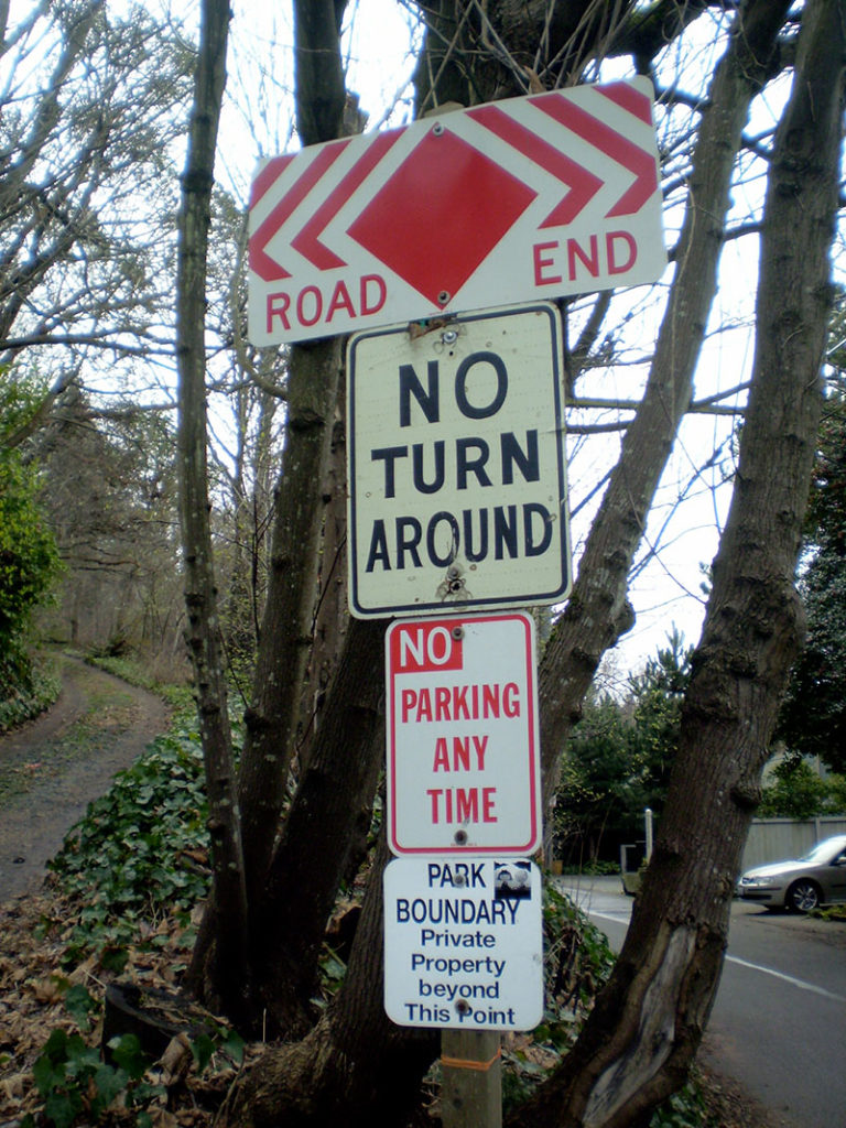
Signs at Beach Drive SW road end, March 2013
Signs along Beach Drive SW a little under 1,000 feet north of Lincoln Park. The park boundary sign is unofficial. Its placement appears to imply that the tail end of Beach Drive is private, which it’s not. Nor is the driveway (SW Othello Street) on the left. Photograph by Benjamin Lukoff, March 10, 2013. Copyright © 2013 Benjamin Lukoff. All rights reserved.

Harbor Avenue SW

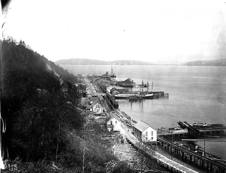
As noted in Alaskan Way, Harbor Avenue SW was once part of Railroad Avenue. When the Elliott Bay tidelands were platted in 1895, Railroad Avenue stretched from (using current landmarks) the Magnolia Bridge along the waterfront to the Industrial District, then across Harbor Island to West Seattle, ending southwest of Duwamish Head. In 1907 the West Seattle portion was renamed Alki Avenue, and sometime between 1912 and 1920 it was given its current name.

Looking northwest up what is now Harbor Avenue SW toward Duwamish Head, April 1902

Today, Harbor Avenue SW begins at SW Avalon Way and SW Spokane Street at the west end of the West Seattle Bridge and goes 1¾ miles northwest to Duwamish Head, where it becomes Alki Avenue SW.

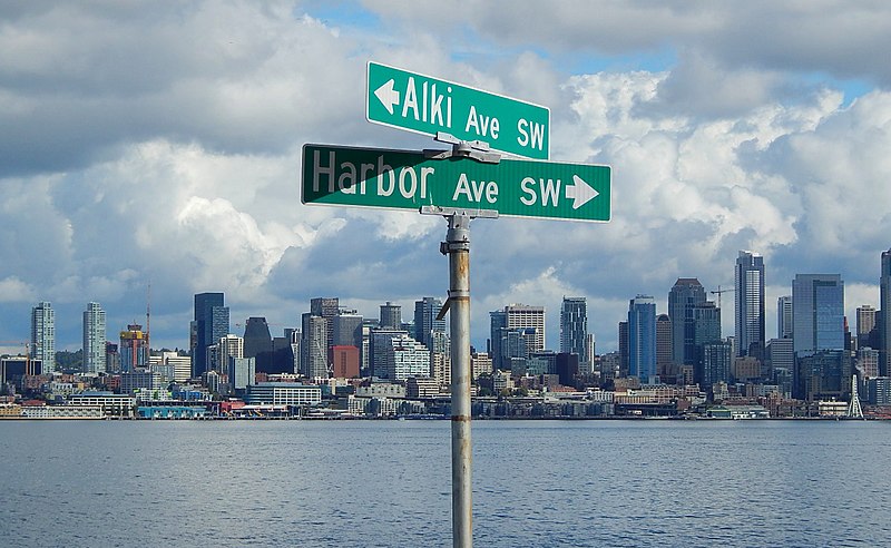
Street sign at corner of Harbor Avenue SW and Alki Avenue SW, October 2017
Street sign at corner of Harbor Avenue SW and Alki Avenue SW, Duwamish Head, with Elliott Bay and downtown Seattle in background, October 2017. Photograph by Ron Clausen, Wikimedia Commons, licensed under Creative Commons Attribution-ShareAlike 4.0 International

Alaskan Way

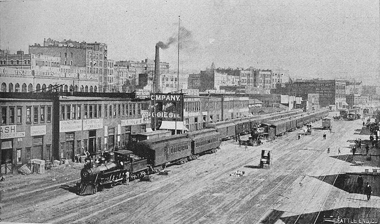
Alaskan Way was originally Railroad Avenue. Jennifer Ott writes for HistoryLink.org:

On the central waterfront a web of railroads grew out from the shore in the 1880s and 1890s as various railroads, including the Columbia & Puget Sound, the Seattle, Lake Shore & Eastern, and the Northern Pacific jockeyed for space at the foot of the bluffs that ended at the beach, where Western Avenue is today. In January 1887 the City Council passed an ordinance establishing Railroad Avenue, a street created, according to historian Kurt Armbruster, to provide space for the Seattle, Lake Shore & Eastern franchise to the west of the Northern Pacific’s franchise along the shoreline.

Railroad Avenue looking south from between Madison and Marion Streets, circa 1898

When the tidelands were platted in 1895, Railroad Avenue extended to Harbor Island and West Seattle, but:

  • Sometime between 1912 and 1920 the Harbor Island portion was renamed W Florida Street (SW Florida Street today).
  • In 1907, the West Seattle portion was renamed Alki Avenue.
    • Sometime between 1912 and 1920 the West Seattle portion southeast of Duwamish Head was given its current name, Harbor Avenue.

In an article for Crosscut (now CascadePBS.org), Knute Berger explains why a new name was wanted for the remainder:

Seattle’s waterfront was unpaved — a beat-up plank road ran its length. There was no modern seawall — the street was built over the water. Train tracks were everywhere.… But the waterfront was undergoing a massive renovation. A seawall was being constructed, the shoreline filled in, the road made into a wide, paved boulevard.…

According to Berger and Ott’s articles, names that were proposed but were ultimately rejected included Anchors Way, Artery Way, Battery Way, Bois Boolong, Bread Street, Cargo Way, Chief Seattle Avenue, Cosmos Quay, Dock Street, Export Way, Fleet Way, Gateway Avenue, Golden West Way, Hiak Avenue, Klatawa Avenue, Maritime Avenue, Metropolis Avenue, Olympian Way, Pacific Way, Pier Avenue, Port Strand, Port Way, Port-Haven Drive, Potlatch Avenue, Puget Avenue, Puget Dyke, Puget Portal, Queen City Way, Roadstead Way, Salt Spray Way, Salt Water Avenue, Seawall Avenue, Seven Seas Road, Skookum Way, Steamship Way, Sunset Avenue, Terminal Avenue, Terrebampo Way, The Battery, The Esplanade, Transit Row, Voyage Way, Welcome Way, and Worldways Road. (Those in italics apparently came under serious consideration.)

So how did we end up with Alaskan Way? And why Alaskan instead of Alaska (the already existing S Alaska Street could have been renamed)?

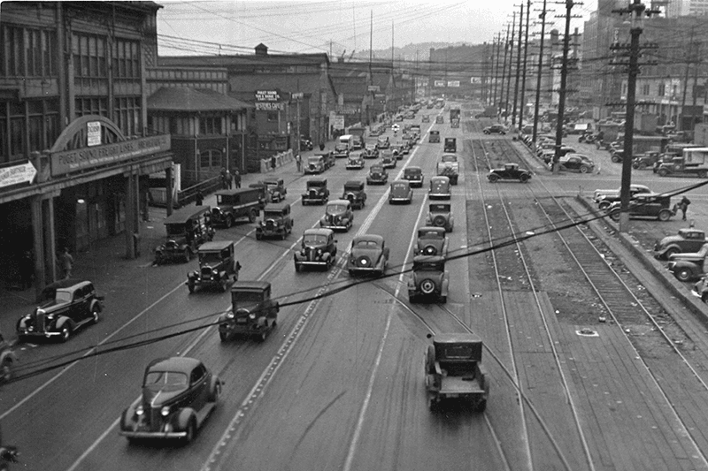
Alaskan Way, July 1939
Alaskan Way between Marion and Madison Streets, Canadian National Dock at left, July 1939. Courtesy of the Seattle Municipal Archives, Identifier 77093

The May 19, 1932, issue of The Seattle Times reports that the Seattle Maritime Association had run a renaming contest which received “more than one thousand letters… some of them contained scores of suggestions.” 4,868 names (including duplications) were received, and the judges selected four finalists, in order of preference: Puget Portal (one submission), Klatawa Avenue (one submission, from Chinook Jargon word meaning ‘to go, to travel’), Hiak Avenue (one submission, from Chinook Jargon word meaning ‘lively, quick and fast’), and Maritime Avenue (49 submissions [Maritime Way received 99 submissions but was not chosen]). The next day, the Times reported that the judges had chosen Maritime Avenue, and awarded the $20 prize to a Mr. B.I. Schwartz, the first to have suggested the name.

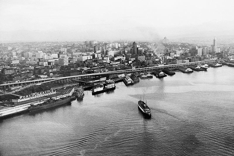
Alaskan Way Viaduct, July 1952
Alaskan Way Viaduct, July 1952, the year before it opened. The double-decker freeway paralleled Alaskan Way as far north as Union Street, where it diverged from the alignment on its approach to Elliott Avenue and the Battery Street Tunnel. Bell Street Pier, with the large Port of Seattle sign, is at left. The Bell Street Overpass can be seen behind the ‘P’ in ‘Port’. The bridge at the southern end of the pier is the Lenora Street Viaduct. Courtesy of the Seattle Municipal Archives, Identifier 43586

However, that July, a George D. Root proposed the name Cosmos Quay. At first, it was met with indifference, and then it seems the entire renaming project was put on the back burner until construction progressed. Somehow, when he restarted his campaign in 1934, Cosmos Quay became a leading candidate, and it was approved unanimously by the city council on January 14, 1935. An ordinance began to be drafted. But, as the Seattle Post-Intelligencer noted the next day, this was only because one councilmember, Frank J. Laube, had been absent… and he was adamantly opposed.

He wasn’t the only one. The Seattle Times published an editorial on January 20 headlined ‘City Locksmith Needed for Pronunciation Key’, which proclaimed that “to burden the waterfront stretch with a name that could be used and understood only through long courses in cosmogony, cosmology, etymology, and articulation would be a sad piece of nonsense for which there is no excuse.” The next day the Times reported that David Levine, city council president, said Cosmos Quay “no longer sounds so good to him. Many citizens have complained its meaning, as well as its pronunciation, mystifies them.” On February 4, according to the P-I, the council killed the ordinance and decided to leave Railroad Avenue as it was.

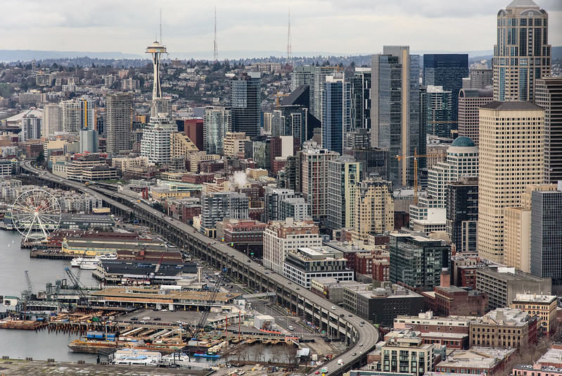
Alaskan Way Viaduct, February 2018
Alaskan Way Viaduct, February 2018. It closed permanently in January 2019; the replacement tunnel opened the next month. and demolition was complete by November of the same year. Photograph by Flickr user Washington State Department of Transportation, licensed under Creative Commons Attribution-NonCommercial-NoDerivs 2.0 Generic

When the new street opened in 1936, the question of renaming came up again. Mayor John F. Dore appointed a committee that chose The Pierway, a suggestion that won a W.C. Denison, Jr., a prize of $50 from the mayor’s own pocket, but the final decision lay with the city council, which was not enthused. Pacific Way emerged as their favorite, according to a Seattle Times article on July 2, 1936, though a July 6 article in the same paper “the public apparently was not in accord with the idea.” On July 7, the Times reported that even though “at least seven votes [were] lined up in advance for the adoption of ‘Pacific Way’… with Council President Austin E. Griffiths contending for ‘Cosmos Quay’ or ‘Cosmos Way’,” an ordinance renaming Railroad Avenue “Alaskan Way” passed unanimously.

Alaska Way had been proposed in 1932 by the Puget Sound Travel Directors, according to an article in the April 13 issue of The Seattle Times. (As an aside, it was also proposed in 1931 by attorney John S. Robinson as an alternate name for Aurora Avenue N and the Aurora Bridge, according to a Times article on June 19.) It was also an entry in the Seattle Maritime Association’s aforementioned naming contest, submitted by Fred E. Pauli, manager of the Alaska Division of the Washington Creamery Company, according to a Times article on April 10, 1932. Then, in 1935, after Cosmos Quay had been rejected by the city council, the Alaska Yukon Pioneers endorsed Alaska Way (The Seattle Times, March 5), followed by the Whittier Heights Improvement Club (Times, March 7) and the Junior Alaska-Yukon Pioneers (Times, July 25). When renaming became a distinct possibility once again in 1936, as discussed above, the Alaska Yukon Pioneers passed a resolution in favor of Alaska Way (Times, July 4): “…It was here that the gold rush activity actually took place… put Seattle on the map and directly made possible the magnificent improvement now about completed.”

Alaskan Way south from Bell Street
Alaskan Way looking south from the Bell Street pedestrian bridge, August 2011. The Alaskan Way Viaduct is barely visible at center; the Seattle Aquarium is at center right. Photograph by Orange Suede Sofa, Wikimedia Commons, licensed under Creative Commons Attribution-Share Alike 3.0 Unported

It came down to one councilmember, apparently. The Seattle Post-Intelligencer reported on July 7 that, the previous day, Robert H. Harlin proposed that the already-prepared ordinance renaming Railroad Avenue “Pacific Way” be amended to read “Alaskan Way” instead:

Councilman Robert H. Harlin, who offered the motion for adoption of “Alaskan Way,” said he preferred it to “Alaska Way” because it “recognizes the human element, honoring the men and women who pioneered the territory.” Although a majority of the council had informally agreed to support the name “Pacific Way,” sentiment crystallized rapidly in favor of “Alaskan Way” after Harlin’s statement.

Alaskan Way, March 2021
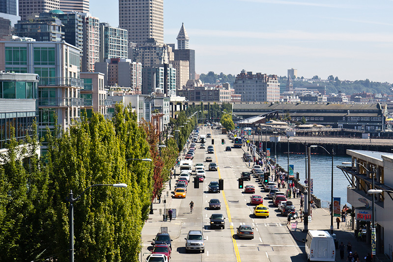
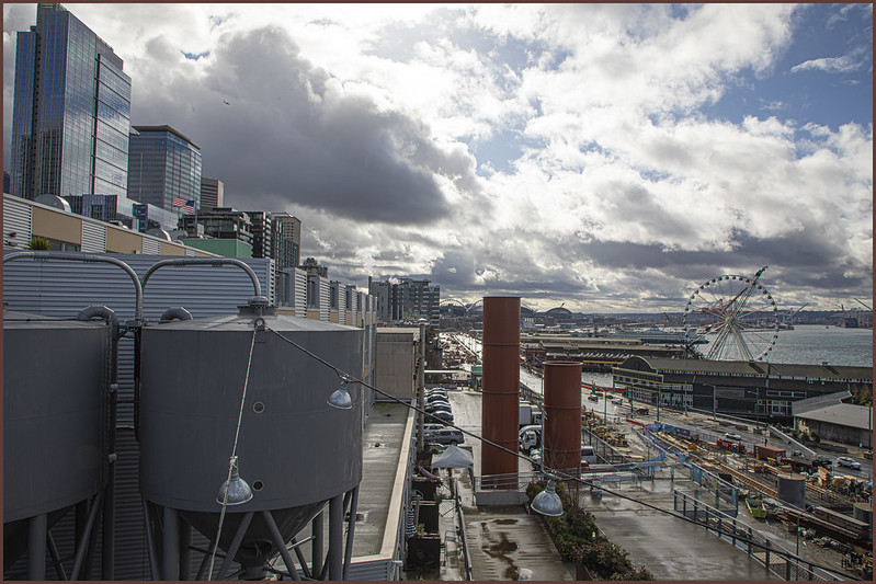
Alaskan Way from the Pike Place Market’s MarketFront, March 2021. Construction of the street that wasn’t going to be called Elliott Way — but now, as of early 2023, will be — is visible at center right. The Seattle Great Wheel can be seen above the Seattle Aquarium. Photograph by Flickr user Scott Smithson, licensed under Creative Commons Attribution-NonCommercial-NoDerivs 2.0 Generic

Today, Alaskan Way S begins at the north end of E Marginal Way S, at the entrance to the Port of Seattle’s Terminal 30, and goes 2⅓ miles north, then northwest, to Broad Street, having become Alaskan Way on crossing Yesler Way. This is the Alaskan Way most people think of.

But, as they say, wait — there’s more! The right-of-way continues for another 1¾ miles, ending at W Garfield Street under the Magnolia Bridge, at the entrance to the Port of Seattle’s Terminal 91. From the Olympic Sculpture Park, which begins at Broad Street, to Myrtle Edwards Park, the right-of-way is taken up by park land and the tracks of the BNSF Railway — successor to the Columbia & Puget Sound; the Seattle, Lake Shore & Eastern; and the Northern Pacific, the railroads for which Railroad Avenue was originally built. Northwest of Myrtle Edwards, it’s entirely taken up by the tracks that run alongside Centennial Park. It isn’t until W Galer Street that there’s a city street in the right-of-way again, and Alaskan Way W only goes about ⅙ of a mile northwest from there to W Garfield Street. Even less than that is signed Alaskan Way, as the city has put up a sign for Expedia Group Way W where the W Galer Street flyover “touches down.” However, even though southeast of Galer the roadway runs first on Expedia property, then Port of Seattle property, the city appears to still consider it Alaskan Way W between the Expedia campus entrance and the north end of Centennial Park — a distance of just over ⅓ of a mile.
Queen Anne Boulevard

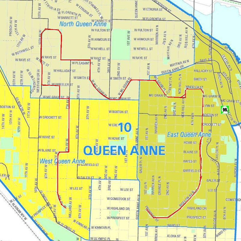
Like Queen Anne Avenue N, Queen Anne Boulevard is named for the neighborhood and hill, themselves named for the Queen Anne architectural style popular with builders in the 1880s. Unlike the avenue, though, the boulevard is not one single street, but a scenic loop incorporating many streets (and hence has no directional designation, such as Queen Anne Boulevard W).

The legislation establishing Queen Anne Boulevard was passed in 1907, and construction took place from 1911 to 1916. The Seattle Department of Transportation has had jurisdiction over the streets since 1942; jurisdiction over the landscaping remains with Seattle Parks and Recreation.

The loop is slightly over 3⅔ miles in length; the ordinance gives its route as follows (edited for style and current street names and directional designations, with notes added):

Extending from Prospect Street between Warren Avenue N and 2nd Avenue N, in a northeasterly direction*, to an intersection with Galer Street near Bigelow Avenue N; thence northerly following the general direction of Bigelow Avenue N as nearly as the contours of the ground will permit, to Wheeler Street; thence westerly to Nob Hill Avenue N; thence southerly to McGraw Street; thence westerly to 2nd Avenue N; thence northwesterly to Smith Street, west of Warren Avenue N; thence westerly along Smith Street to a point east of 1st Avenue W; thence southerly to W McGraw Street and 2nd Avenue West; thence westerly to 3rd Avenue W; thence northwesterly to 5th Avenue W and W Smith Street§; thence northerly to W Raye Street; thence westerly to 8th Avenue W; thence northerly to W Armour Street; thence northwesterly to W Fulton Street; thence westerly to 9th Avenue W; thence southwesterly to 10th Avenue W and W Armour Street; thence southerly to W Wheeler Street; thence easterly to 8th Avenue W; thence southerly to W McGraw Street; thence easterly to 7th Avenue W; thence southerly to W Blaine Street; thence westerly to 8th Avenue W; thence southerly to W Lee Street; thence southeasterly to W Highland Drive and 7th Avenue West.

* Now the southern extension of Bigelow Avenue N.
Now McGraw Place.
Now the east half of W McGraw Place.
§ Now the west half of W McGraw Place.
Now 8th Place W.

Notably, there is a gap in the loop; Highland Drive between 7th Avenue W and Warren Avenue N could have made it closed, but this was not done.

As noted in Bigelow Avenue Nneighbors’ yards often encroach on the public right-of-way, leading, among other things, to confrontations over chestnuts…

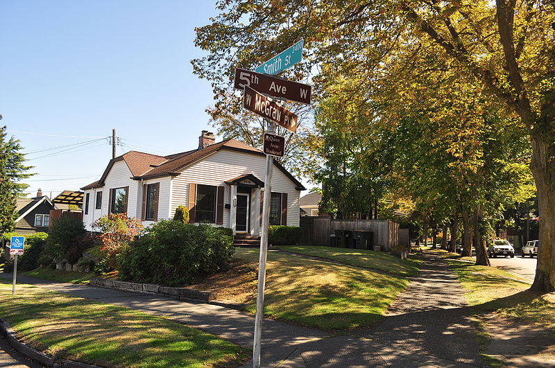
Queen Anne Boulevard street sign, corner of 5th Avenue W, W Smith Street, and W McGraw Place, September 2015
Street sign, corner of 5th Avenue W, W Smith Street, and W McGraw Place, September 2015. The signs for 5th and McGraw are brown because of Queen Anne Boulevard’s status as a parks boulevard; note also the distinctive Queen Anne Boulevard sign beneath that for McGraw. Photograph by Joe Mabel, Wikimedia Commons, licensed under Creative Commons Attribution-ShareAlike 3.0 Unported
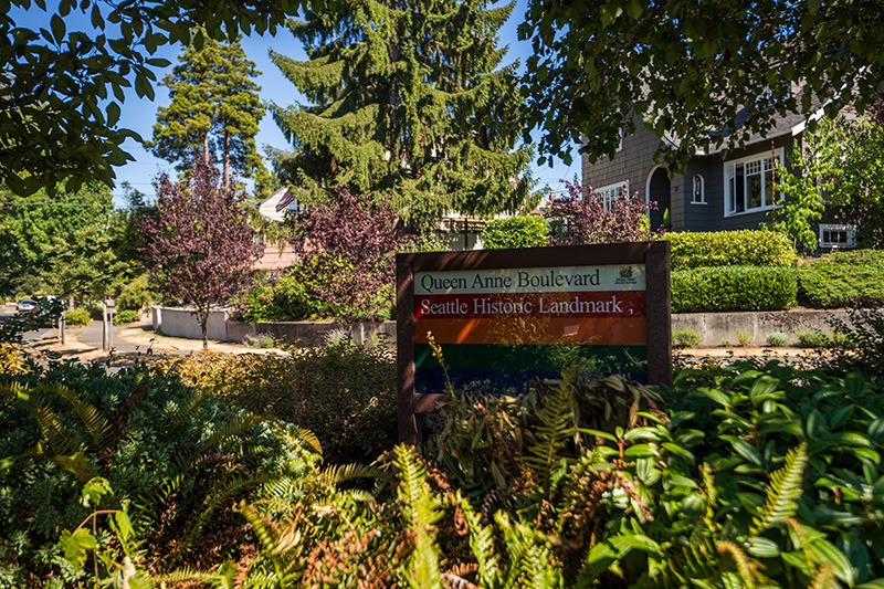
Queen Anne Boulevard Seattle Historic Landmark Parks Department sign, 1st Avenue W and W Smith Street, July 2015
“Queen Anne Boulevard, Seattle Historic Landmark” Parks Department sign, 1st Avenue W and W Smith Street, July 2015. Courtesy of the Seattle Municipal Archives, Identifier 178301
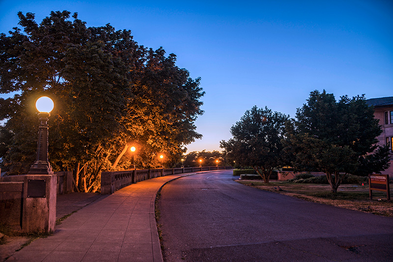
Queen Anne Boulevard at night: 8th Place W just north of Marshall Park, July 2015
Queen Anne Boulevard at night: 8th Place W just north of Marshall Park, July 2015. Note the Wilcox Wall supporting the light fixtures. Courtesy of the Seattle Municipal Archives, Identifier 178303

Queen Anne Avenue N

Originally Temperance Street and Villard Avenue, Queen Anne Avenue N was given its current name in 1895 as part of the Great Renaming. It was named after Queen Anne Hill and the Queen Anne neighborhood. Originally called Eden Hill or Galer Hill, they were themselves renamed after the Queen Anne architectural style that became popular in the 1880s.

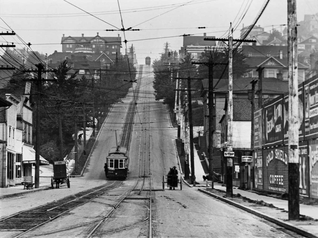
Looking up the Counterbalance (Queen Anne Avenue N), 1910
Looking north up the Counterbalance (Queen Anne Avenue N), 1910
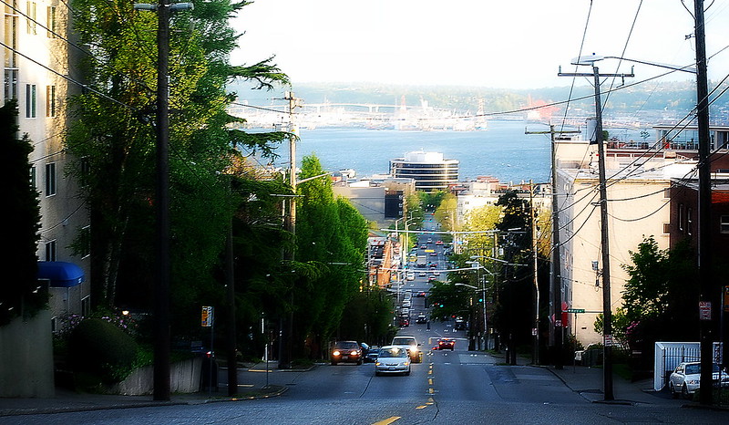
Looking south down Queen Anne Avenue N, April 2012
Looking south down Queen Anne Avenue N, April 2012. Photograph by Flickr user Joe Wolf, licensed under Creative Commons Attribution-NoDerivs 2.0 Generic

Queen Anne Avenue begins at Western Avenue, less than 100 feet south of Denny Way, and becomes Queen Anne Avenue N as it crosses Denny. From there it goes 2⅕ miles north to Bertona Street and the Ship Canal Trail.

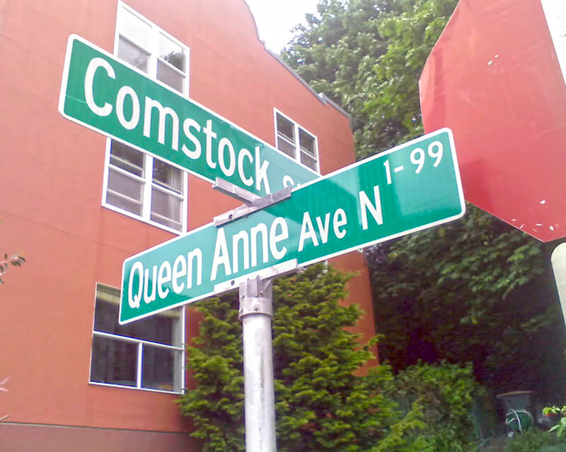
Signs at corner of Comstock Street and Queen Anne Avenue N, June 17, 2011
Signs at corner of Comstock Street and Queen Anne Avenue N, June 17, 2011. Photograph by Benjamin Lukoff. Copyright © 2011 Benjamin Lukoff. All rights reserved.

Surber Drive NE

This street is named after William Harvey “Uncle Joe” Surber (1834–1923), who came to Seattle from Indiana in 1859, having spent time in Missouri, California, and British Columbia along the way. Valarie Bunn tells his story in “From Yesler to Wedgwood,” and his Find a Grave page reproduces his biography from Clarence Bagley’s History of Seattle from the Earliest Settlement to the Present Time. In 1861, he established a homestead in what is now Laurelhurst, on what was then the east shore of Union Bay but is now Yesler Swamp. He was appointed the first sheriff of King County in 1866.

Originally 39th Avenue NE in the plat of Belvoir, an Addition to the City of Seattle, filed by his executor in 1926, it and E 37th Street became Surber Drive in 1939. Today, Surber Drive NE begins at NE 41st Street and goes around 700 feet to NE 38th Street, where it becomes NE Surber Drive and goes nearly 1,000 feet to 42nd Avenue NE.

Clise Place W

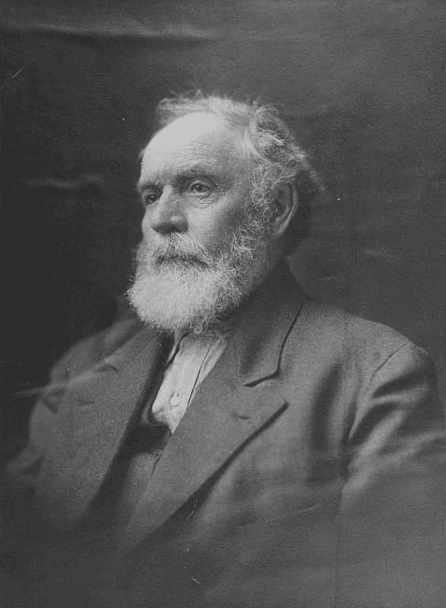
This street is named for James William Clise (1855–1938), who is said to have come to Seattle with his wife, Anna Herr Clise (1866–1936), on June 7, 1889, the day after the Great Seattle Fire. Anna is best known for founding Children’s Orthopedic Hospital (today known as Seattle Children’s) in 1907. In 1890, James founded what is now Clise Properties. Over the years he, among other things:

  • Helped the University of Washington relocate from Downtown to its current campus
  • Helped establish Fort Lawton (now Discovery Park) in Magnolia
  • Helped Lyman Smith build the Smith Tower
  • Helped kickstart the agricultural industry in Eastern Washington
  • Founded the Washington Trust Company, which after a series of mergers is now part of Bank of America
  • Helped organize the Alaska–Yukon–Pacific Exposition 
  • Helped fund the construction of the Lake Washington Ship Canal and Ballard Locks

Clise Place W originates in the 1928 plat of Magnolia View Addition to the City of Seattle, filed by the Clise Investment Company. It originally only went from W Howe Street at Magnolia Boulevard W to W Crockett Street, but the name replaced that of Rucker Place between there and W Lynn Street and 33rd Avenue W, giving it a total length of just under ¼ mile.

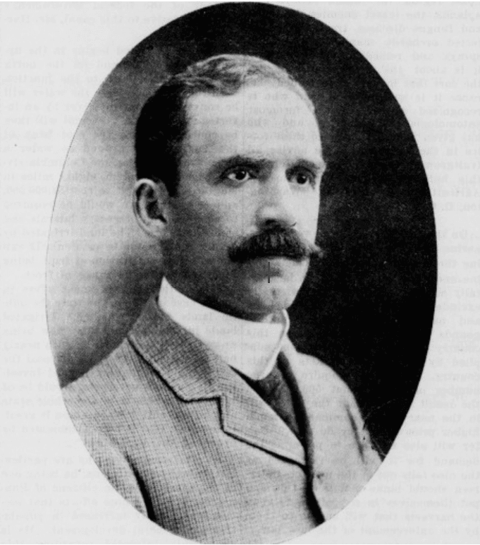
JW Clise
J.W. Clise, from The Ranch and Range, June 26, 1902 issue

Bigelow Avenue N

This street was named for developer Isaac Newton Bigelow (1838–1922). The Queen Anne Historic Context Statement, as we quoted in Newton Street, says:

In the early 1870s, the Denny and Mercer families gradually began to systematically subdivide their large land holdings on the south and east slopes of Queen Anne Hill. When a severe windstorm blew down thousands of trees in the north district in 1875, views opened up and land seekers turned their attentions beyond Belltown. Real estate speculators new to the territory arrived and began to buy up property on the crest of Queen Anne Hill. Some of these speculators also became developers, such as George Kinnear, or builder-developers, such as Isaac Bigelow.

Bigelow Avenue N forms a major part of Queen Anne Boulevard, the scenic loop atop Queen Anne Hill. It begins at 2nd Avenue N and Prospect Street and goes 9⁄10 of a mile to Wheeler Street between 4th Avenue N and 5th Avenue N.

Part of the street is lined with chestnut trees — not horse chestnuts, but the edible variety, specifically the Chinese chestnut, Castanea mollissima, according to the city’s records. My family (my mother was Korean) never foraged here, though we have done so elsewhere in the area, both for chestnuts and fiddlehead ferns. But plenty of others have, and continue to do so, as these articles show:

It should be noted that since Bigelow Avenue N is part of Queen Anne Boulevard, the trees belong to the parks department, not to the neighbors. As with similar park boulevards in town, neighbors’ yards often encroach on the public right-of-way.

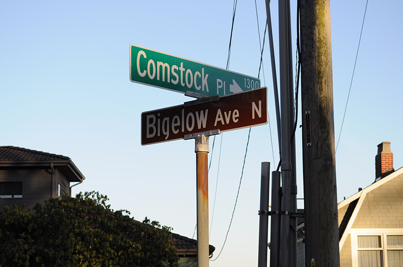
Street sign at corner of Comstock Street and Bigelow Avenue N, February 2010
Street sign at corner of Comstock Place and Bigelow Avenue N, February 2010. Photograph by Joe Mabel, Wikimedia Commons, licensed under Creative Commons Attribution-Share Alike 3.0 Unported
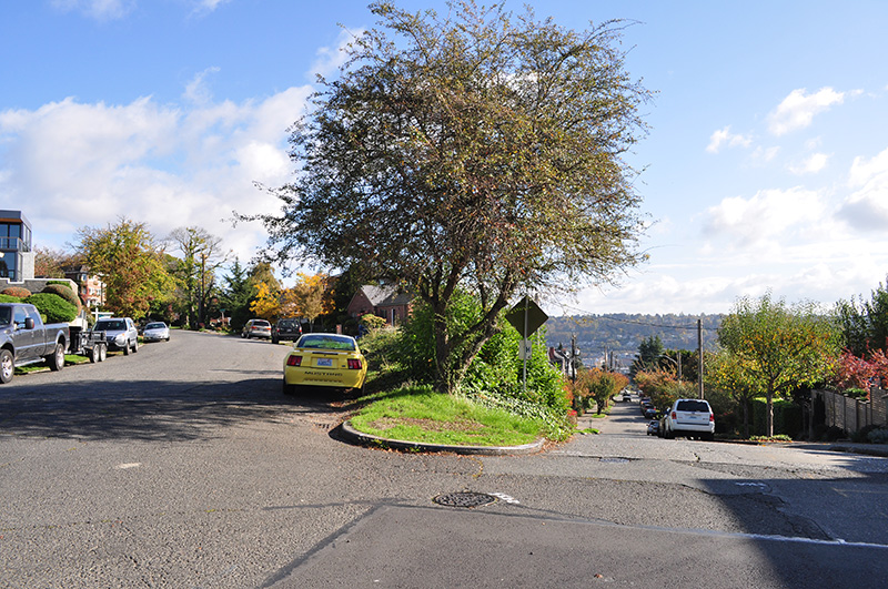
Beginning of Bigelow Avenue N (Queen Anne Boulevard) at 2nd Avenue N and Prospect Street, October 2015. Photograph by Joe Mabel, Wikimedia Commons, licensed under Creative Commons Attribution-Share Alike 3.0 Unported

Alonzo Avenue NW

This street was named for Alonzo Hamblet (1863–1937), son of Eli (1820–1905) and Mary Booth Hamblet (1840–1905), namesake of Mary Avenue NW. According to an article in the November 19, 1937 issue of The Seattle Times, the Hamblets had their homestead where Ballard High School is today. Alonzo was one of the men behind the West Coast Improvement Company that developed Ballard (then known as Gilman Park).

Alonzo Avenue NW begins at NW 67th Street just north of the high school and goes ⅖ of a mile to NW 75th Street.

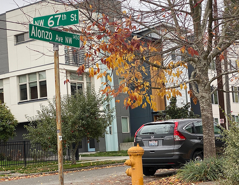
Street sign at NW 67th Street and Alonzo Avenue NW, Seattle, October 12, 2021
Street sign at NW 67th Street and Alonzo Avenue NW, Seattle. Photograph by Benjamin Lukoff, October 12, 2021. Copyright © 2021 Benjamin Lukoff. All rights reserved.

Mary Avenue NW

This street was named for Mary Booth Hamblet (1840–1905), wife of Eli (1820–1905) and mother of Alonzo (1863–1937), namesake of Alonzo Avenue NW. The Hamblets were early Ballard settlers, and according to an article in the November 19, 1937 issue of The Seattle Times had their homestead where Ballard High School is today.

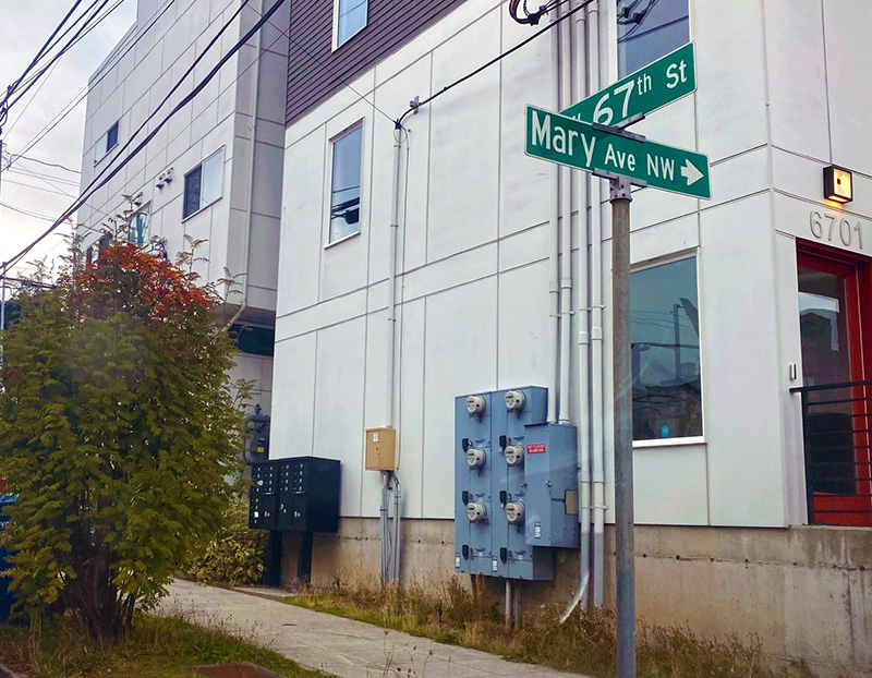
Street sign at NW 67th Street and Mary Avenue NW, Seattle, October 12, 2021
Street sign at NW 67th Street and Mary Avenue NW, Seattle. Photograph by Benjamin Lukoff, October 12, 2021. Copyright © 2021 Benjamin Lukoff. All rights reserved.

Mary Avenue NW begins at NW 67th Street just north of the high school and goes nearly 2 miles to the NW 105th Street right-of-way, where it becomes a trail leading to Carkeek Park. As I wrote in NW Blue Ridge Drive,

Ten or so years ago I saw a Private Property sign at the trailhead, put up by the Blue Ridge Club, but it was gone the next time I visited — I can’t remember if I complained or someone else did. (The woods are private, but the trail is Mary Avenue NW right-of-way.) This wasn’t in the original plat, but according to an old Flickr chat I had with Andreas “Severinus” Breuer, “there was apparently a WPA project approved to install a 30′-wide gravel road between 100th and 110th (apparently now NW Carkeek Park Road).… I imagine the ravine would look quite different if a 30′ gravel road had been put in, so presumably this plan wasn’t carried out. But a 1940 engineering map shows a surveyed ROW from 105th to the Carkeek border, and in Carkeek there seems to be a route that follows the WPA route (Clay Pit Trail > Hillside Trail > Brick Road Trail > Road). Perhaps the trail that exists today was made by the original surveyors or by WPA men?”

S Industrial Way

In 1930, Seattle City Light acquired a number of transmission line rights-of-way. The one immediately concerning us approaches the utility’s South Service Center from the southeast. East of Interstate 5, the Chief Sealth Trail runs along the right-of-way from Beacon Hill to Kubota Garden. West of the freeway, a road was built in the late 1960s as part of the South Seattle Redevelopment Project, or South Seattle Industrial Park, as it came to be known. This street was designated Industrial Way in 1969, and runs from Airport Way S in the southeast to 4th Avenue S and Diagonal Avenue S in the northwest, a distance of about ⅓ of a mile.
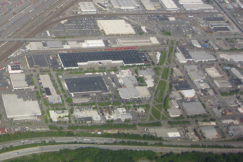
Aerial view of Industrial District with S Industrial Way at center right
Aerial view of Industrial District, May 2009. S Industrial Way is the boulevard with the grassy median at center right, leading to the City Light South Service Center. The diagonal street at its end is, appropriately, Diagonal Avenue S, and the arterial it stops at is 4th Avenue S. The Union Pacific Railroad’s Argo Yard is in the upper-left-hand corner, and Airport Way S and Interstate 5 run along the bottom. Photograph by Flickr user J Brew, licensed under Creative Commons Attribution-ShareAlike 2.0 Generic

Colorado Avenue S

This street was created in 1895 as part of the plat of Seattle’s tide lands. As Seattle expanded to the south, it became obvious that Commercial Street (1st Avenue S) would not be the westernmost street east of Elliott Bay. Fortunately, instead of using zero or negative numbers, they went with states: the first street west of 1st was named Utah, and the next, Colorado. (Some perpendicular streets were named Alaska, Vermont, Connecticut, Texas, Massachusetts, etc. There doesn’t appear to have been any particular order.)

Colorado Avenue S begins at S Royal Brougham Way and goes ⅓ of a mile south to S Massachusetts Street. It begins again on the back side of the Starbucks Center and goes ⅘ of a mile to just south of S Spokane Street, and its final segment begins just north of Diagonal Avenue S and goes ⅔ of a mile to S Dawson Street.

NE Pacific Street

What is now Pacific Street was Harrison Avenue in the 1889 Latona Addition and Railroad Avenue in the 1890 Brooklyn Addition, corresponding to the eastern part of Northlake and to the University District, respectively. The road was built on either side of railroad tracks that were originally part of the independent Seattle, Lake Shore and Eastern Railway, but which were soon thereafter taken over by the Northern Pacific Railway. (The route of the SLS&E through and east of Seattle is now the Burke–Gilman Trail, the Sammamish River Trail, and the East Lake Sammamish Trail.)

In 1906, Harrison Avenue became Pacific Place and Railroad Avenue became Brintnall Place. (Why the opportunity wasn’t taken to match the names is unclear. Brintnall Place may have been named for Burgess W. Brintnall, who, according to the September 1912 issue of the Northwest Journal of Education, had been school superintendent for Olympia and Thurston County, founded the journal itself, and, after moving to Seattle in 1899, founded the Pacific Teachers Agency. He was murdered on July 3, 1912.)

At some point both streets became Pacific Street. Brintnall Place appears for the last time in The Seattle Times in October 1920, and Pacific Street for the first time in July 1921. The 1920 Kroll atlas shows all three names, including Pacific Place, indicating the change must have been planned at the time of its publication.

I haven’t seen any indication of why the Pacific name was chosen. Seattle got an Atlantic Street in 1895 — maybe it was thought the other major ocean deserved a street as well. But I wonder if it wasn’t named for the Northern Pacific, whose tracks the street ran along?

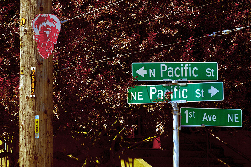
Street sign where NE Pacific Street becomes N Pacific Street on crossing 1st Avenue NE, August 2011. Photograph by Flickr user Panegyrics of Granovetter (Sarah C. Murray), licensed under Creative Commons Attribution-ShareAlike 2.0 Generic

Today, NE Pacific Street begins at Montlake Boulevard NE, at the north end of the Montlake Bridge and the southeastern corner of the University of Washington campus, and goes ¾ of a mile to Eastlake Place NE, underneath the University Bridge, where it becomes NE Northlake Way. It begins again at NE 40th Street just west of the Ship Canal Bridge and goes another ¾ of a mile to N 34th Street just east of Meridian Avenue N.

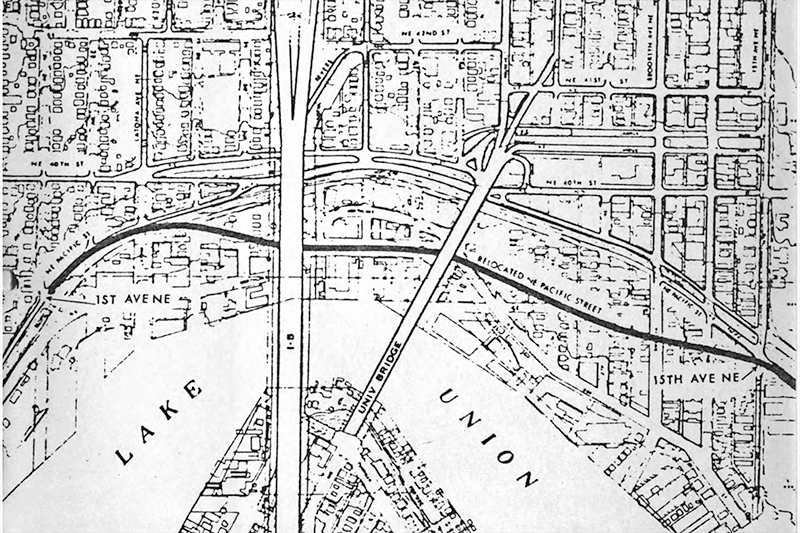
Pacific Street’s current configuration is the result of a realignment that took place in the 1970s; originally, instead of turning west at University Way NE, it kept going northwest, cutting through what is now the University of Washington’s West Campus, and there was no interruption between the University and Ship Canal Bridges. The Burke–Gilman Trail follows the original railroad alignment, though, as does, for a few blocks, the campus road Cowlitz Road NE.

Joliet Avenue W

This street was created in 1895 as part of the Seattle Tide Lands plat (in full, Seattle Tide Lands as Surveyed and Platted by the Board of Appraisers of Tide and Shore Lands for King County, Washington). Streets were laid out from the northern tip of Magnolia (see W Semple Street) to West Seattle, but only the land southeast of Magnolia down to the Duwamish River was ultimately filled and developed.* (Magnolia’s tidelands were intended to become industrial land as part of the Bogue Plan, but this was rejected, and they have remained untouched west of the Elliott Bay Marina.)

* I certainly don’t want to minimize the extent of what was filled — over 92% of the tidelands, according to local historian and geologist David B. Williams.

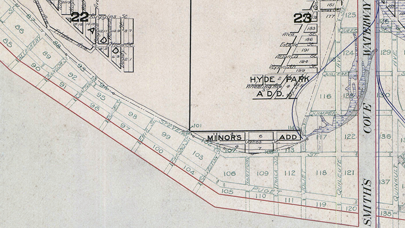
As can be seen in the portion of the plat map reproduced below, the streets perpendicular to the shoreline in southwest Magnolia were named alphabetically after various cities in the United States. (Northwest of here, they were simply given letters of the alphabet, beginning with A and making it as far as O.) The namers began with Allegheny (Pennsylvania), and continued with Bangor (Maine), Chattanooga (Tennessee), Duluth (Minnesota), Erie (Pennsylvania), Fresno (California), Galveston (Texas), Hartford (Connecticut), Ithaca (New York), and our subject, Joliet (Illinois), before switching to yet another series.

Portion of Plat of Seattle Tide Lands showing Smith Cove and Southwest Magnolia
Portion of 1895 Plat of Seattle Tide Lands showing Smith Cove and Southwest Magnolia

Most of these streets have been renamed or vacated, but for some reason this never happened to Joliet Avenue, even when the Navy took over the Smith Cove piers and uplands in 1941 and 1942 to form Naval Supply Depot Seattle. Today, this is the Port of Seattle’s Terminal 90/91 complex, but as the quarter section map shows, it’s still crisscrossed by public right-of-way. It may very well take the proposed redevelopment of the uplands and Washington National Guard armory site to eliminate these paper streets for good.
Viewmont Way W

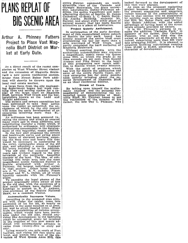
This street was created in 1915 as part of the plat of Carleton Park, a replat of much of southwest Magnolia (basically a triangle formed by W Raye Street, 34th Avenue W, and Magnolia Boulevard W). Arthur A. Phinney (1885–1941) led the project, named after his father, Guy Carleton Phinney (1851–1893) (Phinney Avenue N, Phinney Ridge). As The Seattle Times reported:

The old plat was executed thirty years ago without regard to the preservation of the naturally beautiful contour of the land.… In the new plat the streets and boulevards curve and swing about the bases of elevated portions, escaping the deep cuts and heavy fills that would be necessary in conforming to the strict, rectangular plans of the old plat, and affording a scenic frontage for every building lot in the addition.… This entire district commands an unobstructible view of the Cascade and Olympic Mountains, the state university, Laurelhurst, Denny-Fuhrman addition, the entire waterfront and manufacturing district of Seattle, St. James Cathedral, 42-story L.C. Smith Building, Alaska Building, majestic Mt. Rainier, and about every other phase of natural scenery that has made Seattle attractive as a place of habitation.

Article on Carleton Park, Seattle Times, April 25, 1915

Viewmont Way was obviously named after its view of the mountains, and is of a piece with other Carleton Park streets like Montavista Place, Westmont Way, Eastmont Way, Altavista Place, and the like.
Viewmont Way W begins at the intersection of 34th Avenue W, W Lynn Street, and Montvale Place W in Magnolia Village, and goes ¼ mile southwest to Constance Drive W, where it becomes W Viewmont Way W. The name initially continued about the same distance northwestwards, where the street became 41st Avenue W, but this portion and the rest of 41st Avenue as far north as Fort Lawton (now Discovery Park) were apparently changed at some point to W Viewmont Way. In 1961, the streets became Viewmont Way W and W Viewmont Way W.