Howell Street

This street is said to have been named for Jefferson Davis Howell (1846–1875), the youngest of 11 children of William Burr Howell and Margaret Louisa Kemp. He was himself named after Jefferson Davis, future president of the Confederate States of America, who married his older sister, Varina Anne Banks Howell, in 1845. He joined the Confederate Navy in 1862, having earlier been a midshipman at Annapolis, and served until being captured in 1865.

Howell was captain of the SS Pacific, en route from Victoria to San Francisco, when it sank off Cape Flattery the evening of November 4, 1875. Only one passenger and one crew member survived of nearly 275 aboard, making it the worst maritime disaster on the West Coast to date. As Daryl C. McClary writes for HistoryLink.org:

Although lost at sea, Jefferson Davis Howell was not forgotten by his many friends in Puget Sound. They had a 10-foot-tall sandstone obelisk erected in his memory at the Seattle Masonic Cemetery, established in 1872 and renamed the Lake View Cemetery in 1890. On the base of the monument is chiseled the simple epitaph: “Captain J. D. Howell, perished at sea on the steamship Pacific, November 4, 1875, aged 34 years.”

The Plat of the Second Addition to the Town of Seattle as Laid Off by the Heirs of Sarah A. Bell (Deceased), on which Howell Street was first laid out, was filed on December 14, 1875, so the timing certainly fits the story.

Howell Street begins at 8th Avenue and Olive Way and goes ⅓ of a mile northwest to Eastlake Avenue, just west of Interstate 5. On the other side of the freeway, it resumes at Bellevue Avenue as E Howell Street and goes ⅕ of a mile east to Harvard Avenue, where it is blocked by Seattle Central College. After a very short segment between Broadway and Nagle Place, it begins again east of Cal Anderson Park at 11th Avenue and goes ½ a mile east to 19th Avenue. E Howell Street resumes at Homer Harris Park at 24th Avenue and goes ¾ of a mile east to 38th Avenue, being a stairway and pathway between the alley east of 25th Avenue and 26th Avenue. It begins again at Madrona Drive and goes ⅒ of a mile east to 39th Avenue E and Evergreen Place. Its last segment is just over 100 feet long, from Lake Washington Boulevard to Howell Place and Howell Park beach.

Leary Avenue NW

This street is named for John Leary (1837–1905), a Canadian who came to Seattle in 1869. He became a lawyer in 1871, and was involved in various mining and shipping concerns, streetcar lines, utilities, railroads, and banks. He helped found the First National Bank of Seattle in 1882; in 1929, it merged with the Dexter Horton Bank and the Seattle National Bank to form Seattle-First National Bank, later known as Seafirst and bought by Bank of America in 1983. He also founded, in 1878, the Seattle Post, which merged with the Daily Intelligencer in 1881 to form the Seattle Post-Intelligencer. Leary was a Seattle city councilman in 1873, 1875, and 1876, and was the city’s mayor in 1884 and 1885. He helped form the West Coast Improvement Company with Thomas Burke, William Rankin Ballard, and Boyd J. Tallman; they filed the plat of Gilman Park in 1889, which became the city of Ballard in 1890 and was annexed to Seattle in 1907. 

John Leary
John Leary

Leary Avenue NW begins at NW Market Street just east of 22nd Avenue NW and goes ⅖ of a mile southeast to 17th Avenue NW. The arterial continues as NW Leary Way for another ⅖ of a mile, to NW 48th Street just west of 9th Avenue NW, where it changes names once again, to Leary Way NW, which goes ⅘ of a mile southeast to 2nd Avenue NW before turning into NW 36th Street.

Ballard Avenue NW

This street is named after Captain William Rankin Ballard (1847–1929). Born in Ohio, he came to the West Coast with his family in 1857. They initially settled in Oregon, then moved to King County in 1865. (His father founded Auburn, then known as Slaughter.) Ballard attended the University of Washington for one year, in 1868, then was a schoolteacher, surveyor, and captain of the Zephyr, which took passengers between Olympia and Seattle. He helped form the West Coast Improvement Company with Thomas Burke, John Leary, and Boyd J. Tallman; they filed the plat of Gilman Park in 1889. The city of Ballard was incorporated the next year; it was annexed by Seattle in 1907. It was so named because, at the time, the tracks of the Seattle, Lake Shore and Eastern Railway stopped at Salmon Bay. Passengers had to disembark and complete the rest of their trip to Gilman Park via footbridge. Apparently one of Ballard’s friends who worked for the railway began referring to the stop as Ballard Junction, and the name stuck.

William Rankin Ballard
William Rankin Ballard, circa 1917

Ballard Avenue NW begins at NW Market Street between 22nd Avenue NW and 24th Avenue NW and goes ½ a mile southeast to 17th Avenue NW, where it becomes NW Ballard Way. Most of it is part of the Ballard Avenue Historic District. (NW Ballard Way goes a further ½ mile east and becomes NW 47th Street when it crosses Leary Way NW at 9th Avenue NW.)

S Horton Street

I have read that, and until recently assumed that, S Horton Street is named for Dexter Horton (1825–1904), but have come to wonder if it instead is named for Julius, his younger brother (1834–1904), or for the Horton family in general. Julius came to Seattle in 1869, bought land in South Seattle in 1871, and platted Georgetown in 1890, naming it after his son, George (1865–1927), who had recently become a doctor. (Georgetown became a city in 1904 and was annexed by Seattle in 1910.) S Horton Street doesn’t run through Georgetown — it’s around 2 miles north of there — but it does run through South Seattle. It appears to have been named in 1870, after Julius arrived in town but before he bought what is now Georgetown. I am not sure if Dexter had any special connection to South Seattle; he certainly never lived there.

Julius Horton family circa 1890
Julius Horton and family, circa 1890. Back row, left to right: Dora Estelle (Horton) Carle, Mabel Maude (Horton) Edlund, Flora Groover, Elmer Petigoe. Front row, left to right: May Bigelow Boucher, Julius Horton, Howard Dexter Horton, Anna Emily (Bigelow) Horton, Vera Horton Hudson, George Monroe Horton, and Harry Bateman.

S Horton Street begins at E Marginal Way S and goes ⅔ of a mile east to 6th Avenue S, with a brief interruption at the SODO Busway. After a block-long segment between Airport Way S and 10th Avenue S just west of Interstate 5, it resumes on Beacon Hill at 13th Avenue S, where it goes one block east. It begins again at 16th Avenue S and goes ⅖ of a mile to 23rd Avenue S, being a stairway and pathway from just east of 19th Avenue S to 20th Avenue S. Horton resumes east of Kimball Elementary School at 24th Avenue S and goes a block and a half before it ends at the Cheasty Natural Area. Besides a very short segment just west of Martin Luther King Jr. Way S, its next appearance is at 33rd Avenue S and S Walden Street. From here, it goes ½ a mile east to Lake Washington Boulevard S, being a stairway between 36th Avenue S and 37th Place S and a stairway and pathway between Cascadia Avenue S and Sierra Drive S. Between Sierra Drive S and Lake Washington Boulevard S, it is part of Landing Parkway, under the jurisdiction of the parks department.

Dexter Avenue N

This street is named for Dexter Horton (1825–1904). Born in Seneca Lake, New York, he was living in Princeton, Illinois before he came west in 1852 with, among others, Thomas Mercer and Daniel and Clarence Bagley. He and Mercer came to Seattle in 1853. In 1870, he founded the city’s first bank, the Dexter Horton Bank. (It later merged with Seattle National Bank and First National Bank to form the First Seattle Dexter Horton National Bank, which unwieldy name became First National Bank of Seattle, then Seattle-First National Bank, and eventually Seafirst, the name it used from 1974 until the brand was retired in favor of Bank of America in 1999. (Bank of America had bought Seafirst in 1983.)

Dexter Horton
Dexter Horton

Dexter Avenue begins just south of Denny Way at 7th Avenue and becomes Dexter Avenue N north of Denny. From there it goes 2 miles north, then northwest, to the intersection of Westlake Avenue N, 4th Avenue N, and Nickerson Street, just south of the Fremont Bridge.

Terry Avenue

This street is named after Charles Carroll Terry (1830–1867), one of the members, along with his older brother, Lee, of the Denny Party that landed at Alki Point in November 1851. Shortly after the landing, he opened the first store in King County. Lee had made a land claim in Alki a few months earlier, but went home to New York the next year; Charles remained, even after most of the other settlers left for what is now Pioneer Square. It seems he finally moved north in 1857, trading his Alki land for that of David Swinson “Doc” Maynard in Pioneer Square. He died 10 years later, according to this biography, of tuberculosis. (Whether or not he and his brother were responsible for naming the Alki Point settlement New York, which became New York–Alki [the latter word meaning ‘by and by’ or ‘someday’ in Chinook Jargon] and then just Alki, is unclear, although he did officially apply the Alki name to the town plat he filed in 1853.)

In 1855, he, along with Edward Lander, bought Carson Boren’s downtown land claim for $500; he and Lander donated two acres to form the first campus of the University of Washington, which opened in 1861. (He named one of his sons, born in 1862, Edward Lander Terry.) His name also appears on Terry Hall, a UW dormitory on NE Campus Parkway.

Charles C. Terry
Charles Carroll Terry

Terry Avenue begins at Alder Street on First Hill and goes ½ a mile to Spring Street, where it is blocked by Virginia Mason Hospital. Resuming at Seneca Street, it goes ⅕ of a mile to Pike Street. On the other side of Interstate 5 and the Washington State Convention Center, it begins again at Howell Street and goes ⅘ of a mile to Valley Street and Lake Union Park, becoming Terry Avenue N as it crosses Denny Way. Amazon.com’s headquarters are at 410 Terry Avenue N, between Harrison Street and Republican Street.

S Lander Street

I initially posted that this street was named for Judge Edward Lander (1816–1907), chief justice of the territorial supreme court from 1853 to 1857. In 1855, he, along with Charles Terry, bought Carson Boren’s downtown land claim for $500. They subsequently donated two acres of land, along with Arthur Denny, who donated eight, to form the first campus of the University of Washington, which opened in 1861. The university owns the Metropolitan Tract to this day, though it moved to its present location in 1895. Lander’s name also appears on Lander Hall, a UW dormitory on NE Campus Parkway.

Edward Lander
Edward Lander

However, I recently (April 2022) came across “What’s in a Name?,” a paper by Phillip H. Hoffman, director of the Alki History Project, in which he asserts that the correct namesake is Edward Lander’s brother, Frederick William Lander (1821–1862). I find his argument compelling. The street was named by Edward Hanford (S Hanford Street) when he filed the plat of Hanford’s Addition to South Seattle in 1869. Hanford also named streets for George McClellan and Isaac Stevens. All three men — McClellan, Stevens, and Frederick Lander — were part of the Northern Pacific Railroad Survey (1853–1855), and all three were likewise Union generals in the Civil War. Besides this,

Edward Lander was a political foe of and was jailed by Stevens [then governor of Washington Territory] when Lander opposed Stevens’ 1855 martial law declaration and actions. Stevens and Edward Lander maintained a widely recognized lifelong enmity. It is unlikely that Hanford would have memorialized this hostility.

Frederick William Lander
Frederick W. Lander

SW Lander Street begins at 59th Avenue SW in the Alki neighborhood of West Seattle, and goes ⅕ of a mile to 55th Avenue SW. It resumes just to the south at S Lander Place and goes a further ⅛ of a mile to SW Admiral Way. Picking up again at 50th Avenue SW, it makes it ½ a mile to Walnut Avenue SW before being interrupted again, as happens to so many West Seattle streets because of the varying topography. There is a final ¼-mile stretch in West Seattle from 39th Avenue SW to 36th Avenue SW, then a very short segment on Harbor Island before S Lander Street resumes in the Industrial District at Colorado Avenue S and goes ¾ of a mile east to Airport Way S. On Beacon Hill, Lander begins just west of 13th Avenue S and goes ⅔ of a mile to just past 23rd Avenue S, including the block-long stretch that is now known as S Roberto Maestas Festival Street. Lander begins again at 30th Avenue S in Mount Baker and goes a final four blocks to 34th Avenue S.

Minor Avenue

This street is named for Dr. Thomas Taylor Minor (1844–1889), who came to Seattle in 1883 from Port Townsend, where he had lived since 1868 and whose mayor he had been in 1880 and 1881. He was one of the founders of the Seattle, Lake Shore and Eastern Railway in 1885 and became mayor of Seattle from 1887 to 1889. He drowned off Whidbey Island while on a duck-hunting trip on December 2, 1889. The other fatalities were George Morris Haller, brother of Theodore Haller for whom Haller Lake is named, and his brother-in-law, Lewis Cox.

Thomas Taylor Minor
Dr. Thomas Taylor Minor

Minor Avenue begins at Broadway just north of Jefferson Street and goes ⅔ of a mile northwest to Pine Street. Resuming on the other side of Interstate 5 at Olive Way, it goes another ⅔ of a mile northwest, then north, to Mercer Street, having become Minor Avenue N north of Denny Way. After a two-block stretch from Roy Street to Aloha Street, it appears again as Minor Avenue E at E Newton Street, and goes nearly ½ a mile to its end at E Roanoke Street.

Sign at corner of E Boston Street and Minor Avenue E, September 1, 2010
Signs at corner of E Boston Street and Minor Avenue E, September 1, 2010. Photograph by Benjamin Lukoff. Copyright © 2010 Benjamin Lukoff. All rights reserved.

Roethke Mews

This alley, which runs from NE 45th Street to NE 47th Street between 7th Avenue NE and 8th Avenue NE, adjacent to the Blue Moon Tavern, was named in 1995 for poet Theodore Huebner Roethke (1908–1963). A professor of English at the University of Washington from 1947 to 1963, Roethke won the Pulitzer Prize for Poetry in 1954, the National Book Award for Poetry in 1959 and (posthumously) 1965, and the Bollingen Prize for Poetry in 1959. His best-known poem may be “The Waking,” which begins:

I wake to sleep, and take my waking slow.   
I feel my fate in what I cannot fear.   
I learn by going where I have to go.

The Seattle Times says the resolution naming the alley “notes [Roethke] conducted numerous ‘symposia formal and informal in the Blue Moon Tavern and celebrated his receipt of both the Pulitzer and Bollingen prizes at the Blue Moon.’” The full text of the resolution is not available online, but I wonder if it specifically calls out the reason for Roethke Mews as opposed to Roethke Alley; as Knute Berger notes for Crosscut (now CascadePBS Newsroom), it’s “a great pun on ‘muse’ if nothing else.”

Roethke Mews sign on wall of Blue Moon Tavern, University District, Seattle, August 2008
Roethke Mews sign on wall of Blue Moon Tavern, University District, Seattle, August 2008. Photograph by Flickr user Chris Blakeley, licensed under Creative Commons Attribution-NonCommercial-NoDerivs 2.0 Generic.

S Hanford Street

This street is named for Edward Hanford (1807–1884) and his wife, Abigail Jane Holgate (1824–1905), who left Iowa in the early 1850s to settle adjacent to Abigail’s brother, John (namesake of S Holgate Street), on what is today known as Beacon Hill but was known from then until the early 1890s as Holgate and Hanford Hill. Edward and his family were loggers, then orchardists, and unlike John Holgate, he went on to develop his donation claim.

The Hanfords’ son Clarence (1857–1920) founded, with James D. Lowman, the Lowman & Hanford Stationery and Printing Company in 1885. The firm went out of business in the 1960s, but their Pioneer Square building still, the last time I drove by, had a sign painted on it reading “Seattle’s Oldest Retail Company,” which it very well might have been when it closed. Their son Thaddeus (1847–1892) was for a time the owner of the Daily Intelligencer newspaper, predecessor of the Seattle Post-Intelligencer. And their son Cornelius (1849–1926), a federal judge from 1890 to 1912, was earlier a territorial legislator, Seattle city attorney, and chief justice of the Washington Supreme Court. He is the namesake of Hanford, Washington, and by extension the Hanford Site, which produced the plutonium used in the first nuclear explosion and the bombing of Nagasaki. He was also the author of Seattle and Environs, 1852-1924.

Edward Hanford
Edward Hanford

SW Hanford Street begins in West Seattle at SW Admiral Way and 59th Avenue SW and goes ¼ mile east to Schmitz Preserve Park at 56th Avenue SW. It begins again at 51st Avenue SW and goes nearly a mile east to 36th Avenue SW, becoming a stairway for the half-block east of 46th Avenue SW. After serving as little more than a driveway between SW Admiral Way and Fauntleroy Avenue SW, it next appears as S Hanford Street at E Marginal Way S, where it goes for ⅓ of a mile east to Occidental Avenue S. After a few short segments farther east in the Industrial District, Hanford begins again on Beacon Hill at 12th Avenue S and goes nearly a mile east to Rainier Avenue S, the segment between 25th Avenue S and Morse Avenue S being a stairway. It resumes a few blocks east at 30th Avenue S and finishes up ½ a mile east at Cascadia Avenue S.

S Holgate Street

This street is named for John Cornelius Holgate (1828–1868). Born in Ohio, he took the Oregon Trail west in 1847 and explored Elliott Bay and the Duwamish River by canoe in the summer of 1850. (The Seattle Times calls him “the first non-Indian of record to have done so.”) He returned to Oregon afterwards, however, and did not settle in what is now Seattle — specifically, Beacon Hill — until 1853, two years after the Denny Party landed at Alki Point. His mother, Elizabeth; brothers, Lemuel and Milton; and sister, Abigail, along with her husband, Edward Hanford (namesakes of S Hanford Street), soon followed. The Hanfords settled on the hill — known thereafter as Holgate and Hanford Hill until the late 1880s — adjacent to Holgate. (Milton was one of three whites to die in the Battle of Seattle in 1856, and was himself the cause of one of those deaths, having earlier shot Jack Drew, a deserting sailor from the USS Decatur, in a “friendly-fire” incident.)

A gold prospector, Holgate left for Idaho in 1863, and died there in 1868, the first casualty of the War Under the Mountain, a conflict between two rival gold mines in the Owyhee Desert, one of which he was part owner. According to Robert L. Deen, writing for True West magazine, there are conflicting accounts of Holgates death. The Owyhee Avalanche reported that:

Desperate fighting ensued during the charge…. John C. Holgate… one of the foremost in the advance, was shot in the head, and must have died instantaneously.

The Idaho Tri-Weekly Statesman had a slightly different story:

It appears that J.C. Holgate has been killed, some say assassinated, murdered — not killed in a fight, but shot through the head without provocation.

SW Holgate Street begins in West Seattle just west of 47th Avenue SW and goes ¼ of a mile east to California Avenue SW at Palm Avenue SW. There are two more short segments on the peninsula, between 41st Avenue SW and Arch Avenue SW and between Victoria Avenue SW and Brook Avenue SW. S Holgate Street resumes at Utah Avenue S and goes ¾ of a mile east to an overpass over Interstate 5, where it becomes Beacon Avenue S. There is a one-block stretch between 12th Avenue S and 13th Avenue S on top of the hill, and then Holgate goes a mile from the Beacon Hill Playfield at 14th Avenue S to 31st Avenue S at Colman Park, the half-block east of 16th Avenue S being a stairway and the block between 28th Avenue S and 29th Avenue S being unimproved. There is finally a short stretch east of Lakeside Avenue S at 36th Avenue S that essentially serves as a private driveway; it is a shoreline street end, but one not yet accessible to the public.

W Kinnear Place

This street was named in 1895 for George Kinnear (1836–1912), the namesake of nearby Kinnear Park. Born in Ohio, he grew up first in Indiana, then Illinois. He fought for the Union during the Civil War and came to Seattle in 1878, his brother, John, following a few years later. During the time of anti-Chinese agitation, he was captain of the Home Guard that enforced the rule of law and prevented those who wished to expel Chinese laborers from doing so violently. His account of the events of February 1886 was published in the Seattle Post-Intelligencer in 1911 as “Anti-Chinese Riots at Seattle, Wn., February 8th, 1886.”

W Kinnear Place begins at 1st Avenue W and goes ⅖ of a mile west to W Prospect Street between Willard Avenue W and 7th Avenue W.

Tallman Avenue NW

This Ballard street is named for Boyd J. Tallman (1858–1932), who became a superior court judge in 1900. Originally from Pennsylvania, Tallman came to Walla Walla in 1885 and moved to Seattle two years later. That same year, he, along with Thomas Burke, William Rankin Ballard, and John Leary, founded the West Coast Improvement Company, which filed the plat of Gilman Park in 1889. Almost all of the street names were changed when Ballard was annexed to Seattle in 1907, but five streets that paralleled the Salmon Bay shoreline and one that ran perpendicular to it, as opposed to following the cardinal directions, were left alone: Shilshole Avenue, Ballard Avenue, Leary Avenue, Tallman Avenue, Barnes Avenue, and Ione Place.

Boyd J. Tallman
Judge Boyd J. Tallman

Tallman Avenue NW goes ⅕ of a mile from NW Market Street just east of 20th Avenue NW to 17th Avenue NW just south of NW 52nd Street and NW Ione Place.

Goodwin Way NE

This street, originally named Columbian Way in the 1920 plat of Victory Heights, was given its current name sometime during or before 1936, the first time I find it mentioned in the archives of The Seattle Times. I presume this was to avoid confusion with the Columbian Way in South Seattle, even though Victory Heights wasn’t annexed to Seattle until 1953.

The plat was filed by the Goodwin Real Estate Company and the Squire Investment Company. The Goodwin Real Estate Company at that time had Ervin Shirley Goodwin (1869–1937) as its president and his nephew, Arthur Eliot Goodwin (1887–1960), as its secretary. (Ervin and his brothers were instrumental in the development of Pike Place Market.) I presume the renaming was to honor Erwin rather than Arthur, though explicit explanations are rarely given for street naming. It may very well have been to honor the company. (Incidentally, Erwin’s wife, Eda, was a founder of the Seattle Fruit and Flower Mission in 1907; this organization became the Seattle Milk Fund in 1935 and Goodwin Connections in 2019.)

E.S. Goodwin
Ervin Shirley Goodwin

Unfortunately, in addition to being major developers (in addition to Victory Heights, they were behind Lakeridge, Hawthorne Hills, and subdivisions in Northgate, Lake City, and Windermere), the Goodwin Real Estate Company were pioneers in imposing racial restrictive covenants on their developments. As the Seattle Civil Rights & Labor History Project writes,

Seattle’s first known racial restrictive covenant was written in 1924 by the Goodwin Company and applied to three tracts of land and one block of the company’s development in the Victory Heights neighborhood in north Seattle.

It read:

Said tract shall not be sold, leased, or rented to any person or persons other than of Caucasian race nor shall any person or persons other than of Caucasian race use or occupy said tract.

Goodwin Way NE begins at 19th Avenue NE just north of NE Northgate Way and goes ¼ mile northwest to 15th Avenue NE between NE 113th Street and NE 115th Street.

Frink Place S

This street, and the park through which it runs, were named for John Melancthon Frink (1855–1914). Born in Pennsylvania but raised in Kansas, he came to Seattle in 1874. At various times he was a teacher, businessman, school board director, city councilman, and state senator. Frink became a parks commissioner in 1906, the same year he bought Washington Park (not to be confused with the park of the same name to the north) and donated it to the city, which renamed it after him. Frink Place was established in 1927; there had been an earlier Frink Boulevard, but it, like University Boulevard, Stixrud Drive, and Blaine Boulevard, among others, had become part of Lake Washington Boulevard by 1920.

John M. Frink
John Melancthon Frink

S Frink Place begins at S Washington Street just east of 32nd Avenue S, and goes ⅙ of a mile through the park to the intersection of S Jackson Street, 34th Avenue S, and Lake Washington Boulevard S.

Meridian Avenue N

As local historian Paul Dorpat writes in “Section lines on Wallingford Hill,”

The meeting of 45th Street and Meridian Avenue began in the forest, when federal surveyors carrying their Gunter chains described — and marked — the future streets as the west (Meridian) and north (45th) borders for the 640 acres of federal land section number 17. That done, the settlers could identify their claims with some precision.

Indeed, King County’s quarter section map covering the intersection shows that (going clockwise) sections 7, 8, 17, and 18 of Township 25 North, Range 4 East, Willamette Meridian, meet there.

This means Meridian Avenue N is named after meridian, but not the Willamette Meridian (which, once it reaches the latitude of Seattle, is on the Kitsap Peninsula), the Puget Sound Meridian, or the City Standard Meridian. As this overlay map I made shows (see below for the section of the map showing the intersection of 45th and Meridian), Fairview Avenue N follows the same alignment between Denny Way and Valley Street.

Overlay of 1863 cadastral survey of Township 025-0N Range 004-0E, Willamette Meridian, with modern map of Seattle, showing alignment of Meridian Avenue N and N 45th Street with section lines
Overlay of 1863 cadastral survey of Township 25 North, Range 4 East, Willamette Meridian, from the Bureau of Land Management, and modern map of Seattle, showing alignment of Meridian Avenue N and N 45th Street with section lines, generated at Georeferencer.com

Meridian Avenue N begins at N Northlake Way just north of Gas Works Park and goes 1½ miles north to N 55th Street, where it becomes Kenwood Place N. It resumes at Kirkwood Place N just north of N 59th Street, and goes ¼ mile north to E Green Lake Way N. On the north side of the lake, there is a block-long stretch from E Green Lake Drive N to N 75th Street, and a longer, ¾-mile one from N 77th Street to N 92nd Street and North Seattle College. Meridian begins again at the north end of College Way N at N 103rd Street, and goes just under a mile to N 122nd Street, south of Haller Lake. It resumes on the north shore of the lake as a shoreline street end (though not on the city’s official list) and goes a mile north to the city limits at N 145th Street. As with most North Seattle avenues, the name continues into Shoreline, and in this case the arterial street itself keeps going for 3 more miles to the King–Snohomish county line at N 205th Street.

Street sign at N 45th Street and Meridian Avenue N, Seattle, October 13, 2021
Street sign at N 45th Street and Meridian Avenue N, Seattle. Photograph by Benjamin Lukoff, October 13, 2021. Copyright © 2021 Benjamin Lukoff. All rights reserved.

Thomas Burke’s speech on the “Chinese question” and the rule of law

On February 7, 1886, a mob forced 350 Chinese laborers out of their homes and down to the waterfront, there to be loaded onto a waiting steamship. Men such as King County Sheriff John McGraw, while not preventing the expulsion, helped ensure it was done without physical violence, and citizens led by Home Guards Captain George Kinnear escorted a number of them next day to the courthouse. The federal judge told the laborers they could stay, though only a small percentage elected to do so. Some 200 of them set sail for San Francisco that day, and the remainder followed a few days after.

This was the culmination of years of anti-Chinese sentiment, and months of rising tensions. On November 5, 1885, 600 to 700 people gathered in the Opera House for a meeting to discuss the “Chinese question.” At it, Judge Thomas Burke spoke in defense, not of the Chinese laborers’ right to remain, but of the rule of law. For this, he has been praised over the years, though his position was more akin to those who wanted to send freed slaves back to Africa rather than give them the equal rights they deserved. This was a mere two days after the anti-Chinese riot in Tacoma that left two Chinese men dead, and Seattle leaders were hoping to avoid similar bloodshed here.

At any rate, though I was able to find an image of his speech online, there doesn’t seem to be a transcript of it anywhere, so here it is, from the November 6, 1885, issue of the Seattle Post-Intelligencer:


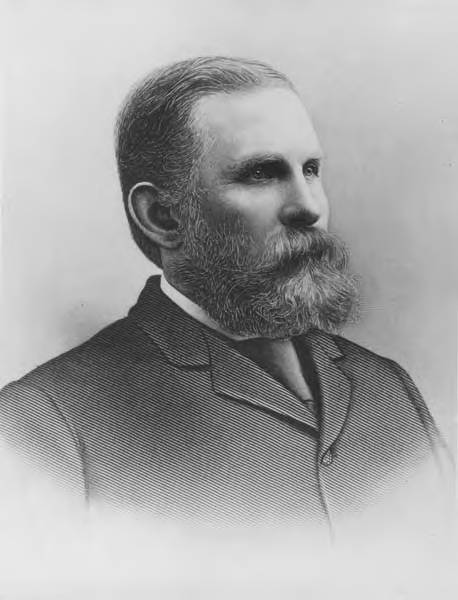
Judge Thomas Burke was next called:

It was considered by a number of persons who met today that it was the duty of all good citizens to unite for the purpose of considering this question, and advising as to the best line to pursue. False stories have been carried to and fro, to incite hostility, and they, like poison, have done their mischief, by tending to alienate one class from the other. It was the judgment of thoughtful men that a meeting where false statements might be pierced by the keen point of truth, would be conducive of good, and tend to unite the community. There is no division among the honest people. We are all laborers, and the attempt to draw class lines is false and malicious. We want, by lawful and fair means, that this community and the Territory shall be freed from the presence of the Chinese. There are but two questions. Shall we do it, like Americans, according to law? or as foreigners, outside the law?

I am an American, and appeal to the Americans. Of the two methods — the lawful and unlawful — I favor the American method. The deputy sheriffs were organized to protect the interests of the laborers. History records the fact that no class suffers so much from riots as the working men, and in the future you will curse the counsel of those who incite or advise you to lawlessness. This nation has turned to the oppressed of Europe, and welcomed them to her doors. After being here two years they can take a farm, and in five years be accorded the ballot, which requires an American 21 years to attain. All fields are open to them. All that is asked of them is to uphold the laws.

I have patience with the German, the Frenchman, or the Englishman, when he sneers at the laws of this country, but none for the Irishman. I am but one remove myself, having been born in America, and I have a right to speak of him. He comes from a land where he is ground down, burdened and oppressed, to free America, where he is given a farm, his children can grow up and be educated, as our public schools are thrown open to them, his sons can, and do, fill offices of trust, and every freedom is accorded to him. When an Irishman raises his voice against this Republic then my patience ceases, and I stand aghast at the base ingratitude. How can they raise their hands against the laws of a government that has done more to elevate the laboring man than any other government on the face of the earth?

I am a poor man, and don’t hire much help; but I have not had a Chinaman in my house for two years. I pay a white woman five dollars more per month than a Chinaman would do the same work for; but it is a matter of principle with me, and I felt it my duty. In this matter much has been accomplished. There is not a corporation in King county employing Chinese, and outside of the laundries there are only a few house servants in private families, and they are being replaced as speedily as possible. This is all being accomplished by peaceful means.

Three or four hundred armed men at Tacoma went around and packed up the Chinese, bag and baggage, and marched them through the streets and eight miles out to Lakeview, where they were left on the prairie all night, exposed, without shelter, to a drenching storm, and two died from exposure. After the expulsion of the Chinese, their stores and houses were burned. The Mayor of Tacoma is a foreigner, and can hardly speak the English language. I have read how the Germans rose up against the Jews and drove them from their homes. I remember how they drove the Russian peasants out; but what am I to think that only thirty miles from where I stand, in the Republic of the United States, such atrocities have been committed. It could not be done under an American. It was done under a German. [Derisive shouts and hisses from the gallery.]

George V. Smith

I hope the workingmen will be patient and listen to what the Judge has to say.

Mr. Burke

Excuse me, Mr. Smith, but I can assure you I need no one to intercede with a Seattle audience for me. I know the people of Seattle. They will hear me if they hate me. They have no reason to hate me, for I have always been their friend.

Why, gentlemen, injustice to a dog I would denounce. One year from tonight you will say I am right. In Tacoma they will say I am right. In Tacoma they have gone further, and actually notified lawful American citizens to go. “The American must go.” That’s the word in Tacoma. I am a free man, and would rather live under the autocrat of all the Russias than live under the rule of a dozen or twenty lawless men — worse than tyrants. You may go outside the law, but you will be glad to get back.

Mark the course of the French Republic; mark the course of our Nation. Look at the English; while they oppress they demand their liberty, because the greatest King of England cannot go outside the law. I have never advised you wrongfully. Look at it! One year ago, while you were voting for the forfeiture of the unearned land grants held by grasping monopolies, the people of Tacoma stood almost to a man for monopoly. Now they go to the other extreme. I do not believe there is a city in the United States presided over by an American, or a man with an American heart, where such outrages could or would be permitted.

They say they did it peacefully. If a highwayman presents a pistol to my head and takes my pocket-book from me, or comes to my house and holds a bludgeon over me and compels me to leave, he does not use force or violence. He would do it peacefully, but would it be lawful or right? To call such work peaceful is adding insult to injury. In the future the blackest page in the history of Washington Territory will be that on which it is recorded that 200 human beings were driven out of Tacoma like dogs, and compelled to face a driving storm all night, during which two of their number died from exposure. Dumb animals are deserving of better treatment than that.

The same God that makes my heart beat made the Chinaman. He is not to blame for his condition or color. In the South black men are persecuted, in Hungary the Jews are maltreated and persecuted, and so it goes. I believe the people of Seattle would lay down their lives in defense of the law. It has not been twenty years since I carried water on the railroad, and less than that since I worked on the dump. My brothers are laborers, and why should I speak against the laboring men. I am a free man, and will preserve my liberty. This question is on the rapid road to solution, but in order to hasten it you cannot afford to violate the eternal laws of justice.

The Chinese want to go, but don’t like to be robbed or murdered. Let the workingmen of the Queen City show to the world that the great principle of justice prevails here. Do not be unjust to a dog or horse, or anything else. The Chinamen are here under solemn treaty stipulation, but they are going. The workingmen will look around and see no Chinamen employed. It is to our interest to see them go, but it is not to our interest, but just the opposite, to see one drop of innocent blood spilled or a single breach of the law. I knew you would listen to me. If I should say a thousand times as distasteful things you would listen to me. I thank you.

Burke Avenue N

This street is named for Judge Thomas Burke (1849–1925), after whom the Burke–Gilman Trail and Burke Museum of Natural History and Culture are also named. In 1875, Burke, who was friends with the Bagley family, came to Seattle from Michigan, where he had attended law school. He began working with John McGilvra and ended up marrying his daughter, Caroline. He and Daniel Gilman were two of the founders of the Seattle, Lake Shore and Eastern Railway in 1885; the Burke–Gilman Trail today runs over the old railroad right-of-way. The Burke Museum, founded in 1885 by the Young Naturalists’ Society as Naturalists’ Hall, became the Washington State Museum in 1899 and took Burke’s name in the 1960s as part of a bequest from Caroline, who died seven years after her husband. He is also remembered for his defense of the rule of law during the period of peak anti-Chinese agitation in the 1880s. (He wanted the Chinese laborers to leave Seattle, but for this to happen non-violently, as opposed to what had happened in Tacoma.)

Thomas Burke, circa 1910
Thomas Burke, ca. 1910

Burke Avenue N begins at N Northlake Way and the Burke–Gilman Trail just north of Gas Works Park, and goes 1¼ miles north to N 50th Street. It resumes for a block at the north end of Green Lake between N 80th Street and N 82nd Street, and picks up again north of Bishop Blanchet High School at N 85th Street, going ⅓ of a mile north to N 92nd Street, where it becomes College Way N. With the exception of a few short segments, its next appearance is at N 135th Street, where it goes ½ a mile north to the city limits at N 145th Street. As with many other North Seattle avenues, the name continues on into Shoreline, and last appears as a short stub just north of N 203rd Street.

Bagley Avenue N

When I first posted this article, I wrote that Bagley Avenue N was named for Reverend Daniel Bagley (1818–1905) and his son, Clarence B. Bagley (1843–1932). That, after all, is what Sophie Frye Bass says in Pig-Tail Days in Old Seattle, which I pretty much took as gospel growing up. Junius Rochester says the same thing in his HistoryLink.org article on the Bagleys (using, I think, Pig-Tail Days as a reference.) And C.T. Conover (himself namesake of E Conover Court) repeats the story on two separate occasions for The Seattle Times — on February 18, 1950, and April 11, 1960.

However, today (September 10, 2021), I noticed that Conover had written a follow-up to his April 11 article. On April 25, 1960, he wrote that Clarence’s son, Colonel Cecil Clarence Bagley, had sent him a letter saying that, decades previous, he had asked his father if Bagley Avenue was named for his family. Daniel said no, it was named for Dr. Herman Beardsley Bagley (1845–1899). He had filed the plat of Bagley’s Addition in 1883. A small tract northeast of what is today Gas Works Park along the Lake Union shoreline, one of its streets was named Day Street. This later needed to be changed as it was duplicative of another Day Street elsewhere in the city. (I presume this is the S Day Street in Mount Baker that was almost entirely obliterated by the construction of what is now Interstate 90.) I can’t find the ordinance in question but, Conover continues, “as this was the central street in Dr. Bagley’s addition, it was considered appropriate to rename it Bagley Avenue in his honor, and that was done.”

H.B. Bagley — after whom Bagley Viewpoint on Capitol Hill is also named (I should note that parks historian Don Sherwood, even though I think he got the namesake of W Commodore Way wrong, got the namesake of Bagley Avenue right) — was, according to his biography in A Volume of Memoirs and Genealogy of the City of Seattle and County of King, Washington, Including Biographies of Many of Those Who Have Passed Awayan 1868 graduate of the Cleveland Homeopathic College who did postgraduate work at Bellevue Hospital Medical College in New York City the next year. He came to Seattle in 1874, two years after his father, Dr. Alvin Bagley, had moved here. (The elder Bagley’s Ohio home had apparently been a stop on the Underground Railroad.) He headed both the county and state homeopathic medicine societies, was a bank director, and was a city councilman in 1879 and 1880.

The biography also says he was president for a time of the Seattle Improvement Company, which appears to be another name for the Lake Washington Improvement Company, one of many schemes to build what is today the Lake Washington Ship Canal. Jennifer Ott writes for HistoryLink.org that David T. Denny, along with Bagley and J. W. George, Corliss P. Stone, Thomas Burke, Frederick H. Whitworth, Benjamin F. Day, Erasmus M. Smithers, G. M. Bowman, Guy C. Phinney, John W. Van Brocklin, and William H. Llewellyn, formed the company in 1883, and, using Chinese laborers digging by hand, dug early versions of what are now the Fremont Cut and Montlake Cut.

Dr. Herman Beardsley Bagley

Even though it appears that Bagley Avenue N was not named for Daniel and Clarence Bagley, I’m leaving their biographical information as I originally wrote it, followed by the usual description of the street’s route.


The Bagleys came west in 1852 with, among others, Thomas Mercer and Dexter Horton, two other names familiar to those interested in Seattle history, but didn’t arrive in Seattle until 1860. The elder Bagley was one of the founders of the University of Washington in 1861; the younger was its first college student. Daniel Bagley also founded the Methodist Protestant “Little Brown Church” in 1865, so called to distinguish it from Seattle’s first church, the Methodist Episcopal “Little White Church.” (This church finally closed in 1993, by which time it had become the Capitol Hill United Methodist Church.) Clarence, who went on to marry one of Thomas Mercer’s daughters, is best remembered today for his multi-volume works on local history, including History of Seattle from the Earliest Settlement to the Present Time and History of King County, Washington.

Bagley Avenue N begins at N 35th Street and N Pacific Street and goes a mile north to the Meridian Playground/Good Shepherd Center. It resurfaces north of Green Lake at E Green Lake Drive N and goes ½ a mile to N 85th Street. Besides a block-long stretch from N 106th Street to N 107th Street and another one north of N 133rd Street, it finishes up with a ¼-mile run from N 140th Street to the northern city limits at N 145th Street. Unlike many other North Seattle avenues, the name stops there and does not continue on into Shoreline, though there is a Bagley Drive N at the Ballinger Commons housing development.

Wallingford Avenue N

Wallingford Avenue and the Wallingford neighborhood are named for real estate developer John Noble Wallingford (1833–1913). Originally from Maine, he moved to Massachusetts, then Minnesota as a young man. He fought for the Union all four years of the Civil War, and later moved to California before coming to Seattle in 1888. He was a city councilman from 1889 to 1891 and also a police commissioner.

John Noble Wallingford, circa 1893
John Noble Wallingford, ca. 1893

Wallingford Avenue N begins as the Wallingford Steps at N Northlake Way, just north of Gas Works Park. It then goes 1⅔ miles north from N 34th Street to Woodlawn Avenue N, just south of Green Lake. At the north end of Green Lake, it goes 1⅓ miles north from E Green Lake Drive N to N 105th Street at Mineral Springs Park. It picks up again at N 135th Street, just north of Ingraham High School, and goes ½ a mile to the northern city limits at N 145th Street. As with many other North Seattle avenues, the name continues on into Shoreline; its northernmost appearance is at the King–Snohomish county line at N 205th Street.