Today, Fir Street begins where 8th Avenue and 9th Avenue meet, a block south of Harborview Medical Center. From there to its end at Martin Luther King Jr. Way 1⅕ miles to the east, it is almost completely uninterrupted, except for the portion west of 11th Avenue being blocked by a retaining wall at Boren Avenue.
Today, Alder Street begins at the south entrance to the Harborview Medical Center parking garage, its original first few blocks having been obliterated by Interstate 5, and goes ⅓ of a mile northeast and then east to the Children and Family Justice Center at 12th Avenue.* It resumes at 14th Avenue and goes just over a mile to 32nd Avenue. Finally, just west of 35th Avenue, the Lake Dell Avenue arterial becomes E Alder Street, which snakes ⅕ of a mile down the hill to end at Lake Washington Boulevard. It was originally part of a group of streets named after trees — Pine, Alder, Cedar, and Fir — though Pine and Cedar have since become Terrace and Spruce, since they duplicated street names in other parts of Downtown.
* The Alder Street right-of-way technically begins at Yesler Way just west of 6th Avenue, but is unimproved and indistinguishable from the adjacent open space, and the Interstate 5 right-of-way begins on the east side of 6th.
Unlike S Charles Street, which makes it all the way to Lake Washington, S Plummer Street runs a mere block from Airport Way S and Maynard Avenue S in the west to 7th Avenue S in the east, where it is stopped by the city’s Charles Street Service Center.
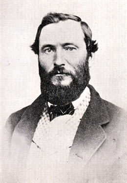
Charles Street originates in the 1876 plat of Plummer’s Addition to the City of Seattle, filed by George Washington Harris (late 1840s–1914).* How did Harris end up with the land, and why would he name the addition after Charles Plummer (who, it appears from the text of the plat description, bought the tract from David Swinson “Doc” Maynard in 1860)?
As it turns out: Plummer married Ellender Smith (sister of Dr. Henry A. Smith, namesake of Smith Cove and Smith Street) in 1855. Harris’s mother, Sarah Jane Crossman, was widowed the next year. Plummer himself became a widower when his wife died giving birth to twins Edward and Frank in 1859, and he married Harris’s mother in 1860, apparently at Maynard’s own Alki Point house. Harris then became Plummer’s stepson (and a daughter, Ida, was born to the newlyweds the next year). When Plummer died in 1866, Harris apparently inherited at least this much of his stepfather’s estate. (It’s unclear just what Edward and Ida may have received; Frank is reported to have inherited $60,000.)
Charles Plummer
Today, S Charles Street begins at Airport Way S and 6th Avenue S and is stopped a block and a half to the east at 7th Avenue S by the city’s Charles Street Service Center. (Its twin to the south, S Plummer Street, also ends at the service center, never to return.) It briefly reappears at the northern lip of Beacon Hill between 12th Avenue S and Sturgus Avenue S, and then east of Interstate 90 runs for about ⅓ of a mile between Poplar Place S and 20th Place S at Judkins Park. The right-of-way, which continues through the park, becomes an improved street again at 22nd Avenue S, and ends just east of 26th Avenue S. East of here, S Charles runs three blocks from 28th Avenue S to 30th Avenue S, and then around ¼ mile made up of alternating roadway and stairways from the alley west of 32nd Avenue S to a shoreline street end on Lake Washington — one of Leschi’s String of Pearls.
Note added October 23, 2023: S Charles Street now begins at 1st Avenue S and goes a block east to Occidental Avenue S, before resuming on the other side of Lumen Field at Airport Way S.
Because its original location is covered by King County Metro’s Atlantic Base and Interstate 5, Judkins Street now starts on Beacon Hill just west of 12th Avenue S and goes around 850 feet east to just east of 14th Avenue S, where it becomes a stairway to 15th Avenue S. The unimproved right-of-way continues through a greenbelt to 16th Avenue S, where there exists a 100-foot stretch of Judkins before it is stopped by Sturgus Avenue S, Daejon Park, and Interstate 90. On the other side of I-90, it resumes at 20th Avenue S and goes ⅘ of a mile east to Lake Washington Boulevard S, the last 50 or so feet being a stairway. Between Lake Washington Boulevard S and Lakeside Avenue S, only the first 150 feet is improved, mainly serving as a driveway for two houses. And east of Lakeside Avenue S there is a very short stretch that, like its neighbor to the north, S Norman Street, turns into a shoreline street end on Lake Washington — one of Leschi’s String of Pearls.
Built on the site of a former ravine landfill that was used for about four decades, Judkins Park was transferred to the parks department in the late 1940s and early 1950s, and opened to the public on October 8, 1977, according to a story in the October 6 issue of The Seattle Times.
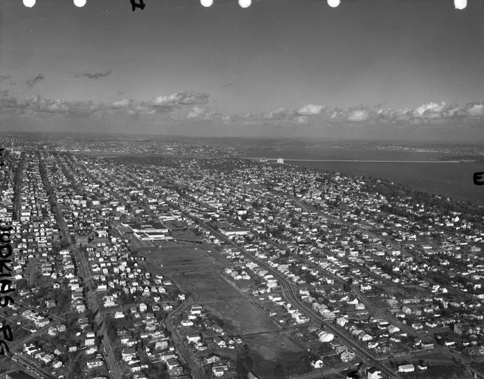
Aerial view of Judkins Park and Playfield, 1965. Courtesy of the Seattle Municipal Archives, Identifier 29470. S Judkins Street is at bottom center and right, below the park. Washington Middle School is at the north end of the park and 23rd Avenue S is the arterial to its east. Lake Washington and the Evergreen Point Floating Bridge (Washington State Route 520) are visible in the distance.
For the origin of S Norman Street, we go back to our first street name post, SW Seattle Street, which read in part:
On August 4, 1869, Ike M. Hall — the executor of the estate of Norman B. Judkins — filed the Judkin’s (sic) Addition to the Town of Seattle, located just southwest of where the interchange between I-5 and I-90 is today. From north to south, the east–west streets are named Norman, B, Judkins, Addition, Town, and Seattle.
Today, S Norman Street begins on the other side of Beacon Hill, the portion shown above having been obliterated by King County Metro’s Atlantic Base and Interstate 5. (In fact, S Addition Street is the only one remaining in its original location, Judkins Street now starting on Beacon Hill and Seattle Street only existing in West Seattle.) Beginning at Poplar Place S just east of Interstate 90, it goes for a block northeast to Rainier Avenue S. It picks up again at Davis Place S and S Bush Place and goes a block east to 21st Avenue S. Resuming at 22nd Avenue S, just east of Judkins Park (also named for Norman B. Judkins), it goes ⅗ of a mile east to 33rd Avenue S, with only two short interruptions:
An unimproved stretch south of St. Gebriel Ethiopian Orthodox Church between 26th Avenue S and Martin Luther King Jr. Way S: what looks to be a bramble patch followed by a driveway for some townhouses; and
A stairway from 31st Avenue S to half a block west of 32nd Avenue S.
There appears to be a privately maintained stairway from 33rd Avenue S down to Lake Washington Boulevard S, and the next block is completely unimproved, though in both cases neighbors appear to be incorporating the right-of-way into their yards and driveways. Finally, there is a short stretch of Norman Street east of Lakeside Avenue S that turns into a shoreline street end on Lake Washington — one of Leschi’s String of Pearls.
King County Parcel Viewer showing S Norman Street between 26th Avenue S and Martin Luther King Jr. Way S. What appears to be a private driveway from Martin Luther King is actually public right-of-way.King County Parcel Viewer showing S Norman Street from 33rd Avenue S to Lake Washington. The private driveway in the public right-of-way east of Lake Washington Boulevard S (center of image) is easily visible, as is the shoreline street end east of Lakeside Avenue S.
W View Place, formerly an unnamed block-long alley between 28th Avenue W and 29th Avenue W just south of W Elmore Place, was named in 1950 at the request of Norman E. Boor, et al. The houses at 2805, 2815, and 2829 were all built in 1947, according to county records; I suppose this necessitated that the street be named, and for some reason no one could come up with anything more interesting than “View,” for the view of Ballard residents were able to enjoy.
Given the choice between W Boor Place and W View Place, I’d take the latter, but really… I’m surprised this was approved, especially given the existence of View Avenue NW near Golden Gardens Park.
But given the power of naming bestowed on platters of subdivisions, why would Edward B. Cox and Harry Whitney Treat, and Treat’s wife, Olive Marion Graef Treat, name something simply “View Avenue,” as was done in the 1907 plat of Loyal Heights? I think it and W View Place must be tied for the most boring street name in Seattle, but am willing to consider other contenders for the title.
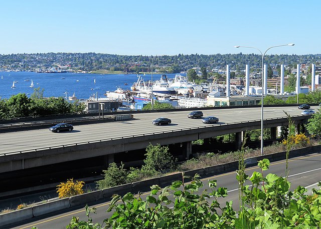
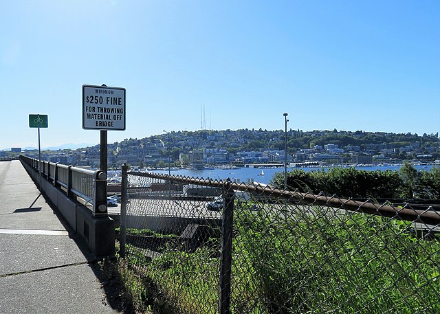
Lakeview Boulevard E, which originated in David and Louisa Denny’s 1886 East Park Addition to the City of Seattle, is named for its view of Lake Union to the west. For a time part of the Pacific Highway (now routed onto Aurora Avenue N), it begins today at an overpass over Interstate 5 at Eastlake Avenue E and Mercer Street and goes a mile north to Boylston Avenue E and E Newton Street.
Interstate 5 blocks the view of the lake from much of the northern section of the street, but the southern section’s view is still more or less intact.
Undated daguerreotype portrait of Louisa Boren Denny
Today, E Louisa Street begins at Minor Avenue E and goes a block east to Yale Avenue E. It resumes half a block east at the alley west of Eastlake Avenue E and makes it 2½ blocks before being stopped by Interstate 5 at Boylston Avenue E. Resuming in the Montlake neighborhood just west of W Montlake Place E, it then goes ¼ mile east to 25th Avenue E.
Forming a trio with Eastlake Avenue and Northlake Way, Westlake Avenue is so named for running along the western shore of Lake Union. Beginning today at Stewart Street between 5th Avenue and 6th Avenue, just north of McGraw Square, it runs 2½ miles north to 4th Avenue N between Nickerson Street and Florentia Street — the south end of the Fremont Bridge.
Westlake Avenue once started a couple of blocks to the south, at 4th Avenue and Pike Street, and based on the quarter section map, it appears that its former route through Westlake Park between Pike Street and Pine Street is still public right-of-way as opposed to park land. (The portion between Pine Street and Olive Way was vacated in 1986 to make way for the Westlake Center mall, which opened in 1988, and the portion between Olive Way and Stewart Street was closed in 2010 to allow for the expansion of McGraw Square.)
Westlake was extended south to 4th and Pike from Denny Way in 1902 (one former mayor has called for that extension to be closed to cars); the original Westlake Avenue (now, properly, Westlake Avenue N) was created in 1895 as part of the Great Renaming ordinance, Section 5 of which reads
That the names of Rollin Street, Lake Union Boulevard and Lake Avenue from Depot Street [changed by the same ordinance to Denny Way] to Florentia Street, be and the same are hereby changed to Westlake Avenue.
Rollin Street, the southernmost portion, was named for Rolland Herschel Denny (1851–1939), the youngest member of the Denny Party at just six weeks old. In its honor, an apartment complex that opened at the corner of Westlake and Denny in 2008 is named Rollin Street Flats.
Having covered Northlake, Eastlake, and Westlake so far, one might ask: why is there no Southlake?
There does appear to have been a Southlake Avenue for a time — 1909 to 1924 or so, based on the last mention of it I could find in Seattle newspapers, an article in the August 8, 1924, edition of The Seattle Times on a car crash that had taken place a number of weeks earlier. Now the northern section of Fairview Avenue N, it extended from the intersection of Valley Street northwest to E Galer Street and Eastlake Avenue E, “thus eliminating the present grade on Eastlake for University traffic” in the words of a real estate advertisement in the August 23, 1914, edition of the Seattle Post-Intelligencer. But why the Southlake name disappeared seems clear: once it was decided to extend the Fairview name along the shore lands, there was no other appropriate road to carry it. The northern and eastern shores of Lake Union are just shy of 2 miles long each, but since the lake is shaped like a ? (and, surprisingly, like a uterus if Portage Bay is included) there is hardly any southern shore to speak of — only about ¼ mile.
As for the neighborhood name, I’m not sure why South Lake Union came to be used instead of Southlake. Perhaps it’s as simple as the lack of a similarly named street to “anchor” the neighborhood.
Like NE Northlake Way, Eastlake Avenue E is so named because it runs along the shore of Lake Union — in this case, obviously, the eastern one. It, too, was earlier named Lake Avenue (in part), but this was changed as part of the Great Renaming of 1895. Ordinance 4044, Section 6 reads
That the names of Albert Street, Waterton Street, Lake Avenue and Green Street from Depot Street [changed by the same ordinance to Denny Way] to the shore of Lake Union at the northerly point of the Denny–Fuhrman addition, be and the same are hereby changed to Eastlake Avenue.
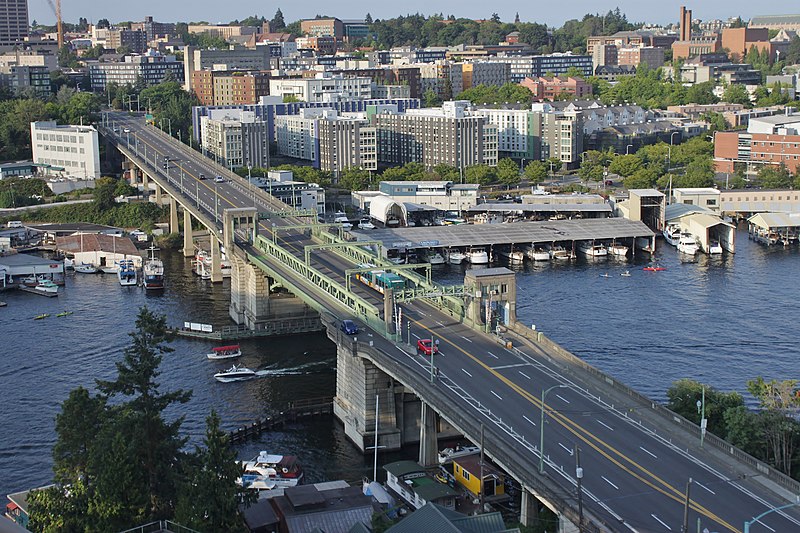
Today, Eastlake, at 2⁹⁄₁₀ miles in length, extends slightly farther north and south than the roadway mentioned in the ordinance. It starts in the south at the intersection of Court Place and Howell Street as Eastlake Avenue, then becomes Eastlake Avenue E a block north as it crosses Denny Way. From here to just south of E Galer Street it divides the Avenue: E; Street: E section of town from the Avenue: N; Street section. Just north of Portage Bay Place E it crosses Lake Union as the University Bridge, then continues on as the one-way–northbound Eastlake Avenue NE to 11th Avenue NE just north of NE 41st Street. (Southbound, it is fed by Roosevelt Way NE at NE Campus Parkway.)
Eastlake, like Fairview and Boren Avenues, is one of the few north–south streets in Seattle to have three different directional designations.
As explained in NE Boat Street, NE Northlake Way was originally Lake Avenue in the 1890 Brooklyn Addition to Seattle, so named because it ran along the northern shore of Lake Union. I couldn’t find an ordinance changing its name from Lake Avenue (used elsewhere, notably for what are now Westlake Avenue and Fremont Avenue N and for part of Eastlake Avenue E) to Northlake Avenue, but the latter name begins to appear in local newspapers in 1901. (Complicating matters slightly, the street appears as North Lake Avenue in the state’s 1907 plat of Lake Union Shore Lands.) Northlake Avenue began being referred to as Northlake Way in 1935, and this was made official in 1956.
Today, NE Northlake Way begins at the west end of NE Pacific Street under the University Bridge at Eastlake Place NE, and continues 1½ miles west to just shy of the Aurora Bridge, where it becomes a private road through formerly industrial land developed by the Fremont Dock Company into a business park. (The Puget Sound Business Journal and The Seattle Times have good articles on how over the years Suzie Burke transformed her father’s Burke Millwork Co., which opened in 1939, into what is today home to local offices for Google and Adobe and corporate headquarters for Tableau and Brooks Sports, among other tenants.) This private roadway continues for ⅖ of a mile beyond the end of the public right-of-way to the intersection of N Canal Street, N 34th Street, and Phinney Avenue N.
NE Northlake Way once began ⅖ of a mile further east, at NE Columbia Road on the University of Washington South Campus, but this stretch was changed to NE Boat Street in 1962, not without some controversy.
The Director of Highways is hereby authorized and directed to select and locate a suitable and fitting street and highway approach to the University of Washington campus in the City of Seattle, from Roosevelt Way to Fifteenth Avenue northeast, including an underpass beneath the surface of Roosevelt Way, and necessary approaches to said underpass.
(A separate section appears to have been responsible for the creation of Stadium Way in Pullman as an approach to Washington State University.) A Seattle ordinance passed the same year committed the city to build and maintain the road, as required by the law, and NE Campus Parkway opened in 1950 — HistoryLink refers to it as a “long-proposed ceremonial gateway to the University.” In 1954, the roadway was deeded to the city.
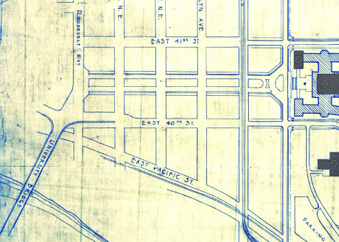
Portion of the Regents Plan showing planned route of Campus Parkway
In 1925 Bebb and Gould proposed a revision to their earlier Regents Plan of 1915, which included a formal boulevard that extended from the University to the west to serve as a principal entry to the campus from the city. Campus Parkway, the formal axis envisioned in the Regents Plan to the west, was constructed finally in the 1940s. It extended the University campus into its surrounding city neighborhood in a monumental and somewhat strident manner. Construction in the 1970s of an underground parking garage, below the Central Quadrangle [actually the Central Plaza, or Red Square], provided a primary vehicle entry south of Denny Hall, and reduced vehicular traffic along the campus ring road.
Traffic to and from lower campus and the lower University District via the University Bridge does necessarily take NE Campus Parkway, but it hardly functions as a gateway, ceremonial or otherwise. The entrance to the above-mentioned parking garage is at NE 41st Street, a block to the north; the west entrance to campus is a block to the south at NE 40th Street, which turns into W Stevens Way NE. One must take a narrow pedestrian bridge over 15th Avenue NE to walk from the parkway onto campus. The pedestrian-only southeast entrance at Rainier Vista and the north entrance at 17th Avenue NE, which turns into Memorial Way NE, fulfill the function far better.
Not even the UW Visitor Center is on NE Campus Parkway, having moved to Odegaard Library a number of years ago. Schmitz Hall, one of the university’s main administrative buildings, remains, between University Way NE and 15th Avenue NE, and with it the Office of Undergraduate Admissions and the Office of the University Registrar — and the university’s “mapping/directions address,” 1410 NE Campus Parkway.
(An aside — NE Campus Parkway was once home to the International Friendship Grove of Trees [see articles by Arthur Lee Jacobson and Dick Falkenbury] but many of the trees have since died or been removed.)
This Magnolia street, which goes not quite 700 feet from 37th Avenue W just south of W Armour Street in the south to W Fulton Street just west of 36th Avenue W in the north, originated in 1939 as part of the plat of Carleton Park Terrace, an Addition to the City of Seattle, filed by C.F. Bishop, Jr., his wife, Elizabeth, and the city of Seattle itself, owners of the land in question.
Charles F. Bishop, Jr. (1881–1963) was — according to his Seattle Post-Intelligencer and Seattle Times obituaries, and based on information in his father’s Times obituary from 1943 — born in Brockport, New York, near Rochester, and came to Seattle when he was 18. The elder Bishop was a marine engineer for the Alaska Steamship Company and the Puget Sound Navigation Company. Bishop Jr. was a grocery wholesaler who ran the Puget Sound Quality Stores (PSQ Stores) cooperative, which, according to local historian Paul Dorpat in his April 6, 1986 Now & Then column for the P-I, was a predecessor of Associated Grocers — now, after a number of mergers and acquisitions, part of United Natural Foods.
Bishop founded Modern Home Builders, Inc., with his brother, Ralph Waldo Bishop, Sr., in 1940, the year after he filed the plat of Carleton Park Terrace. This particular plat of his carried no racial restrictive covenants, but the adjacent Carleton Park Terrace Division № 3, filed in 1941, did, banning non-whites from living in the subdivision unless they were domestic servants of white residents.
To reach their homes, residents of Bay Terrace — east of Lawtonwood and west of Land’s End at the northern tip of Magnolia — must drive through Discovery Park. Within the park, their street (the narrow neighborhood only has one) is known as Bay Terrace Road, but changes to 42nd Avenue W north of the park boundary. Similarly to Lawtonwood Road, it does not appear to have been officially so designated until 2007, when ordinance 122503 was passed. Also similarly to Lawtonwood Road, it carries no directional designation, since it is a park boulevard.
Bay Terrace Road runs ¼ mile north from Lawtonwood Road just west of 40th Avenue W, and then becomes 42nd Avenue W, which continues on for another ⅕ of a mile to a viewpoint overlooking Shilshole Bay.
The neighborhood of Lawtonwood, or Lawton Wood — both spellings have been in use over the years — is perched atop Discovery Park north of W Cramer Street. Lawtonwood Road, which goes through the park, is the only way in or out. It would have been a natural part of Fort Lawton, and it certainly would have made a great addition to the park, but as local historian Paul Dorpat explains in his introduction to the neighborhood,
Steady white settlement started in 1875 when German immigrant Christian Scheuerman moved to the area, cleared the timber and married a native woman who had ten children before she died in 1884. In 1895 Seattle boosters organized to attract a military post to the area and gathered the acreage that is now Fort Lawton–Discovery Park. The part of it that is now Lawton Wood… is not part of the military holding because Scheuerman withheld it.
It should not be thought that Scheuerman cared nothing at all for the defense of Seattle — he and his family did donate 26.13 acres to the cause — though that made up less than 4% of the 704.21 acres given in total. (The single largest contributors of land were Thomas W. Prosch and his wife, Virginia, who gave 330.97 acres, a full 47%.)
Dorpat continues:
Soon after the military moved in next door, this protected enclave was improved with mansions of a few of Seattle’s elite. In 1952 these neighbors — about 30 houses sparingly distributed about a generous 30 acres – organized the Lawton Wood Improvement Club, waving the motto “To Beautify and Develop Lawton Wood.” By the time that the last of the Scheuermans, Ruby, moved out in the late 1970s, the beautifying had turned more to developing, and the lots got smaller.
The first reference to Lawtonwood Road I was able to find in The Seattle Times or the Seattle Post-Intelligencer is from 1935, but it does not appear to have been officially so designated until 2007. According to ordinance 122503, park roads “are considered ‘private’” — technically residents of Lawtonwood and Bay Terrace had no legal right to transit the park to reach their homes, though of course they had never been prevented from doing so. To rectify this and other issues, and in anticipation of the privatization of the residences on Officers’ Row and Montana Circle, the ordinance made Lawtonwood Road, Bay Terrace Road, Utah Street, Washington Avenue, California Avenue, Iowa Street, Illinois Avenue, Texas Way, Idaho Avenue, and 45th Avenue W “public park boulevards.”
Note, by the way, that none of these streets except 45th Avenue W contain a directional designation. Ordinarily one would expect to see W Lawtonwood Road, or Lawtonwood Road W, but park roads in Seattle carry no directional designation. An exception seems to have been made for 45th Avenue W, presumably because a numbered avenue with no directional designation “belongs” in Madrona or Leschi, seven miles to the southeast.
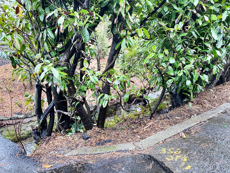
The bulk of W Lawton Street comes not from the Lawton Park plat, which covered 34th Avenue W to 36th Avenue W, but from a grant from the federal government in 1909 for sewer and street purposes. Lawton Street was laid out along the north edge of the fort, from its northwest corner at 36th Avenue W to what is now 40th Avenue W. There is a short discontinuity beginning about 250 feet east of 40th Avenue W consisting of a footpath and stairs; I’m not sure when that was created, but I don’t think it was the original configuration, as that would have defeated the purpose of the street.


.jpg)
.jpg)
.jpg)