Gilman Avenue W

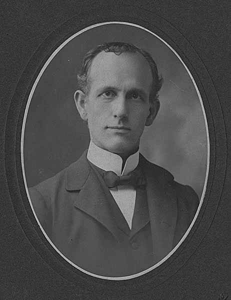
This street was named for Daniel Hunt Gilman (1845–1913), who among other things was one of the founders of the Seattle, Lake Shore and Eastern Railway (SLS&E) in 1885. The SLS&E is now part of the BNSF Railway, and its old right-of-way along the Lake Washington Ship Canal and Lake Washington is now the Burke–Gilman Trail.
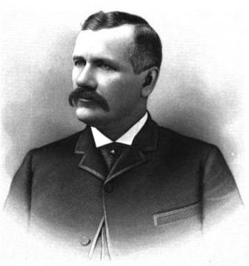
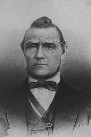
Daniel Hunt Gilman, circa 1890

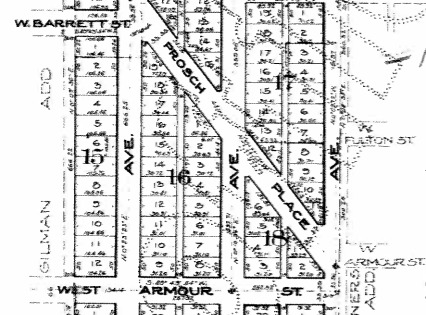
The street was created in 1890 as part of Gilman’s Addition to the City of Seattle by Dr. Henry A. Smith (Smith Cove) and Franklin M. Jones and his wife, Carrie B. Jones. Franklin was a member of the New York banking firm Jameson, Smith and Cotting, financiers of Gilman’s business ventures.

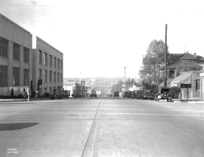
Today, Gilman Avenue W begins at 20th Avenue W and W Bertona Street and goes ⁹⁄₁₀ of a mile northwest to 28th Place W, where it becomes W Government Way. The right-of-way continues on from there, though, and there is a 120-foot-long segment between 32nd Avenue W and Gay Avenue W and then, on the other side of Kiwanis Memorial Preserve Park, another 120-foot-long segment at the end of 34th Avenue W.

Originally, Gilman Avenue W existed east of the railroad tracks as well, but that section, between 15th Avenue W and 11th Avenue W, was changed to Gilman Drive W in 1961.
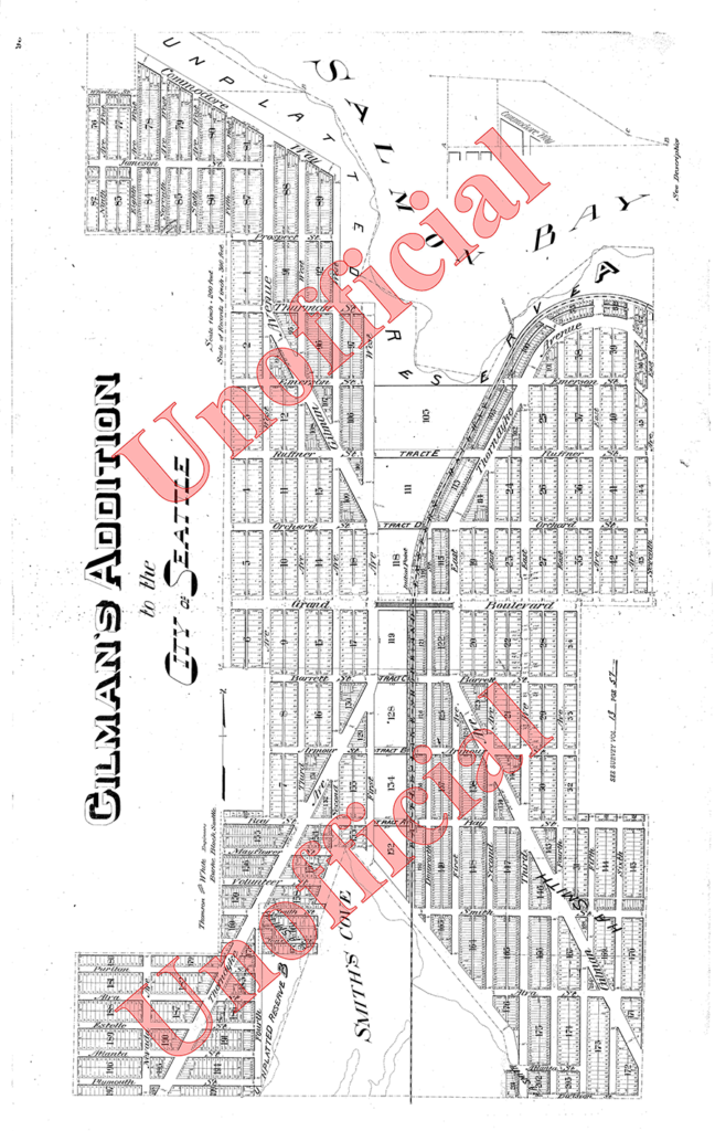
Gilman's Addition to Seattle, 1890, two sheets stitched together
Gilman’s Addition to Seattle, 1890

Yukon Avenue S

This very short street (375 feet long) in the Dunlap neighborhood runs from Spear Place S in the south to S Henderson Street in the north. Like Valdez Avenue S, which it intersects, it was established in 1905 as part of Dunlap’s Supplemental to the City of Seattle, and was named after the Yukon River, likely due to the recent Klondike Gold Rush (ended 1899).

Yukon Avenue S, incidentally, holds the distinction of being the at the very end of the list of Seattle streets taken in alphabetical order — hence the tagline for Streets of Seattle, a blog from 2012 that sadly never seems to have gotten off the ground: “Seattle street names, from Adams to Yukon.”

Valdez Avenue S

This short street (just ⅛ of a mile long) connects Martin Luther King Jr. Way S to Yukon Avenue S in Seattle’s Dunlap neighborhood. Established in 1905 as part of Dunlap’s Supplemental to the City of Seattle, it was named after Valdez, Alaska, which was itself named after Spanish naval officer Antonio Valdés y Fernández Bazán. (Other streets in the plat include the above-mentioned Yukon Avenue as well as Tanana Drive, Fairbanks Drive, and Rampart Drive. Tanana Drive is now part of S Henderson Street; Fairbanks Drive is now S Fairbanks Street; and Rampart Drive is now part of S Director Street.)

I haven’t been able to find a specific connection the Hulbert or Dunlap families might have with Alaska, but 1905 was just six years after the Klondike Gold Rush ended, and just four years before the Alaska–Yukon–Pacific Exposition. Seattle’s population went from 42,837 in 1890 to 80,671 in 1900 — an increase of 88% — and much of this was due to its central role in the gold rush as “the premier supply centre and the departure point for the gold fields.”

Boyer Avenue E

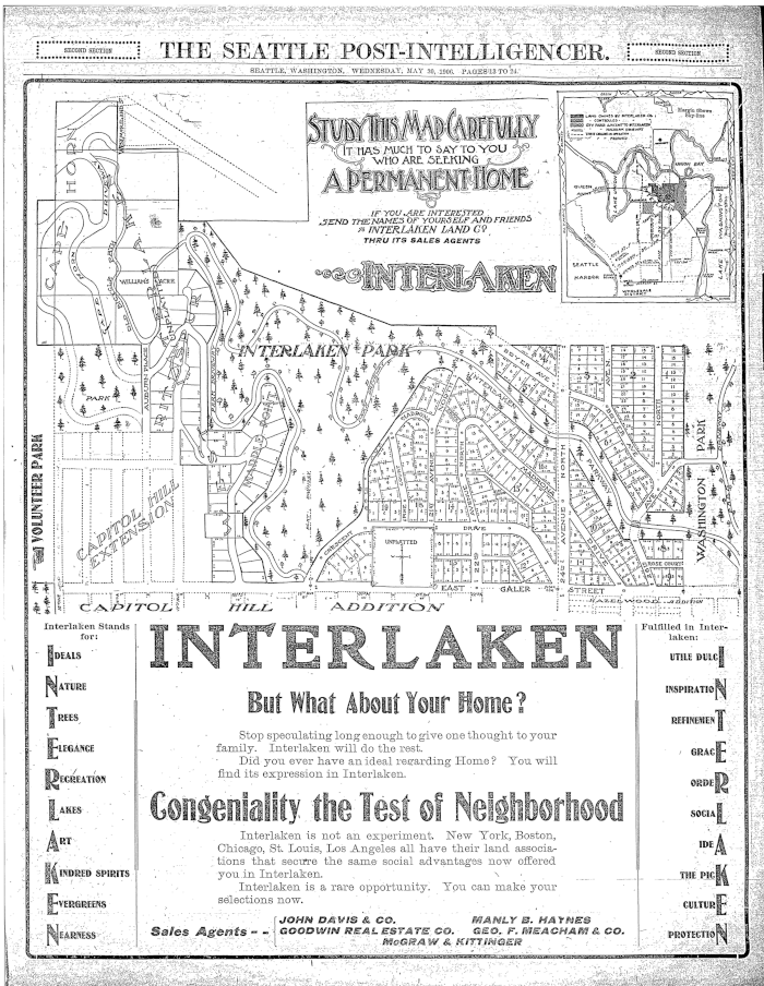
This street, which runs just over 1⅓ miles from Lake Washington Boulevard E northwest to Fuhrman Avenue E, was established in 1905 as part of Interlaken, an Addition to the City of Seattle, platted by the Interlaken Land Company, whose president was John E. Boyer (1866–1961).

Advertisement for Interlaken in the Seattle Post-Intelligencer, May 30, 1906

California Avenue SW

This West Seattle street was established in 1888 as part of the First Plat of West Seattle by the West Seattle Land and Improvement Company. As “most of [its] capital came from San Francisco,” I would assume that is why California Avenue was given its name.

California Avenue SW — a major West Seattle arterial connecting the Admiral, Alaska, and Morgan Junctions (three commercial hubs named after long-gone streetcar line intersections) — runs 4½ miles from California Lane SW in the north, past which it turns into California Way SW on its way down the hill to the waterfront, to SW Sullivan Street in the south. Beyond there it exists as a few short segments, then briefly as part of the SW Brace Point Drive–SW Barton Street arterial, and lastly as a nearly mile-long residential street that ends at Marine View Drive SW.

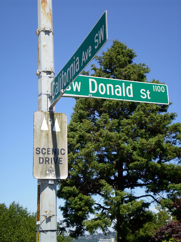
Sign at corner of SW Donald Street and California Avenue SW, July 4, 2011
Sign at corner of SW Donald Street and California Avenue SW, July 4, 2011. Photograph by Benjamin Lukoff. Copyright © 2011 Benjamin Lukoff. All rights reserved.

Maynard Avenue S

Maynard Avenue S, which was 8th Street in David Swinson “Doc” Maynard’s first plat of Seattle in May 1853, was given its current name as part of the 1895 Great Renaming. It begins today at S Main Street* and goes about ⅖ of a mile south to Airport Way S just past S Charles Street. There is another block-long segment in the Industrial District and then one of 2½ blocks in Georgetown. Maynard is generally credited with naming the town of Seattle, after his friend siʔaɫ, or Chief Seattle, and he was its “first physician, merchant, Indian agent, and justice of the peace.”

* As a card-carrying address nerd, I feel compelled to mention that the driveway for the Nippon Kan Theatre/Kobe Park Building at the dead end of S Washington Street is, technically, the northernmost segment of Maynard Avenue S, at least for its first hundred feet.

David Swinson Maynard, ca 1868, photographer unknown

Maynard — unlike Republican Arthur Armstrong Denny, who platted the tract to the north — was a Democrat, and named a number of streets in his plat after prominent Democratic politicians, including the slaveholders President Andrew Jackson and Vice President William Rufus DeVane King; Oregon Territorial Governor Joseph Lane, who went on to be the pro-slavery Southern Democratic candidate for vice president in 1860; and pro-slavery California Senator John B. Weller. I haven’t seen much online about Maynard’s personal racial views, but he was known to have had good relations (given the era) with the local Native Americans, at least. Junius Rochester writes for HistoryLink:

Perhaps one of Doc Maynard’s most enduring qualities, besides his amiability, was his high regard for the local Indians. Chief Seattle was a particular friend, having stated: “My heart is very good toward Dr. Maynard.” Maynard, who knew tribulations in his own life, understood that besides the tools, medicines, guns, and other wonders that the white men had brought to Puget Sound, they also introduced disease, intolerant religions, and the inhospitable idea of private property.

But, as Clay Eals notes,

There can be no avoiding his privileged promotion of white settlers at Native Americans’ expense. “They will fight,” he writes on Nov. 4, 1855. “There is no reason why they (sho)uld not, but we must conquer them.”

One hopes that, if Maynard were alive today, he would choose worthier men (and women) to honor than Jackson, King, Lane, and Weller.

Post Avenue

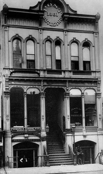
Counting Post Avenue and Post Alley as one street, and ignoring a couple of block-long gaps, this street runs about ¾ of a mile from Yesler Way in the southeast to Virginia Street in the northwest. (Post Avenue becomes Post Alley northwest of Seneca Street.) According to local historian Jean Sherrard, writing at PaulDorpat.com, it was named for the offices of the Seattle Post, predecessor of today’s Seattle Post-Intelligencer newspaper, which was built at the corner of Yesler and Post in 1881.

Seattle Post Building, by Asahel Curtis

Prosch Avenue W

Thomas Prosch, who named Conkling Place W after his mother, didn’t neglect to name something after himself. Prosch Avenue W runs about ¼ mile from W Barrett Street in the north to 13th Avenue W in the south. It appears as Prosch Place in Prosch’s Queen Anne Addition to the City of Seattle in 1909. Six years later, Prosch was killed in a car crash that also took the lives of his wife, Virginia; painter Harriet Foster Beecher; and Margaret Lenora Denny, namesake of Lenora Street.

Thomas Wickham Prosch, 1890
Portion of Prosch's Queen Anne Addition to the City of Seattle, 1909
Portion of Prosch’s Queen Anne Addition to the City of Seattle, 1909

Fairview Avenue N

Fairview Avenue is one of a handful in the city that changes directional designations twice along a continuous stretch. The street begins in the south at Virginia Street as Fairview Avenue, but becomes Fairview Avenue N a block and a half to the north as it crosses Denny Way, and a mile north and east of that becomes Fairview Avenue E at E Galer Street and Eastlake Avenue E. It continues to E Roanoke Street, two miles from its origin, where it is interrupted by the Mallard Cove houseboat community. Picking up a block to the north, it then runs half a mile from E Hamlin Street to Fuhrman Avenue E and Eastlake Avenue E, just south of the University Bridge.

Originally Lake Street in Rezin and Margaret Pontius’s 1875 plat of the Fairview Homestead Association for the Benefit of Mechanics and Laborers, it received its current name during the Great Renaming of 1895. (Before 1875, it had been known as Prohibition Street.)

The Fairview Homestead Association, according to Paul Dorpat, was intended to “help working families stop paying rents and start investing in their own homes. Innovative installment payments made the lots affordable and many of the homes were built by those who lived in them.”

I assume Fairview took its name from the view of Lake Union and what is now Wallingford that is still barely visible today from what is now the Cascade neighborhood.

1931 view looking north toward Lake Union along Fairview Avenue N, Courtesy of the Seattle Municipal Archives, Identifier 5265

Occidental Avenue S

Occidental Avenue S, which begins at Yesler Way in Pioneer Square, is one of those Seattle streets whose names extend into the suburbs. It makes its southernmost appearance at S 197th Street in Des Moines.

It received its name in 1895 as part of the Great Renaming — it had originally been S Second Street. It once had a partner, Oriental Avenue, to the east (originally S Fourth Street), which is today 3rd Avenue S. “Oriental,” of course, means “Eastern,” as “Occidental” means “Western.” (I haven’t been able to determine just when Oriental Avenue became 3rd, but it was last mentioned in The Seattle Times on October 17, 1920.)

And why this particular pairing? The Occidental Hotel, which once overlooked the beginning of Occidental Avenue, is almost certainly the reason, but it’s not spelled out in the ordinance.