W McLaren Street

Continuing the story we began in Hubbell Place, we take up W McLaren Street in Magnolia, which runs about 950 feet from Perkins Lane W in the west to 43rd Avenue W and W Ruffner Street in the east. 

As was previously mentioned, the ordinance establishing Hubbell Place “accept[s] a deed of conveyance from George S. McLaren, et ux, and Helen Moore Hubbell” for the land. Who was this McLaren, and was he the namesake of W McLaren Street?
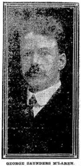
Photo of George S. McLaren that ran in the August 4, 1911, issue of The Seattle Times

George S. McLaren appears to have been on the finance committee of the 1909 Alaska–Yukon–Pacific Exposition, and Clarence Bagley’s History of Seattle from the Earliest Settlement to the Present Time notes that he was among the founders of Seattle’s Nile Shrine Temple in 1908. He is mentioned in the press as being an investment manager for the Northwestern Mutual Life Insurance Company, a founder of the Lake Chelan Land Company, and a representative of the Milwaukee Road in purchasing tideland real estate. And in February 1906, he was apparently one of the local businessmen who proclaimed, in the words of The Seattle Star, that “Something Will Be Done to Lift From the Shoulders of This City the Burden Placed There by the Sunset Telephone Co.,” and managed to get 2,000 similarly minded “long-suffering contributors to the yawning coffers of the Sunset concern” to assemble at the Grand Opera House to determine how best to “[remedy] the existing evil.”

In short, he does appear to have been, as The Hood River Glacier described him on August 10, 1911, “one of the leading business men of Seattle,” whose death “of ptomaine poisoning caused by eating canned mushrooms at a dinner at Tacoma” must have come as a great shock to the community.

As for W McLaren Street? It’s part of the Magnolia Heights subdivision, which was platted in 1907.
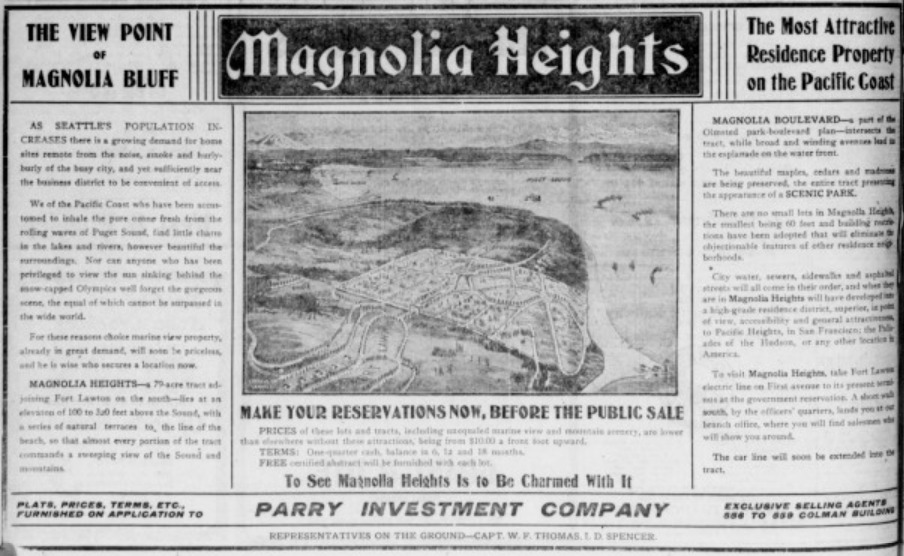
Advertisement for the Magnolia Heights subdivision in The Seattle Star, May 4, 1907

I thought it possible that George S. McLaren and W McLaren Street were related, but couldn’t be certain — nothing appeared in historical newspapers to definitively link the two. Then I looked him up in AncestryLibrary.com, which Seattle Public Library cardholders can access for free. And there it was! His probate records from 1911 contained an inventory of his assets, and among them were a “note of Magnolia Heights Co. for $333.33, dated September 5, 1907” and a “note of Parry Investment Co., for $155.64, dated July 17, 1907.” (Incidentally, both were valued at nil, though his total assets amounted to $367,228.76, or about $9.5 million in today’s money.)
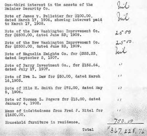
Portion of inventory of the assets at death of George S. McLaren, from King County probate records via AncestryLibrary.com

As you can see in the newspaper advertisement above, the Parry Investment Company marketed lots in Magnolia Heights, which was platted by the Magnolia Heights Company. I’m willing on that basis to say that George McLaren’s name lives on in W McLaren Street. 

W Marina Place

This street, established in 1991 as part of the development of the Elliott Bay Marina at the southern foot of Magnolia Bluff, runs ⅖ of a mile west from 23rd Avenue W to just shy of the 30th Avenue W street end beach.

While the origin of its name may not be interesting, the story of its establishment is a bit more so:

  • The marina itself began the permitting process in 1983, but lawsuits delayed its creation for nearly a decade. The Muckleshoot Indian Tribe and Suquamish Tribe sued to block its construction on the basis that “construction of the Marina would eliminate a portion of one of their usual and accustomed fishing areas in Elliott Bay and thus would interfere with their treaty right to fish at the Marina site.” Homeowners on the bluff above intervened on the side of the developers, as “the area has had numerous major landslides that have left several homes at the crest of the bluff at risk and have repeatedly caused breaks in a trunk sewer line located at the base of the bluff.… The Marina construction includes the placement of 500,000 cubic yards of fill at the toe of the bluff, which would stabilize the area.” Eventually, a settlement was reached, which “calls for ongoing fisheries-related expenses paid to the tribe, which will be funded by a percentage of the moorage income.… [the] ‘Indian Treaty Surcharge.’”
  • I believe this was the last major fill operation within Seattle city limits. Such a development would be all but unthinkable today.
  • The marina was built on tidelands where W Lee Street and Puget Avenue W were platted but never built. They were vacated and W Marina Place was established. When it came to naming the access road, the developers originally proposed W Marina Boulevard, contending that as the road fell between the W Oakes Street right-of-way and the former W Lee Street right-of-way, it wasn’t a violation of the city’s principle of maintaining street grid names as much as possible. This was initially rejected by the city, which preferred W Lee Street, but after further discussion, W Marina Place was settled on. An interesting point the developers made was that as W Lee Street had never physically existed in Magnolia, though it had been platted there, calling the access road W Lee Street could actually be confusing, as “people familiar with Seattle streets know that there is no W Lee Street on Magnolia. Rather, they know W Lee Street as being on Queen Anne Hill.” Still, though, I have to believe they were more interested in their own vanity — Marina Boulevard? — than any particular concern for folks’ ability to navigate.
  • For some reason, the public street ends just feet from the 30th Avenue W street end beach. I’m not entirely sure why that is; I don’t think the marina is opposed to public access to the beach; otherwise, they wouldn’t be in favor of the Magnolia Trail project, which would connect W Marina Place to W Galer Street, 32nd Avenue W, and thence to Magnolia Village.
Aerial photograph of Elliott Bay Marina area in the 1930sAerial photograph of Elliott Bay Marina area, present day
Elliott Bay Marina site, 1930s and today

W Ruffner Street

This street, which runs, with interruptions, for 2⅓ miles from Queen Anne to just short of Elliott Bay in Magnolia (though it is platted for several more blocks west over the tideflats) is named, as I learned from the Ruffner Family Association, for Presbyterian minister William Henry Ruffner. A slaveholder who “advocated the gradual emancipation and colonization of the state’s African Americans”, he was also, according to Encyclopedia Virginia, “the designer and first superintendent of Virginia’s public school system.”

How did this “Horace Mann of the South” end up with his name on a Seattle street? Apparently, in addition to being an educator, he was also a geologist, and so was hired by Thomas Burke and Daniel Gilman (of Burke–Gilman Trail fame), two of the founders of the Seattle, Lake Shore and Eastern Railway, to spend just over five weeks in 1887 surveying the area, the results of which were published in the SLS&E’s promotional book A Report on Washington Territory two years later. When it came time in 1890 for the plat of Gilman’s Addition to the City of Seattle to be filed, Ruffner’s name appeared on the map. 

The Seattle, Lake Shore and Eastern became part of the Northern Pacific Railway in 1892. Today, the Interbay Car Shop of the BNSF Railway, successor to the NP, is located at the corner of W Ruffner Street and Gilman Avenue W.

Constance Drive W

This ⅔-mile–long Magnolia street is named for Mount Constance in the Olympic Mountains. Constance was the older sister of Ellinor Fauntleroy, namesake of Mount Ellinor and Ellinor Drive W. (There are no Magnolia streets named Edward, Arthur, or The Brothers.)

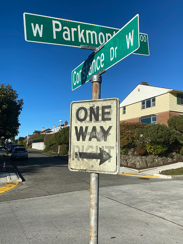
W Parkmont Drive and Constance Drive W street sign above One Way sign with Keep Right ghost sign underneath
Street sign at corner of W Parkmont Place and Constance Drive W, with One Way sign over Keep Right ghost sign, January 9, 2022. Photograph by Benjamin Lukoff. Copyright © 2022 Benjamin Lukoff. All rights reserved.

Ellinor Drive W

This short street in Magnolia’s Carleton Park subdivision is named for Mount Ellinor in the Olympic Mountains, which was itself named for Ellinor Fauntleroy, the fiancée of George Davidson of the U.S. Coast Survey, who named the peak in 1853. Nearby Constance Drive W is named for Mount Constance, itself named for Ellinor’s older sister.

Most of Magnolia’s streets follow Seattle’s cardinal-direction grid. Here, however, in the southwest corner of the neighborhood, they are laid out to follow the contour of the steep bluff that affords many streets a view of the Olympic Mountains, the Cascade Range, or both.