Westlake Avenue

Forming a trio with Eastlake Avenue and Northlake Way, Westlake Avenue is so named for running along the western shore of Lake Union. Beginning today at Stewart Street between 5th Avenue and 6th Avenue, just north of McGraw Square, it runs 2½ miles north to 4th Avenue N between Nickerson Street and Florentia Street — the south end of the Fremont Bridge.
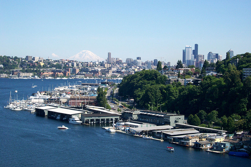
Westlake neighborhood and Mount Rainier from the Aurora Bridge, June 23, 2006
Westlake neighborhood and Mount Rainier from the Aurora Bridge, June 23, 2006. Photograph by Flickr user Steve Voght, licensed under Creative Commons Attribution-ShareAlike 2.0 Generic

Westlake Avenue once started a couple of blocks to the south, at 4th Avenue and Pike Street, and based on the quarter section map, it appears that its former route through Westlake Park between Pike Street and Pine Street is still public right-of-way as opposed to park land. (The portion between Pine Street and Olive Way was vacated in 1986 to make way for the Westlake Center mall, which opened in 1988, and the portion between Olive Way and Stewart Street was closed in 2010 to allow for the expansion of McGraw Square.)
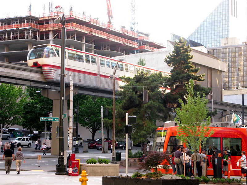
Monorail and streetcar, corner of Westlake Avenue and Olive Way, in 2008
Monorail and streetcar, corner of Westlake Avenue and Olive Way, in 2008. Photograph by Flickr user Oran Viriyincy, licensed under Creative Commons Attribution-ShareAlike 2.0 Generic

Westlake was extended south to 4th and Pike from Denny Way in 1902 (one former mayor has called for that extension to be closed to cars); the original Westlake Avenue (now, properly, Westlake Avenue N) was created in 1895 as part of the Great Renaming ordinance, Section 5 of which reads

That the names of Rollin Street, Lake Union Boulevard and Lake Avenue from Depot Street [changed by the same ordinance to Denny Way] to Florentia Street, be and the same are hereby changed to Westlake Avenue.

Rollin Street, the southernmost portion, was named for Rolland Herschel Denny (1851–1939), the youngest member of the Denny Party at just six weeks old. In its honor, an apartment complex that opened at the corner of Westlake and Denny in 2008 is named Rollin Street Flats.
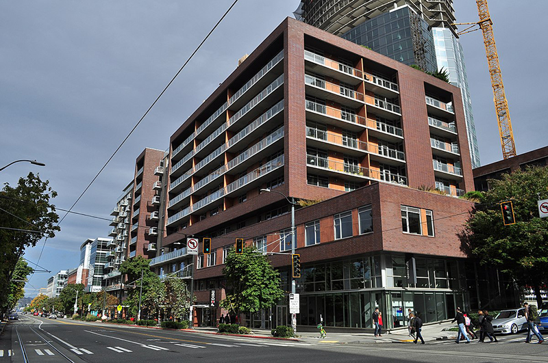
Rollin Street Flats, northeast corner of Westlake Avenue N and Denny Way, South Lake Union
Rollin Street Flats, northeast corner of Westlake Avenue N and Denny Way, South Lake Union, October 22, 2017. Photograph by Joe Mabel, Wikimedia Commons, licensed under Creative Commons Attribution-ShareAlike 4.0 International

Northlake, Eastlake, Westlake… why no Southlake?

Having covered Northlake, Eastlake, and Westlake so far, one might ask: why is there no Southlake?

There does appear to have been a Southlake Avenue for a time — 1909 to 1924 or so, based on the last mention of it I could find in Seattle newspapers, an article in the August 8, 1924, edition of The Seattle Times on a car crash that had taken place a number of weeks earlier. Now the northern section of Fairview Avenue N, it extended from the intersection of Valley Street northwest to E Galer Street and Eastlake Avenue E, “thus eliminating the present grade on Eastlake for University traffic” in the words of a real estate advertisement in the August 23, 1914, edition of the Seattle Post-Intelligencer. But why the Southlake name disappeared seems clear: once it was decided to extend the Fairview name along the shore lands, there was no other appropriate road to carry it. The northern and eastern shores of Lake Union are just shy of 2 miles long each, but since the lake is shaped like a ? (and, surprisingly, like a uterus if Portage Bay is included) there is hardly any southern shore to speak of — only about ¼ mile.

As for the neighborhood name, I’m not sure why South Lake Union came to be used instead of Southlake. Perhaps it’s as simple as the lack of a similarly named street to “anchor” the neighborhood.

Eastlake Avenue E

Like NE Northlake Way, Eastlake Avenue E is so named because it runs along the shore of Lake Union — in this case, obviously, the eastern one. It, too, was earlier named Lake Avenue (in part), but this was changed as part of the Great Renaming of 1895. Ordinance 4044, Section 6 reads

That the names of Albert Street, Waterton Street, Lake Avenue and Green Street from Depot Street [changed by the same ordinance to Denny Way] to the shore of Lake Union at the northerly point of the Denny–Fuhrman addition, be and the same are hereby changed to Eastlake Avenue.

Today, Eastlake, at 2⁹⁄₁₀ miles in length, extends slightly farther north and south than the roadway mentioned in the ordinance. It starts in the south at the intersection of Court Place and Howell Street as Eastlake Avenue, then becomes Eastlake Avenue E a block north as it crosses Denny Way. From here to just south of E Galer Street it divides the Avenue: E; Street: E section of town from the Avenue: N; Street section. Just north of Portage Bay Place E it crosses Lake Union as the University Bridge, then continues on as the one-way–northbound Eastlake Avenue NE to 11th Avenue NE just north of NE 41st Street. (Southbound, it is fed by Roosevelt Way NE at NE Campus Parkway.)

Eastlake, like Fairview and Boren Avenues, is one of the few north–south streets in Seattle to have three different directional designations.

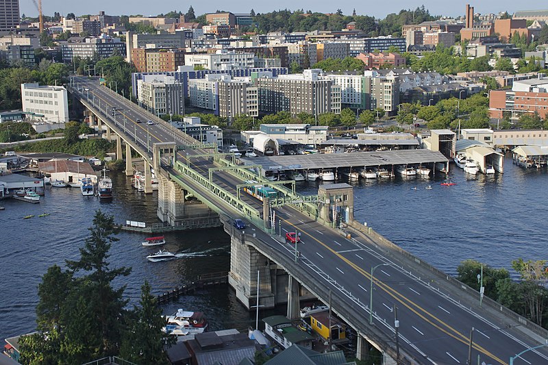
Looking northeast at the University Bridge from the Ship Canal Bridge in Seattle, July 2018
Looking northeast at the University Bridge from the Ship Canal Bridge, July 2018. Photograph by SounderBruce, Wikimedia Commons, licensed under Creative Commons Attribution-Share Alike 4.0 International

Canton Alley S

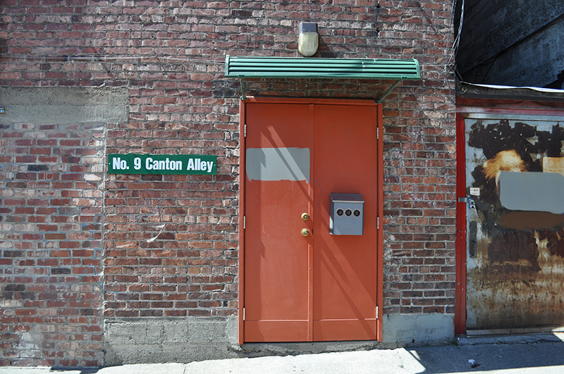
Canton Alley, twin to Maynard Alley a block to the west, is another one of the few named alleys in Seattle. It goes just under ⅕ of a mile from S King Street in the north to S Dearborn Street in the south, between 7th Avenue S and 8th Avenue S.

Similar to the one in Vancouver, British Columbia, it was named after the city and province of Canton in China, today known as Guangzhou in Guangdong province, from where the majority of Chinese immigrants to Seattle came.

As with Maynard Alley, even though Canton Alley had been called that for years, and was signed as such, its name was not officially made Canton Alley S until 2019, so that addresses from which 911 calls were coming could be more easily located and emergency vehicle response times could be reduced.

(The earliest reference I can find to Canton Alley in The Seattle Star, The Seattle Times, or the Seattle Post-Intelligencer is an article in the February 12, 1911, issue of the Times.)

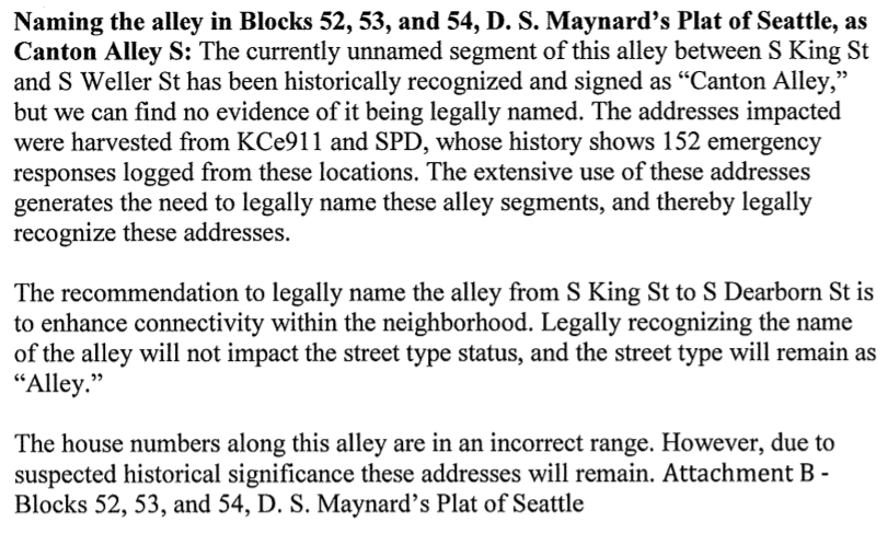
Portion of Summary and Fiscal Note to Seattle Ordinance 125753 Regarding Canton Alley S
Portion of summary and fiscal note to ordinance 125753 regarding Canton Alley S

One major difference between Canton and Maynard Alleys is the house numbers, as mentioned in the excerpt from the summary and fiscal note to the ordinance above. House numbers on Maynard Alley S follow the standard pattern; the 500 block of Maynard Alley is the one south of S King Street, due west of the 500 block of 7th Avenue S, that of 8th Avenue S, etc. But house numbers on Canton Alley S follow the “European system” (also used in American cities like New York), so very low addresses such as 9 Canton Alley S exist — quite rare in Seattle — and were not changed by the ordinance.

Maynard Alley S

Maynard Alley, one of the few named alleys in Seattle, goes just under ¼ mile from S Jackson Street in the north to S Dearborn Street in the south between Maynard Avenue S and 7th Avenue S. Like Maynard Avenue, it was named for David Swinson “Doc” Maynard, who is generally credited with naming the town of Seattle, after his friend siʔaɫ, or Chief Seattle, and was its “first physician, merchant, Indian agent, and justice of the peace.”

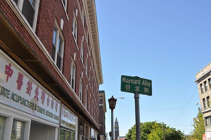
Maynard Alley sign, Seattle, 2010
Maynard Alley sign in front of Washington State Acupuncture and Chinese Medicine Center on S King Street, 2010. Photograph by Joe Mabel, Wikimedia Commons, licensed under Creative Commons Attribution-ShareAlike 3.0 Unported

Even though it had been named that for years, and was signed as such, its name was not officially made Maynard Alley S until 2019, so that addresses from which 911 calls were coming could be more easily located and emergency vehicle response times could be reduced. (The same thing was done for Canton Alley S, a block to the east, as part of the same ordinance.)

(The earliest reference I can find to Maynard Alley in The Seattle Star, The Seattle Times, or the Seattle Post-Intelligencer is an article in the March 30, 1910, issue of the P-I.)

Portion of Summary and Fiscal Note to Seattle Ordinance 125753 Regarding Maynard Alley S, from https://clerk.seattle.gov/search/ordinances/125753
Portion of summary and fiscal note to ordinance 125753 regarding Maynard Alley S

S Royal Brougham Way

This street begins at Colorado Avenue S in the west, at an onramp to the northbound lanes of the State Route 99 tunnel, and goes ⅔ of a mile east to Airport Way S. Originally S Connecticut Street, it was renamed in 1979 in honor of sportswriter Royal Brougham (1894–1978), who worked for the Seattle Post-Intelligencer newspaper from 1910 until his death. Such a name change was formally proposed by city councilman George Benson following a suggestion by P-I columnist Emmett Watson. Originally it was to be Occidental Avenue S whose name was to be changed, then the 2nd Avenue S Extension when objections were raised. Finally S Connecticut Street was settled upon; it was thought to be particularly appropriate because he “worked so hard to see the Kingdome built… and eventually spent his last day on earth there.”

Lumen Field, built on the former Kingdome site, is on the north side of Royal Brougham between 1st Avenue S and 4th Avenue S; and T-Mobile Park is on the south side between 1st Avenue S and 3rd Avenue S.

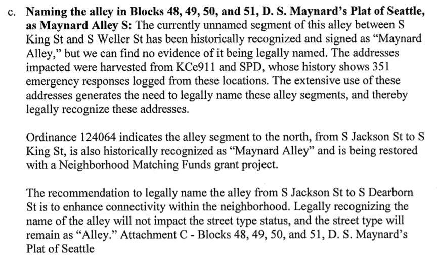
Royal Brougham's ID card for the Seattle Post-Intelligencer newspaper, 1925
Royal Brougham’s Seattle P-I staff ID card, 1925

Borealis Avenue

In 1948, when Aurora Avenue N (then U.S. Route 99) was being readied to connect to the under-construction Alaskan Way Viaduct, it was extended a block south of Denny Way to 6th Avenue and Battery Street, creating a short stretch of Aurora Avenue with no directional designation. This remained the case until 2019, when the replacement tunnel for the viaduct opened. At that time, Aurora south of Harrison Street reverted to its earlier name of 7th Avenue N, and since 7th Avenue south of Denny Way already existed, a new name was needed for the block-long Aurora Avenue.

According to The Urbanist, “Borealis,” referring to the aurora borealis, was a community favorite — but it was named after a nearby apartment building, not after the northern lights directly. As for why the names were changed in the first place, The Seattle Times reported that it was felt there were “negative connotations associated with [the name] Aurora Avenue” they wanted to avoid while reintegrating this stretch of the road into the neighborhood.

Lenora Street

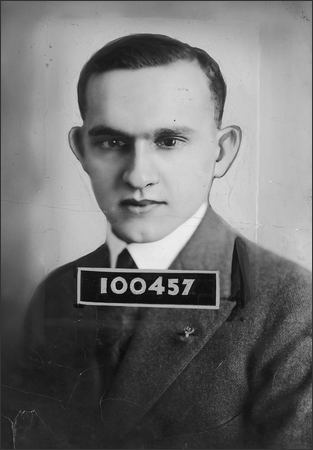
This street is named for Margaret Lenora Denny (1847–1915), daughter of Arthur Armstrong Denny and Mary Ann Boren Denny. She, like Virginia Bell (namesake of Virginia Street) was just four years old when her family, as part of the Denny Party, settled at Alki Point in 1851. She was killed in a car crash that also took the life of Thomas W. Prosch (Prosch Avenue W); his wife, Virginia; and artist Harriet Foster Beecher.

Margaret Lenora Denny, circa 1900

Established as part of A.A. Denny’s 6th Addition to the City of Seattle in 1873, it begins at Alaskan Way as an (temporarily closed as of this writing) elevator and pedestrian bridge over the BNSF Railway tracks. The street proper begins just west of where Elliott Avenue ends at Western Avenue. From there it is just shy of ¾ of a mile to its end at Denny Way and Boren Avenue.

Note added October 10, 2023: Lenora Street now begins a block further to the southeast, at Elliott Way.

Virginia Street

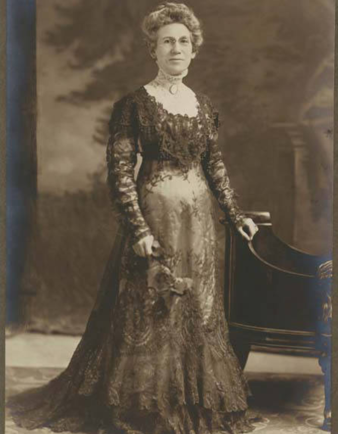
This street is named for Mary Virginia Bell Hall (1847–1931), daughter of William Nathaniel Bell and Sarah Ann Peter Bell. Belltown and Bell Street were named for her father, Olive Way for her sister, and Stewart Street for her brother-in-law. She was just four years old when her family, as part of the Denny Party, settled at Alki Point in 1851.

Virginia Bell Hall, circa 1875
Virginia Bell, circa 1875

Established as part of the Plat of an Addition to the Town of Seattle, Washington Territory, Laid Off by the Heirs of Sarah A. Bell, Deceased in 1872, it begins at Western Avenue by Steinbrueck Park, at the northwest end of Pike Place Market, and goes ¾ of a mile northeast to Minor Avenue and Denny Way.


Stewart Street

This street is named for Joseph Stewart (1830–1889), husband of Olive Julia Bell Stewart (Olive Way). It was established in 1872 as part of the Plat of an Addition to the Town of Seattle, Washington Territory, Laid Off by the Heirs of Sarah A. Bell, Deceased.

Stewart Street begins at Pike Place and ends ⁹⁄₁₀ of a mile to the northwest at Eastlake Avenue E and John Street.

Olive Way

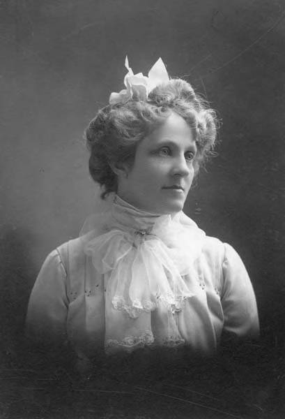
This street is named for Olive Julia Bell Stewart (1846–1921), daughter of William Nathaniel Bell and Sarah Ann Peter Bell. Belltown and Bell Street were named for her father, Virginia Street for her sister, and Stewart Street for her husband, Joseph. She was one of the younger members of the Denny Party, being five years old when they initially settled at Alki Point in 1851.

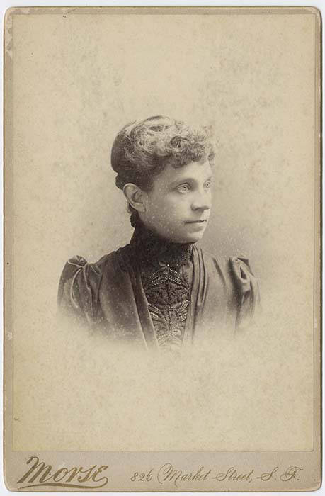
Olive Julia Bell Stewart, circa 1860
Olive Bell, circa 1860

Originally called Olive Street in the Plat of an Addition to the Town of Seattle, Washington Territory, Laid Off by the Heirs of Sarah A. Bell, Deceased in 1872, it begins at Stewart Street just east of 3rd Avenue and goes one mile northeast, then east, to Broadway E and E John Street.

On September 3, 1920, The Seattle Times reported that:

Extension of Olive Street, by the establishment of a diagonal thoroughfare to be known as Olive Way, running from the intersection of Olive Street in a northeasterly direction to Boylston Avenue North and East Denny Way, is provided in an ordinance completed yesterday afternoon by the city engineer’s office…. The purpose of the whole improvement is to afford an east and west arterial highway, leading from the business district into the residence section of the city, supplementary to Pike Street and Pine Street.

According to the Seattle Post-Intelligencer’s June 24, 1923, issue, it “formally opened to traffic yesterday… a public improvement for which a fight extending over a period of fifteen years was waged,” so this 1920 ordinance was certainly not the first time an improved connection between Downtown and Capitol Hill was proposed. I’m not entirely sure what happened in 1908 the writer might have been referring to, but perhaps it was the Bogue Plan and he was off by a few years?

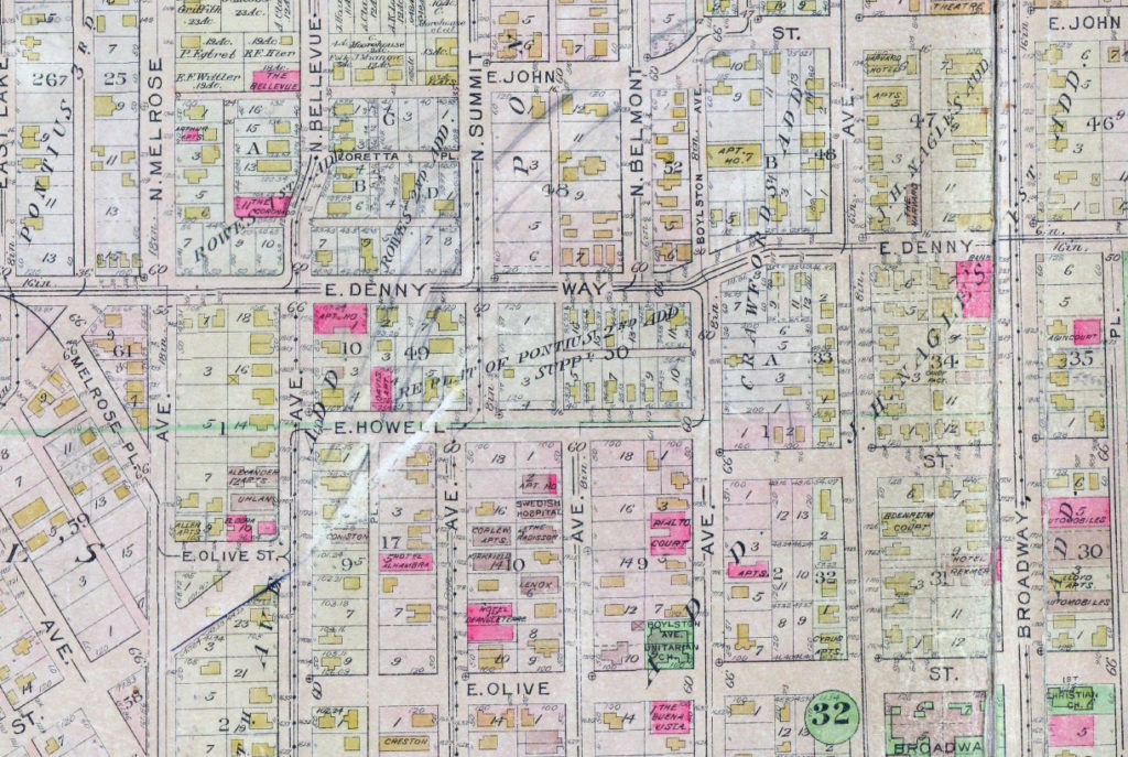
Route of Olive Way drawn on 1912 Baist Atlas plate of Capitol Hill
Portion of plate 7, Baist’s Real Estate Atlas of Seattle (1912), planned route of E Olive Way drawn in pencil. The portion of E Olive St between Melrose and Bellevue Avenues is now E Olive Place.

It appears from the 1921 ordinance establishing the extension that the Olive Way name was originally only applied to the street east of Bellevue Avenue; it wasn’t until 1926 that it was extended west to the street’s origin.

One curiosity about E Olive Way addresses: the block numbers are out of sync with other east–west streets in the area. For example, the block east of Melrose Avenue is the 300 block, east of Bellevue Avenue the 400 block, east of Summit 500, east of Belmont 600, east of Boylston 700, etc. — for other streets. For E Olive Way, east of Melrose is 1300, east of Bellevue 1400 and 1500, east of Summit and Belmont 1600, east of Boylston 1700, etc. — essentially continuing on from Downtown, not starting over at what is now the route of Interstate 5, as the other streets do. 

Pike Street

Pike Street first appears in the Plat of an Addition to the Town of Seattle as Laid Out by Arthur A. Denny, filed on April 5, 1869. It was named by Denny for John Henry Pike (1814–1903), best known for being the architect and builder of the original Territorial University of Washington in 1861. This article by Rob Ketcherside is the most comprehensive information available online about Pike. “Early Pikes in Seattle,” by Stuart Pike, is also worth a read. (Also of note: Pike’s son, Harvey Lake Pike [1842–1897], was the first person to try to connect Lake Washington’s Union Bay to Lake Union’s Portage Bay by a canal. This was unsuccessful, but he did end up platting the land in 1869 as Union City. His E North Street [north of the proposed canal] survives to this day.)

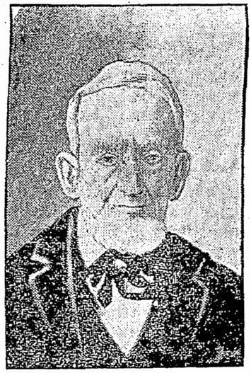
John Pike, from his obituary in the November 22, 1903, issue of The Seattle Times

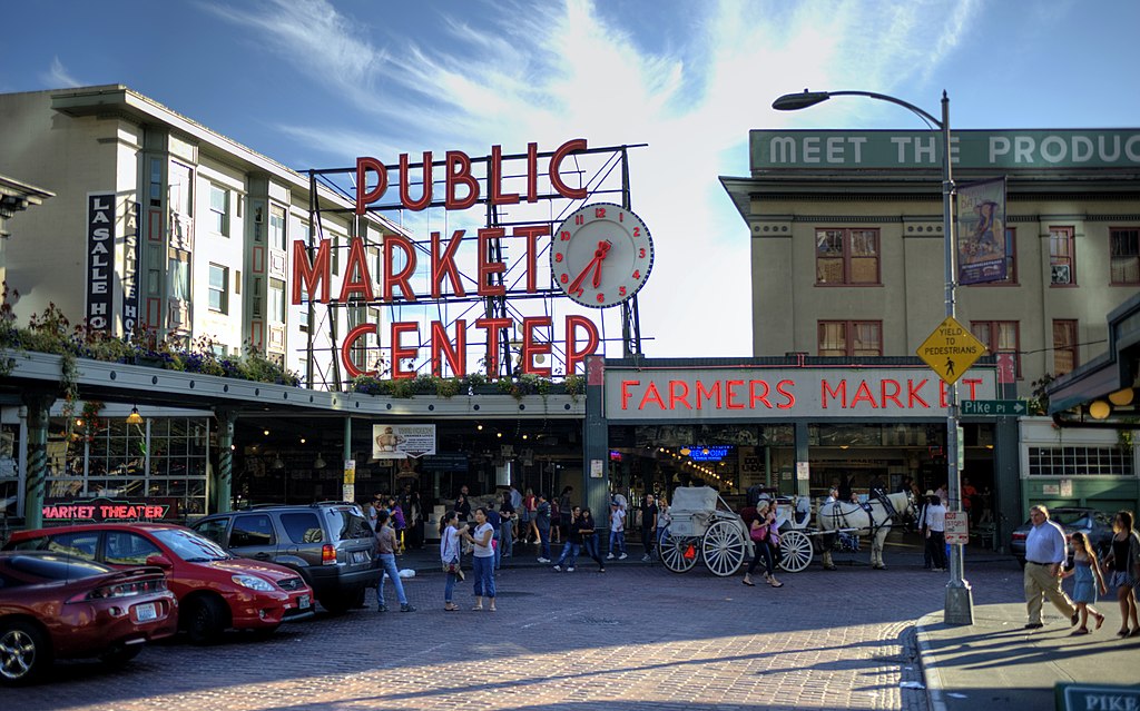
In the original plat, Pike Street (as well as Union and Pine Streets) begins at Front Street — today’s 1st Avenue — but today it begins on the Elliott Bay waterfront at Alaskan Way as the Pike Street Hillclimb. Pike Street proper begins at Pike Place (home of the eponymous market) and Post Alley (underneath the Market Theater sign), both shown below, and makes it a full 1⅔ miles to just past 18th Avenue in the Central District before being interrupted. It then resurfaces at 23rd Avenue and goes another ⅘ of a mile to Grand Avenue in Madrona, a few blocks east of Lake Washington.

Pike Place Market entrance, corner of Pike Street and Pike Place, 2012
Pike Place Market entrance, corner of Pike Street and Pike Place, 2012. Photograph by kissmykumbaya, Wikimedia Commons (public domain)

S King Street

King Street is another of the first streets platted in Seattle by David Swinson “Doc” Maynard in May 1853. It was named after William Rufus DeVane King, a slaveholding Unionist Democratic politician who founded and named Selma, Alabama; was a senator from Alabama from 1819 to 1844 and from 1848 to 1852 (he was ambassador to France in the interim); and was vice president under Franklin Pierce for 45 days in 1853 (he died two days after he returned to the U.S. from Cuba, where he had been convalescing from tuberculosis; King Street was named in his honor 35 days after that).

King County, of which Seattle is the county seat, was named after him in 1852, though it was “renamed” after Martin Luther King, Jr., in 2005. No such action has yet been proposed for King Street.

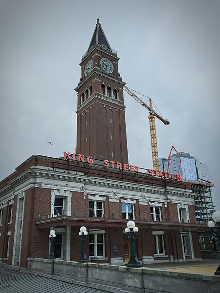
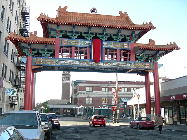
S King Street begins on the Elliott Bay waterfront at Alaskan Way S and runs ¼ of a mile to King Street Station just past 2nd Avenue S. It resumes at at 5th Avenue S, where it is spanned by the Historic Chinatown Gate, then makes it a full mile to 20th Avenue S, passing through Chinatown and Little Saigon along the way. East of there it exists in various segments, none of which is longer than ⅓ of a mile, and it finally ends at Lakeside Avenue S, where it is one of the String of Pearls shoreline street ends.

Historic Chinatown Gate, S King Street and 5th Avenue S
Historic Chinatown Gate. Photograph by Joe Mabel, Wikimedia Commons, licensed under Creative Commons Attribution-Share Alike 3.0 Unported

S Jackson Street

Jackson Street was another one of the first streets platted in Seattle by David Swinson “Doc” Maynard in May 1853. It, like King, Lane, and Weller Streets, was named after a prominent Democratic politician — in this case Andrew Jackson, president of the United States from 1829 to 1837. Because of his history as a slaveholder and a proponent of Indian removal, there have been calls to at least symbolically change the street’s namesake to another Jackson, if not change the name outright.

S Jackson Street begins today at Alaskan Way S on the Elliott Bay waterfront and has an uninterrupted 2-mile run as an arterial to 31st Avenue S in Leschi. On the other side of Frink Park, it makes its way the few remaining blocks to Lake Washington as a minor arterial, then a staircase, then a minor street, and finally a shoreline street end, part of the String of Pearls.

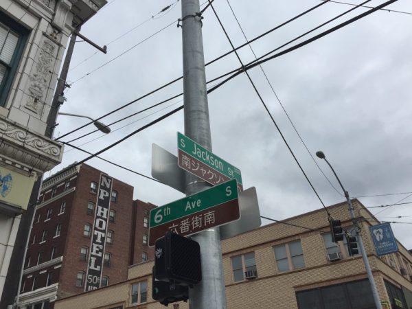
Bilingual (Japanese and English) street sign at corner of 6th Avenue S and S Jackson Street
Bilingual (Japanese and English) street sign at corner of 6th Avenue S and S Jackson Street. Photograph by Stephen Fesler, The Urbanist, licensed under Creative Commons Attribution-NonCommercial-ShareAlike 4.0 International

S Weller Street

Weller Street was among the first streets platted in Seattle by David Swinson “Doc” Maynard in May 1853. It was named after John B. Weller, Democratic senator from California from 1852 to 1857 (Maynard named four streets in his plat after prominent Democratic politicians). Though he wasn’t a slaveowner like President Andrew Jackson or Vice President William R. King, or a future secessionist like Joseph Lane, who was the Southern Democrats’ nominee for vice president in 1860, he was a pro-slavery “Lecompton Democrat” who planned to have California become independent in case of civil war.

S Weller Street begins today at 5th Avenue S and runs ¼ of a mile through the ChinatownInternational District to just east of 8th Avenue S, where it, like S Lane Street, is blocked by Interstate 5. It resumes at 10th Avenue S and runs ¾ of a mile to its end at 20th Place S and Washington Middle School.

Maynard Avenue S

Maynard Avenue S, which was 8th Street in David Swinson “Doc” Maynard’s first plat of Seattle in May 1853, was given its current name as part of the 1895 Great Renaming. It begins today at S Main Street* and goes about ⅖ of a mile south to Airport Way S just past S Charles Street. There is another block-long segment in the Industrial District and then one of 2½ blocks in Georgetown. Maynard is generally credited with naming the town of Seattle, after his friend siʔaɫ, or Chief Seattle, and he was its “first physician, merchant, Indian agent, and justice of the peace.”

* As a card-carrying address nerd, I feel compelled to mention that the driveway for the Nippon Kan Theatre/Kobe Park Building at the dead end of S Washington Street is, technically, the northernmost segment of Maynard Avenue S, at least for its first hundred feet.

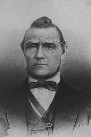
David Swinson Maynard, ca 1868, photographer unknown

Maynard — unlike Republican Arthur Armstrong Denny, who platted the tract to the north — was a Democrat, and named a number of streets in his plat after prominent Democratic politicians, including the slaveholders President Andrew Jackson and Vice President William Rufus DeVane King; Oregon Territorial Governor Joseph Lane, who went on to be the pro-slavery Southern Democratic candidate for vice president in 1860; and pro-slavery California Senator John B. Weller. I haven’t seen much online about Maynard’s personal racial views, but he was known to have had good relations (given the era) with the local Native Americans, at least. Junius Rochester writes for HistoryLink:

Perhaps one of Doc Maynard’s most enduring qualities, besides his amiability, was his high regard for the local Indians. Chief Seattle was a particular friend, having stated: “My heart is very good toward Dr. Maynard.” Maynard, who knew tribulations in his own life, understood that besides the tools, medicines, guns, and other wonders that the white men had brought to Puget Sound, they also introduced disease, intolerant religions, and the inhospitable idea of private property.

But, as Clay Eals notes,

There can be no avoiding his privileged promotion of white settlers at Native Americans’ expense. “They will fight,” he writes on Nov. 4, 1855. “There is no reason why they (sho)uld not, but we must conquer them.”

One hopes that, if Maynard were alive today, he would choose worthier men (and women) to honor than Jackson, King, Lane, and Weller.

S Lane Street

Lane Street was another one of Seattle’s first streets, platted on May 23, 1853 by David Swinson “Doc” Maynard. It was named after Joseph Lane, governor of Oregon Territory (which then included what is now Washington) from March 1849 to June 1850. Ten years later, he was the pro-slavery, pro-secession Southern Democratic nominee for vice president, with John C. Breckenridge at the head of the ticket.

S Lane Street begins today at 6th Avenue S just east of the flagship Uwajimaya grocery store, and runs ⅕ of a mile through the ChinatownInternational District to just east of 8th Avenue S, where it is blocked by Interstate 5. East of there, it is a path and stairway from 10th to 13th Avenues S, past which it appears in segments of varying lengths until it ends for good at Lakeside Avenue S.

S Washington Street

Washington Street was one of Seattle’s first streets, platted on May 23, 1853 by David Swinson “Doc” Maynard and named after President George Washington. Its initial segment begins at Alaskan Way S on the Elliott Bay waterfront and ends half a mile to the east at Kobe Terrace Park. East of Interstate 5 it exists in a number of segments interrupted by schools and parks and finally ends at S Frink Place and Frink Park.

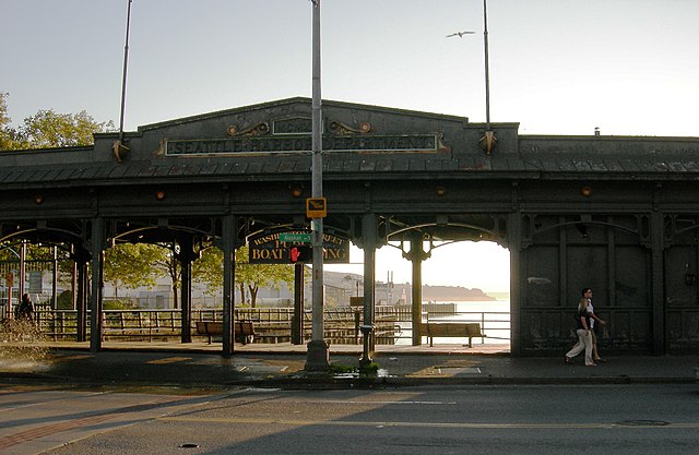
Washington Street Boat Landing, September 2007, by Joe Mabel
Washington Street Public Boat Landing, September 2007. Photograph by Joe Mabel, Wikimedia Commons, licensed under Creative Commons Attribution-Share Alike 3.0 Unported

University Street

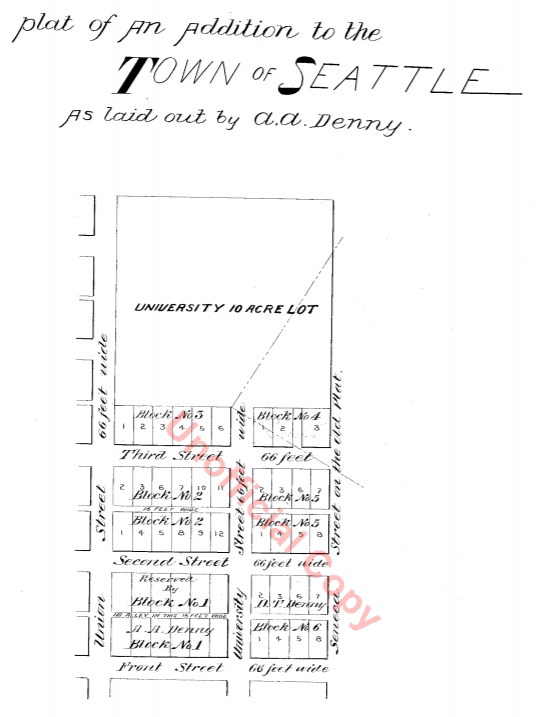
University Street was established as part of the Plat of an Addition to the Town of Seattle as Laid Out by A.A. Denny on November 16, 1861. It was named for the Territorial University of Washington, which had opened 12 days earlier on a 10-acre site atop “Denny’s Knoll.”

Plat of an Addition to the Town of Seattle as Laid Out by A.A. Denny, November 16, 1861
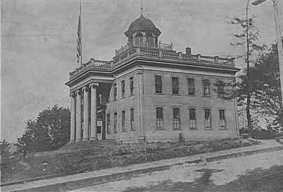
Territorial University on opening day, showing south and west sides of main building, November 4, 1861
Territorial University of Washington on opening day, November 4, 1861

Even though the University of Washington moved to its current location on Portage and Union Bays in 1895, the name was not changed. Nor did the university relinquish the land, though not for lack of trying. This turns out to have been fortunate. The UW owns the Metropolitan Tract to this day, and it earned $25 million in rent on the property during fiscal year 2020 alone.

The street, which originally ran from Front Street (now 1st Avenue) to the university campus, just northeast of 3rd Avenue, today begins at Alaskan Way on the Elliott Bay waterfront, and makes it just one block, to Western Avenue, before it becomes the Harbor Steps. From 1st Avenue, it’s about a third of a mile to 7th Avenue, where University Street is blocked by Interstate 5. It resumes at 9th Avenue and goes for another third of a mile to Boylston Avenue.

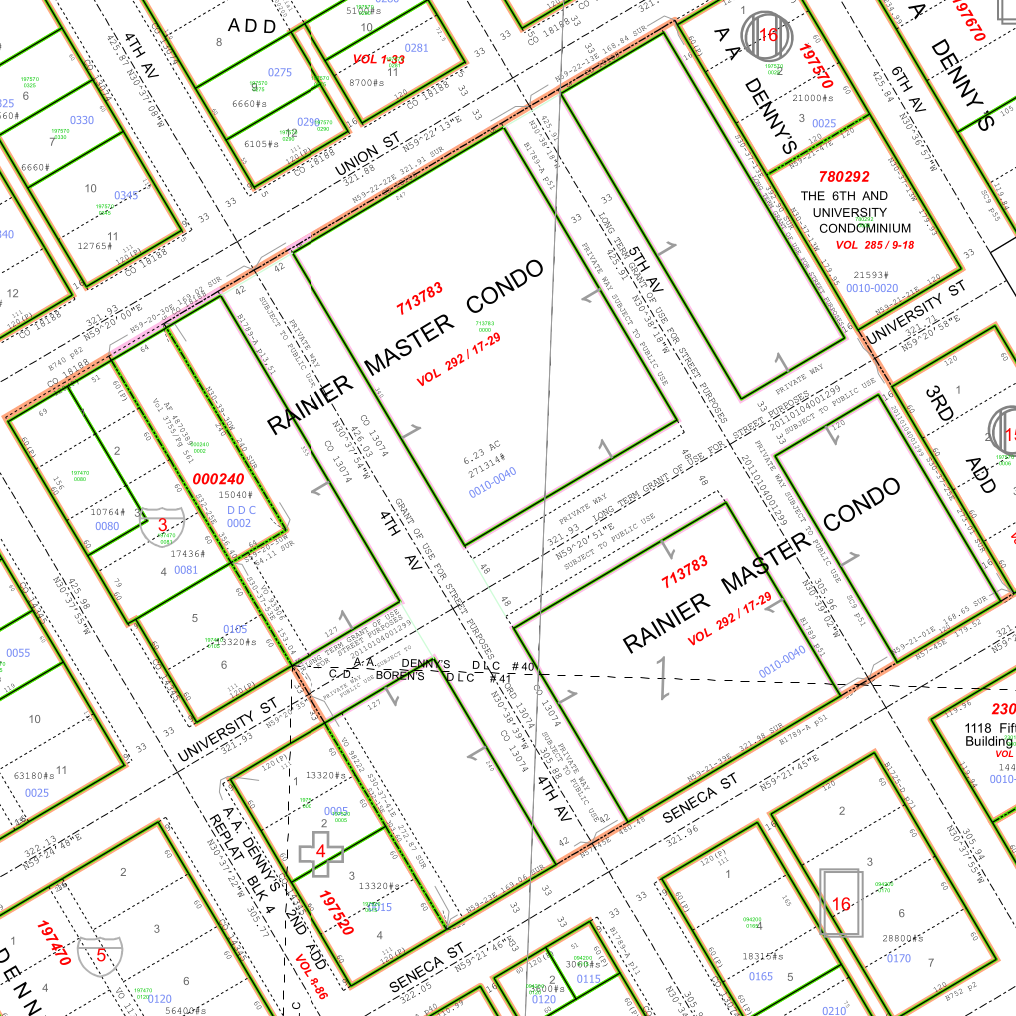
Portion of King County quarter section maps covering Metropolitan Tract

Incidentally, you’ll notice in the map above that 4th and 5th Avenues between Seneca and Union Streets, as well as University Street between 4th and 5th Avenues, plus half a block on either end, are marked private way subject to public use — long term grant of use for street purposes. This fact — that the University of Washington still owns all the land within the Metropolitan Tract and never formally dedicated those streets to the public — was something I never knew until I started taking close looks at King County’s quarter section maps as part of my local history research. It might seem an academic distinction, but as The Seattle Times reported in 2015, there are very real financial consequences.

In 2008… the UW wanted the city to interpret the tract as one undivided lot, streets and all. That novel argument would benefit the UW in calculating the development footprint, or base.… The bigger the base, the logic went, the more square footage a developer could build before triggering affordable-housing fees under the city’s formula.… The university held a heavy hammer in negotiations. Because the UW owned development rights for the land under Fifth Avenue and University Street, it could make the city compensate it, one way or another, for using those streets.

Madison Street

Madison Street — another of Seattle’s “first streets” — was named for James Madison, president of the United States from 1809 to 1817. It is the only street in town that stretches, uninterrupted, from the salt water of Elliott Bay and Puget Sound to the fresh water of Lake Washington.

Originating as the McGilvra Road in 1861, Madison Street begins on the Elliott Bay waterfront at Alaskan Way and ends 3¾ miles northeast of there at a small fishing pier, just east of 43rd Avenue E and north of Madison Park Beach. Apart from a slight bend to the northeast at 22nd Avenue, it is as straight as an arrow from beginning to end.

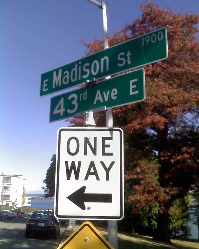
Signs at corner of E Madison Street and 43rd Avenue E, October 11, 2009
Signs at corner of E Madison Street and 43rd Avenue E, October 11, 2009. Photograph by Benjamin Lukoff. Copyright © 2009 Benjamin Lukoff. All rights reserved.

Spring Street

Spring Street was another of Seattle’s “first streets.” Sophie Frye Bass writes in Pig-Tail Days in Old Seattle:

Where springs of clear water bubbled from the earth and the beach was sandy and free from rocks, there the Indians camped. Such a choice spot was Tzee-tzee-lal-litch [dzidzəlalič], which Arthur Denny called Spring Street.

Spring Street begins at Alaskan Way and runs nearly a mile, to Harvard Avenue, before it is interrupted. A few more segments run through the Central District and Madrona. The last is from 38th Avenue to Grand Avenue, at which point it continues to Lake Washington Boulevard as a footpath and stairway.