NE NOAA Drive

This street was created in 1977 to connect the proposed NOAA Western Regional Center to Sand Point Way NE. It was unnamed for many years, but was finally signed sometime before 2009, when the below picture was taken. NOAA, of course, stands for the National Oceanic and Atmospheric Administration, which built its regional headquarters on the northern portion of the decommissioned Sand Point Naval Air Station.

NE NOAA Drive begins at Sand Point Way NE between NE 77th Street and the Fairway Estates access road and goes ¼ mile east to the beginning of a mile-long loop through the NOAA campus.
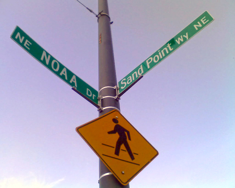
Sign at corner of NE NOAA Drive and Sand Point Way NE, October 2009
Sign at corner of NE NOAA Drive and Sand Point Way NE. Photograph by Benjamin Lukoff, October 2009. Copyright © 2009 Benjamin Lukoff. All rights reserved.

Mountain View Drive S

This street, created in 1923 by Ordinance 45500, received its current name in 1929. Before then, it was part of 28th and 29th Avenues S. The mountain in question would be Mount Rainier, which, it was recently announced, is no longer 14,410 feet high, but rather 14,399.6, due to a melting icecap.

Mountain View Drive S begins at S Columbian Way and S Alaska Street and goes ⅙ of a mile southeast to 29th Avenue S and S Edmunds Street.

E Shore Drive

This private road in the gated Broadmoor neighborhood goes just under 800 feet from Broadmoor Drive E in the west to just east of Waverly Way E in the east. The northernmost street in the development, it runs parallel to the Union Bay shoreline about 950 feet to the northwest, whence its name.

W Laurelhurst Drive NE

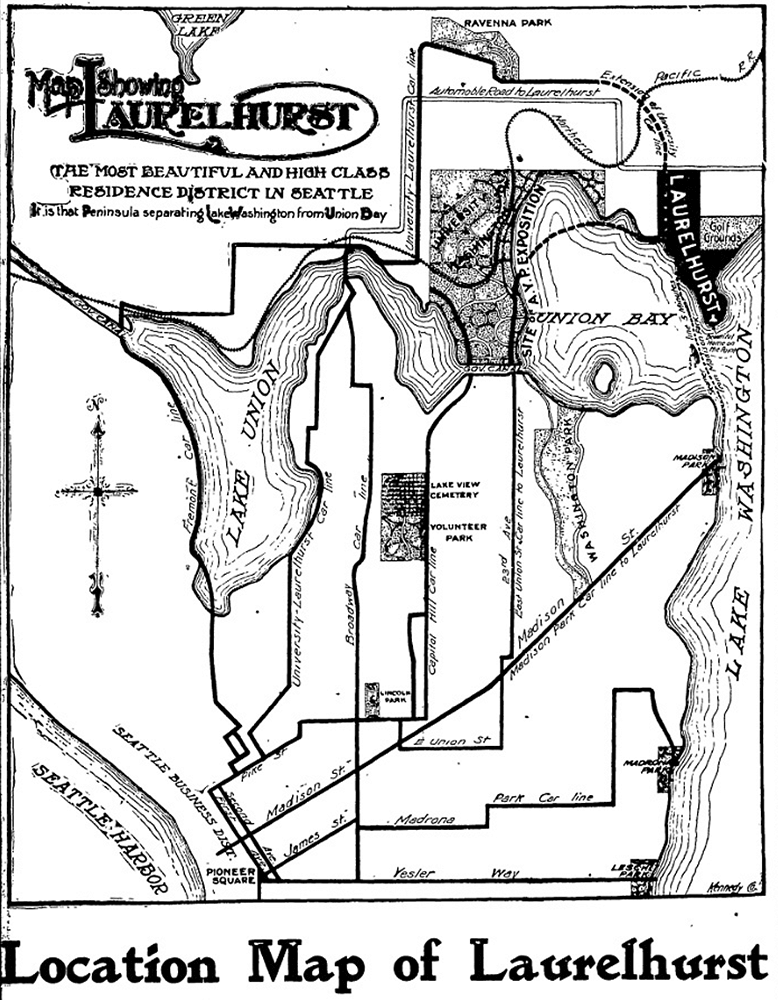
W Laurelhurst Drive NE and E Laurelhurst Drive NE were originally Olympic View Drive and Cascade View Drive, respectively, in the 1906 plat of Laurelhurst, an Addition to the City of Seattle. I am unable to tell exactly when the change was made: I first find “Laurelhurst Drive” being referred to in The Seattle Times in 1920, though a Kroll map from the same year shows the streets as 45th Avenue NE and 47th Avenue NE, respectively.

Laurelhurst itself was annexed to Seattle in 1910 (which makes me wonder why the plat was labelled as an addition to the city four years earlier). “Laurel” must refer to the tree, and “hurst” is an archaic word meaning “wooded hill.” However, as the English Language & Usage Stack Exchange thread that gives that definition notes, “in street names, [hurst is] likely to be a modern invention,” being part of “a name made up from old roots to imbue a sense of history and rootedness” (or, in cases like these, Britishness and stateliness). (I had thought that “Laurel” might refer to a girl or woman [cf. Loyal Avenue NW], but neither of the developers — Joseph Rogers McLaughlin [1851–1923] and Robert F. Booth [1875–1918] — appear to have had a relative by that name.)

(As an aside, the Wikipedia article on the Laurelhurst neighborhood in Portland, Oregon, citing Eugene E. Snyder’s 1979 Portland Names and Neighborhoods, says that “the name Laurelhurst was borrowed from a residential development in Seattle that Laurelhurst Company general manager Paul Murphy had recently completed. The name combined a reference to the laurel shrubbery near the Seattle development with the Old English hurst, denoting a wooded hill.” However, I have my doubts that there were actually enough laurels nearby to warrant the naming [in contrast to Magnolia, which was {mis}named for the plentiful madronas that lined the bluff].)

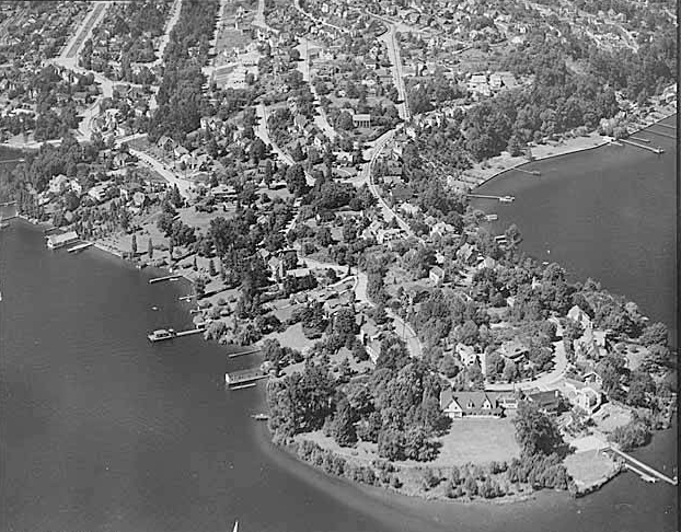
W Laurelhurst Drive NE begins at 43rd Avenue NE just south of NE 38th Street and goes ½ a mile southeast to just east of Webster Point Road NE, where it becomes E Laurelhurst Dr NE. From there, it goes nearly ⅖ of a mile northeast to a dead end just past 47th Avenue NE.

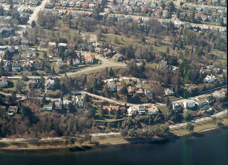
Aerial view of Laurelhurst from the south, 1938
Aerial view of Laurelhurst from the south, 1938. Webster Point dominates the view; W Laurelhurst Drive NE becomes E Laurelhurst Drive NE in front of the house that prominently appears at the southern end of the point. Photograph from the Seattle Post-Intelligencer Collection, Museum of History and Industry, licensed under Creative Commons Attribution 2.0 Generic
Map of Laurelhurst, Seattle Post-Intelligencer, October 21, 1906
Part of an advertisement for the new Laurelhurst subdivision, Seattle Post-Intelligencer, October 21, 1906. Laurelhurst is called “the most beautiful and high-class residence district in Seattle… that peninsula separating Lake Washington from Union Bay.” Prospective buyers were directed to take the Madison Street Cable Railway to its terminus at Madison Park, from which they could take a 5-minute ride on a steamer to Laurelhurst.

Mountain Drive W

This Magnolia street, created in 1915 as part of the plat of Carleton Park, was originally known as Mt. Olympus Drive. Because not all Seattle ordinances have been scanned, I am unable to tell when the change was made (and am unsure why it was made, as the old name doesn’t appear to conflict with anything).

The Seattle Times wrote of Carleton Park that the “entire district commands an unobstructible view of the Cascade and Olympic Mountains” ― being on the west side of the hill, the view here is of the Olympics, of which Mt. Olympus is the most prominent.

Mountain Drive W begins at Westmont Way W and Altavista Place W and goes ⅕ of a mile to Westmont Way W just east of W Viewmont Way W.

Madrona Drive

This street was created in 1915 by renaming portions of Hugo Place, Grand Avenue, and E Denny Way. It was named after the Madrona neighborhood, itself named after Madrona Park, which in turn was named for the madrona or Pacific madrone tree (Arbutus menziesii). According to Seattle parks historian Don Sherwood, this was not because of the tree’s prevalence in the area — if they are characteristic of any Seattle neighborhood, it would be Magnolia. Rather,

J.E. Ayer, one of the “contributors” [of land for the park], suggested “Madrona,” based upon the presence of a few trees in the community — but scarcely more than a “few little (madrona) sprouts” in the park area. However, the name caught on and soon became the district name as well.

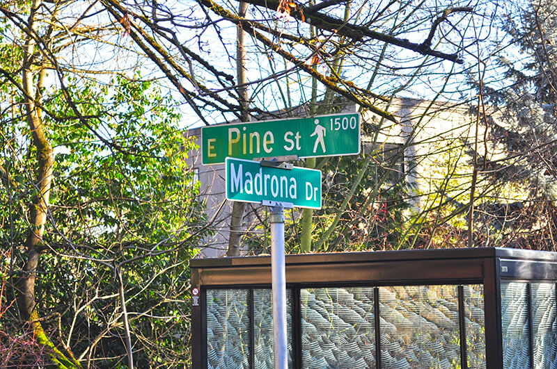
Madrona Drive begins at the intersection of E Denny Way, 38th Avenue, and Madrona Place E, and goes nearly ½ a mile southeast to Lake Washington Boulevard just north of Madrona Park.

Street sign at corner of Madrona Drive and E Pike Street
Sign at corner of Madrona Drive and E Pine Street pedestrian bridge, January 2014. Photograph by Joe Mabel, Wikimedia Commons, licensed under Creative Commons Attribution-ShareAlike 3.0 Unported

E Crescent Drive

This street, created in 1905 as part of the plat of Interlaken, is so named because of its shape. Beginning at the intersection of Interlaken Drive E, 19th Avenue E, and E Galer Street, it goes nearly ⅓ of a mile northeast, then east, then southeast, to the intersection of 24th Avenue E and E Galer Street.

Mount Rainier Drive S

This street was created in 1907 as part of the Mt. Baker Park addition, named for its view of Mount Baker in the North Cascades. In addition to S Mount Baker Boulevard, the neighborhood featured a number of other streets named for mountains in the Cascade Range, including this one, named after Mount Rainier.

According to Wikipedia, at 14,411 feet, Mount Rainier is “the highest mountain in… Washington and the Cascade Range, the most topographically prominent mountain in the contiguous United States, and the tallest in the Cascade Volcanic Arc.” It has been known by a number of other names, including Tacoma (after which, incidentally, Takoma Park, Maryland, was named), which derived from its Lushootseed-language name, təqʷubəʔ (‘permanently snow-covered mountain’). It was given its official English-language name by George Vancouver on HMS Discovery in 1792:

The weather was serene and pleasant, and the country continued to exhibit between us and the eastern snowy range the same luxuriant appearance. At is northern extremity, Mount Baker bore by compass N. 22 E.; the round snowy mountain, now forming its southern extremity, and which, after my friend, Rear Admiral [Peter] Rainier [17411808], I distinguish by the name of Mount Rainier, bore N. 42 E.

Mount Rainier Drive S begins at the intersection of S McClellan Street, Lake Park Drive S, and Mount Baker Drive S, and goes ¼ mile southeast to S Hanford Street and Hunter Boulevard S.

High Point Drive SW

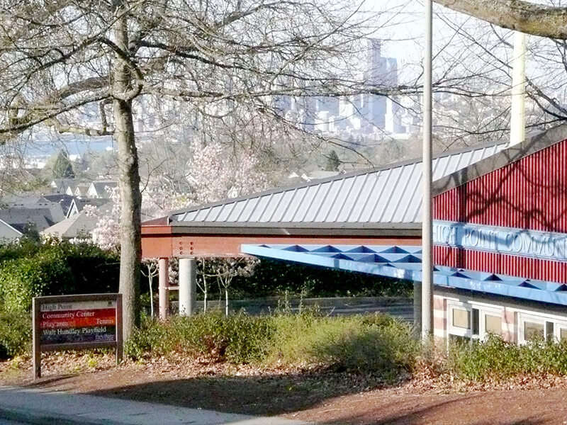
This street was named after High Point, originally developed by the Seattle Housing Authority in 1942 as defense housing and redeveloped in 2004 (see SW Bataan Street and Lanham Place SW for more history). I appear not to have mentioned in either of those posts why the development was so named — as one might guess, the city’s highest point (520 feet) is there, at the corner of 35th Avenue SW and SW Myrtle Street.

High Point Drive SW begins at 30th Avenue SW and SW Juneau Street and goes nearly ⅔ of a mile south to Sylvan Way SW and SW Holly Street.

High Point Community Center from 34th Avenue SW, April 2011. Photograph by Wikimedia Commons user Architectsea, licensed under Creative Commons Attribution-ShareAlike 3.0 Unported

Arboretum Drive E

This street in the Washington Park Arboretum was, like E Foster Island Road, originally unnamed. It received its current name in June 1957. The Arboretum itself was established in 1934 on the western half of a tract that had been logged by the Puget Mill Company; the eastern half became the gated Broadmoor neighborhood and golf course (see Broadmoor Drive E).

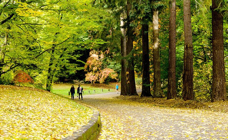
The street, which begins at Lake Washington Boulevard E opposite the Washington Park Playfield, goes nearly a mile north to E Foster Island Road just west of the north entrance to Broadmoor. All but the very northernmost portion, which leads to the Graham Visitors Center, has been closed to motorized traffic for over a decade.

Arboretum Drive E, October 2017. Photograph by Flickr user Steve Ginn (public domain).

NE Keswick Drive

This street in Seattle’s Windermere neighborhood runs just over ⅓ of a mile from NE Windermere Road and Elleray Lane NE in the southwest to 64th Avenue NE in the northeast. It appears to have been named after the Lake District town of Keswick, in the county of Cumbria, England. Just north of Derwentwater, Keswick is about 13¾ miles northwest of Windermere, England’s largest natural lake, after which the neighborhood was named.

Seola Beach Drive SW

According to Seattle parks historian Don Sherwood’s sheet on Seola Park, this street began as a logging railroad. It was then replaced by the Charles Arey county road (“recently surveyed,” according to an article in the August 26, 1893, Seattle Post-Intelligencer), which was renamed Qualheim Road in 1914 by Carl Olsen Qualheim. It received its current name in 1956 when that portion of Arbor Heights was annexed to Seattle. “Seola” itself was the product of a naming contest:

In 1893, a family named Kakeldy built the first home on the beach.… Before long, children in the vicinity school referred to residents of Kakeldy Beach as the “Cackilty Chickens.”… In 1910 the beach residents sponsored a renaming contest which was won by Mel Miller, friend of the school’s teacher of Spanish, Agnes Quigley; his suggestion: “Se-ola = to know the wave.”

Seola Beach Drive SW begins at SW 106th Street between 28th Avenue SW and 31st Avenue SW and goes ⅞ of a mile south, then southwest, to a dead end at the beach, just past SW Seola Lane.

For its entire length, Seola Beach Drive SW forms the southern city limits of Seattle, separating it from Burien and unincorporated King County (White Center). (Unlike the northern city limits, formed by 145th Street, Seattle’s southern city limits are jagged. If they went due east from Seola Beach, Seattle would encompass large portions of Burien, Tukwila, and Renton; whereas if they followed a parallel set at the city limits’ northernmost point, everything south of Kenyon Street [approximately the north end of the South Park Bridge] would be lost to Seattle.)

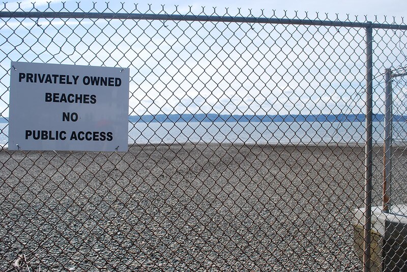
Sign reading Privately Owned Beaches, No Public Access at Seola Beach
Seola Beach, April 8, 2011. Unfortunately, this is not a case where a street was platted into the water, creating a shoreline street end; the right-of-way explicitly ends at the fence, and this portion of the beach belongs to the property owners to the south. Photograph by Flickr user NabeWise, licensed under Creative Commons Attribution 2.0 Generic

S Ronald Drive

This street, like Cecil Avenue S and Leroy Place S, was created in 1905 as part of the plat of Southside Garden Tracts, filed by Crawford & Conover, a partnership of Samuel Leroy Crawford (1855–1916) and Charles Tallmadge Conover (1862–1961). It appears to have been named after Crawford’s father, Ronald C. Crawford (1827–1924).

S Ronald Drive begins at S Benefit Street just west of 37th Avenue S and goes 1⁄10 of a mile southwest to Leroy Place S.

Paisley Drive NE

Like Inverness Drive NE, this street was created in 1954 as part of the plat of Jay Roberts Country Club Estates. Again according to Wedgwood in Seattle History,

Roberts gave the names Inverness Drive and Paisley Drive to the development’s two major connecting roadways. These two names referred to places near Glasgow, Scotland, and were meant to convey the idea of castle-like estate properties on a high vantage point.

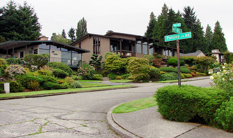
Street sign, NE 85th Street at Paisley Drive NE in Inverness
Street sign, NE 85th Street at Paisley Drive NE. Photograph courtesy of Wedgwood in Seattle History. Copyright © 2013 Wedgwood in Seattle History. All rights reserved.

Paisley Drive NE begins at NE 85th Street and goes ⅖ of a mile northwest to 45th Avenue NE.

Inverness Drive NE

This street was created in 1954 as part of the plat of Jay Roberts Country Club Estates. According to Wedgwood in Seattle History,

Roberts gave the names Inverness Drive and Paisley Drive to the development’s two major connecting roadways. These two names referred to places near Glasgow, Scotland, and were meant to convey the idea of castle-like estate properties on a high vantage point.

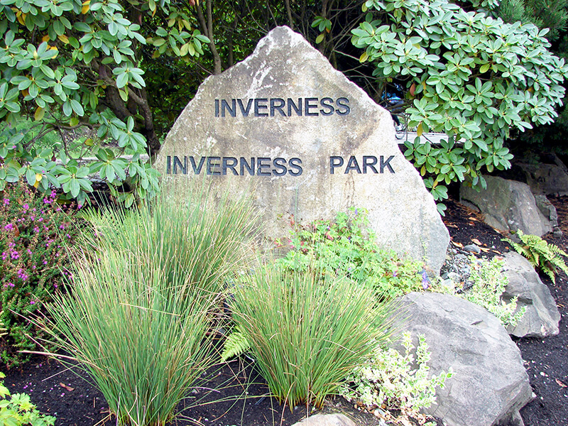
Inverness entrance marker
Inverness entrance marker. Photograph courtesy of Wedgwood in Seattle History. Copyright © 2013 Wedgwood in Seattle History. All rights reserved.

Inverness Drive NE begins at Sand Point Way NE and goes ⅖ of a mile southwest to just south of NE 85th Street, at the north end of the Sand Point Country Club.

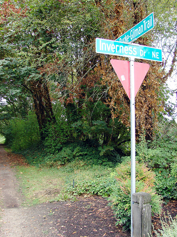
Sign at corner of Inverness Drive NE and the Burke-Gilman Trail
Sign at corner of Inverness Drive NE and the Burke-Gilman Trail. Photograph by Wedgwood in Seattle History. Copyright © 2013 Wedgwood in Seattle History. All rights reserved.

Lake Park Drive S

Like S Mount Baker Boulevard and Hunter Boulevard S, this street was created in 1907 as part of the plat of Mt. Baker Park, an Addition to the City of Seattle, filed by the Hunter Tract Improvement Company along with Rollin Valentine Ankeny and his wife, Eleanor Randolph Ankeny. It was so named for connecting the north end of the neighborhood to Lake Washington at Mount Baker Beach.

Aerial of Mount Baker Park, March 18, 1971
Aerial of Mount Baker Park, March 18, 1971. Lake Park Drive S is just east (toward the bottom of the photograph) of the green swath at center. Courtesy of the Seattle Municipal Archives, Identifier 78115

Lake Park Drive S begins at the intersection of S McClellan Street, S Mount Baker Boulevard, Mount Baker Drive S, and Mount Rainier Drive S, and goes ⅓ of a mile north to Lake Washington Boulevard S.

Lake Shore Drive S

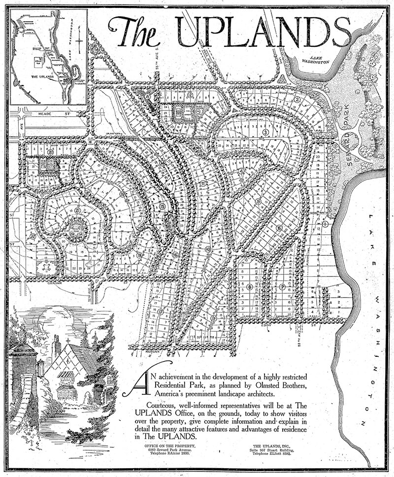
This street, created in 1926 as part of the plat of The Uplands (S Upland Road), was so named because it runs along the Lake Washington shoreline just south of Seward Park.

Full-page ad for The Uplands in The Seattle Times, September 27, 1925
Full-page ad for The Uplands in The Seattle Times, September 27, 1925. Lake Shore Drive is at the lower right-hand corner of the plat.

Lake Shore Drive S begins at Seward Park Avenue S and S Hawthorn Road and goes ¼ mile south to S Eddy Street.

S Corgiat Drive

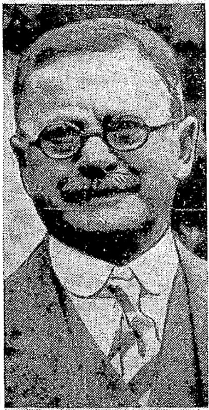
This street was created in 1905 as part of the Corgiat Addition to Georgetown (then an independent town), filed by John Corgiat (1858–1936) and his wife, Caroline Genasci Corgiat (1866–1954).

Born Giovanni Domenicio Corgiat in Italy, John was a real estate investor who, according to his Seattle Times obituary, was also notable for “establish[ing] the Louvre Restaurant, the first French-Italian eating place in Seattle, in 1888.” (It was destroyed the next year in the Great Seattle Fire.) He was also apparently involved in a number of legal cases relating to the explusion of restaurateur John Cicoria from the Joseph Mazzini Society in 1907: not only the lawsuit demanding Cicoria’s reinstatement in the Italian-American fraternal organization, but one in which the society succeeded in making him pay its legal fees, and three libel suits — one which Cicoria won against Corgiat, and two which Corgiat filed against The Seattle Times and the Message-Vero-Italo-Americano with Cicoria as co-defendant in each. The suit against the Times was dismissed at Corgiat’s request; I haven’t been able to find any more information about the other.

John Corgiat, from his obituary in the Seattle Times, December 10, 1936

Originally Corgiat Street, S Corgiat Drive begins at the railroad tracks just east of Airport Way S and goes 300 feet northeast to just past Ursula Place S, at which point it turns northwest and becomes S Corgiat Drive (not in the original plat). From there, it goes ⅖ of a mile to S Albro Place, just west of Interstate 5.

Shoreline Park Drive NW

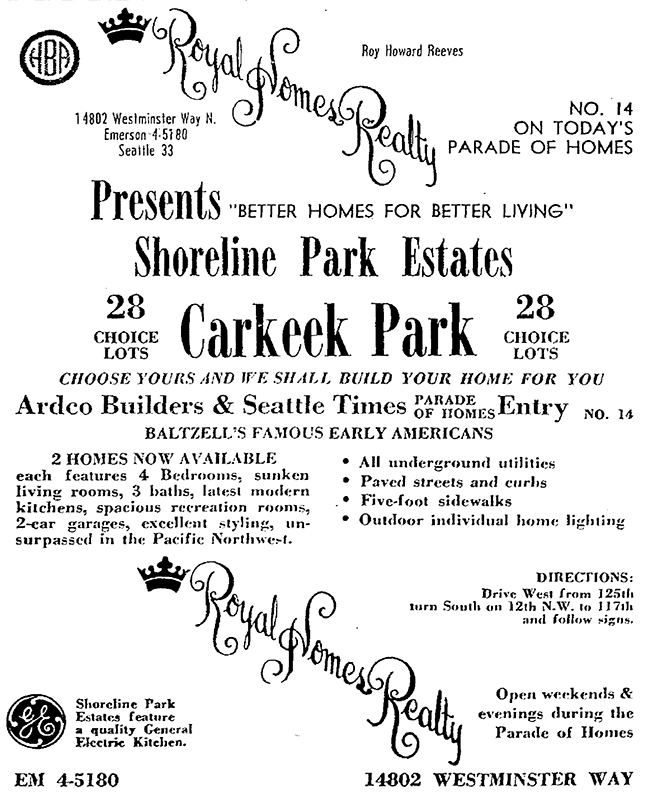
This street was created in 1964 as part of the plat of Shoreline Park Estates. The subdivision was presumably named for Carkeek Park, which surrounds it on three sides and features a long Puget Sound shoreline.

Advertisement for Shoreline Park Estates, The Seattle Times, September 20, 1964
Advertisement for Shoreline Park Estates, The Seattle Times, September 20, 1964. The address and phone number of Royal Homes Realty — 14802 Westminster Way N., Seattle 33, EMerson 4-5180 — would today be Shoreline, WA 98133, 206-364-5180, because of the incorporation of Shoreline in 1995; the mandatory use of ZIP Codes by bulk mailers, which began in 1967; the transition to all-number calling, which was completed in Greater Seattle in 1972; and the mandatory use of 10-digit dialing, which began in Greater Seattle in 2017.

Shoreline Park Drive NW runs about 275 feet between NW 118th Street and NW 117th Street. The developers dedicated a walkway west of NW 117th Street to the public; this connects to the Grand Fir Trail, one of Carkeek Park’s many trails.

E Park Drive E

This street, like W Park Drive E — its twin on the other side of Montlake Boulevard E — was created in 1908 as part of Montlake Park, an Addition to the City of Seattle, and was named after what is now East Montlake Park.

It begins at the east end of E Hamlin Street by the old location of the Museum of History and Industry (currently a staging area for the Montlake Project portion of the rebuilding of Washington State Route 520) and goes 300 feet north to E Shelby Street.

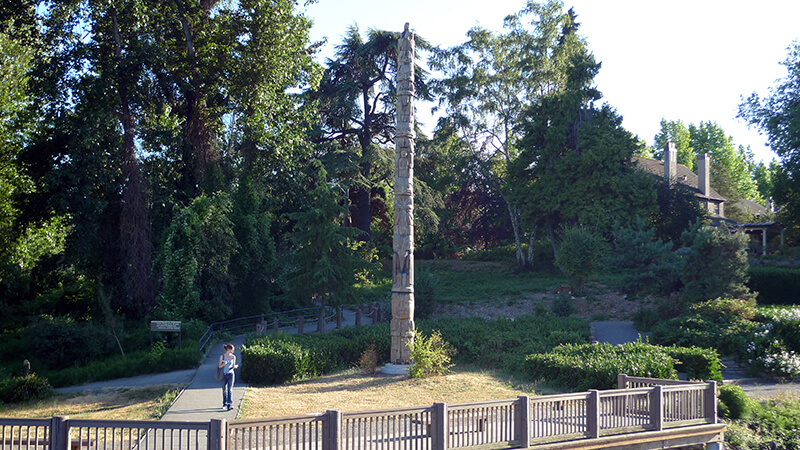
East Montlake Park totem pole, July 2009
East Montlake Park totem pole, carved by John Wallace, July 2009. The pathway is the Lake Washington Ship Canal Waterside trail, which connects East Montlake Park to West Montlake Park along the Montlake Cut. Photograph by Flickr user camknows, licensed under Creative Commons Attribution-NonCommercial-ShareAlike 2.0 Generic