Diagonal Avenue S

This street in the Industrial District is so named because it cuts diagonally across the street grid, going northeast–southwest rather than east–west or north–south. But why is it there in the first place?

In a sense, Diagonal Avenue has been around since the 1850s. As Sophie Frye Bass writes in Pig-Tail Days in Old Seattle,

The Beach or River Road… skirted the shore of the bay at the foot of the high Beacon Hill bluff, east of what is now Airport Way, and ran south along the Duwamish.… Built in the early fifties, [it] was a hard road to keep in good condition.… In 1886, a road was built on piling over the mud flats a little west of the Beach Road to avoid the slides and floods. This street became known as the Grant Street Bridge.

Essentially, there were a series of roads following the semicircular curve of Elliott Bay from Downtown to the Duwamish River before the tideflats were filled in: first Beach Road (or River Road), then the Grant Street Bridge, which in turn became Seattle Boulevard once the fill was complete. Sometime before 1918 (the first mention I could find of the name in The Seattle Times), the portion of Seattle Boulevard that ran northeast–southwest (the southern third of the semicircle) was renamed Diagonal Avenue. (In 1931, the rest of Seattle Boulevard was renamed Airport Way.)

Today, Diagonal Avenue S begins at Airport Way S and goes just about 400 feet to S Spokane Street. There is a slightly shorter segment west of 4th Avenue S which is blocked by railroad tracks, and one even shorter west of 2nd Avenue S blocked by the Union Pacific Railroad’s Argo Yard. It resumes for the last time at S Oregon Street, Colorado Avenue S, and Denver Avenue S, and goes ⅓ of a mile to sbəq̓ʷaʔ Park and Shoreline Habitat on the east bank of the Duwamish Waterway, which the Port of Seattle says “is probably the best small boat take-out launch site on the Lower Duwamish Waterway.”

S Stacy Street

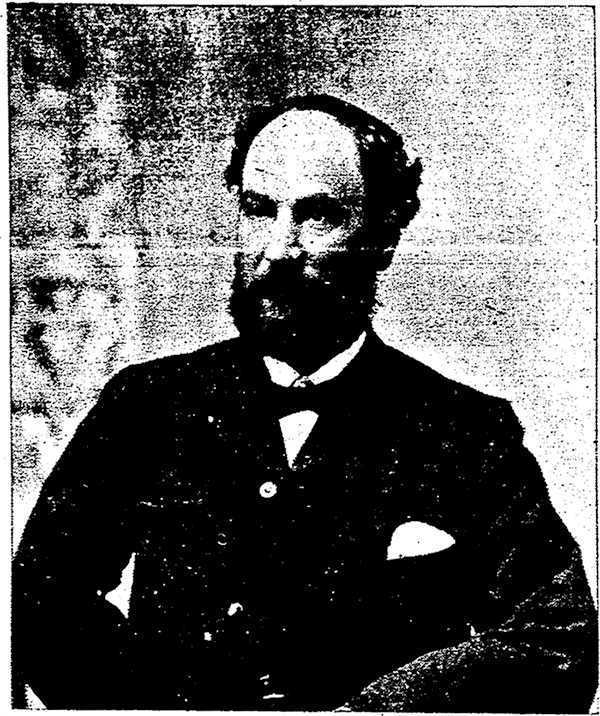
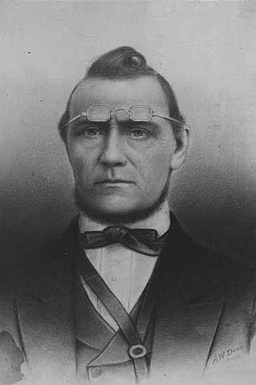
This street is named for Martin Van Buren Stacy (1837–1901), who, according to local historian Paul Dorpat, “brought an inherited wealth to the cash-poor West and bought Seattle land” (and land elsewhere in Western Washington as well). The Northern Pacific Railway’s Stacy Street Yard was named for the street, but was renamed the Seattle International Gateway by Burlington Northern in 1985. His death at Green River Hot Springs apparently came as a shock to many.

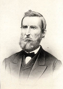
Martin Van Buren Stacy, from his obituary in the April 18, 1901 Seattle Post-Intelligencer
Martin Van Buren Stacy, from his obituary in the April 18, 1901, Seattle Post-Intelligencer. He had died at Green River Hot Springs the previous week of “apoplexy.”

S Stacy Street begins at Airport Way S and goes ⅕ of a mile west to 6th Avenue S. There is a block-long segment between 4th Avenue S and 3rd Avenue S, and then on the other side of the former Stacy Yard a two-block–long segment from Occidental Avenue S to Utah Avenue S and the world headquarters of Starbucks.

S Horton Street

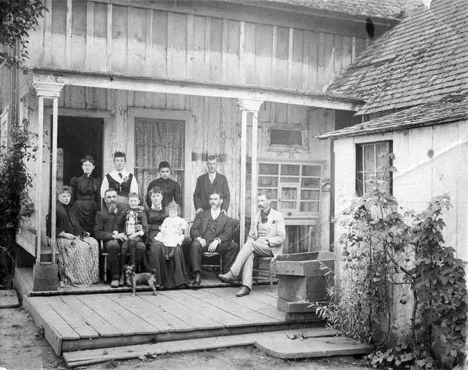
I have read that, and until recently assumed that, S Horton Street is named for Dexter Horton (1825–1904), but have come to wonder if it instead is named for Julius, his younger brother (1834–1904), or for the Horton family in general. Julius came to Seattle in 1869, bought land in South Seattle in 1871, and platted Georgetown in 1890, naming it after his son, George (1865–1927), who had recently become a doctor. (Georgetown became a city in 1904 and was annexed by Seattle in 1910.) S Horton Street doesn’t run through Georgetown — it’s around 2 miles north of there — but it does run through South Seattle. It appears to have been named in 1870, after Julius arrived in town but before he bought what is now Georgetown. I am not sure if Dexter had any special connection to South Seattle; he certainly never lived there.

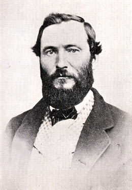
Julius Horton family circa 1890
Julius Horton and family, circa 1890. Back row, left to right: Dora Estelle (Horton) Carle, Mabel Maude (Horton) Edlund, Flora Groover, Elmer Petigoe. Front row, left to right: May Bigelow Boucher, Julius Horton, Howard Dexter Horton, Anna Emily (Bigelow) Horton, Vera Horton Hudson, George Monroe Horton, and Harry Bateman.

S Horton Street begins at E Marginal Way S and goes ⅔ of a mile east to 6th Avenue S, with a brief interruption at the SODO Busway. After a block-long segment between Airport Way S and 10th Avenue S just west of Interstate 5, it resumes on Beacon Hill at 13th Avenue S, where it goes one block east. It begins again at 16th Avenue S and goes ⅖ of a mile to 23rd Avenue S, being a stairway and pathway from just east of 19th Avenue S to 20th Avenue S. Horton resumes east of Kimball Elementary School at 24th Avenue S and goes a block and a half before it ends at the Cheasty Natural Area. Besides a very short segment just west of Martin Luther King Jr. Way S, its next appearance is at 33rd Avenue S and S Walden Street. From here, it goes ½ a mile east to Lake Washington Boulevard S, being a stairway between 36th Avenue S and 37th Place S and a stairway and pathway between Cascadia Avenue S and Sierra Drive S. Between Sierra Drive S and Lake Washington Boulevard S, it is part of Landing Parkway, under the jurisdiction of the parks department.

S Lander Street

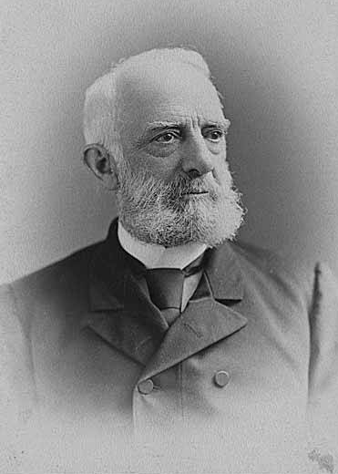
I initially posted that this street was named for Judge Edward Lander (1816–1907), chief justice of the territorial supreme court from 1853 to 1857. In 1855, he, along with Charles Terry, bought Carson Boren’s downtown land claim for $500. They subsequently donated two acres of land, along with Arthur Denny, who donated eight, to form the first campus of the University of Washington, which opened in 1861. The university owns the Metropolitan Tract to this day, though it moved to its present location in 1895. Lander’s name also appears on Lander Hall, a UW dormitory on NE Campus Parkway.

Edward Lander
Edward Lander

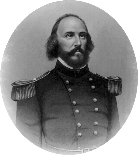
However, I recently (April 2022) came across “What’s in a Name?,” a paper by Phillip H. Hoffman, director of the Alki History Project, in which he asserts that the correct namesake is Edward Lander’s brother, Frederick William Lander (1821–1862). I find his argument compelling. The street was named by Edward Hanford (S Hanford Street) when he filed the plat of Hanford’s Addition to South Seattle in 1869. Hanford also named streets for George McClellan and Isaac Stevens. All three men — McClellan, Stevens, and Frederick Lander — were part of the Northern Pacific Railroad Survey (1853–1855), and all three were likewise Union generals in the Civil War. Besides this,

Edward Lander was a political foe of and was jailed by Stevens [then governor of Washington Territory] when Lander opposed Stevens’ 1855 martial law declaration and actions. Stevens and Edward Lander maintained a widely recognized lifelong enmity. It is unlikely that Hanford would have memorialized this hostility.

Frederick William Lander
Frederick W. Lander

SW Lander Street begins at 59th Avenue SW in the Alki neighborhood of West Seattle, and goes ⅕ of a mile to 55th Avenue SW. It resumes just to the south at S Lander Place and goes a further ⅛ of a mile to SW Admiral Way. Picking up again at 50th Avenue SW, it makes it ½ a mile to Walnut Avenue SW before being interrupted again, as happens to so many West Seattle streets because of the varying topography. There is a final ¼-mile stretch in West Seattle from 39th Avenue SW to 36th Avenue SW, then a very short segment on Harbor Island before S Lander Street resumes in the Industrial District at Colorado Avenue S and goes ¾ of a mile east to Airport Way S. On Beacon Hill, Lander begins just west of 13th Avenue S and goes ⅔ of a mile to just past 23rd Avenue S, including the block-long stretch that is now known as S Roberto Maestas Festival Street. Lander begins again at 30th Avenue S in Mount Baker and goes a final four blocks to 34th Avenue S.

S Hanford Street

This street is named for Edward Hanford (1807–1884) and his wife, Abigail Jane Holgate (1824–1905), who left Iowa in the early 1850s to settle adjacent to Abigail’s brother, John (namesake of S Holgate Street), on what is today known as Beacon Hill but was known from then until the early 1890s as Holgate and Hanford Hill. Edward and his family were loggers, then orchardists, and unlike John Holgate, he went on to develop his donation claim.

The Hanfords’ son Clarence (1857–1920) founded, with James D. Lowman, the Lowman & Hanford Stationery and Printing Company in 1885. The firm went out of business in the 1960s, but their Pioneer Square building still, the last time I drove by, had a sign painted on it reading “Seattle’s Oldest Retail Company,” which it very well might have been when it closed. Their son Thaddeus (1847–1892) was for a time the owner of the Daily Intelligencer newspaper, predecessor of the Seattle Post-Intelligencer. And their son Cornelius (1849–1926), a federal judge from 1890 to 1912, was earlier a territorial legislator, Seattle city attorney, and chief justice of the Washington Supreme Court. He is the namesake of Hanford, Washington, and by extension the Hanford Site, which produced the plutonium used in the first nuclear explosion and the bombing of Nagasaki. He was also the author of Seattle and Environs, 1852-1924.

Edward Hanford
Edward Hanford

SW Hanford Street begins in West Seattle at SW Admiral Way and 59th Avenue SW and goes ¼ mile east to Schmitz Preserve Park at 56th Avenue SW. It begins again at 51st Avenue SW and goes nearly a mile east to 36th Avenue SW, becoming a stairway for the half-block east of 46th Avenue SW. After serving as little more than a driveway between SW Admiral Way and Fauntleroy Avenue SW, it next appears as S Hanford Street at E Marginal Way S, where it goes for ⅓ of a mile east to Occidental Avenue S. After a few short segments farther east in the Industrial District, Hanford begins again on Beacon Hill at 12th Avenue S and goes nearly a mile east to Rainier Avenue S, the segment between 25th Avenue S and Morse Avenue S being a stairway. It resumes a few blocks east at 30th Avenue S and finishes up ½ a mile east at Cascadia Avenue S.

S Holgate Street

This street is named for John Cornelius Holgate (1828–1868). Born in Ohio, he took the Oregon Trail west in 1847 and explored Elliott Bay and the Duwamish River by canoe in the summer of 1850. (The Seattle Times calls him “the first non-Indian of record to have done so.”) He returned to Oregon afterwards, however, and did not settle in what is now Seattle — specifically, Beacon Hill — until 1853, two years after the Denny Party landed at Alki Point. His mother, Elizabeth; brothers, Lemuel and Milton; and sister, Abigail, along with her husband, Edward Hanford (namesakes of S Hanford Street), soon followed. The Hanfords settled on the hill — known thereafter as Holgate and Hanford Hill until the late 1880s — adjacent to Holgate. (Milton was one of three whites to die in the Battle of Seattle in 1856, and was himself the cause of one of those deaths, having earlier shot Jack Drew, a deserting sailor from the USS Decatur, in a “friendly-fire” incident.)

A gold prospector, Holgate left for Idaho in 1863, and died there in 1868, the first casualty of the War Under the Mountain, a conflict between two rival gold mines in the Owyhee Desert, one of which he was part owner. According to Robert L. Deen, writing for True West magazine, there are conflicting accounts of Holgates death. The Owyhee Avalanche reported that:

Desperate fighting ensued during the charge…. John C. Holgate… one of the foremost in the advance, was shot in the head, and must have died instantaneously.

The Idaho Tri-Weekly Statesman had a slightly different story:

It appears that J.C. Holgate has been killed, some say assassinated, murdered — not killed in a fight, but shot through the head without provocation.

SW Holgate Street begins in West Seattle just west of 47th Avenue SW and goes ¼ of a mile east to California Avenue SW at Palm Avenue SW. There are two more short segments on the peninsula, between 41st Avenue SW and Arch Avenue SW and between Victoria Avenue SW and Brook Avenue SW. S Holgate Street resumes at Utah Avenue S and goes ¾ of a mile east to an overpass over Interstate 5, where it becomes Beacon Avenue S. There is a one-block stretch between 12th Avenue S and 13th Avenue S on top of the hill, and then Holgate goes a mile from the Beacon Hill Playfield at 14th Avenue S to 31st Avenue S at Colman Park, the half-block east of 16th Avenue S being a stairway and the block between 28th Avenue S and 29th Avenue S being unimproved. There is finally a short stretch east of Lakeside Avenue S at 36th Avenue S that essentially serves as a private driveway; it is a shoreline street end, but one not yet accessible to the public.

S Plummer Street

S Plummer Street, like S Charles Street, was created as part of the 1876 plat of Plummer’s Addition to the City of Seattle, and was named by George Washington Harris after his late stepfather, Charles Plummer, who had died 10 years earlier.

Charles Plummer
Charles Plummer

Unlike S Charles Street, which makes it all the way to Lake Washington, S Plummer Street runs a mere block from Airport Way S and Maynard Avenue S in the west to 7th Avenue S in the east, where it is stopped by the city’s Charles Street Service Center.

S Charles Street

Charles Street originates in the 1876 plat of Plummer’s Addition to the City of Seattle, filed by George Washington Harris (late 1840s–1914).* How did Harris end up with the land, and why would he name the addition after Charles Plummer (who, it appears from the text of the plat description, bought the tract from David Swinson “Doc” Maynard in 1860)?

* I write “late 1840s” because Harris’s birth year is given variously as 1848 (death certificate, historical journal article, Tacoma Public Library), 1847 (Genealogy.com, The Seattle Times), and 1846 (Geni, FamilySearch). 

As it turns out: Plummer married Ellender Smith (sister of Dr. Henry A. Smith, namesake of Smith Cove and Smith Street) in 1855. Harris’s mother, Sarah Jane Crossman, was widowed the next year. Plummer himself became a widower when his wife died giving birth to twins Edward and Frank in 1859, and he married Harris’s mother in 1860, apparently at Maynard’s own Alki Point house. Harris then became Plummer’s stepson (and a daughter, Ida, was born to the newlyweds the next year). When Plummer died in 1866, Harris apparently inherited at least this much of his stepfather’s estate. (It’s unclear just what Edward and Ida may have received; Frank is reported to have inherited $60,000.)

Charles Plummer
Charles Plummer

Today, S Charles Street begins at Airport Way S and 6th Avenue S and is stopped a block and a half to the east at 7th Avenue S by the city’s Charles Street Service Center. (Its twin to the south, S Plummer Street, also ends at the service center, never to return.) It briefly reappears at the northern lip of Beacon Hill between 12th Avenue S and Sturgus Avenue S, and then east of Interstate 90 runs for about ⅓ of a mile between Poplar Place S and 20th Place S at Judkins Park. The right-of-way, which continues through the park, becomes an improved street again at 22nd Avenue S, and ends just east of 26th Avenue S. East of here, S Charles runs three blocks from 28th Avenue S to 30th Avenue S, and then around ¼ mile made up of alternating roadway and stairways from the alley west of 32nd Avenue S to a shoreline street end on Lake Washington — one of Leschi’s String of Pearls.

Note added October 23, 2023: S Charles Street now begins at 1st Avenue S and goes a block east to Occidental Avenue S, before resuming on the other side of Lumen Field at Airport Way S.

W Marginal Way SW

W Marginal Way SW, like its twin across the water, E Marginal Way S, began literally as a “marginal way” to “give railroads, street cars and other transportation facilities access to the Duwamish waterway.”

W Marginal Way SW begins at 26th Avenue SW at the Port of Seattle’s Terminal 5. From there, it’s 3 miles southeast to 2nd Avenue SW, by the south end of the 1st Avenue S Bridge. It resumes on the east side of the bridge as W Marginal Way S, an extension of Highland Park Way SW, and runs 4⅖ miles from there to the southern city limits. (For all but the first few blocks of this stretch, it is a limited-access highway carrying Washington State Route 99.) Beyond there it runs 3½ miles more to the vicinity of an interchange with Tukwila International Boulevard. The name is dropped at this point (and does not appear on signs south of the initial few blocks); the highway continues 1¾ miles as Washington State Route 599 to Interstate 5.

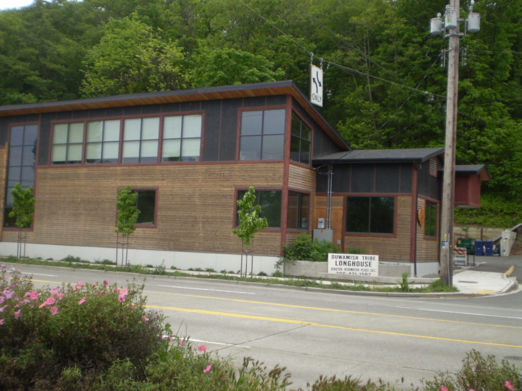
Duwamish Longhouse and Cultural Center, 4705 W Marginal Way SW, May 2010
Duwamish Longhouse and Cultural Center, 4705 W Marginal Way SW, May 2010. Photograph by Benjamin Lukoff, originally appearing in Seattle Then and Now.
Copyright © 2010 Benjamin Lukoff. All rights reserved.

W Marginal Way S is the location of the Duwamish Longhouse and Cultural Center, across the street from həʔapus Village Park and Shoreline Habitat (formerly Terminal 107 Park). həʔapus, or x̌əʔapus, was the name of a Duwamish village that was burned down by settlers in 1895. The new longhouse became the first one within city limits in 114 years. Notably, descendants of settlers Charles Terry and David Denny participated in fundraising and advocacy, without which the project would have been impossible, as the Duwamish were forced to purchase back the land. (A good article for more detail is “On the Duwamish River, a longhouse rises,” which appeared in Real Change in March 2009.)

E Marginal Way S

E Marginal Way S and its twin across the Duwamish Waterway, W Marginal Way SW, are good examples of purely descriptive Seattle street names. In fact, they are first mentioned in the press as adjective + noun, not name + type:

  • “Marginal ways are urged for both sides of Duwamish waterway.” Seattle Post-Intelligencer, October 27, 1911, in reference to the Bogue Plan
  • “Coincident with the completion of the Duwamish waterway and the wide marginal streets on each side, a publicly owned railway should be built along these marginal ways…” C.C. Closson, realtor and the Port of Seattle’s first paid employee, in a letter to the editor, Seattle P-I, July 8, 1912
  • “East and west marginal ways, planned by Bogue to parallel the waterway to give railroads, street cars and other transportation facilities access to the Duwamish waterway, will both pass through Oxbow.“ The Seattle Times, March 26, 1914
  • “Marginal ways parallel the new waterway for the whole distance, connecting with the main streets of the city running to the south.” Seattle P-I, August 13, 1914 

A longer excerpt, from an article in the April 19, 1914, issue of The Seattle Times, explains the reason for their creation:

Second only in importance to the waterway are the projected traffic streets, east and west marginal ways, laid out on both sides of the waterway about 1,000 feet back to give railways and street car lines the opportunity to parallel the waterway on both sides for its entire length, to give service to the industries locating along the waterway. As an allowance of $175,000 was made for East Marginal Way in the $3,000,000 county bond issue for roads, that street is now being condemned by the city and will be constructed 130 feet wide to the south city limits, where it will join a county road. West Marginal Way is also being promoted by interested property owners. As the existing railways are already but a short distance east of the Duwamish River, spurs can be thrown into East Marginal Way at slight expense. Also the port commission is considering a plan for port district terminal tracks on the Marginal Ways to serve the waterway.

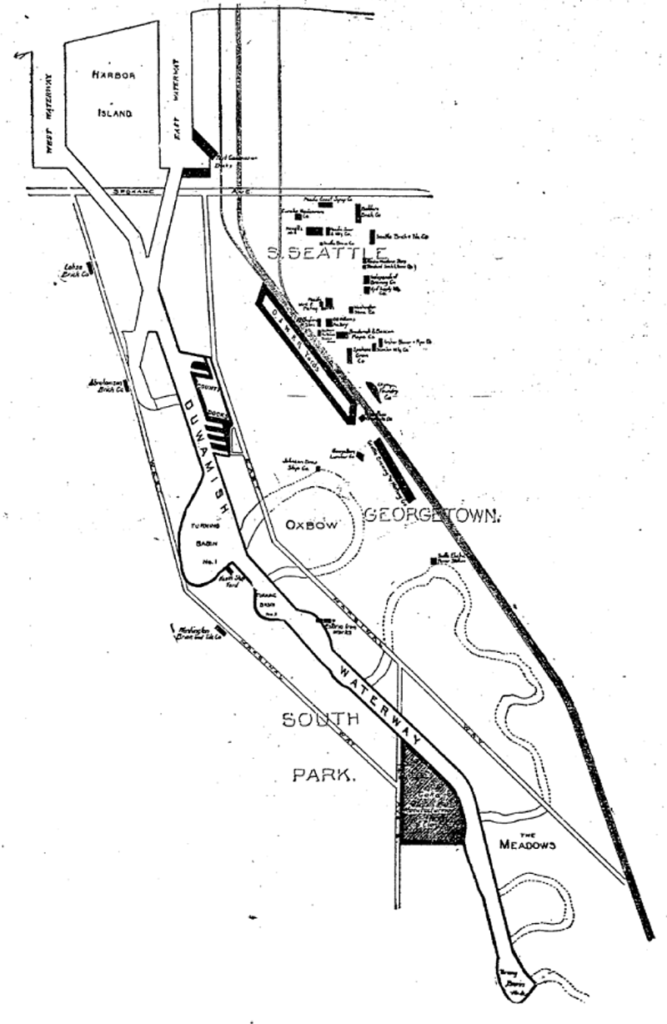
The Duwamish Waterway, whose construction began on October 14, 1913, was a straightening and deepening of the last 6 miles of the formerly meandering river. Construction of the waterway, with Harbor Island at its mouth (the largest artificial island in the world from 1909 to 1938), plus the filling of the Elliott Bay tidelands, are what give Seattle’s harbor its modern shape.

Plan of the Duwamish Waterway, Seattle Post-Intelligencer, August 31, 1913, page 44
Plan of the Duwamish Waterway, from the August 31, 1913, issue of the Seattle Post-Intelligencer, page 44

E Marginal Way S begins as an extension of Alaskan Way S — originally Railroad Avenue, which served much the same function for the central waterfront — at the Port of Seattle’s Terminal 30, and stretches 4⅖ miles from there to the southern city limits. (From the southern end of the Alaskan Freeway to the northern end of the 1st Avenue South Bridge, it carries Washington State Route 99.) Beyond there it runs 3½ miles more to S 133rd Street in Tukwila.

S Royal Brougham Way

This street begins at Colorado Avenue S in the west, at an onramp to the northbound lanes of the State Route 99 tunnel, and goes ⅔ of a mile east to Airport Way S. Originally S Connecticut Street, it was renamed in 1979 in honor of sportswriter Royal Brougham (1894–1978), who worked for the Seattle Post-Intelligencer newspaper from 1910 until his death. Such a name change was formally proposed by city councilman George Benson following a suggestion by P-I columnist Emmett Watson. Originally it was to be Occidental Avenue S whose name was to be changed, then the 2nd Avenue S Extension when objections were raised. Finally S Connecticut Street was settled upon; it was thought to be particularly appropriate because he “worked so hard to see the Kingdome built… and eventually spent his last day on earth there.”

Lumen Field, built on the former Kingdome site, is on the north side of Royal Brougham between 1st Avenue S and 4th Avenue S; and T-Mobile Park is on the south side between 1st Avenue S and 3rd Avenue S.

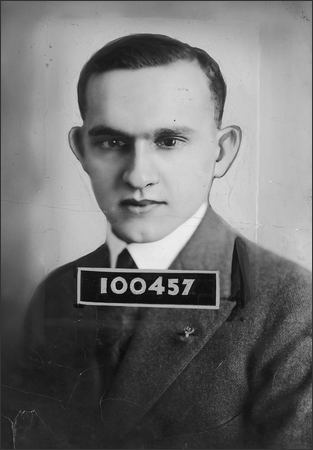
Royal Brougham's ID card for the Seattle Post-Intelligencer newspaper, 1925
Royal Brougham’s Seattle P-I staff ID card, 1925

S River Street

S River Street is just ½ a mile long, and none of it parallels the Duwamish River. The reason behind this is the same reason S Front Street is perpendicular to the waterway — the rechanneling of the Duwamish River that began in 1913. In Joseph R. McLaughlin’s Water Front Addition to the City of Seattle, filed in 1906, Front Street had a horseshoe shape. North Front Street is today’s Front Street, and South Front Street was changed to River Street in 1907, when West Seattle was annexed to Seattle. The Baist Atlas depiction of the Oxbow, below left, is from 1912, so has the modern name.

Portion of index page of Baist's Real Estate Atlas of Seattle, 1912, showing Duwamish River oxbowPortion of King County Parcel Viewer map and aerial view of Seattle showing former location of Duwamish River oxbow

Today’s S River Street begins at 7th Avenue S and goes ½ a mile west, ending at 1st Avenue S, below the 1st Avenue S Bridge. 

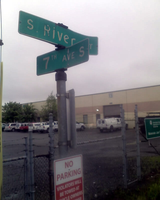
Sign at corner of S River Street and 7th Avenue S, May 22, 2013
Signs at corner of S River Street and 7th Avenue S, May 22, 2013. Photograph by Benjamin Lukoff. Copyright © 2013 Benjamin Lukoff. All rights reserved.

S Front Street

Usually, a Front Street designates a city’s waterfront. Front Street in Philadelphia parallels the Delaware River; NW Front Avenue in Portland, Oregon, goes up the Willamette River; Front Street in Toronto runs along Lake Ontario. Seattle once had a prominent Front Street alongside Elliott Bay, but it was renamed 1st Avenue in 1895. The Front Street we do have runs a grand total of ⅖ of a mile split among three segments, and it runs east–west, while the nearby Duwamish River runs north–south. Why is this?

As it turns out, S Front Street — established as part of Joseph R. McLaughlin’s Water Front Addition to the City of Seattle in 1906 — did use to run along the river, before it was rechanneled beginning in 1913. (Here is an excellent post from the Burke Museum on the Duwamish meanders, with some great maps and aerials.) The maps below show its course along the Duwamish River Oxbow in 1912 (left) and its current landlocked state (right). You can still make out its former location, as well as small remnants in the form of the Slip 2 and Slip 3 inlets. (Incidentally, Front Street originally was shaped like a horseshoe — today’s S Front Street was originally North Front Street, and South Front Street is today S River Street.)

Portion of index page of Baist's Real Estate Atlas of Seattle, 1912, showing Duwamish River oxbowPortion of King County Parcel Viewer map and aerial view of Seattle showing former location of Duwamish River oxbow

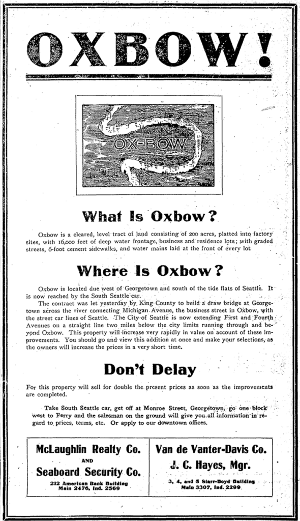
Speaking of the Oxbow, here’s an advertisement for it. So much for that “16,000 feet of deep water frontage.”

Advertisement for Oxbow in June 1, 1906, issue of The Seattle Times

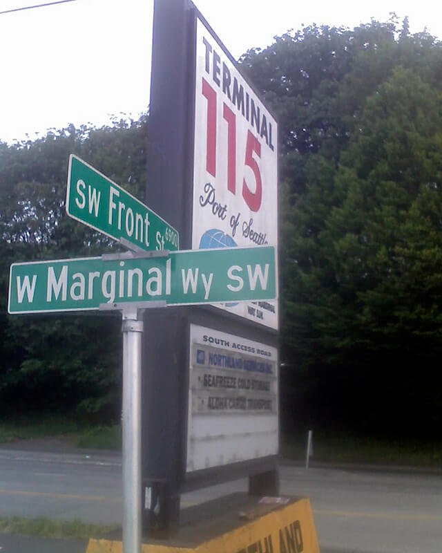
Today’s S Front Street begins at 6th Avenue S and goes ¼ of a mile west, ending just beyond 4th Avenue S. There is another 400-foot-long section between E Marginal Way S and 1st Avenue S, below the approach to the 1st Avenue S Bridge. And then there is one last 200-foot-long section on the west side of the Duwamish River — SW Front Street starts at W Marginal Way SW and ends at the entrance to the Port of Seattle’s Terminal 115 (which used to be Boeing Plant 1, the airplane manufacturer’s first production facility).

Incidentally, here’s a great article on the one in New Orleans I came across while looking up various Front Streets. It’s hard to beat a lede like this: “In a city replete with famed streets, scenic avenues and poetic street names, one particular artery excels at being obscure, nominally insipid, marvelously intermittent, and sometimes barely even a street.”

Sign at corner of SW Front Street and W Marginal Way SW, May 20, 2013
Sign at corner of SW Front Street and W Marginal Way SW, May 20, 2013. Photograph by Benjamin Lukoff. Copyright © 2013 Benjamin Lukoff. All rights reserved.

Maynard Avenue S

Maynard Avenue S, which was 8th Street in David Swinson “Doc” Maynard’s first plat of Seattle in May 1853, was given its current name as part of the 1895 Great Renaming. It begins today at S Main Street* and goes about ⅖ of a mile south to Airport Way S just past S Charles Street. There is another block-long segment in the Industrial District and then one of 2½ blocks in Georgetown. Maynard is generally credited with naming the town of Seattle, after his friend siʔaɫ, or Chief Seattle, and he was its “first physician, merchant, Indian agent, and justice of the peace.”

* As a card-carrying address nerd, I feel compelled to mention that the driveway for the Nippon Kan Theatre/Kobe Park Building at the dead end of S Washington Street is, technically, the northernmost segment of Maynard Avenue S, at least for its first hundred feet.

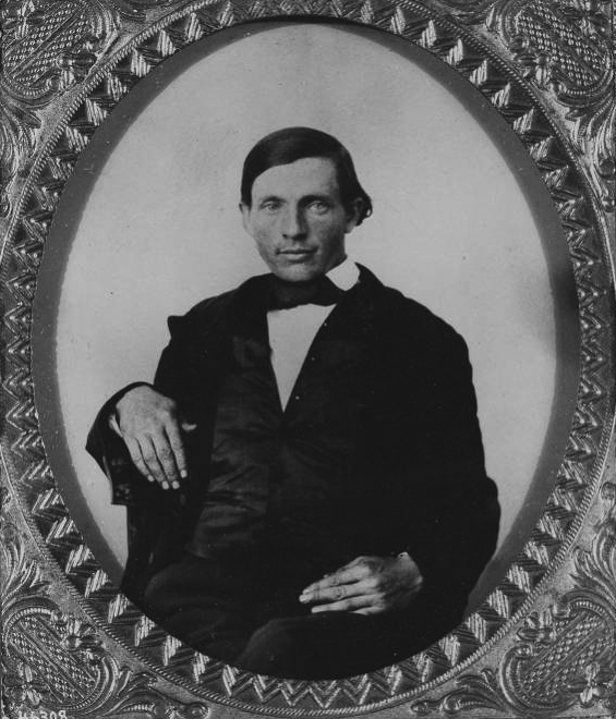
David Swinson Maynard, ca 1868, photographer unknown

Maynard — unlike Republican Arthur Armstrong Denny, who platted the tract to the north — was a Democrat, and named a number of streets in his plat after prominent Democratic politicians, including the slaveholders President Andrew Jackson and Vice President William Rufus DeVane King; Oregon Territorial Governor Joseph Lane, who went on to be the pro-slavery Southern Democratic candidate for vice president in 1860; and pro-slavery California Senator John B. Weller. I haven’t seen much online about Maynard’s personal racial views, but he was known to have had good relations (given the era) with the local Native Americans, at least. Junius Rochester writes for HistoryLink:

Perhaps one of Doc Maynard’s most enduring qualities, besides his amiability, was his high regard for the local Indians. Chief Seattle was a particular friend, having stated: “My heart is very good toward Dr. Maynard.” Maynard, who knew tribulations in his own life, understood that besides the tools, medicines, guns, and other wonders that the white men had brought to Puget Sound, they also introduced disease, intolerant religions, and the inhospitable idea of private property.

But, as Clay Eals notes,

There can be no avoiding his privileged promotion of white settlers at Native Americans’ expense. “They will fight,” he writes on Nov. 4, 1855. “There is no reason why they (sho)uld not, but we must conquer them.”

One hopes that, if Maynard were alive today, he would choose worthier men (and women) to honor than Jackson, King, Lane, and Weller.

Edgar Martinez Drive S

This street runs ¼ mile from 1st Avenue S in the west to 4th Avenue S in the east. West of 1st, it’s S Atlantic Street — its original name — and east of 4th, it’s the beginning of Interstate 90. It is part of State Route 519, a short highway that connects I-90 to Washington State Ferries’ Colman Dock.

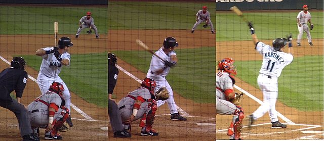
Edgar Martínez was a member of the Seattle Mariners baseball team from 1987 to 2004. This stretch of S Atlantic Street was renamed in his honor the year he retired.

Edgar Martínez at bat, September 15, 2004, licensed under Creative Commons Attribution-Share Alike 3.0 Unported license. https://commons.wikimedia.org/wiki/File:E_Martinez.jpg
Edgar Martínez at bat, September 15, 2004. Photographs by Galaksiafervojo, Wikimedia Commons, licensed under  Creative Commons Attribution-Share Alike 3.0 Unported

Now — why is it Edgar Martinez Drive S instead of S Edgar Martinez Drive, since east–west streets in Seattle have their directional designators at the beginning? I asked Paul Jackson this in 2005. Jackson, who was then the Seattle Department of Transportation’s manager of traffic, signs, and markings, responded:

I appreciate your desire to see our City’s sign system remain consistent.… But ultimately, there is nothing requiring such a naming convention in the Seattle Municipal Code.… In this case, those proposing the street name change wanted to see Edgar Martínez’s name out front. Because this is only a three-block stretch of street (from 1st Avenue S to 4th Avenue S), and does not have any addresses along it, the decision was made to veer slightly from the typical naming convention. The term “drive” was agreed upon to evoke Mr. Martínez’s batting skills at the plate.

Occidental Avenue S

Occidental Avenue S, which begins at Yesler Way in Pioneer Square, is one of those Seattle streets whose names extend into the suburbs. It makes its southernmost appearance at S 197th Street in Des Moines.

It received its name in 1895 as part of the Great Renaming — it had originally been S Second Street. It once had a partner, Oriental Avenue, to the east (originally S Fourth Street), which is today 3rd Avenue S. “Oriental,” of course, means “Eastern,” as “Occidental” means “Western.” (I haven’t been able to determine just when Oriental Avenue became 3rd, but it was last mentioned in The Seattle Times on October 17, 1920.)

And why this particular pairing? The Occidental Hotel, which once overlooked the beginning of Occidental Avenue, is almost certainly the reason, but it’s not spelled out in the ordinance.

S Addition Street

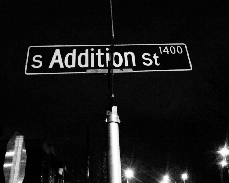
This Industrial District street — a mere 80 feet long — runs from Airport Way S east to the Interstate 5 right-of-way. It may very well be the shortest street in Seattle (I’d love to hear about other candidates).

Sign at corner of S Addition Street and Airport Way S, January 30, 2011
S Addition Street sign, January 30, 2011. Photograph by Benjamin Lukoff. Copyright © 2011 Benjamin Lukoff. All rights reserved.

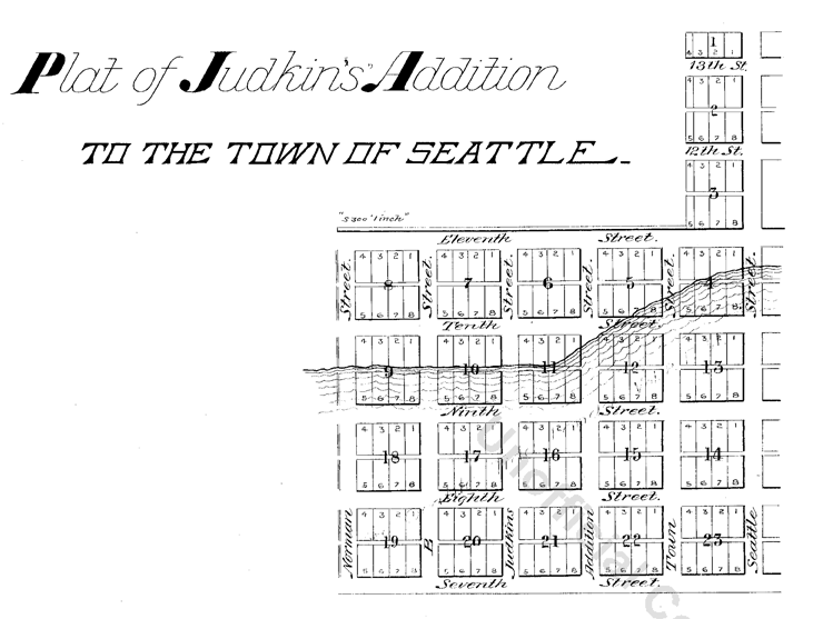
As explained in SW Seattle Street, the plat of Judkin’s Addition to the Town of Seattle was filed in 1869. From north to south, the east–west streets are named Norman, B, Judkins, Addition, Town, and Seattle. (Did they really think B Street would last, I wonder?)

Of these, Norman, Judkins, Addition, and Seattle Streets remain, though Addition is the only one still in its original location. (SW Seattle Street now only exists for a few blocks in West Seattle, and S Norman and S Judkins Streets only east of Interstate 5.)

SW Seattle Street

What better way to start things off than with SW Seattle Street?

SW Seattle Street is a minor residential street in West Seattle that runs about ³/₁₀ of a mile from 42nd Avenue SW in the east to Sunset Avenue SW in the west.

It might seem strange that such a short street would be chosen to bear the city’s name — it was the only one to do so until 2010, when the first two blocks of Airport Way S were renamed Seattle Boulevard S — but this has more to do with unimaginative naming than with civic pride.

On August 4, 1869, Ike M. Hall — the executor of the estate of Norman B. Judkins — filed the Judkin’s (sic) Addition to the Town of Seattle, located just southwest of where the interchange between I-5 and I-90 is today. From north to south, the east–west streets are named Norman, B, Judkins, Addition, Town, and Seattle.

Portions of the original Seattle Street were vacated over the years (for example, in 1900, 1957, and 2000), and the construction of I-5 took care of the rest. However, when the city annexed West Seattle in 1907 it changed the name of Maple Street to W Seattle Street as part of rationalizing the street grid… and so the name lives on.

(The city itself, of course, was named after Si’ahl [siʔaɫ], better known in English as Chief Seattle of the Duwamish and Suquamish Tribes.)

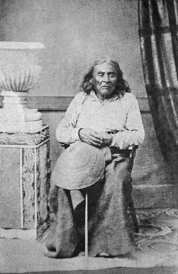
siʔaɫ, or Chief Seattle
The only known photograph of Chief Seattle (1786?–1866), taken by E.M. Sammis in 1864
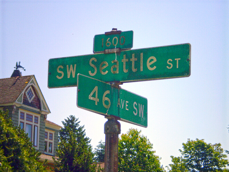
Sign at corner of SW Seattle Street and 46th Avenue SW, July 4, 2011
Sign at corner of SW Seattle Street and 46th Avenue SW, July 4, 2011. Photograph by Benjamin Lukoff. Copyright © 2011 Benjamin Lukoff. All rights reserved.

So, why SW Seattle Street instead of Seattle Street SW?

In Seattle, east–west streets have the directional come first, and north–south avenues have it come last. The Wikipedia article “Street layout of Seattle,” which I helped write, has a more comprehensive description of Seattle’s addressing system, including the answer to this question:

Why was it W Seattle Street in 1907 but SW Seattle Street now?

In 1961, city ordinance 89910 “established a standard system of street name designations” so that in almost all cases streets within a given zone would carry the same directional. West Seattle avenues already carried the SW designation.