Paisley Drive NE

Like Inverness Drive NE, this street was created in 1954 as part of the plat of Jay Roberts Country Club Estates. Again according to Wedgwood in Seattle History,

Roberts gave the names Inverness Drive and Paisley Drive to the development’s two major connecting roadways. These two names referred to places near Glasgow, Scotland, and were meant to convey the idea of castle-like estate properties on a high vantage point.

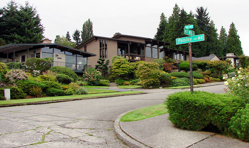
Street sign, NE 85th Street at Paisley Drive NE in Inverness
Street sign, NE 85th Street at Paisley Drive NE. Photograph courtesy of Wedgwood in Seattle History. Copyright © 2013 Wedgwood in Seattle History. All rights reserved.

Paisley Drive NE begins at NE 85th Street and goes ⅖ of a mile northwest to 45th Avenue NE.

Inverness Drive NE

This street was created in 1954 as part of the plat of Jay Roberts Country Club Estates. According to Wedgwood in Seattle History,

Roberts gave the names Inverness Drive and Paisley Drive to the development’s two major connecting roadways. These two names referred to places near Glasgow, Scotland, and were meant to convey the idea of castle-like estate properties on a high vantage point.

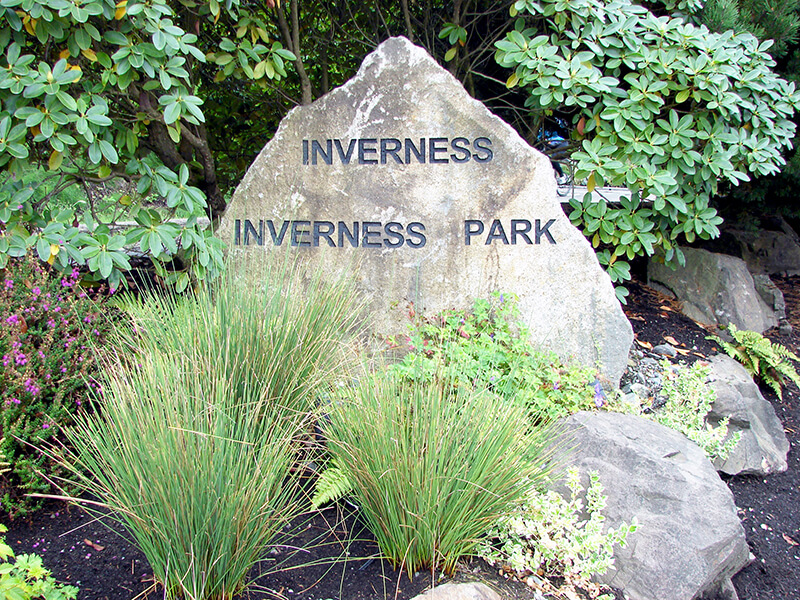
Inverness entrance marker
Inverness entrance marker. Photograph courtesy of Wedgwood in Seattle History. Copyright © 2013 Wedgwood in Seattle History. All rights reserved.

Inverness Drive NE begins at Sand Point Way NE and goes ⅖ of a mile southwest to just south of NE 85th Street, at the north end of the Sand Point Country Club.

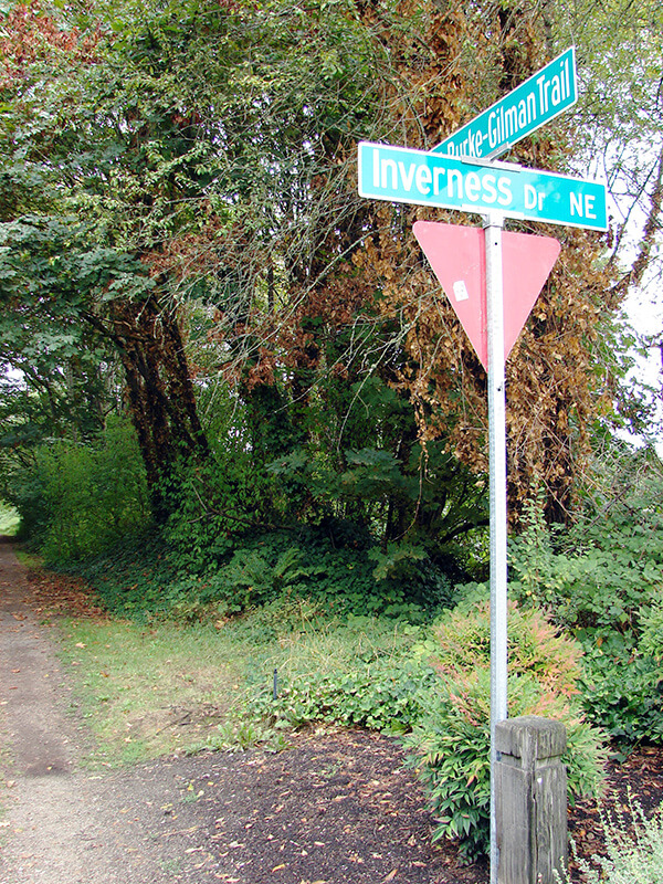
Sign at corner of Inverness Drive NE and the Burke-Gilman Trail
Sign at corner of Inverness Drive NE and the Burke-Gilman Trail. Photograph by Wedgwood in Seattle History. Copyright © 2013 Wedgwood in Seattle History. All rights reserved.

Pinehurst Way NE

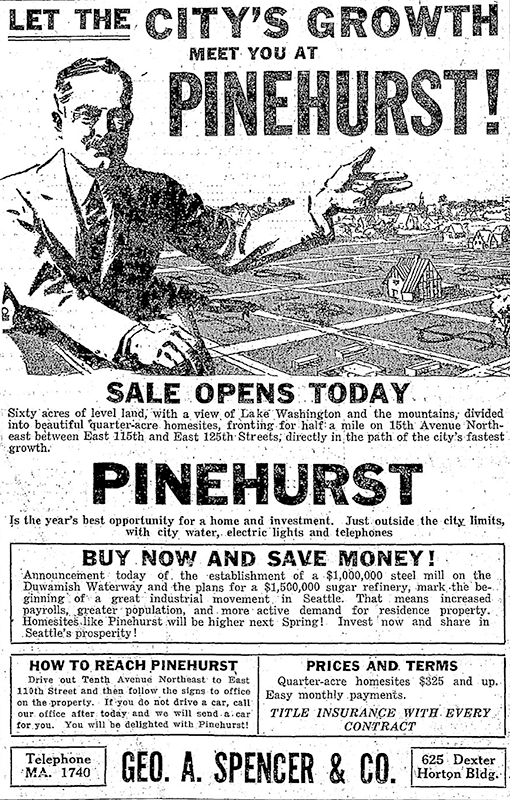
This street was established in 1926 as part of the plat of Pinehurst. Originally beginning at 15th Avenue NE and NE 117th Street and going northeast to 17th Avenue NE between NE 123rd Street and NE 125th Street, it was subsequently extended to connect the 15th Avenue NE and Roosevelt Way NE arterials.

Today, Pinehurst Way NE begins at Roosevelt Way NE and NE 113th Street, and goes ⅔ of a mile northeast to 17th Avenue NE and NE 124th Street.

Ad for Pinehurst, The Seattle Times, October 3, 1926

Victory Lane NE

This street, which was originally named Lake View Lane in the 1920 plat of Victory Heights, appears to have received its current name no later than August 1943, when it first appears in the Seattle Post-Intelligencer as part of the obituary of Dr. Lewis R. Dawson, “dean of Seattle physicians and surgeons.” (Victory Heights was itself named for Victory Way, known today as Lake City Way NE within Seattle city limits and as Bothell Way NE in Lake Forest Park, Kenmore, and Bothell. The road was given this name in the wake of the Allied victory in World War I.)

My first thought was that Lake View Lane had been renamed Victory Lane to preserve the Victory Way name after the highway became Bothell Way, but it turns out that happened a number of years later, so I am unsure as to the reason for this name change.

NE Brockman Place

This street appears to have been named for Charles Carl Brockman (1869–1954), proprietor of the unrecorded plat of Brockman’s Tracts. According to the obituary of his son, Charles Clark Brockman (1915–2010), the elder Brockman was “a Seattle pioneer who owned a grocery store [and] various real estate interests in the Denny Regrade and Lake City area.”

NE Brockman Place begins at 19th Avenue NE just north of NE 127th Street and goes ¼ mile northwest to just west of 14th Place NE.

NE Northgate Way

This street was named in 1968 for Northgate Station, which opened in 1950 as the Northgate Center shopping mall. According to HistoryLink.org, it was “the country’s first regional shopping center to be defined as a ‘mall’ (although there were at least three predecessor shopping centers).” Newspaper archives show that it became known early on as Northgate Mall, and that became its official name in 1974. As of this writing, the property is in the midst of a massive redevelopment project that began in 2019.

Prior to 1968, Northgate Way was known as (from west to east) N 105th Street, Mineral Springs Way N, N 110th Street, NE 110th Street, and Chelsea Place NE. Today, it begins at N 105th Street and Aurora Avenue N and goes 2⅕ miles east to NE 113th Street and Lake City Way NE.

The Northgate name itself has been attributed to Ben Erlichman. Feliks Banel writes:

Digging into the newspaper archives, The Seattle Times of February 22, 1948, published a big spread on the plans for the shopping center. The story quoted one of the developers, a local investor named Ben Ehrlichman (the uncle of future Watergate figure John Ehrlichman). “The name Northgate was chosen, Ehrlichman [told The Seattle Times], because the development ‘will be the most important northerly business district serving Seattle and vicinity and the gateway to metropolitan Seattle.’” Though a 30th anniversary story in the same paper in 1980 credited Ehrlichman for coming up with the name — based on the 1948 story — we may never know for certain whose idea it was.

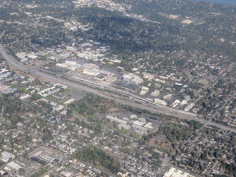
Aerial of Northgate, September 2018, from https://flickr.com/photos/25443792@N05/43844953055
Aerial of Northgate, September 2018, looking northeast. Interstate 5 cuts across the photo from bottom right to upper left. To its west is North Seattle College; to its east is Northgate Station, the Thornton Place complex, the Northgate Transit Center, and the Northgate commercial district. The elevated tracks of Sound Transit’s Line 1 light rail can be seen just east of the freeway. The Lake City commercial district is visible to the northeast of the mall; the greenbelt closer to the mall is one of the forks of Thornton Creek. Photograph by Flickr user Atomic Taco, licensed under Creative Commons Attribution-ShareAlike 2.0 Generic

Goodwin Way NE

This street, originally named Columbian Way in the 1920 plat of Victory Heights, was given its current name sometime during or before 1936, the first time I find it mentioned in the archives of The Seattle Times. I presume this was to avoid confusion with the Columbian Way in South Seattle, even though Victory Heights wasn’t annexed to Seattle until 1953.

The plat was filed by the Goodwin Real Estate Company and the Squire Investment Company. The Goodwin Real Estate Company at that time had Ervin Shirley Goodwin (1869–1937) as its president and his nephew, Arthur Eliot Goodwin (1887–1960), as its secretary. (Ervin and his brothers were instrumental in the development of Pike Place Market.) I presume the renaming was to honor Erwin rather than Arthur, though explicit explanations are rarely given for street naming. It may very well have been to honor the company. (Incidentally, Erwin’s wife, Eda, was a founder of the Seattle Fruit and Flower Mission in 1907; this organization became the Seattle Milk Fund in 1935 and Goodwin Connections in 2019.)

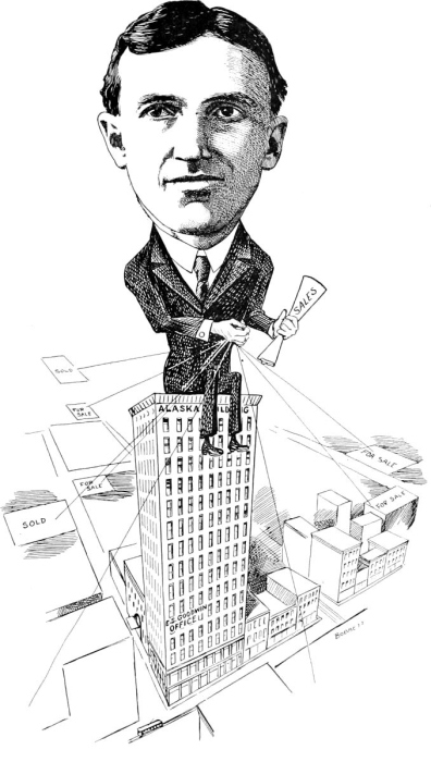
E.S. Goodwin
Ervin Shirley Goodwin

Unfortunately, in addition to being major developers (in addition to Victory Heights, they were behind Lakeridge, Hawthorne Hills, and subdivisions in Northgate, Lake City, and Windermere), the Goodwin Real Estate Company were pioneers in imposing racial restrictive covenants on their developments. As the Seattle Civil Rights & Labor History Project writes,

Seattle’s first known racial restrictive covenant was written in 1924 by the Goodwin Company and applied to three tracts of land and one block of the company’s development in the Victory Heights neighborhood in north Seattle.

It read:

Said tract shall not be sold, leased, or rented to any person or persons other than of Caucasian race nor shall any person or persons other than of Caucasian race use or occupy said tract.

Goodwin Way NE begins at 19th Avenue NE just north of NE Northgate Way and goes ¼ mile northwest to 15th Avenue NE between NE 113th Street and NE 115th Street.

Lake Shore Boulevard NE

This street, created in 1906 as part of the Lake Shore View Addition to Seattle, begins in the north at NE 105th Street and Exeter Avenue NE, and curves south for a mile along the Burke-Gilman Trail, which parallels the Lake Washington shoreline, to a dead end at the north boundary of Matthews Beach Park. Unlike most, though not all, boulevards in Seattle, this one is not one of the Olmsted boulevards designed by John Charles Olmsted in 1903.

Riviera Place NE

This narrow street, created in 1926 as part of Riviera Beach, an Addition to King County, Washington, Divisions № 1, 2, 3, and 4, and situated between the shoreline of Lake Washington and the right-of-way of the Northern Pacific Railway, appears on the plats simply as “Road” — it first appears in The Seattle Times on July 20, 1930, as “Riviera Beach Road,” and then on July 2, 1932, with its current name. The name simply means ‘coastline’ in Italian.

Today, Riviera Place NE begins at the north city limits, where Seattle meets Lake Forest Park at the NE 145th Street right-of-way, and goes nearly a mile south along the Lake Washington shoreline to a spot a few houses north of NE 125th Street, where it ends at one house and picks up again on the other side of its neighbor. From there, it runs 1¼ miles south to its end at Lake Shore Boulevard NE between NE 100th Street and NE 103rd Street. The portions between the NE 135th Street right-of-way and NE 125th Street are private.

Riviera Place NE is probably most notable to the city at large for being the location of the NE 130th Street End park, which became an official park in 2019 after years of controversy. It’s not, strictly speaking, a shoreline street end, because it’s owned by Seattle Parks and Recreation, rather than being a right-of-way under the jurisdiction of the Seattle Department of Transportation. This is because it was never properly dedicated to the public in 1932 (see background and court filings). For years, it had been treated as just another shoreline street end, but in 2012, when the city announced its intention to make improvements to the beach to improve public access, the neighbors on either side filed suit, and ended up having their ownership of the lot confirmed. The city ended up having to exercise its right of eminent domain, condemned the property, and paid the neighbors $400,000 each. (As unfortunate as it was to have to pay $800,000 for the street end, I’d say it was worth it, as NE 130th is the only accessible shoreline street end north of NE 43rd Street, and the only public lake access, period, north of Matthews Beach [around where NE 95th Street would be if it had been platted into the water].)

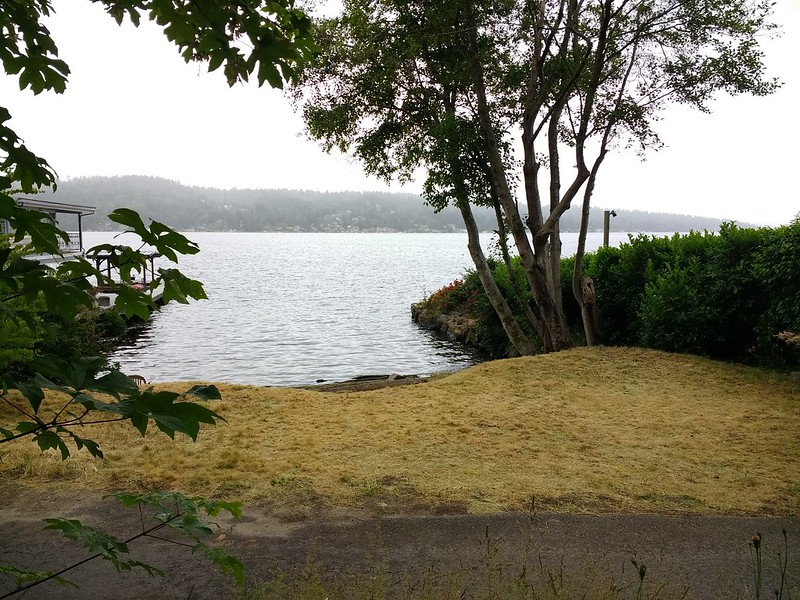
View of NE 130th Street park on Lake Washington east of Burke-Gilman Trail and Riviera Place NE, June 18, 2019.
View of NE 130th Street End park on Lake Washington east of Riviera Place NE, June 18, 2019. Photograph by Flickr user Seattle Parks and Recreation, licensed under Creative Commons Attribution 2.0 Generic

Erickson Place NE

This street, which runs around 675 feet from 35th Avenue NE at NE 135th Street to Lake City Way NE at NE 137th Street, connecting the two arterials, was named, as local historian Valarie Bunn tells us in Gerhard Ericksen’s Good Road, after Norwegian immigrant Gerhard Johan Ericksen (1860, Molde, Norway – 1920, Bothell, Washington). 

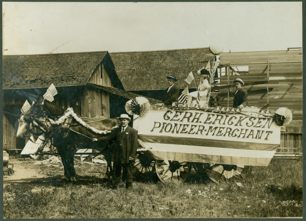
Parade float, July 4, 1908, for Gerhard Ericksen’s Mercantile, Bothell; Ericksen at far left
Parade float, July 4, 1908, for Gerhard Ericksen’s Mercantile, Bothell; Gerhard Ericksen at far left, son George Ericksen at far right

Ericksen, a Bothell merchant and Washington state legislator, was behind the creation of what is now the Washington State Department of Transportation, and the Gerhard Erickson Road (sic) was named in his honor. Bunn writes:

This road preceded the creation of Victory Way (Bothell Way/Lake City Way.)… In Wedgwood today, the Erickson Road route still exists as part of Ravenna Avenue NE north of NE 83rd Street.… as far as NE 110th Street. At the corner where Nathan Hale High School is located… the Erickson Road route took an eastward turn over to what is now 35th Avenue NE. At NE 135th Street, the 35th Avenue NE arterial angles over and merges with Lake City Way NE. The two-block portion from NE 135th to 137th Streets is still called Erickson Place NE.

Why the street is spelled Erickson instead of Ericksen is unknown.

Fischer Place NE

I am certainly not the first person to have been interested in, or to blog about, the origins of Seattle street names. One of the historians whose work I’ve been inspired by is Valarie Bunn, who writes Wedgwood in Seattle History (though she does not restrict herself to Wedgwood).

In “The Fischer Farm in Meadowbrook,” from 2013, she writes about August and Wilhelmine Fischer, who came to Seattle from Saxony, Germany, in 1888, and lived here until they died in 1940 and 1941, respectively. In 1922, they established what is now Fischer Place NE as Fischer Street in the plat of Fischer’s Highway Garden Tracts. (“Highway” because of Victory Way [now Lake City Way NE, part of State Route 522] and Pacific Highway [now Ravenna Avenue NE]. The latter lost its Pacific Highway designation to the former that same year, and the designation shifted farther west to what is now Aurora Avenue N a number of years later.) I highly recommend this article and her entire blog.

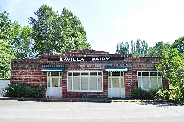
Exterior of LaVilla Dairy building on Fischer Place NE, August 2017, licensed under Creative Commons Attribution 4.0 International license. https://commons.wikimedia.org/wiki/File:Seattle_-_Lavilla_Dairy_03.jpg
Exterior of LaVilla Dairy building on Fischer Place NE, August 2017. Built in 1922 by Ole Blindheim, son-in-law of the Fischers. Photograph by Joe Mabel, Wikimedia Commons, licensed under Creative Commons Attribution 4.0 International

Today, Fischer Place NE runs about ¼ mile from NE 102nd Street and Lake City Way NE in the southwest to NE 105th Street in the northeast.