Bainbridge Place SW

This short street — not quite 275 feet long — connects SW Othello Street to Fauntleroy Way SW just north of Lincoln and Solstice Parks. Created as part of the Lincoln Home Addition in 1907 by builder Albert Eugene Felmley and his wife, Mabel L. Felmley, it is named after Bainbridge Island, located 5¼ miles to the northwest, across Puget Sound. The island itself was named for U.S. Navy Commodore William Bainbridge, commander of the USS Constitution, by Charles Wilkes in 1841.

Two other streets in the Lincoln Home Addition are named for Puget Sound islands: Blake Place SW and Vashon Place SW.
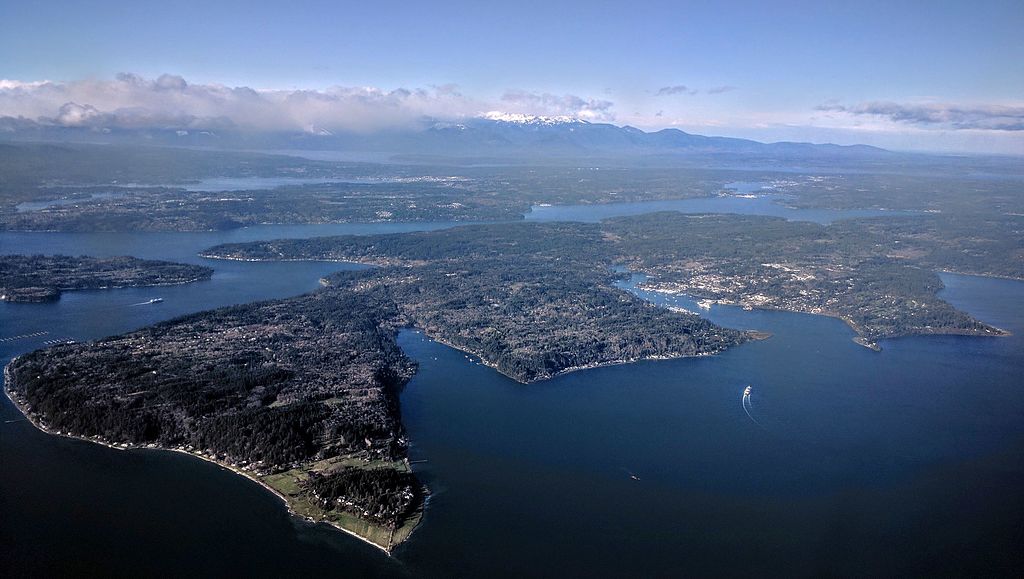
 

Aerial view of Bainbridge Island from the southeast
Aerial view of Bainbridge Island from the southeast. Photograph by Dicklyon, Wikimedia Commons, licensed under Creative Commons Attribution-Share Alike 4.0 International

W Briarcliff Lane

W Briarcliff Lane runs about 400 feet west from 39th Avenue W before it makes a 90° turn to the north and becomes Briarcliff Lane W. That segment runs about 200 feet north to W Dravus Street. A private road, it is part of the Briarcliff development on what was once Briarcliff School (1949–1984, demolished 2003). You can read more about the history of Briarcliff at HistoryLink.com.

As for the school’s name? In an article published August 21, 1948, The Seattle Times noted that “on recommendation of district residents, the board named the new school being built in the Magnolia area the Briarcliff School.”

NW Esplanade

More common in older cities like London (Aldgate, Cheapside, Crosswall, Eastcheap, Houndsditch, Lothbury, Minories, Moorgate, Poultry, Queenhithe, and Walbrook, just to name those that merit a Wikipedia article of their own), single-word street names are a rarity in Seattle. NW Esplanade is one of them. It was platted in 1924 as part of the Golden View Addition, and its extension in 1927 as part of the Loyal Heights Annex.

NW Esplanade runs just over half a mile along the Puget Sound shoreline from Triton Drive NW in the northeast to just shy of the northern boundary of Golden Gardens Park in the southwest. For those who might not know, the word means “a long, open, level area, usually next to a river or large body of water where people may walk.”

Delridge Way SW

This street runs nearly four miles from Chelan Avenue SW, SW Spokane Street, and W Marginal Way SW in the north to 16th Avenue SW and SW Roxbury Street in the south — all the way from the Duwamish Waterway to the southern city limits. It was given its current name in 1940 — before then, it had carried the names of Youngstown Place, 21st Avenue SW, 22nd Avenue SW, McKinnon Place SW, 23rd Avenue SW, and 24th Avenue SW. As The Seattle Times explained on May 14, 1940, “Delridge” came from “the dells and ridges through which the thoroughfare runs,” and had been “suggested by West Seattle community organizations.”

E Foster Island Road

This street, which runs about ¼ mile from Lake Washington Boulevard E to the beginning of the Foster Point Trail, all within the Washington Park Arboretum, was without a name until 1968, when it was named for the island in Union Bay to which it led. (It remained unsigned until a few decades later, however. There was no sign at the intersection until at least the 1990s, as I know since my parents’ house was at the south end of the Arboretum and I drove or biked by there weekly, if not more often, while I was growing up.)

Foster Island is known by the Duwamish tribe, who once used it as a burial ground, as Stitici, or ‘little island’. It was named by the settlers for Joel Wellington Foster, who came to Washington in the 1870s from St. Joseph, Missouri. He is said to have donated the island to the city in one HistoryLink article, but another says the city bought it in 1917.

(Note added November 6, 2022: David B. Williams, the “Street Smart Naturalist,” recently posted The Lost Islands of Seattle, in which he wrote that he had seen various sources for the name Foster but none with good documentation. I asked him about the HistoryLink article I cite above:

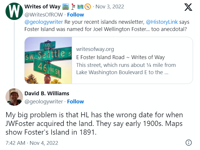
A screen shot of a tweet by me reading "@geologywriter Re your recent islands newsletter, @HistoryLink says Foster Island was named for Joel Wellington Foster... too anecdotal?" and David B. Williams's reply, "My big problem is that HL has the wrong date for when JWFoster acquired the land. They say early 1900s. Maps show Foster's Island in 1891."

I’m embarrassed to have missed that, but of course he’s right. So if not Joel Wellington Foster, then who? The search continues

[Note: On July 10, 2024, I began converting embedded tweets on this website to screenshots because of issues with how they were integrating with WordPress, which began not too long after Elon Musk purchased Twitter and changed its name to X.]

Island Drive S

There are only a handful of islands within Seattle city limits, and of them just one — Harbor Island — is large enough to have streets on it. But Island Drive S isn’t on Harbor Island — rather, it’s along the shore of Lake Washington, 5½ miles to the southeast. What gives?

As it turns out, Island Drive once was on an island — Pritchard Island. Known as tleelh-chus (‘little island’) by the Duwamish tribe, it was bought in 1900 by Alfred J. Pritchard (grandfather of Joel Pritchard, who was a congressman from Washington state in the 1970s and 1980s and its lieutenant governor in the 1980s and 1990s). In 1916, Lake Washington was lowered by 9 feet as part of the construction of the Lake Washington Ship Canal, and Pritchard’s island became part of the mainland.

It’s still known as Pritchard Island, though. Today, Pritchard Island Beach, Rainier Beach Urban Farm and Wetlands, and Be’er Sheva Park separate the island from the mainland.

Webster Point Road NE

This very short street in the Laurelhurst neighborhod — just over 200 feet long — was created in 1962 as part of the Webster Point plat. Why it’s a road rather than a place, lane, or court, I’m not sure — roads in Seattle (of which there aren’t many) are usually longer, such as Windermere Road NE, Holman Road NW, and Military Road S. It has the distinction of the lowest-numbered address on a north–south street north of the Lake Washington Ship Canal, as far as I am aware — 3000.

The plat and road are named for Webster Point, at the very southern tip of the Laurelhurst peninsula, which itself was named for Henry A. Webster, who once owned the land. This Webster appears to have been the Indian agent for the Makah tribe at Neah Bay on the Olympic Peninsula.

Constance Drive W

This ⅔-mile–long Magnolia street is named for Mount Constance in the Olympic Mountains. Constance was the older sister of Ellinor Fauntleroy, namesake of Mount Ellinor and Ellinor Drive W. (There are no Magnolia streets named Edward, Arthur, or The Brothers.)

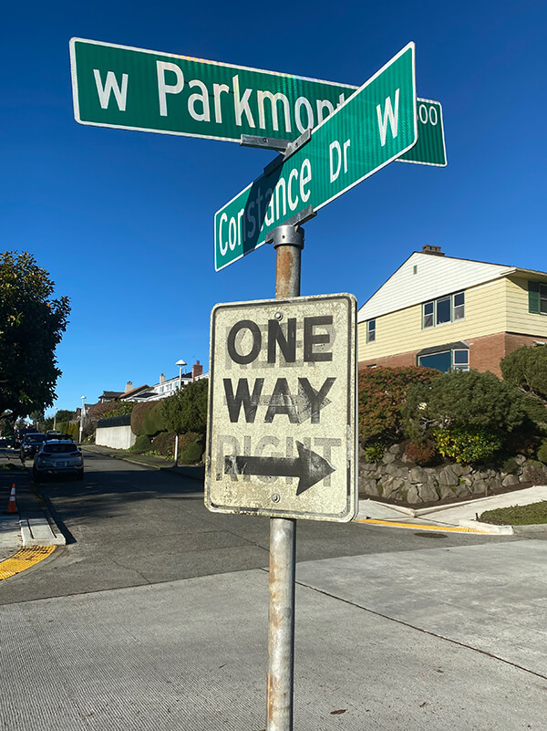
W Parkmont Drive and Constance Drive W street sign above One Way sign with Keep Right ghost sign underneath
Street sign at corner of W Parkmont Place and Constance Drive W, with One Way sign over Keep Right ghost sign, January 9, 2022. Photograph by Benjamin Lukoff. Copyright © 2022 Benjamin Lukoff. All rights reserved.

Ellinor Drive W

This short street in Magnolia’s Carleton Park subdivision is named for Mount Ellinor in the Olympic Mountains, which was itself named for Ellinor Fauntleroy, the fiancée of George Davidson of the U.S. Coast Survey, who named the peak in 1853. Nearby Constance Drive W is named for Mount Constance, itself named for Ellinor’s older sister.

Most of Magnolia’s streets follow Seattle’s cardinal-direction grid. Here, however, in the southwest corner of the neighborhood, they are laid out to follow the contour of the steep bluff that affords many streets a view of the Olympic Mountains, the Cascade Range, or both.