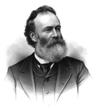
This street is named for Dr. Henry A. Smith (1830–1915), after whom Smith Cove is also named. He and his family once owned most of what is now Interbay, between Smith Cove and Salmon Bay. He is likely best known today for his translation of Chief Seattle’s Speech. Though its authenticity has been questioned, it is accepted by the Suquamish Tribe and Duwamish Tribe, both of which siʔaɫ was chief.
Dr. Henry A. Smith
Today, W Smith Street begins in Magnolia at the intersection of 37th Avenue W and 36th Avenue W and goes ⅘ of a mile east to just past 24th Avenue W, briefly becoming a stairway just west of 26th Avenue W at Ella Bailey Park. It begins again in Queen Anne at 7th Avenue W and goes ½ a mile east to Warren Avenue N, forming a portion of Queen Anne Boulevard between 1st Avenue W and Warren Avenue N. Smith Street’s final segment begins at 4th Avenue N and goes a block east, ending at a greenbelt overlooking Aurora Avenue N.
Born and raised in Seattle, Benjamin Donguk Lukoff had his interest in local history kindled at the age of six, when his father bought him settler granddaughter Sophie Frye Bass’s Pig-Tail Days in Old Seattle at the gift shop of the Museum of History and Industry. He studied English, Russian, and linguistics at the University of Washington, and went on to earn his master’s in English linguistics from University College London. His book of rephotography, Seattle Then and Now, was published in 2010. An updated version came out in 2015.
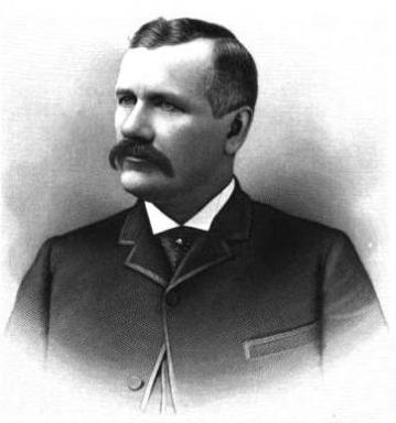
All in one year John McGraw was Chief of Police, Marshall, Sheriff, Harbor Master and Fire Warden. Later he was Governor of Washington and in between, bank president and attorney-at-law — quite a career.
The second governor of Washington after statehood (1893–1897), he had been King County sheriff during the anti-Chinese riots of 1886. He defended Chinese laborers from the mob that was trying to expel them from the city, although, according to The Role of Federal Military Forces in Domestic Disorders, 1877–1945, he initially sympathized with the rioters and allowed them to force the Chinese (without physically harming them) to the waterfront to be loaded onto the steamship Queen of the Pacific. Both he and Mayor Henry Yesler lost their bids for re-election that summer in what the book calls “a resounding show of support for anti-Chinese forces.”
John H. McGraw
Today, W McGraw Street begins as a shoreline street end on Elliott Bay in Magnolia west of Perkins Lane W. It begins in earnest at the intersection of Westmont Way W, Montavista Place W, and Rosemont Place W and goes ⅘ of a mile east to 24th Avenue W, forming the heart of Magnolia Village, the neighborhood’s commercial district, from 35th Avenue W to 32nd Avenue W. It resumes on the other side of Interbay in Queen Anne, beginning at 11th Avenue W and going 1⅛ miles east to the Northeast Queen Anne Greenbelt east of Bigelow Avenue N. There are a few block-long segments heading down the hill to Westlake and, like Blaine Street, a right-of-way platted into Lake Union that serves as a driveway and affords no actual lake access.
E McGraw Street doesn’t appear again until 15th Avenue E and Boyer Avenue E in Montlake, where it goes ⅔ of a mile east to 26th Avenue E at the west end of the Washington Park Arboretum, becoming a stairway for a short distance just before 19th Avenue E. It ends for good in Madison Park as a two-block stretch between 38th Avenue E and 40th Avenue E.
Born and raised in Seattle, Benjamin Donguk Lukoff had his interest in local history kindled at the age of six, when his father bought him settler granddaughter Sophie Frye Bass’s Pig-Tail Days in Old Seattle at the gift shop of the Museum of History and Industry. He studied English, Russian, and linguistics at the University of Washington, and went on to earn his master’s in English linguistics from University College London. His book of rephotography, Seattle Then and Now, was published in 2010. An updated version came out in 2015.
Unfortunately, though the Blaines may have been feminists, they, according to HistoryLink.org, had no love for Native Americans (or, for that matter, the Irish). Their departure in 1856 was prompted by the Battle of Seattle. Junius Rochester writes:
On January 20, 1856, a son John, was born to Catharine and David Blaine. Six days later the Battle of Seattle erupted. David had duty at one of the blockhouses, but managed to get Catharine and their babe aboard the Decatur in Elliott Bay. David had described the Indians as a “poor degraded race,” which would “soon disappear.” Catharine compared their “stupidity and awkwardness” to that of the Irish. The Indian uprising confirmed their worst fears and prejudices.
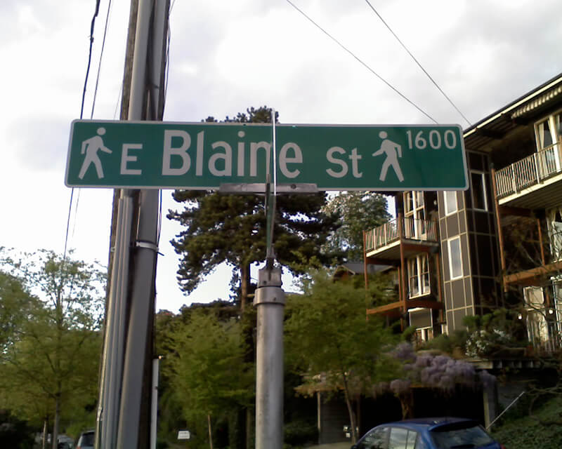
Today, W Blaine Street begins in Magnolia at 36th Avenue W and goes a semicircular ⅕ of a mile to 34th Avenue W and W Howe Street. It resumes at 31st Avenue W and goes almost ⅓ of a mile to Thorndyke Avenue W. There is a stub of W Blaine east of 15th Avenue W that is quickly stopped by the Southwest Queen Anne Greenbelt. The street resumes at 12th Avenue W and goes just over a mile to 4th Avenue N, having briefly become a stairway at 9th Avenue W. After a series of short stretches serving as driveways and parking, the Blaine Street right-of-way resurfaces east of Westlake Avenue N and heads into Lake Union. Here, too, it serves as a driveway and offers no access to the water. East of Lake Union, E Blaine Street begins at Fairview Avenue E and goes ⅛ of a mile to Franklin Avenue E, where it becomes part of the I-5 Colonnade park underneath the freeway. From Lakeview Boulevard E to just west of 10th Avenue E it is a stairway, and then two blocks of roadway ending at 12th Avenue E and Lake View Cemetery. There is then a diagonal ¼-mile stretch from 19th Avenue E to E Howe Street in Montlake. E Blaine finishes up as a ⅕-mile stretch from 37th Avenue E to McGilvra Boulevard E and a final two-block run from E Madison Street to 43rd Avenue E, both in Madison Park.
Born and raised in Seattle, Benjamin Donguk Lukoff had his interest in local history kindled at the age of six, when his father bought him settler granddaughter Sophie Frye Bass’s Pig-Tail Days in Old Seattle at the gift shop of the Museum of History and Industry. He studied English, Russian, and linguistics at the University of Washington, and went on to earn his master’s in English linguistics from University College London. His book of rephotography, Seattle Then and Now, was published in 2010. An updated version came out in 2015.
In the early 1870s, the Denny and Mercer families gradually began to systematically subdivide their large land holdings on the south and east slopes of Queen Anne Hill. When a severe windstorm blew down thousands of trees in the north district in 1875, views opened up and land seekers turned their attentions beyond Belltown. Real estate speculators new to the territory arrived and began to buy up property on the crest of Queen Anne Hill. Some of these speculators also became developers, such as George Kinnear, or builder-developers, such as Isaac Bigelow.
Though its proximity to Boston and Lynn Streets suggest a tribute to Newton, Massachusetts, neither the Georges nor the Bigelows appear to have a connection to the state, so it seems this one should be chalked up to Isaac Bigelow’s middle name.
Today, Newton Street begins in Magnolia as W Newton Street at 30th Avenue W, and goes nearly half a mile east to 23rd Avenue W. There is then a two-block stretch from 15th Avenue W to 13th Avenue W in Interbay, and then the “original” Newton Street, which stretches almost a half mile from 1st Avenue N to Taylor Avenue N, followed by another two-block stretch from Dexter Avenue N to just past 8th Avenue N. On the east side of Lake Union, E Newton Street picks up again at Terry Pettus Park, just west of Fairview Avenue E, and goes ¼ mile to Boylston Avenue E and Lakeview Boulevard E. There follows another ¼-mile stretch from Broadway E to Everett Avenue E. East of there, Newton exists in a number of short segments through Montlake, and then enjoys a run of ⅓ of a mile from 37th Place E to 43rd Avenue E in Madison Park.
Born and raised in Seattle, Benjamin Donguk Lukoff had his interest in local history kindled at the age of six, when his father bought him settler granddaughter Sophie Frye Bass’s Pig-Tail Days in Old Seattle at the gift shop of the Museum of History and Industry. He studied English, Russian, and linguistics at the University of Washington, and went on to earn his master’s in English linguistics from University College London. His book of rephotography, Seattle Then and Now, was published in 2010. An updated version came out in 2015.
W View Place, formerly an unnamed block-long alley between 28th Avenue W and 29th Avenue W just south of W Elmore Place, was named in 1950 at the request of Norman E. Boor, et al. The houses at 2805, 2815, and 2829 were all built in 1947, according to county records; I suppose this necessitated that the street be named, and for some reason no one could come up with anything more interesting than “View,” for the view of Ballard residents were able to enjoy.
Given the choice between W Boor Place and W View Place, I’d take the latter, but really… I’m surprised this was approved, especially given the existence of View Avenue NW near Golden Gardens Park.
Born and raised in Seattle, Benjamin Donguk Lukoff had his interest in local history kindled at the age of six, when his father bought him settler granddaughter Sophie Frye Bass’s Pig-Tail Days in Old Seattle at the gift shop of the Museum of History and Industry. He studied English, Russian, and linguistics at the University of Washington, and went on to earn his master’s in English linguistics from University College London. His book of rephotography, Seattle Then and Now, was published in 2010. An updated version came out in 2015.
This Magnolia street, which goes not quite 700 feet from 37th Avenue W just south of W Armour Street in the south to W Fulton Street just west of 36th Avenue W in the north, originated in 1939 as part of the plat of Carleton Park Terrace, an Addition to the City of Seattle, filed by C.F. Bishop, Jr., his wife, Elizabeth, and the city of Seattle itself, owners of the land in question.
Charles F. Bishop, Jr. (1881–1963) was — according to his Seattle Post-Intelligencer and Seattle Times obituaries, and based on information in his father’s Times obituary from 1943 — born in Brockport, New York, near Rochester, and came to Seattle when he was 18. The elder Bishop was a marine engineer for the Alaska Steamship Company and the Puget Sound Navigation Company. Bishop Jr. was a grocery wholesaler who ran the Puget Sound Quality Stores (PSQ Stores) cooperative, which, according to local historian Paul Dorpat in his April 6, 1986 Now & Then column for the P-I, was a predecessor of Associated Grocers — now, after a number of mergers and acquisitions, part of United Natural Foods.
Bishop founded Modern Home Builders, Inc., with his brother, Ralph Waldo Bishop, Sr., in 1940, the year after he filed the plat of Carleton Park Terrace. This particular plat of his carried no racial restrictive covenants, but the adjacent Carleton Park Terrace Division № 3, filed in 1941, did, banning non-whites from living in the subdivision unless they were domestic servants of white residents.
Born and raised in Seattle, Benjamin Donguk Lukoff had his interest in local history kindled at the age of six, when his father bought him settler granddaughter Sophie Frye Bass’s Pig-Tail Days in Old Seattle at the gift shop of the Museum of History and Industry. He studied English, Russian, and linguistics at the University of Washington, and went on to earn his master’s in English linguistics from University College London. His book of rephotography, Seattle Then and Now, was published in 2010. An updated version came out in 2015.
To reach their homes, residents of Bay Terrace — east of Lawtonwood and west of Land’s End at the northern tip of Magnolia — must drive through Discovery Park. Within the park, their street (the narrow neighborhood only has one) is known as Bay Terrace Road, but changes to 42nd Avenue W north of the park boundary. Similarly to Lawtonwood Road, it does not appear to have been officially so designated until 2007, when ordinance 122503 was passed. Also similarly to Lawtonwood Road, it carries no directional designation, since it is a park boulevard.
Bay Terrace Road runs ¼ mile north from Lawtonwood Road just west of 40th Avenue W, and then becomes 42nd Avenue W, which continues on for another ⅕ of a mile to a viewpoint overlooking Shilshole Bay.
Born and raised in Seattle, Benjamin Donguk Lukoff had his interest in local history kindled at the age of six, when his father bought him settler granddaughter Sophie Frye Bass’s Pig-Tail Days in Old Seattle at the gift shop of the Museum of History and Industry. He studied English, Russian, and linguistics at the University of Washington, and went on to earn his master’s in English linguistics from University College London. His book of rephotography, Seattle Then and Now, was published in 2010. An updated version came out in 2015.
The neighborhood of Lawtonwood, or Lawton Wood — both spellings have been in use over the years — is perched atop Discovery Park north of W Cramer Street. Lawtonwood Road, which goes through the park, is the only way in or out. It would have been a natural part of Fort Lawton, and it certainly would have made a great addition to the park, but as local historian Paul Dorpat explains in his introduction to the neighborhood,
Steady white settlement started in 1875 when German immigrant Christian Scheuerman moved to the area, cleared the timber and married a native woman who had ten children before she died in 1884. In 1895 Seattle boosters organized to attract a military post to the area and gathered the acreage that is now Fort Lawton–Discovery Park. The part of it that is now Lawton Wood… is not part of the military holding because Scheuerman withheld it.
It should not be thought that Scheuerman cared nothing at all for the defense of Seattle — he and his family did donate 26.13 acres to the cause — though that made up less than 4% of the 704.21 acres given in total. (The single largest contributors of land were Thomas W. Prosch and his wife, Virginia, who gave 330.97 acres, a full 47%.)
Dorpat continues:
Soon after the military moved in next door, this protected enclave was improved with mansions of a few of Seattle’s elite. In 1952 these neighbors — about 30 houses sparingly distributed about a generous 30 acres – organized the Lawton Wood Improvement Club, waving the motto “To Beautify and Develop Lawton Wood.” By the time that the last of the Scheuermans, Ruby, moved out in the late 1970s, the beautifying had turned more to developing, and the lots got smaller.
The first reference to Lawtonwood Road I was able to find in The Seattle Times or the Seattle Post-Intelligencer is from 1935, but it does not appear to have been officially so designated until 2007. According to ordinance 122503, park roads “are considered ‘private’” — technically residents of Lawtonwood and Bay Terrace had no legal right to transit the park to reach their homes, though of course they had never been prevented from doing so. To rectify this and other issues, and in anticipation of the privatization of the residences on Officers’ Row and Montana Circle, the ordinance made Lawtonwood Road, Bay Terrace Road, Utah Street, Washington Avenue, California Avenue, Iowa Street, Illinois Avenue, Texas Way, Idaho Avenue, and 45th Avenue W “public park boulevards.”
Note, by the way, that none of these streets except 45th Avenue W contain a directional designation. Ordinarily one would expect to see W Lawtonwood Road, or Lawtonwood Road W, but park roads in Seattle carry no directional designation. An exception seems to have been made for 45th Avenue W, presumably because a numbered avenue with no directional designation “belongs” in Madrona or Leschi, seven miles to the southeast.
Born and raised in Seattle, Benjamin Donguk Lukoff had his interest in local history kindled at the age of six, when his father bought him settler granddaughter Sophie Frye Bass’s Pig-Tail Days in Old Seattle at the gift shop of the Museum of History and Industry. He studied English, Russian, and linguistics at the University of Washington, and went on to earn his master’s in English linguistics from University College London. His book of rephotography, Seattle Then and Now, was published in 2010. An updated version came out in 2015.
The bulk of W Lawton Street comes not from the Lawton Park plat, which covered 34th Avenue W to 36th Avenue W, but from a grant from the federal government in 1909 for sewer and street purposes. Lawton Street was laid out along the north edge of the fort, from its northwest corner at 36th Avenue W to what is now 40th Avenue W. There is a short discontinuity beginning about 250 feet east of 40th Avenue W consisting of a footpath and stairs; I’m not sure when that was created, but I don’t think it was the original configuration, as that would have defeated the purpose of the street.
Born and raised in Seattle, Benjamin Donguk Lukoff had his interest in local history kindled at the age of six, when his father bought him settler granddaughter Sophie Frye Bass’s Pig-Tail Days in Old Seattle at the gift shop of the Museum of History and Industry. He studied English, Russian, and linguistics at the University of Washington, and went on to earn his master’s in English linguistics from University College London. His book of rephotography, Seattle Then and Now, was published in 2010. An updated version came out in 2015.
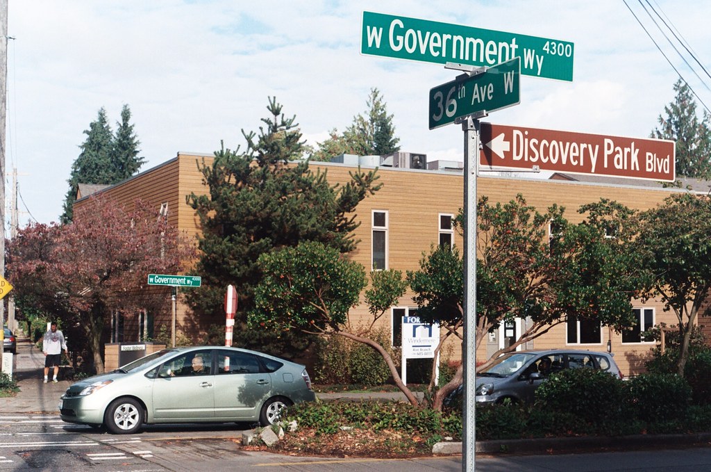
Fort Street originated as Fort Place in the 1905 plat of Lawton Park, an Addition to the City of Seattle. It originally formed part of the “government roadway leading from the east boundary of the military reservation of Fort Lawton,” but in 1961 four of its blocks were officially renamed W Government Way. What remains today is a one-block stretch between 36th Avenue W and 35th Avenue W, a three-block stretch between Kiwanis Memorial Reserve Park and 32nd Avenue W, and a bridge over the BNSF Railway tracks from 28th Avenue W and Gilman Avenue W to 27th Avenue W.
Born and raised in Seattle, Benjamin Donguk Lukoff had his interest in local history kindled at the age of six, when his father bought him settler granddaughter Sophie Frye Bass’s Pig-Tail Days in Old Seattle at the gift shop of the Museum of History and Industry. He studied English, Russian, and linguistics at the University of Washington, and went on to earn his master’s in English linguistics from University College London. His book of rephotography, Seattle Then and Now, was published in 2010. An updated version came out in 2015.
In 1897 a number of Magnolia landowners deeded to the federal government land for “a government roadway leading from the east boundary of the military reservation of Fort Lawton,” which was to open in 1900, to a wharf at what is now 27th Avenue W and W Commodore Way. At some point between then and 1907, when it appears in in the plat of Lawton Heights, an Addition to the City of Seattle, filed by Anna S. Brygger (see Brygger Drive W and NW Brygger Place), it became known as Government Way. (There are similarly named streets in Spokane leading to the former Fort George Wright and in Coeur D’Alene, Idaho, leading to the former Fort Sherman.)
The street was initially known as Government Way only from 32nd Avenue W to the east gate of the fort at 36th Avenue W (now the main entrance to Discovery Park), but in 1961 the name was extended to cover 32nd Avenue W north to W Fort Street as well as W Fort Street east to Gilman Avenue W, so today its length is about ½ a mile in total.
Born and raised in Seattle, Benjamin Donguk Lukoff had his interest in local history kindled at the age of six, when his father bought him settler granddaughter Sophie Frye Bass’s Pig-Tail Days in Old Seattle at the gift shop of the Museum of History and Industry. He studied English, Russian, and linguistics at the University of Washington, and went on to earn his master’s in English linguistics from University College London. His book of rephotography, Seattle Then and Now, was published in 2010. An updated version came out in 2015.
This Magnolia street boasts one of the best views in all of Seattle — a completely unobstructed vista of Elliott Bay, Puget Sound, the Kitsap Peninsula, and the Olympic Mountains — if you’re fortunate enough to own property there. The view from the street itself is mostly of houses to the west, forested slope to the east. Notable Seattleites such as developer Martin Selig, broadcaster Kathi Goertzen, musician Ryan Lewis, and co-founder of Starbucks and Redhook Ale Brewery Gordon Bowker have called the winding lane — and it truly is a winding lane, hugging the bluff with barely enough room for two cars to pass each other — home.
The street was created as part of Carleton Beach Tracts, an Addition to the City of Seattle, Washington, on New Year’s Eve, 1920. The owners were Arthur Alexander Phinney (1885–1941), son of Guy Carleton Phinney, after whom Phinney Ridge and Phinney Avenue N are named; his wife, Daisy Euphemia Phinney (1884–1950); the Phinney Realty and Investment Company; and Oscar E. Jensen & Co., Inc. It begins at W Emerson Street in the north, just south of Discovery Park, and goes 1⅖ miles southeast to a roadblock a few feet beyond the bottom of the Montavista Stairs (more on that later). The roadway continues about 250 feet past the roadblock — all the buildings and lots on the west side belong to Martin Selig — and the right-of-way continues a little over 800 feet beyond that (see below for why).
The lane’s namesake had been a mystery to me for a long time, until I came across the Phinneys’ wedding announcement in the May 11, 1913, issue of the Seattle Post-Intelligencer:
Formal announcement made yesterday of the marriage at Victoria, B.C., May 2, of Miss Daisy E. Perkins, of Portland, to Mr. Arthur A. Phinney, of Seattle, contained the first intimation to local friends of Mr. Phinney of the nuptial event. The bride and groom had laid their plans in secret and protected this secret against all inquiring friends.
It seems, then, that we have a case similar to that of Thorndyke Avenue W — naming a prominent street after the wife’s maiden name.
For all its advantages, though — view, privacy (though it’s a public street, there are only a couple of ways to drive there from the rest of the city, plus two rickety staircases down from Magnolia Boulevard) — Perkins Lane has its faults, as the headline ‘Perkins Lane: Seattle’s Poster Child for Landslide Risk’ implies. A major landslide at the end of 1996 took out five or six houses, depending on whom you ask, at the southeast end of the street, and the adjoining roadway — hence the aforementioned roadblock. A lawsuit against the city, of course, was filed, but was dismissed at summary judgment. Slides had been a problem for the seven decades of Perkins Lane’s existence before that, as the images below attest. (The statute of limitations for false advertising has long elapsed, alas…)
Landslide at W Raye Street, with tilting utility pole, March 22, 1925. Courtesy of the Seattle Municipal Archives, Identifier 38072
Land for sale! Who was that civil engineer, I wonder… “No slides — Civil engineer says ‘Good condition to build on,’” 2461 Perkins Lane W, April 14, 1938. Courtesy of the Seattle Municipal Archives, Identifier 12194Landslide at 2445 Perkins Lane W, January 27, 1954. Courtesy of the Seattle Municipal Archives, Identifier 44997Ruins of house destroyed in Perkins Lane landslide on Magnolia beach in front of Magnolia bluff, Photograph by Flickr user Whitney H, licensed under Creative Commons Attribution-NonCommercial-NoDerivs 2.0 Generic
In fact, as the map below shows, there have been numerous slides over the years along the entire length of the road.
Perkins Lane W is also home to six of Seattle’s shoreline street ends — at W Bertona, Dravus, Barrett, Armour, Raye, and McGraw Streets, though McGraw is the only one currently accessible from land. The project to improve it back in 2013 and 2014 was not without opposition, but ultimately the threats never materialized (nor did the opponents’s fears). It’s well worth a visit.
Born and raised in Seattle, Benjamin Donguk Lukoff had his interest in local history kindled at the age of six, when his father bought him settler granddaughter Sophie Frye Bass’s Pig-Tail Days in Old Seattle at the gift shop of the Museum of History and Industry. He studied English, Russian, and linguistics at the University of Washington, and went on to earn his master’s in English linguistics from University College London. His book of rephotography, Seattle Then and Now, was published in 2010. An updated version came out in 2015.
Technically, W Bertona Street begins as Bertona Street at the Ship Canal Trail around 80 feet east of Queen Anne Avenue N, but both streets there are little more than parking aisles nestled up against Seattle Pacific University’s Wallace Field. W Bertona begins in earnest at W Nickerson Street and goes ¾ of a mile west to 14th Avenue W, where it becomes a block-long stairway to 15th Avenue W. On the other side of 15th, it goes two more blocks before being stopped by the BNSF Railway tracks at 17th Avenue W; on the other side of the tracks it goes ⅗ of a mile west from 20th Avenue W to 30th Avenue W, becoming a stairway again for a block just about halfway. As with its Magnolia partner W Dravus Street, it’s ⅓ of a mile from 31st Avenue W to 36th Avenue W, where it becomes a stairway for a block, and then ½ a mile more from 37th Avenue W to 45th Avenue W. There is finally a 300-foot-long segment west of Perkins Lane W, where the roadway ends. (There is a shoreline street end beyond that, but it is currently inaccessible.)
Born and raised in Seattle, Benjamin Donguk Lukoff had his interest in local history kindled at the age of six, when his father bought him settler granddaughter Sophie Frye Bass’s Pig-Tail Days in Old Seattle at the gift shop of the Museum of History and Industry. He studied English, Russian, and linguistics at the University of Washington, and went on to earn his master’s in English linguistics from University College London. His book of rephotography, Seattle Then and Now, was published in 2010. An updated version came out in 2015.
Portion of plat map of Denny and Hoyt’s Addition to the City of Seattle, Washington Territory (1888) showing Aetna, Bertona, Cremona, Dravus, Etruria, and Florentia Streets
As can be seen in the plat map above, Dravus is part of a series of streets — Aetna, Bertona, Cremona, Dravus, Etruria, and Florentia — that appear in alphabetical order and have the common theme of being locations in Italy, which had been unified 17 years earlier. I have yet to find a connection between Denny, Hoyt, the Blewetts, or Kilbourne and Italy. The closest I’ve come is an item in the February 28, 1903, issue of The Seattle Mail and Herald, which reports that “on February 27, the Woman’s Century Club met and discussed the subject ‘Italian Art and Literature.’ Mrs. Bessie L. Savage and Mrs. E.C. Kilbourne [Leilla Shorey] prepared papers relating to these subjects.” I would love to find out if there’s anything more solid!
The Drava River, which originates in the Italian region of the South Tyrol, flows from there through Austria, Slovenia, and Croatia, forming much of the border between that country and Hungary, and joining the Danube on the Croatia–Serbia border. It was known as Dravus in Latin and Δράβος in Greek.
Dravus Street begins in the east at Nickerson Street and goes ⅗ of a mile west to 8th Avenue W and Conkling Place W. It resumes for half a block at 10th Avenue W, is briefly a foot path and stairway, and then is an arterial connecting Queen Anne and Magnolia via Interbay, going just over a mile from 11th Avenue W to 30th Avenue W. (This section was originally known as Grand Boulevard, and indeed W Dravus is double the width of the other streets in the area, though it features wide planting strips instead of a central median.) It’s ⅓ of a mile from 31st Avenue W to 36th Avenue W, where it becomes a stairway for a block, and then ½ a mile more from 37th Avenue W to just west of Magnolia Boulevard W, where the roadway ends. (There is a shoreline street end off Perkins Lane W, but it is currently inaccessible.)
Born and raised in Seattle, Benjamin Donguk Lukoff had his interest in local history kindled at the age of six, when his father bought him settler granddaughter Sophie Frye Bass’s Pig-Tail Days in Old Seattle at the gift shop of the Museum of History and Industry. He studied English, Russian, and linguistics at the University of Washington, and went on to earn his master’s in English linguistics from University College London. His book of rephotography, Seattle Then and Now, was published in 2010. An updated version came out in 2015.
Paragraph on establishment of Puget Sound Construction Company in 1886
In his article “The Orphan Railroad and the Rams Horn Right of Way,” in the April 1923 issue of The Washington Historial Quarterly, C.H. Hanford writes of the SLS&E, “A number of Seattle men… subscribed to the capital of the new company to the extent of their means, and having gained so much, Gilman and Judge Burke were successful in inducing Philip D. Armour of Chicago to advance the money required to start the enterprise.” So it is unclear just which Armour brother the street is named for — perhaps it is named for them both.
W Armour Street starts at 1st Avenue N and goes two blocks west to 1st Avenue W, where it is stopped by Rodgers Park. It makes it two more blocks, from 3rd Avenue W to 5th Avenue W, before again being stopped, this time by Mount Pleasant Cemetery. From there it exists in a number of short segments, including paths and stairs, before being stopped, once again, by the Interbay Golf Center at 15th Avenue W. Once across the railroad tracks in Magnolia, there is a nearly uninterrupted ¾ mile stretch from Thorndyke Avenue W to the West Magnolia Playfield at 32nd Avenue W, and then a few more short segments west of 34th Avenue W, ending for good at 46th Avenue W. (There is a shoreline street end off Perkins Lane W, but it is currently inaccessible.)
Born and raised in Seattle, Benjamin Donguk Lukoff had his interest in local history kindled at the age of six, when his father bought him settler granddaughter Sophie Frye Bass’s Pig-Tail Days in Old Seattle at the gift shop of the Museum of History and Industry. He studied English, Russian, and linguistics at the University of Washington, and went on to earn his master’s in English linguistics from University College London. His book of rephotography, Seattle Then and Now, was published in 2010. An updated version came out in 2015.
W Commodore Way, which runs 1⅓ miles along Salmon Bay from 21st Avenue W to 40th Avenue W, obviously has a nautical name, but is its backstory as simple as that, like NE Boat Street along Portage Bay? Or does it honor a particular person?
The only online mention I’ve seen of a possible specific referent of Commodore is in the Don Sherwood Parks History file for Commodore Park:
Who was particularly in mind when the street was named Commodore Way is not recorded. However, the choice of Commodore Peary’s flagship [the SS Roosevelt]… to participate in the dedication of the [Ballard] Locks is significant. Peary must have sailed from Seattle as the port nearest Alaska and the Arctic.
It’s a reasonable theory on its face, but there are some major flaws. The street was named in 1890 as part of Gilman’s Addition to the City of Seattle, when Peary was a lieutenant — 19 years before he reached the North Pole (supposedly) and 27 years before the Ballard Locks were dedicated. In addition, Peary’s port of departure was New York, not Seattle. It doesn’t seem possible Commodore Way was named for Robert E. Peary.
I first became aware of Smith’s connection to Seattle when I came across this line in the March 30, 1890, issue of the Seattle Post-Intelligencer, while looking for a connection between Commodore and the Seattle, Lake Shore and Eastern Railway: “Mr. J.S. Dunham, treasurer of the Seattle, Lake Shore & Eastern, and Commodore Smith visited Snohomish yesterday.”
Item mentioning Commodore Smith in March 30, 1890, issue of Seattle Post-Intelligencer
Before I go too much farther, I should note that the landowners in the plat of Gilman’s Addition were listed as Dr. Henry A. Smith and Franklin M. Jones and his wife, Carrie B. Jones. Franklin was a member of the New York banking firm Jameson, Smith and Cotting, financiers of the business ventures of Daniel Hunt Gilman, including the Seattle, Lake Shore and Eastern Railway (SLS&E). Hence the search terms I’d been using at Washington Digital Newspapers.
This article from the June 17, 1897, issue of the P-I also came up, further associating Commodore Smith (to distinguish him from Dr. Smith) with the SLS&E and with New York:
Portion of article mentioning Commodore Smith in June 17, 1897, issue of Seattle Post-Intelligencer
I then did some reading on Commodore Smith… but still wasn’t quite sure until I found this passage in Men of Mark in Connecticut: Ideals of American Life Told in Biographies and Autobiographies of Eminent Living Americans(1904): “Among his successful performances was the establishment, in 1865, of the banking firm of Jameson, Smith & Cotting, now the banking house of James D. Smith & Company.” So Commodore Smith was the Smith in Jameson, Smith and Cotting! If J.A. Jameson merited a street (W Jameson Street), surely so did Commodore Smith. And why Commodore Way instead of Smith Way? Because there was another Smith to be honored — Dr. Henry A. Smith (Smith Street, as well as Smith Cove).
It may not have been one of the great mysteries of the ages, but I do think I may have solved this one.
Born and raised in Seattle, Benjamin Donguk Lukoff had his interest in local history kindled at the age of six, when his father bought him settler granddaughter Sophie Frye Bass’s Pig-Tail Days in Old Seattle at the gift shop of the Museum of History and Industry. He studied English, Russian, and linguistics at the University of Washington, and went on to earn his master’s in English linguistics from University College London. His book of rephotography, Seattle Then and Now, was published in 2010. An updated version came out in 2015.
It’s not entirely clear why the street is named Thorndyke rather than Thorndike. There was an announcement of the Gilman–Thorndike wedding in the January 15, 1888, issue of the Seattle Post-Intelligencer that spelled the name with a y, but otherwise the family’s name routinely appears in the Seattle press with an i. Yet we see that Grace’s sister Minnie — wife of James Bothwell (W Bothwell Street) — spelled her name with a y (at any rate, that is what appears on her tombstone).
(It’s also worth noting that Grace’s sister Estella married Captain William Rankin Ballard, after which the Ballard neighborhood is named, and her sister Delia married Ballard’s business partner Captain John Ayres Hatfield. The Thorndikes’ father was himself a ship’s captain, one Ebenezer Augustus Thorndike.)
Today, Thorndyke Avenue W begins at W Galer Street, at the west end of the Magnolia Bridge, and goes just over a mile northwest to 20th Avenue W and W Barrett Street. It picks up again as a minor road on the other side of the BNSF Railway tracks, going about ⅕ of a mile northwest from 17th Avenue W and W Bertona Street to a dead end under the 15th/Emerson/Nickerson overpass at the south end of the Ballard Bridge.
Born and raised in Seattle, Benjamin Donguk Lukoff had his interest in local history kindled at the age of six, when his father bought him settler granddaughter Sophie Frye Bass’s Pig-Tail Days in Old Seattle at the gift shop of the Museum of History and Industry. He studied English, Russian, and linguistics at the University of Washington, and went on to earn his master’s in English linguistics from University College London. His book of rephotography, Seattle Then and Now, was published in 2010. An updated version came out in 2015.
The street was created in 1890 as part of Gilman’s Addition to the City of Seattle by Dr. Henry A. Smith (Smith Cove) and Franklin M. Jones and his wife, Carrie B. Jones. Franklin was a member of the New York banking firm Jameson, Smith and Cotting, financiers of Gilman’s business ventures.
Today, Gilman Avenue W begins at 20th Avenue W and W Bertona Street and goes ⁹⁄₁₀ of a mile northwest to 28th Place W, where it becomes W Government Way. The right-of-way continues on from there, though, and there is a 120-foot-long segment between 32nd Avenue W and Gay Avenue W and then, on the other side of Kiwanis Memorial Preserve Park, another 120-foot-long segment at the end of 34th Avenue W.
Originally, Gilman Avenue W existed east of the railroad tracks as well, but that section, between 15th Avenue W and 11th Avenue W, was changed to Gilman Drive W in 1961.
Born and raised in Seattle, Benjamin Donguk Lukoff had his interest in local history kindled at the age of six, when his father bought him settler granddaughter Sophie Frye Bass’s Pig-Tail Days in Old Seattle at the gift shop of the Museum of History and Industry. He studied English, Russian, and linguistics at the University of Washington, and went on to earn his master’s in English linguistics from University College London. His book of rephotography, Seattle Then and Now, was published in 2010. An updated version came out in 2015.
This Magnolia street, like W Tilden Street, was named by Dr. Francis G. Bryant as part of the 1877 Bay View Addition to the City of Seattle. As I noted in the Tilden Street article, he named his streets for prominent Democratic politicians of the era. Only Tilden and Grover remain. It would appear that the Grover in question was La Fayette Grover, governor of Oregon from 1870 to 1877 and senator from Oregon from 1877 to 1883.
As Wikipedia notes, “During the [disputed] 1876 presidential election, Oregon’s statewide result clearly favored Rutherford Hayes, but then-governor Grover claimed that elector John Watts was constitutionally ineligible to vote since he was an ‘elected or appointed official’. Grover substituted a Democratic elector in his place. The two Republican electors dismissed Grover’s action and each reported three votes for Hayes, while the Democratic elector, C. A. Cronin, reported one vote for Samuel Tilden and two votes for Hayes. The vote was critical because the electoral college without John Watts’s vote was tied 184–184.”
As it turns out, the election was ultimately awarded to Hayes as part of the Compromise of 1877, but it appears Governor Grover did his best to help his fellow Democrat. (There’s more about Oregon’s pivotal role in the Wilamette Week article “That One Time Oregon Decided the Presidential Election.”)
W Grover Street begins at 28th Avenue W at the entrance to Magnolia Manor Park, and runs a tenth of a mile west to 30th Avenue W. It then runs one more block from 31st Avenue W to 32nd Avenue W.
Born and raised in Seattle, Benjamin Donguk Lukoff had his interest in local history kindled at the age of six, when his father bought him settler granddaughter Sophie Frye Bass’s Pig-Tail Days in Old Seattle at the gift shop of the Museum of History and Industry. He studied English, Russian, and linguistics at the University of Washington, and went on to earn his master’s in English linguistics from University College London. His book of rephotography, Seattle Then and Now, was published in 2010. An updated version came out in 2015.
This Magnolia street was named by Dr. Francis G. Bryant as part of the 1877 Bay View Addition to the City of Seattle for Samuel J. Tilden, governor of New York from 1875 to 1876 and Democratic candidate for president in the election of 1876. The Compromise of 1877, according to Wikipedia, “resulted in the United States federal government pulling the last troops out of the South, and ending the Reconstruction Era. Through the Compromise, Republican Rutherford B. Hayes was awarded the White House over Democrat Samuel J. Tilden on the understanding that Hayes would remove the federal troops whose support was essential for the survival of Republican state governments in South Carolina, Florida and Louisiana.” The plat was filed on February 17 — while the Electoral Commission was in session and had not yet awarded the election to Hayes.
Of the other named streets in the Bay View Addition, only Grover remains, but most of them appear to be named for prominent Democratic politicians of the era (Jackson excepted, as he died 32 years earlier). I left off the two I could not associate with anyone (Randall, Nichols) and am not as sure about Williams as I am about the others:
Hewett — Abram Hewitt, New York congressman, chairman of the Democratic National Committee
Hampton — Wade Hampton III, governor of South Carolina (disputed until April 11, uncontested thereafter)
Williams — James D. Williams, Hendricks’ successor as governor of Indiana
As for Dr. Bryant, I was unable to find out much about him other than he was some sort of doctor and filed a patent in 1877 for a new type of fire escape.
W Tilden Street begins at 28th Avenue W and goes just about 1,000 feet west to 31st Avenue W, its last hundred feet being a footpath through the landscaped right-of-way. On the other side of the valley, there is a 225-foot-long segment from 37th Avenue W to 38th Avenue W.
Born and raised in Seattle, Benjamin Donguk Lukoff had his interest in local history kindled at the age of six, when his father bought him settler granddaughter Sophie Frye Bass’s Pig-Tail Days in Old Seattle at the gift shop of the Museum of History and Industry. He studied English, Russian, and linguistics at the University of Washington, and went on to earn his master’s in English linguistics from University College London. His book of rephotography, Seattle Then and Now, was published in 2010. An updated version came out in 2015.


