NE Thornton Place

Thornton Creek runs 18 miles from Shoreline to Seattle, where it empties into Lake Washington at Matthews Beach Park. Its watershed, which drains 11.6 square miles, is the largest in Seattle. Yet until recently, no street bore its name — and the one that now does is a short private road.

NE Thornton Place, which runs not quite 500 feet between 3rd Avenue NE and NE 103rd Street, cuts through the Thornton Place development, built on the site of a former Northgate Mall parking lot under which the South Fork of Thornton Creek ran in a culvert. A portion of the creek was daylighted as part of the project. (Incidentally, I had the pleasure of seeing the IMAX version of The Beatles: Get Back – The Rooftop Concert at the Regal Thornton Place on January 30 of this year, the 53rd anniversary of the historic event. I am an even bigger fan of the Beatles than I am of odonymy!) You can read more about the Thornton Creek Water Quality Channel at Wedgwood in Seattle History.
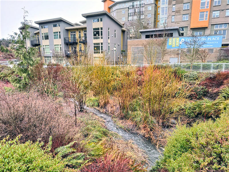
Thornton Creek Water Quality Channel with apartments and Thornton Place sign in background
Thornton Creek Water Quality Channel, with Thornton Place development in background. Photograph courtesy of Wedgwood in Seattle History. Copyright © 2023 Wedgwood in Seattle History. All rights reserved.

I originally wrote here that “The creek is named for John Q. Thornton (1825–1904), who… never actually lived in the Seattle area, but in 1885 bought land near what are today Meridian Park and Twin Ponds Park, at or near the headwaters of Meridian Creek, a tributary of the North Fork of Thornton Creek….” However, in the summer of 2022, the person whose article on Thornton I cited told me that they no longer believed this to be the case, and had edited their article accordingly. The creek’s namesake, therefore, remains a mystery.

NE Northgate Way

This street was named in 1968 for Northgate Station, which opened in 1950 as the Northgate Center shopping mall. According to HistoryLink.org, it was “the country’s first regional shopping center to be defined as a ‘mall’ (although there were at least three predecessor shopping centers).” Newspaper archives show that it became known early on as Northgate Mall, and that became its official name in 1974. As of this writing, the property is in the midst of a massive redevelopment project that began in 2019.

Prior to 1968, Northgate Way was known as (from west to east) N 105th Street, Mineral Springs Way N, N 110th Street, NE 110th Street, and Chelsea Place NE. Today, it begins at N 105th Street and Aurora Avenue N and goes 2⅕ miles east to NE 113th Street and Lake City Way NE.

The Northgate name itself has been attributed to Ben Erlichman. Feliks Banel writes:

Digging into the newspaper archives, The Seattle Times of February 22, 1948, published a big spread on the plans for the shopping center. The story quoted one of the developers, a local investor named Ben Ehrlichman (the uncle of future Watergate figure John Ehrlichman). “The name Northgate was chosen, Ehrlichman [told The Seattle Times], because the development ‘will be the most important northerly business district serving Seattle and vicinity and the gateway to metropolitan Seattle.’” Though a 30th anniversary story in the same paper in 1980 credited Ehrlichman for coming up with the name — based on the 1948 story — we may never know for certain whose idea it was.

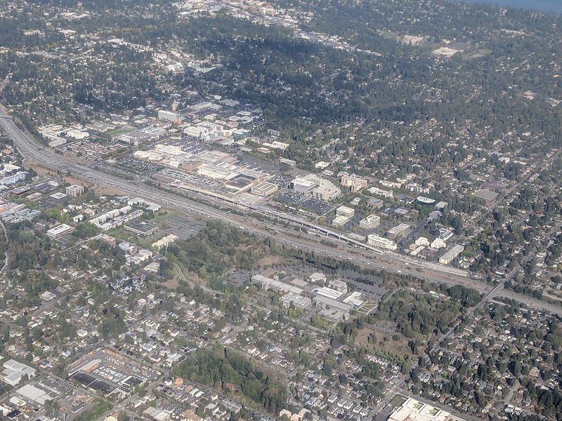
Aerial of Northgate, September 2018, from https://flickr.com/photos/25443792@N05/43844953055
Aerial of Northgate, September 2018, looking northeast. Interstate 5 cuts across the photo from bottom right to upper left. To its west is North Seattle College; to its east is Northgate Station, the Thornton Place complex, the Northgate Transit Center, and the Northgate commercial district. The elevated tracks of Sound Transit’s Line 1 light rail can be seen just east of the freeway. The Lake City commercial district is visible to the northeast of the mall; the greenbelt closer to the mall is one of the forks of Thornton Creek. Photograph by Flickr user Atomic Taco, licensed under Creative Commons Attribution-ShareAlike 2.0 Generic

Brooklyn Avenue NE

This street was named after the Brooklyn Addition to Seattle, platted by James Alexander Moore (1861–1929) in 1890. The addition itself was named for Brooklyn, New York (see the history of the University District Paul Dorpat wrote for HistoryLink and this article on his own blog):

[Moore] chose the name because his addition “looked across the water” to Seattle proper like the New York borough of the same name that looks across the East River to Manhattan.

I haven’t been able to find an online source for this assertion, but Dorpat may have been referring to a passage in Roy G. Nielsen’s UniverCity: The Story of the University District in Seattle (1986), which quotes an article in the August 31, 1928, issue of the University Herald in which George F. Cotterill (mayor from 1912–1914) says:

[In 1885], there was no thought of a university and section sixteen was still untouched. J.A. Moore, one of the greatest Seattle real estate promoters of the time, started Brooklyn between 10th Ave. N.E. and the campus. This addition was intended by Mr. Moore to be to Seattle what Brooklyn is to New York.

Today’s Brooklyn Avenue is a block west of Moore’s. Again quoting Paul Dorpat:

None of James Moore’s street names survive. His Tremont Avenue became 15th Avenue. One block west he named University Way — the District’s future “Main Street” — Columbus Avenue. He called the future Brooklyn Avenue, “Broadway,” ­ and this was Moore’s intended “Main Street.” He called 12th Avenue “Brooklyn.”

Brooklyn Avenue NE begins at NE Boat Street just north of Fritz Hedges Waterway Park and goes 1¾ miles north through the University District and Roosevelt neighborhood to NE 66th Street at Roosevelt High School. It resumes at NE 70th Street and goes just short of 300 feet to Froula Playground and the Roosevelt Reservoir. There is another segment between NE 75th Street and NE 77th Street and a final one between NE 80th Street and NE 82nd Street by Maple Leaf Reservoir Park.

NE Elk Place

As requested by Steve Sorbo: what’s the deal with NE Elk Place — a rare named street in the sea of numbered ones that is Roosevelt and Maple Leaf?

It looks like the name originated as Elk Street in Pitner’s Division of Green Lake Addition to Seattle, W.T., filed July 30, 1889, by Levi Carroll Pitner (1824–1911), a Methodist minister from Illinois, and his wife, Arminda Francis Cartwright Pitner (1828–1917). Shortly thereafter, on November 16, 1889, Zenas Upham Dodge (1859–1942) and his wife, Mary Jane Jones Dodge (1861–1902), filed Dodge’s Division of Green Lake Addition to the City of Seattle, Wash. Because streets on the two plats do not change names when they cross from one to the other, it’s possible the Pitners and Dodges came up with the names together, or simply that the Pitners named the streets and the Dodges willingly went along. I am not sure when Seattle began requiring that streets not change names when they cross plat lines, but if it was before 1889, that could have been the case as well. I do know it wasn’t long before Ordinance 4044 — the “Great Renaming” — was passed in 1895, which sought to clean up the mess created by the previous decades’ lack of regulation.

At any rate, Elk is part of a series here including Buffalo and Deer, so someone — I’m not sure who — was apparently a fan of large ungulates. As for why Elk remains when Buffalo and Deer are gone, I’m not entirely sure either, although I do see that it’s in line with NE 82nd Street west of Latona Avenue NE, but between NE 82nd Street and NE 83rd Street as they’re laid out east of Latona. I suppose the choice would have been between something like 82nd Place and Elk Place, and Elk won out.

Roosevelt Way NE

This street runs nearly 6 miles from the north end of the University Bridge in the south (at Eastlake Avenue NE and NE Campus Parkway) to Aurora Avenue N in the north, just shy of Seattle city limits at N 145th Street. It runs north–south for most of its length, but starting at NE 125th Street, its last 1½ miles cut a northwest–southeast diagonal across the street grid, making it Roosevelt Way N once it crosses 1st Avenue NE between N 133rd and N 135th Streets.

Originally 10th Avenue NE south of NE 125th Street, Roosevelt received its current name in 1933. According to local historian Feliks Banel, this was first proposed in 1927 by businesses in the Roosevelt district, itself having taken that name earlier in the decade in honor of President Theodore Roosevelt, who died in 1919. Nothing came of it for six years, but in 1933 they tried again and asked that 10th Avenue be renamed after both Theodore and Franklin Delano Roosevelt, who had been elected president the previous November. As Banel notes in his piece, The Seattle Times had this to say:

This change, we assume, must be pleasing to local Democrats of all sorts and shades. At the same time, due to the incidence of somewhat tenuous family ties, it cannot be at all displeasing to Republicans. The name of Roosevelt has high standing in both political parties, as indeed it has throughout the world. Even now it is quite certain that those who may traverse our Roosevelt Way in years to come will neither know nor particularly care whether it was named for Teddy or for Frank.

As for its diagonal stretch, it appears on old King County maps as M. Roy Sayles Road (County Road 2240), Golf Way, and State Highway 1J (predecessor of today’s SR 513). It ceased to be a state highway in 1991. As for when it, too, became Roosevelt Way, it’s difficult to tell as King County doesn’t have as good a system for looking up ordinances online as Seattle’s. It appears as Roosevelt Way on a 1966 map in local historian Rob Ketcherside’s maps album on Flickr, but as Golf Way in another one from 1947. As the area in question wasn’t annexed into Seattle until 1953, the name must have been changed by the county sometime between 1947 and 1953 in anticipation. (The 1933 Seattle ordinance is the only one on file relating to Roosevelt Way’s name, so this must have been a county change.)

As for M. Roy SaylesThe International Confectioner’s January 1915 issue reports that he, along with Annie B. Sayles, C.M. Sayles, and W.H. Rogers, founded the Rogers Candy Co. in Seattle in 1915; and Golf Way almost certainly comes from the road’s proximity to the public course at Jackson Park, which opened in 1928.

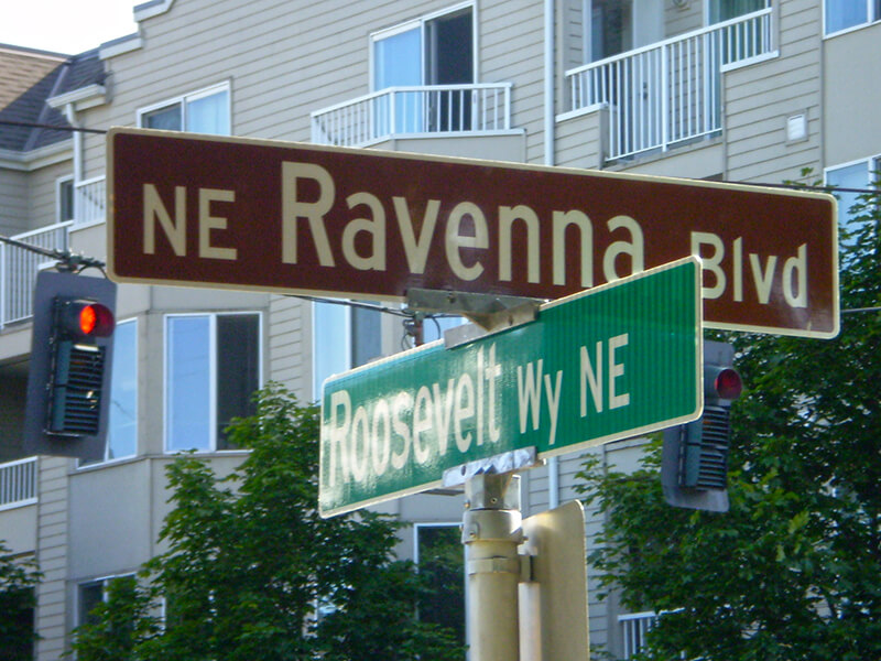
Sign at corner of NE Ravenna Boulevard and Roosevelt Way NE, July 4, 2009
Signs at corner of NE Ravenna Boulevard and Roosevelt Way NE, July 4, 2009. Photograph by Benjamin Lukoff. Copyright © 2009 Benjamin Lukoff. All rights reserved.