Delridge Way SW

This street runs nearly four miles from Chelan Avenue SW, SW Spokane Street, and W Marginal Way SW in the north to 16th Avenue SW and SW Roxbury Street in the south — all the way from the Duwamish Waterway to the southern city limits. It was given its current name in 1940 — before then, it had carried the names of Youngstown Place, 21st Avenue SW, 22nd Avenue SW, McKinnon Place SW, 23rd Avenue SW, and 24th Avenue SW. As The Seattle Times explained on May 14, 1940, “Delridge” came from “the dells and ridges through which the thoroughfare runs,” and had been “suggested by West Seattle community organizations.”

Edgar Martinez Drive S

This street runs ¼ mile from 1st Avenue S in the west to 4th Avenue S in the east. West of 1st, it’s S Atlantic Street — its original name — and east of 4th, it’s the beginning of Interstate 90. It is part of State Route 519, a short highway that connects I-90 to Washington State Ferries’ Colman Dock.

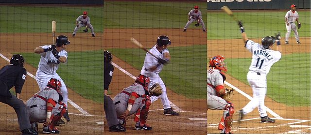
Edgar Martínez was a member of the Seattle Mariners baseball team from 1987 to 2004. This stretch of S Atlantic Street was renamed in his honor the year he retired.

Edgar Martínez at bat, September 15, 2004, licensed under Creative Commons Attribution-Share Alike 3.0 Unported license. https://commons.wikimedia.org/wiki/File:E_Martinez.jpg
Edgar Martínez at bat, September 15, 2004. Photographs by Galaksiafervojo, Wikimedia Commons, licensed under  Creative Commons Attribution-Share Alike 3.0 Unported

Now — why is it Edgar Martinez Drive S instead of S Edgar Martinez Drive, since east–west streets in Seattle have their directional designators at the beginning? I asked Paul Jackson this in 2005. Jackson, who was then the Seattle Department of Transportation’s manager of traffic, signs, and markings, responded:

I appreciate your desire to see our City’s sign system remain consistent.… But ultimately, there is nothing requiring such a naming convention in the Seattle Municipal Code.… In this case, those proposing the street name change wanted to see Edgar Martínez’s name out front. Because this is only a three-block stretch of street (from 1st Avenue S to 4th Avenue S), and does not have any addresses along it, the decision was made to veer slightly from the typical naming convention. The term “drive” was agreed upon to evoke Mr. Martínez’s batting skills at the plate.

Fairview Avenue N

Fairview Avenue is one of a handful in the city that changes directional designations twice along a continuous stretch. The street begins in the south at Virginia Street as Fairview Avenue, but becomes Fairview Avenue N a block and a half to the north as it crosses Denny Way, and a mile north and east of that becomes Fairview Avenue E at E Galer Street and Eastlake Avenue E. It continues to E Roanoke Street, two miles from its origin, where it is interrupted by the Mallard Cove houseboat community. Picking up a block to the north, it then runs half a mile from E Hamlin Street to Fuhrman Avenue E and Eastlake Avenue E, just south of the University Bridge.

Originally Lake Street in Rezin and Margaret Pontius’s 1875 plat of the Fairview Homestead Association for the Benefit of Mechanics and Laborers, it received its current name during the Great Renaming of 1895. (Before 1875, it had been known as Prohibition Street.)

The Fairview Homestead Association, according to Paul Dorpat, was intended to “help working families stop paying rents and start investing in their own homes. Innovative installment payments made the lots affordable and many of the homes were built by those who lived in them.”

I assume Fairview took its name from the view of Lake Union and what is now Wallingford that is still barely visible today from what is now the Cascade neighborhood.

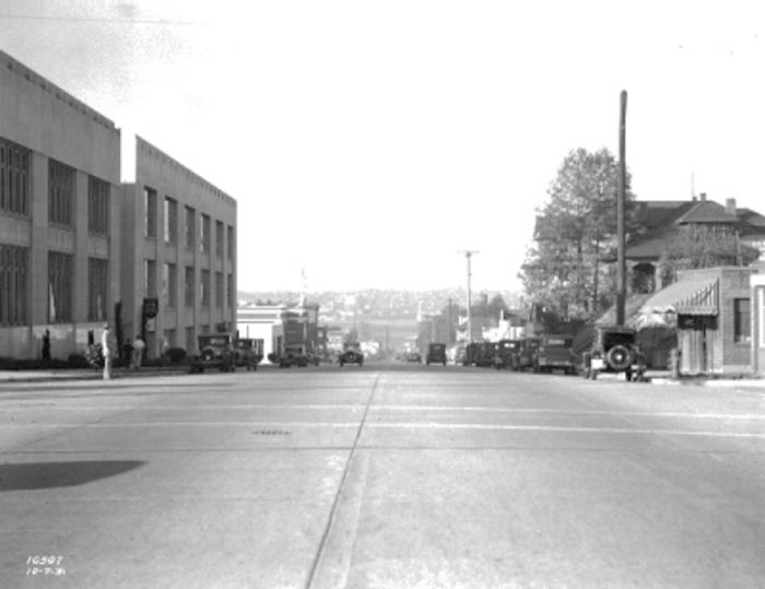
1931 view looking north toward Lake Union along Fairview Avenue N, Courtesy of the Seattle Municipal Archives, Identifier 5265

NE Boat Street

This street runs just shy of 2,000 feet from NE Pacific Street in the west, just east of the University Bridge, to NE Columbia Road in the east, on the University of Washington South Campus.

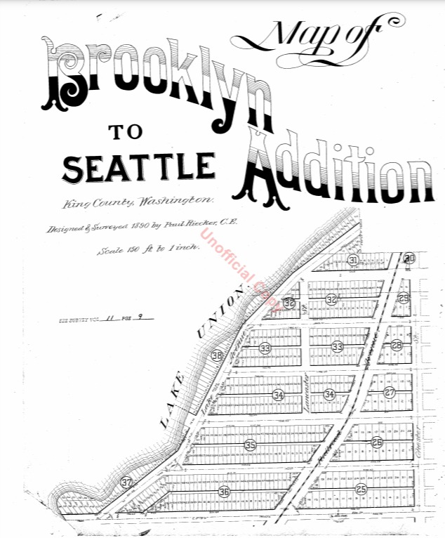
Originally Lake Avenue in the 1890 Brooklyn Addition to Seattle, as it ran along the north shore of Lake Union, it became Northlake Avenue at some point between then and 1901, based on my search of Seattle Times, Seattle Star, and Seattle Post-Intelligencer archives. It starts being referred to as Northlake Way in 1935, though it seems this wasn’t formalized until 1956.

Portion of Map of Brooklyn Addition to Seattle, 1890, showing Lake Avenue (now NE Boat Street) and Railroad Avenue (now NE Pacific Street)

In 1960, Jerry Bryant of Bryant’s Marina proposed that all of Northlake Way — beginning far to the west, at the Fremont Bridge — receive the new name of Boat Street, but the 1962 ordinance establishing Boat Street only changes the name of the few blocks between the University Bridge and the UW campus. The Seattle P-I reports on December 22, 1960, that the Street Naming Committee of the Board of Public works rejected the proposal “because the present name is more descriptive,” but Bryant went ahead and filed his proposal with the City Council anyway in 1961.

According to The Seattle Times on May 24, 1962, the Board of Public Works once again asked the City Council to reject the proposal, which was “backed by more than 50 marine firms or individuals… [and] the University Commercial Club,” but on June 20, the Times reported that the City Council Streets and Sewers Committee approved the change. This met with much opposition. On July 2, the Times published a letter from Vince Lieb, 668 NE Northlake Way, that read, in part, that “numerous business firms… are more than a little chagrined at the City Council’s recent move… to please a minority of merchants who hawk their wares along the way,” and wondered if this might set a precedent:

We can think of such dandies as “Chop Suey Street,” “Gas and Oil Street,” “Beer Street,” and “Fish Street.” How about “Sand and Gravel Street” for a paved thoroughfare?

That same day, according to the P-I, the City Council postponed the implementation of the name change, sending it back to committee, and on July 10, according to the Times, the committee said it would give proponents and opponents two weeks to gather signatures, as the original petition had somehow been lost. Finally, on the 24th, they came up with a compromise: The name would be changed between the University Bridge and 15th Avenue NE only. This is where Bryant’s Marina was located, as well as the Jensen Motor Boat Company, which lasted until 2019 and was the last shipyard left on NE Boat Street.

Headline regarding Boat Street naming controversy, Seattle Times, July 25, 1962
From The Seattle Times, July 25, 1962

Today, Fritz Hedges Waterway Park — built on the former site of the marina — occupies most of the Boat Street waterfront.

Cheasty Boulevard S

This Olmsted boulevard was designed in 1910 as Jefferson Boulevard, the entrance to Jefferson Park. It runs about 1⅕ miles from Beacon Avenue S and S Alaska Street in the southwest to S Winthrop Street in the northeast, which also forms part of the park boulevard. After crossing Martin Luther King Jr. Way S and Rainier Avenue S, it continues on as S Mount Baker Boulevard, ending at Mount Baker Park.

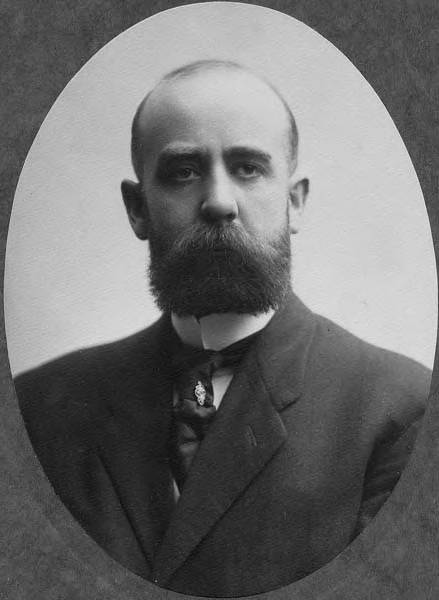
In 1914, it was renamed Cheasty Boulevard after E.C. (Edward) Cheasty (born 1864), who died that year. He had been police commissioner, commissioner of the Alaska–Yukon–Pacific Exposition, and a member of the park board from 1907 to 1910 and 1912 to his death, according to the Don Sherwood Park History Files. He also ran Cheasty’s Store, a downtown haberdashery, from 1888 until his death. 

E.C. Cheasty, photograph by Edward S. Curtis, from the University of Washington Libraries’ Portrait Collection

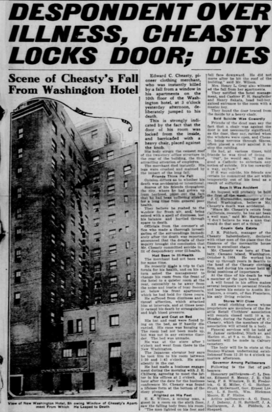
Speaking of his death, it sadly appears that it was due to suicide. He fell from the 10th floor of the Washington Hotel — the same hotel in which fellow businessman Frank B. Hubbell killed himself in 1905.

Seattle Star article on death of E.C. Cheasty
Front-page article on Cheasty’s death, The Seattle Star, June 13, 1914

S Dose Terrace

This street runs just about 1,000 feet from 31st Avenue S in the west to Colman Park in the east. West of 31st Avenue, it’s S Walker Street, and the right-of-way extends through the park to Lake Washington Boulevard S as the Dose Terrace steps.

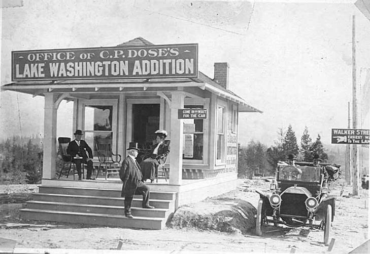
The 1905 plat of C.P. Dose’s Lake Washington Addition to the City of Seattle has it as Walker Street from 30th Avenue S to the park, but its name was changed to Dose Terrace in 1911 after C.P. Dose, a real estate developer originally from Beckerwitz, Germany.

Office of C.P. Dose’s Lake Washington Addition, 1903, from University of Washington Libraries, Special Collections Division

E Jansen Court

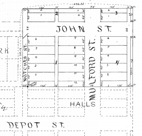
When I saw that E Jansen Court fell within Jansen’s Addition to the City of Seattle, filed in 1889 by Mary Jansen, I thought “Ah, another case of a landowner naming a street after themselves,” though I did note it was rare to see a single woman’s, and no one else’s, name on such a plat. But once I got a good look at the plat map I realized that, as is often the case, things weren’t quite that simple.

There’s no Jansen Court on this map — instead, John Street keeps its name as it crosses Mulford Street (now 20th Avenue E). So what happened?

In 1954, E John Street — the arterial east of 21st Avenue E — and E Thomas Street — the arterial west of 20th — were connected directly to each other by lopping off a small part of Miller Playfield (creating Miller Triangle in the process). As part of this, a one-way extension of John was built east of 20th, connecting with the arterial just before 21st. But this meant what is now Jansen Court needed a new name (remember, it originally remained John Street after crossing 20th). The powers that be decided to simply name it after Mary Jansen (or her subdivision). So even though she hadn’t named it after herself, 65 years after she filed her plat Jansen finally had her name on a street sign.

Roosevelt Way NE

This street runs nearly 6 miles from the north end of the University Bridge in the south (at Eastlake Avenue NE and NE Campus Parkway) to Aurora Avenue N in the north, just shy of Seattle city limits at N 145th Street. It runs north–south for most of its length, but starting at NE 125th Street, its last 1½ miles cut a northwest–southeast diagonal across the street grid, making it Roosevelt Way N once it crosses 1st Avenue NE between N 133rd and N 135th Streets.

Originally 10th Avenue NE south of NE 125th Street, Roosevelt received its current name in 1933. According to local historian Feliks Banel, this was first proposed in 1927 by businesses in the Roosevelt district, itself having taken that name earlier in the decade in honor of President Theodore Roosevelt, who died in 1919. Nothing came of it for six years, but in 1933 they tried again and asked that 10th Avenue be renamed after both Theodore and Franklin Delano Roosevelt, who had been elected president the previous November. As Banel notes in his piece, The Seattle Times had this to say:

This change, we assume, must be pleasing to local Democrats of all sorts and shades. At the same time, due to the incidence of somewhat tenuous family ties, it cannot be at all displeasing to Republicans. The name of Roosevelt has high standing in both political parties, as indeed it has throughout the world. Even now it is quite certain that those who may traverse our Roosevelt Way in years to come will neither know nor particularly care whether it was named for Teddy or for Frank.

As for its diagonal stretch, it appears on old King County maps as M. Roy Sayles Road (County Road 2240), Golf Way, and State Highway 1J (predecessor of today’s SR 513). It ceased to be a state highway in 1991. As for when it, too, became Roosevelt Way, it’s difficult to tell as King County doesn’t have as good a system for looking up ordinances online as Seattle’s. It appears as Roosevelt Way on a 1966 map in local historian Rob Ketcherside’s maps album on Flickr, but as Golf Way in another one from 1947. As the area in question wasn’t annexed into Seattle until 1953, the name must have been changed by the county sometime between 1947 and 1953 in anticipation. (The 1933 Seattle ordinance is the only one on file relating to Roosevelt Way’s name, so this must have been a county change.)

As for M. Roy SaylesThe International Confectioner’s January 1915 issue reports that he, along with Annie B. Sayles, C.M. Sayles, and W.H. Rogers, founded the Rogers Candy Co. in Seattle in 1915; and Golf Way almost certainly comes from the road’s proximity to the public course at Jackson Park, which opened in 1928.

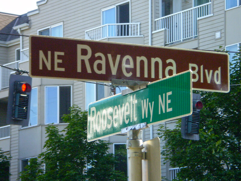
Sign at corner of NE Ravenna Boulevard and Roosevelt Way NE, July 4, 2009
Signs at corner of NE Ravenna Boulevard and Roosevelt Way NE, July 4, 2009. Photograph by Benjamin Lukoff. Copyright © 2009 Benjamin Lukoff. All rights reserved.

University Way NE

This street runs 1¼ mile from NE Pacific Street in the south to NE Ravenna Boulevard and Cowen Park in the north. Until 2001, it was a block longer, starting farther south at NE Boat Street, but that portion was vacated as part of the development of the University of Washington campus.

Originally Columbus Avenue and then 14th Avenue NE, it was renamed University Way in 1920 after the University of Washington, which had moved to the neighborhood from its original home downtown in 1895. As local historian Paul Dorpat explains in this HistoryLink essay,

[In 1919] the University Commercial Club… ran [a contest] to rename 14th Avenue…. Club member Arthur Quigley’s “University Way” won the street name contest easily. To deflect any charges that the contest was fixed, Quigley donated the prize money to charity.

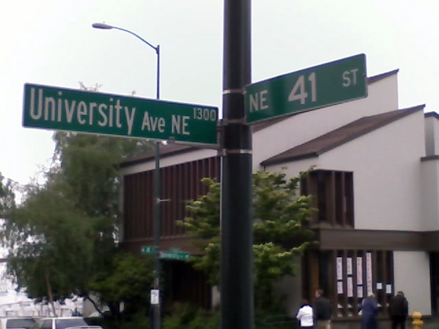
Even though it’s been a “way” for 101 years now, to locals University Way has always been, and always will be, “The Ave.” And that in itself will always cause some confusion, as this street sign demonstrates.

Even the city gets street names wrong sometimes. Photograph by Benjamin Lukoff, May 23, 2008. Copyright © 2008 Benjamin Lukoff. All rights reserved.

Occidental Avenue S

Occidental Avenue S, which begins at Yesler Way in Pioneer Square, is one of those Seattle streets whose names extend into the suburbs. It makes its southernmost appearance at S 197th Street in Des Moines.

It received its name in 1895 as part of the Great Renaming — it had originally been S Second Street. It once had a partner, Oriental Avenue, to the east (originally S Fourth Street), which is today 3rd Avenue S. “Oriental,” of course, means “Eastern,” as “Occidental” means “Western.” (I haven’t been able to determine just when Oriental Avenue became 3rd, but it was last mentioned in The Seattle Times on October 17, 1920.)

And why this particular pairing? The Occidental Hotel, which once overlooked the beginning of Occidental Avenue, is almost certainly the reason, but it’s not spelled out in the ordinance.

W Armory Way

This Interbay street, established in 1910 as Lawton Way, runs ¼ mile northwest from 15th Avenue W to the BNSF Railway’s Balmer Yard. Its right-of-way runs about 800 feet beyond that, across the railroad tracks, to 20th Avenue W, as it was once the location of a bridge to Magnolia.

W Lawton Way was changed to W Armory Way in 1973, presumably in anticipation of the construction in 1974 of an armory for the Washington Army National Guard. Will its name be changed again once the National Guard moves — or if it becomes the location of a new Magnolia Bridge?

(Another Armory Way near Pike Place Market existed on paper for many years — from 1936 to 2019 — but was never built. Something similar is currently under construction.)

sluʔwiɫ

I end my piece on Lushootseed-language place names in Seattle, “Native names abide,” thus:

…Let Carkeek remain Carkeek, but know that it was once and is still kʷaatəb, as Montlake is still stəx̌ʷugʷił, the Locks, which lowered x̌ačuʔ and x̌áx̌əʔčuʔ, still xʷiwálqʷ, and University Village still sluʔwił village, and celebrate that wǝɫǝbʔaltxʷ now sits where Whitman and Stevens meet.

wǝɫǝbʔaltxʷ – Intellectual House is “a longhouse-style facility on the [University of Washington] Seattle campus [that] provides a multi-service learning and gathering space for American Indian and Alaska Native students, faculty and staff, as well as others from various cultures and communities to come together in a welcoming environment to share knowledge.” Its location at the corner of Stevens Way and Whitman Court is significant in that almost all campus roads are named for Washington counties, and these two counties were named after Isaac Stevens and Marcus and Narcissa Whitman:

  • As noted in “Should Seattle rename its streets?” Stevens, governor of Washington Territory, “forced Native American tribes to cede their lands to the federal government.… He also pardoned himself for contempt charges relating to unjust declaration of martial law during the Yakima War, and insisted on the capture of the subsequently executed Chief Leschi of the Nisqually Tribe, even though at that point he had ceased fighting and fled the area.
  • The Whitmans’ story is more complex. The missionary couple were among 13 whites killed by a group of Cayuse Indians in what has become known as the Whitman massacre. A measles epidemic in the mission settlement and a nearby Cayuse village produced a death rate far higher among the Cayuse; Marcus Whitman, who was a also a physician and tried to treat the Cayuse as well as the whites, was accused of poisoning tribe members: “the fact that nearly all of his white patients recovered while his Indian patients died convinced some Cayuses that he was deliberately poisoning Indians in order to give their land to white setters.” Even though this is unlikely, the fact remains that they were missionaries and colonizers, and there have been calls to replace the statue of Marcus that stands in the National Statuary hall.

Now the University of Washington has renamed Whitman Court sluʔwiɫ, after a village that once stood where University Village is today. (sluʔwiɫ means ‘Little Canoe Channel’ in the Lushootseed language.)

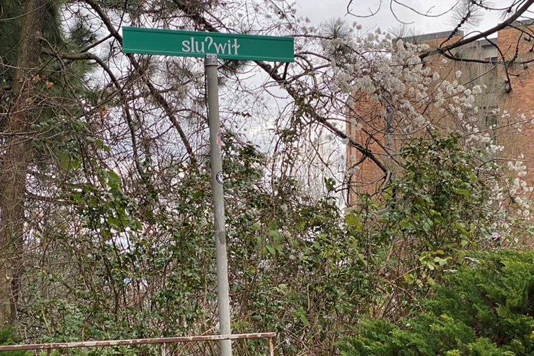
Street sign reading sluʔwiɫ on University of Washington campus
sluʔwiɫ street sign at corner of Stevens Way, with Padelford Hall in the distance, February 2021. Photograph by Benjamin Lukoff. Copyright © 2021 Benjamin Lukoff. All rights reserved.

The UW Board of Regents made this change in May 2018, but the sign only recently made its appearance. I asked the writer of the University of Washington Magazine piece on the name change, Hannelore Sudermann, if she knew whether “the renaming was official — that Whitman Court no longer exists and the street’s name is now sluʔwiɫ – or if it was honorary and the street is still officially Whitman Court,” and she pointed me to the meeting minutes, which read, in part: 

The Board of Regents chooses to honor the Coast Salish peoples of the land on which the University of Washington sits, and indigenous peoples across the State, by renaming Whitman Court sluʔwił.… In the Lushootseed language of the Coast Salish peoples, sluʔwił is the name for the village site closest to the campus, and means ‘Little Canoe Channel.’… It is the Board’s intention to recognize the native place-names of the region and thereby to enrich the historical context of the campus. The Board feels that this naming action is particularly appropriate, given the proximity of Whitman Court to wǝɫǝbʔaltxʷ, meaning ‘Intellectual House,’ a multi-service learning and gathering space for American Indian and Alaska Native students, faculty, and staff.

Even though an earlier part of the minutes reads “Regent Rice moved, Regent Ayer seconded, and the Board of Regents approved the honorific renaming of Whitman Court sluʔwił” (italics mine), given the excerpt above and the presence of the sign without any reference to Whitman Court, my interpretation is that honorific here means “in honor of,” in contrast to honorary meaning “symbolic.” 

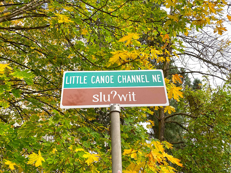
Street sign on the University of Washington campus reading Little Canoe Channel NE / sluʔwit; ‘t’ appears instead of the correct ‘ɫ’. sluʔwiɫ means ‘little canoe channel’ in Lushootseed. October 27, 2021
New street sign, reading Little Canoe Channel NE / sluʔwit; ‘t’ appears instead of the correct ‘ɫ’. Photograph by Leslie Holmes, October 27, 2021. Copyright © 2021 Leslie Holmes. All rights reserved.

Update as of February 16, 2023: I recently noticed that sluʔwiɫ is appearing on maps (UW, OpenStreetMap) as sluʔwiɫ (Little Canoe Channel NE). Per the UW’s page on McMahon Hall, “Whitman Court NE has been renamed Sluʔwił (Little Canoe Channel NE). Although street signs have changed, you may hear the street referred to by both names as the name change awaits formal state recognition. The name change acknowledges the Duwamish Peoples who continue to fight for federal recognition as a tribe, and who lived and engaged in potlaches, gift-giving festivals of sharing and trading, in the area, until the land was colonized by white settlers.” I will try to find out when and how formal state recognition will come.

Should Seattle rename its streets?

Since the killing of George Floyd on May 25, 2020, set off a wave of protests and demonstrations that has not yet abated, calls to rename streets dedicated to Confederate leaders have grown ever louder. Among them are Robert E. Lee Boulevard and Jefferson Davis Parkway in New Orleans; Confederate Avenue in Tyler, Texas; Stonewall Jackson Drive and Bedford Forrest Drive in Wilmington, North Carolina; and Stonewall Jackson Drive and General Lee Avenue in Fort Hamilton, a U.S. Army base in Brooklyn.

In Montgomery County, Maryland, the county council has called for “a comprehensive review of all County owned and maintained street names and public facilities to determine all those named for Confederate soldiers or those who otherwise do not reflect Montgomery County values.” The pull-quotes WTOP News chose from the council’s letter were spot-on:

As we work to dismantle the structures that perpetuate racism, we must target the symbols that normalize and legitimize it. The names of public streets and buildings are not merely a reminder of the past; they are a very clear indication of who and what we value today.… We cannot recreate history, but we can decide how accurately we reflect it, and who we choose to glorify from it. The names of our buildings and streets should reflect the people in and on them, not threaten and intimidate them.

Calls for renaming Seattle streets haven’t been as loud — perhaps because we, fortunately, have none named for Confederates. In fact, we have both a Union Street and a Republican Street.

However, those honored by Seattle street names are not without their own issues. Without even considering the streets named for the settlers and developers who displaced the Native American inhabitants, there are:

Returning to the issue of settlers and developers, in 2008, I wrote “Is it wrong to have a Negro Creek?” for Crosscut. (Tl;dr: Yes, it is, and stringers don’t write their own headlines.) After discussing the Chelan County creek in question, I started wondering just where the line should be drawn. (I mentioned the other day to my friend Thomas May that if it came to light that Beorma was found to be an unsavory character we could hardly change the name of Birmingham.)

[Added September 3, 2021: Upon further research, I have found out that George Kinnear was not responsible for the racial restrictive covenants applied to his subdivision — those were imposed decades later, after his death, by lot owners. I am leaving in the references to Kinnear I made in my Crosscut story, but changing those in this post.]

I wrote:

As for the settlers, though men like “Doc” Maynard (of the International District avenue and alley) may have maintained excellent relations with the city’s original inhabitants, Seattle is also home to neighborhoods like Hawthorne Hills and Kinnear, which are named for men (Safeco founder Hawthorne K. Dent and developer George Kinnear, respectively) who saw fit to exclude non-whites from owning property in their subdivisions.

Yet to eradicate all possible traces of offense from the map seems to be a losing proposition. Kinnear’s story isn’t cut-and-dried: he also served as captain of the Home Guard during Seattle’s anti-Chinese riot of 1886, which militia prevented Seattle’s Chinese from being forcibly deported, as had happened the previous year in Tacoma. And King County is named for a slaveholder, Franklin Pierce’s vice president William Rufus deVane King, though the county and state governments have managed to “rename” it after Martin Luther King, Jr.

Case-by-case, as these issues come up, seems the only sensible way to go. I am brought to mind of Liverpool’s Penny Lane, which was forgiven its association with the slave trade on account of its Beatles-related fame. Blanket proclamations can’t help but run into trouble.

I still do largely agree with what I wrote, although the idea of a renaming that isn’t really a renaming is less objectionable to me now. (My issue with King County’s name wasn’t that I thought William Rufus DeVane King deserved the honor, but that nothing was actually changed — the county’s name remained King County, not Martin Luther King Jr. County.) I would say this to those who still would want to rename Penny Lane: consider it named for the Beatles hit rather than for James Penny. (However, as it turns out, it wasn’t named for him in the first place, so the issue is moot.)

It makes you appreciate the system in Center City Philadelphia that much more — generally speaking, north–south streets numbered and east–west streets after trees.

So… besides Madison, Jackson, Stevens, and Lane — are any other Seattle streets ripe for renaming?

NW Locks Place

Seattle’s newest street name is no longer E Barbara Bailey Way but NW Locks Place — formerly the block of NW 54th Street that ran between NW Market Street and the entrance to the Hiram M. Chittenden Locks, more commonly known as the Ballard Locks.

Ordinance 125947, passed by the city council in late September, was signed by the mayor the next week and went into effect a few days ago. As the Seattle Department of Transportation explained this summer, the name change stemmed from a request by emergency dispatchers: previously, there were two locations in which NW Market Street and NW 54th Street intersected; once in front of the locks and once over a mile to the east, where Market descends from Phinney Ridge. This name change will serve to eliminate any confusion about what is meant by “the intersection of 54th and Market.”

A similar change was made to Green Lake street names in 1961, when the various segments of Green Lake Way north of NE Ravenna Boulevard and N 72nd Street were changed to Green Lake Drive — previously, Latona Avenue NE, Sunnyside Avenue N, and Ashworth Avenue N (to name a few) had intersected Green Lake Way twice.

Interestingly, only the Lockspot Cafe’s address (3005) is affected by this name change. The other buildings fronting NW Locks Place have addresses on NW Market Street, and the address of the Ballard Locks remains 3015 NW 54th Street.

Expedia Group Way W

“Look! They’ve finally signed the W Galer Street Flyover!” I thought to myself the other day as I drove onto the Magnolia Bridge onramp from 15th Avenue W. “I wonder why they took so long?” (It was built in 2002.)

Then I saw the sign that directed drivers to take the flyover if they were headed toward Expedia Group Way W. Of course… it was because Expedia was moving their corporate headquarters from Bellevue to Interbay, and the first employees were scheduled to arrive this month.

It made sense for the private road — originally Amgen Court W after the campus’s previous corporate occupants — to change its name… but why to Expedia Group?

Yes, Expedia’s official name is Expedia Group — it’s the parent company not only of the eponymous online travel agency but of many other brands, including Hotels.com, Orbitz, Travelocity, Hotwire, and CheapTickets — but still. Wouldn’t Expedia Way W sound and look better? Adding the “group” makes the name sound much more corporate to my ear.

E Barbara Bailey Way

As of this writing, Seattle’s newest street name is E Barbara Bailey Way — formerly the block of E Denny Way between Broadway and 10th Avenue E.

Barbara Bailey, who died on September 1, 2018, was best known for Bailey/Coy Books, which she founded on Broadway in 1982. As Seattle Mayor Jenny Durkan wrote,

Barbara’s commitment to action made her an early pioneer for LGBTQ+ rights. Her bookstores – B. Bailey Books and Bailey/Coy Books – were nationally beloved independent book stores that regularly brought communities together and hosted renowned authors. They were also safe and welcoming spaces for the LGBTQ+ community, particularly for those just coming out and during the height of anti-LGBTQ+ actions.

Barbara Bailey Way is one of a number of “festival streets” in the city of Seattle. 

Native names abide

Before white settlers came to to dᶻidᶻəlalič in 1852, before they came to sčəgʷaliču in 1832, even before they first sighted the shores of x̌ʷəlč in 1792, the dxʷdəwʔabš were here, living at sluʔwił and šilšul, babaqʷəb and t’uʔəlalʔtxʷ, and paq’ác’ałčuʔ and səxʷt’ičib, by the lakes called c’alq’ʷadiʔ and sisałtəb and dxʷƛ’əš and xáx̌əʔčuʔ, and most of all xačuʔthe lake — the smaller ones being fed by springs like liq’təd where the waters run red, the lake being fed by the river whose mouth was at ƛ’ax̌ʷadis, but one by one their names were replaced by the settlers, who though they named the city for siʔał and the river for the dxʷdəwʔabš nevertheless named places Pioneer Square for themselves, or Fremont for where they came from, or Brooklyn for that which they aspired to be, and while šilšul became Shilshole and liq’təd became Licton, other dxʷləšúcid names were left unwritten and hardly spoken for decades but still remembered — so let Carkeek remain Carkeek, but know that it was once and is still kʷaatəb, as Montlake is still stəx̌ʷugʷił, the Locks, which lowered xačuʔ and xáx̌əʔčuʔ, still xʷiwálqʷ, and University Village still sluʔwił village, and celebrate that wǝɫǝbʔaltxʷ now sits where Whitman and Stevens meet.


This piece (originally titled “Lushootseed names remain”) appeared as the first item in One-Sentence Stories: An Intriguing New Anthology of Stories Told in a Single Sentence, Book 2, compiled by Val Dumond in 2018. Apparently I was the first potential contributor to ask if the story could be non-fiction. There was a minimum length of 200 words — this comes in at 203.

The names are in the dxʷləšúcid or Lushootseed language, spoken by many of the Coast Salish Native American tribes in the Puget Sound region. They are written in the Lushootseed alphabet, which is based on the International Phonetic Alphabet.

I selected most, though not all, of the names by using the Burke Museum’s Waterlines Project map. They appear below, along with their translations and the current, settler-given names.

  1. dᶻidᶻəlalič — Little Crossing-Over Place — Pioneer Square
  2. sčəgʷaliču — Extensive Sand Banks Over Which the Water Is Shallow/Big Tide/Long Run-Out — Sequalitchew/Fort Nisqually/DuPont
  3. x̌ʷəlč — Salt Water — Puget Sound
  4. dxʷdəwʔabš — People of the Inside (Elliott Bay) — Duwamish
  5. sluʔwił — Little Canoe Channel — University Village
  6. šilšul — Tucked Away Inside — Salmon Bay (Shilshole is one of two unchanged Native names within Seattle city limits)
  7. babaqʷəb — Little Prairie — Belltown
  8. t’uʔəlalʔtxʷ — Herring’s House — West Seattle Industrial District
  9. paq’ác’ałčuʔ — Brush Spread on the Water — West Point
  10. səxʷt’ičib — Place Where One Wades — Lakeridge
  11. c’alq’ʷadiʔ — Blackcaps on the Sides — Bitter Lake
  12. sisałtəb — Calmed Down a Little — Haller Lake
  13. dxʷƛ’əš — translation unknown — Green Lake
  14. xáx̌əʔčuʔ — Small Lake — Lake Union
  15. xačuʔ — Lake — Lake Washington
  16. liq’təd — Red Paint — Licton Springs, the other unchanged Native name within Seattle city limits
  17. ƛ’ax̌ʷadis — The Growing Place — Squawk (Squak) Slough, mouth of the Sammamish River at Kenmore
  18. siʔał — personal name — Chief Seattle (Sealth)
  19. dxʷləšúcid — Salt Water Language — Lushootseed
  20. kʷaatəb — Dropped Down — Piper’s Creek at Carkeek Park beach
  21. stəx̌ʷugʷił — Carry a Canoe (Portage) — Montlake Cut from Union Bay to Portage Bay 
  22. xʷiwálqʷ — Lots of Water — Commodore Park (Magnolia side of Ballard Locks)
  23. wǝɫǝbʔaltxʷ — Intellectual House

SW Seattle Street

What better way to start things off than with SW Seattle Street?

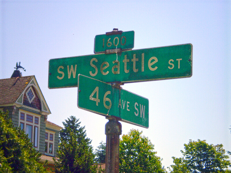
SW Seattle Street is a minor residential street in West Seattle that runs about ³/₁₀ of a mile from 42nd Avenue SW in the east to Sunset Avenue SW in the west.

It might seem strange that such a short street would be chosen to bear the city’s name — it was the only one to do so until 2010, when the first two blocks of Airport Way S were renamed Seattle Boulevard S — but this has more to do with unimaginative naming than with civic pride.

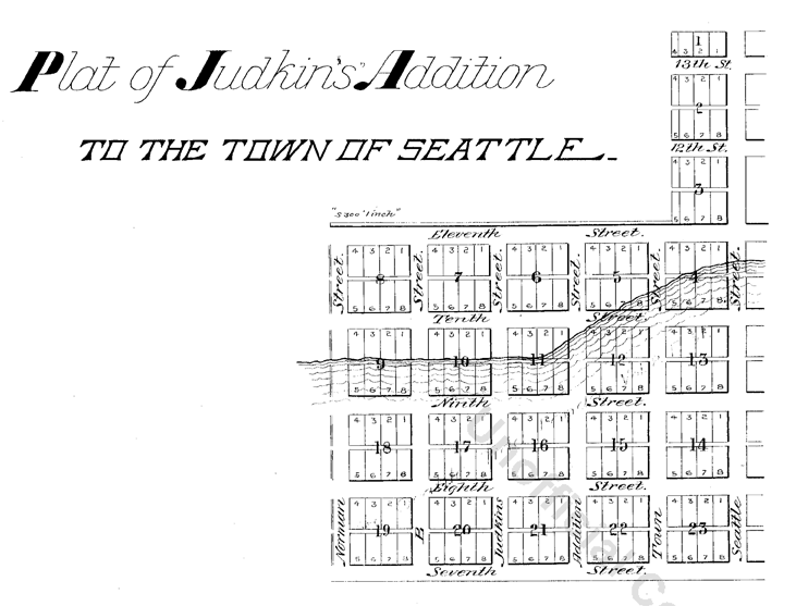
On August 4, 1869, Ike M. Hall — the executor of the estate of Norman B. Judkins — filed the Judkin’s (sic) Addition to the Town of Seattle, located just southwest of where the interchange between I-5 and I-90 is today. From north to south, the east–west streets are named Norman, B, Judkins, Addition, Town, and Seattle.

Portions of the original Seattle Street were vacated over the years (for example, in 1900, 1957, and 2000), and the construction of I-5 took care of the rest. However, when the city annexed West Seattle in 1907 it changed the name of Maple Street to W Seattle Street as part of rationalizing the street grid… and so the name lives on.

(The city itself, of course, was named after Si’ahl [siʔaɫ], better known in English as Chief Seattle of the Duwamish and Suquamish Tribes.)

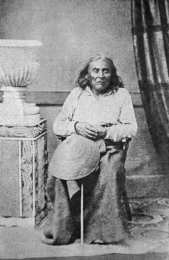
siʔaɫ, or Chief Seattle
The only known photograph of Chief Seattle (1786?–1866), taken by E.M. Sammis in 1864
Sign at corner of SW Seattle Street and 46th Avenue SW, July 4, 2011
Sign at corner of SW Seattle Street and 46th Avenue SW, July 4, 2011. Photograph by Benjamin Lukoff. Copyright © 2011 Benjamin Lukoff. All rights reserved.

So, why SW Seattle Street instead of Seattle Street SW?

In Seattle, east–west streets have the directional come first, and north–south avenues have it come last. The Wikipedia article “Street layout of Seattle,” which I helped write, has a more comprehensive description of Seattle’s addressing system, including the answer to this question:

Why was it W Seattle Street in 1907 but SW Seattle Street now?

In 1961, city ordinance 89910 “established a standard system of street name designations” so that in almost all cases streets within a given zone would carry the same directional. West Seattle avenues already carried the SW designation.