Schmitz Boulevard

This road, and the park through which it runs, Schmitz Park (or Schmitz Preserve Park), was named for German immmigrants Ferdinand Schmitz (1860–1942) and his wife, Emma Althoff Schmitz (1864–1959). Ferdinand was a banker, city councilman, and parks commissioner. He and Emma donated land — mostly, though not entirely, old-growth forest — to the city in 1908, forming the core (just over 55%) of the present park.

The Schmitzes had four children: Dietrich, Henry, Emma Henrietta, and Ferdinand Jr. A banker, Dietrich (1890–1969) became president of Washington Mutual in 1934 and retired as chairman of the board two years before his death. He was also a member of the Seattle School Board from 1928 (or 1930; sources differ) to 1961. Henry (1892–1965) was president of the University of Washington from 1952 to 1958. Schmitz Hall, the university’s administration building on NE Campus Parkway, was named in his memory in 1970.
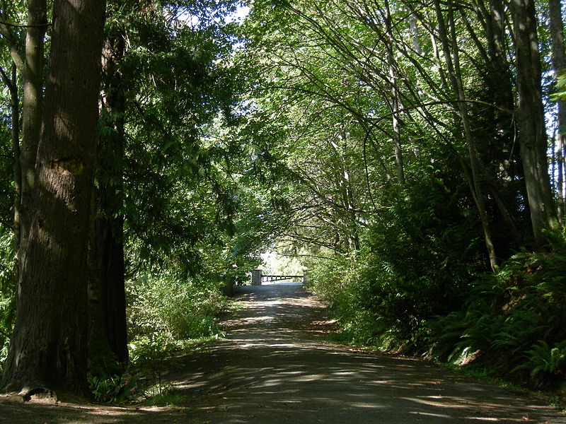
https://commons.wikimedia.org/wiki/File:Seattle_-_Schmitz_Park_road_01.jpg
Schmitz Boulevard looking north toward SW Stevens Street and SW Admiral Way. September 2007. Photograph by Joe Mabel, Wikimedia Commons, licensed under Creative Commons Attribution-ShareAlike 3.0 Unported

According to the Friends of Seattle’s Olmsted Parks,

The roadway was originally envisioned as a continuation of the West Seattle Parkway, never realized, which would have connected Alki Beach to Lake Washington via a series of parkways. The built section is instead a short road that provided the only automobile entry to Schmitz Park, extending through an allée of trees and terminating at a pergola and shelterhouse.
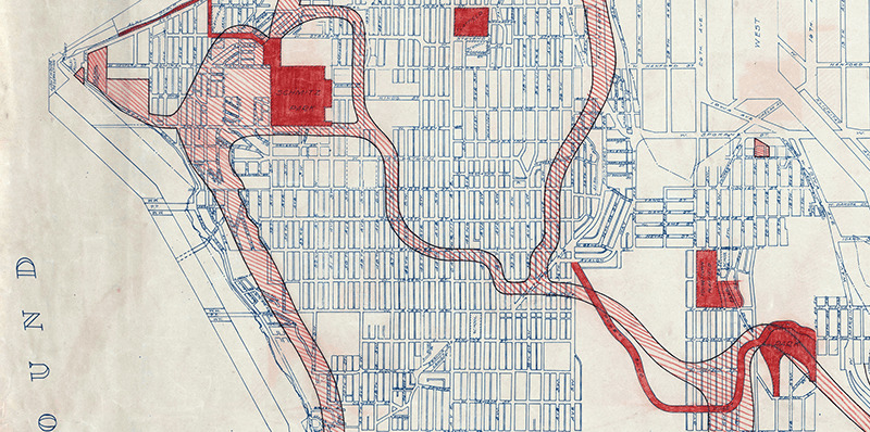
Map of proposed West Seattle Parkway, cropped from a 1928 map of Seattle's park system
Map of proposed West Seattle Parkway, cropped from a 1928 map showing both existing (red) and proposed (red hatched) park features. Schmitz Park and Boulevard are at upper left. Courtesy of the Seattle Municipal Archives, Identifier 2333.

The portion between 59th Avenue SW and 58th Avenue SW in front of Alki Elementary School having been closed in 1949, Schmitz Boulevard today begins at 58th Avenue SW and SW Stevens Street and goes not quite half a mile east, then southeast, then north, to SW Admiral Way and SW Stevens Street. It is closed to automobile traffic.
Puget Boulevard SW

Puget Boulevard is a curious street, for a number of reasons:

  • The paved portions are only a few blocks long — hardly comparable to, say, Lake Washington Boulevard or Magnolia Boulevard;
  • Both east–west and north–south portions are called Puget Boulevard SW, contrary to the rule that directional designations precede street names for east–west streets (this is why Lake Washington Boulevard E becomes E Lake Washington Boulevard when it curves west on its approach to Montlake Boulevard E);
  • Despite its name, it has no view of Puget Sound, sitting as it does in the Longfellow Creek valley in the Delridge neighborhood of West Seattle;
  • And, as it turns out, it isn’t even named for Puget Sound, as might be expected, but rather for the Puget Mill Company (later part of Pope & Talbot and today part of Rayonier).

The Puget Mill Company, which once owned large swaths of land in the city (including what became the Washington Park Arboretum and the Broadmoor Golf Club), made two donations to the city in 1912, according to the Ninth Annual Report of the Board of Park Commissioners:

  • “A rugged tract of logged-off land south of Pigeon Point and Youngstown in the large unplatted area” (20.5 acres — this became Puget Park); and
  • “A strip of land 160 feet in width extending from Sixteenth Avenue Southwest and Edmonds Street (sic) to Thirty-fifth Avenue Southwest and Genessee Street, a distance of 8,500 feet, and comprising an area of about fifteen acres for parkway purposes. Under the conditions of this gift improvement work must be undertaken within five years. This acquisition forms an important link in the contemplated boulevard to West Seattle.”

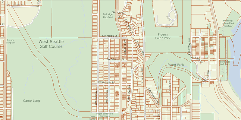
This strip is today’s Puget Boulevard SW. Two things become apparent when looking at the King County Parcel Viewer map of West Seattle:

Map of Puget Boulevard, from King County Parcel Viewer

Once past the present site of West Seattle Stadium, the “contemplated boulevard to West Seattle” was to have run, as the Friends of Seattle’s Olmsted Parks puts it,

[Across] California Avenue a few blocks north of [the] present-day Alaska Junction, at that time part of the “Boston Subdivision.” It would have then headed northwest and down a ravine, eventually turning southwest to terminate at Alki Point.

Map of proposed West Seattle Parkway, cropped from a 1928 map of Seattle's park system
Map of proposed West Seattle Parkway, cropped from a 1928 map showing both existing (red) and proposed (red hatched) park features. Puget Park and Boulevard are at lower right. Courtesy of the Seattle Municipal Archives, Identifier 2333.

Returning to the question of the name — the Puget Mill Company was, of course, named after Puget Sound, which itself was named in 1792 by Captain George Vancouver of HMS Discovery for Lieutenant Peter Puget (1765–1822).

Today, the paved portion of Puget Boulevard SW begins at 23rd Avenue SW, about 1⁄10 of a mile north of SW Hudson Street, and goes ⅕ of a mile south to a dead end. After a very short section — not more than 150 feet long — east of Delridge Way SW, which serves as a driveway for a complex of townhouses, it resumes west of a foot path off Delridge and goes about 1⁄10 of a mile west to 26th Avenue SW. Along this stretch, there are houses to the north and the Delridge P-Patch and Puget Boulevard Commons to the south.

Queen Anne Boulevard

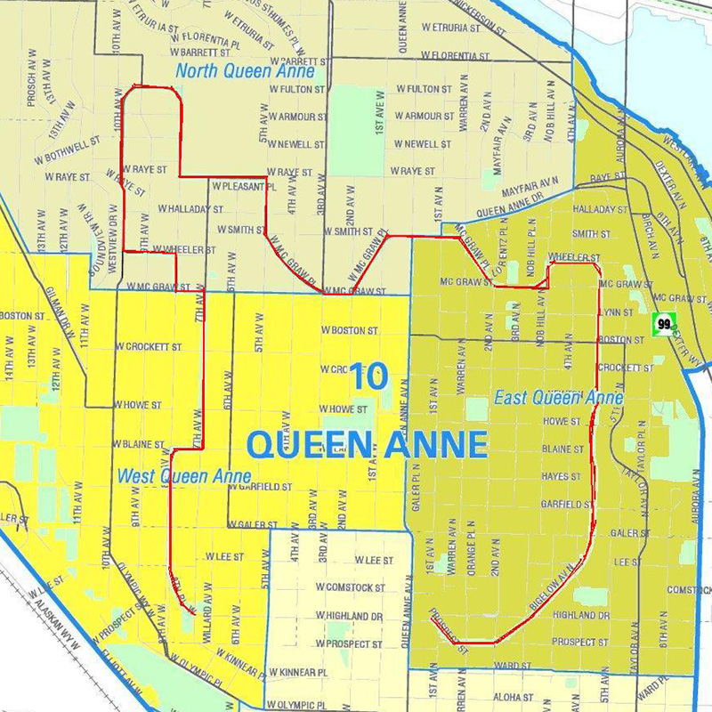
Like Queen Anne Avenue N, Queen Anne Boulevard is named for the neighborhood and hill, themselves named for the Queen Anne architectural style popular with builders in the 1880s. Unlike the avenue, though, the boulevard is not one single street, but a scenic loop incorporating many streets (and hence has no directional designation, such as Queen Anne Boulevard W).

The legislation establishing Queen Anne Boulevard was passed in 1907, and construction took place from 1911 to 1916. The Seattle Department of Transportation has had jurisdiction over the streets since 1942; jurisdiction over the landscaping remains with Seattle Parks and Recreation.

The loop is slightly over 3⅔ miles in length; the ordinance gives its route as follows (edited for style and current street names and directional designations, with notes added):

Extending from Prospect Street between Warren Avenue N and 2nd Avenue N, in a northeasterly direction*, to an intersection with Galer Street near Bigelow Avenue N; thence northerly following the general direction of Bigelow Avenue N as nearly as the contours of the ground will permit, to Wheeler Street; thence westerly to Nob Hill Avenue N; thence southerly to McGraw Street; thence westerly to 2nd Avenue N; thence northwesterly to Smith Street, west of Warren Avenue N; thence westerly along Smith Street to a point east of 1st Avenue W; thence southerly to W McGraw Street and 2nd Avenue West; thence westerly to 3rd Avenue W; thence northwesterly to 5th Avenue W and W Smith Street§; thence northerly to W Raye Street; thence westerly to 8th Avenue W; thence northerly to W Armour Street; thence northwesterly to W Fulton Street; thence westerly to 9th Avenue W; thence southwesterly to 10th Avenue W and W Armour Street; thence southerly to W Wheeler Street; thence easterly to 8th Avenue W; thence southerly to W McGraw Street; thence easterly to 7th Avenue W; thence southerly to W Blaine Street; thence westerly to 8th Avenue W; thence southerly to W Lee Street; thence southeasterly to W Highland Drive and 7th Avenue West.

* Now the southern extension of Bigelow Avenue N.
Now McGraw Place.
Now the east half of W McGraw Place.
§ Now the west half of W McGraw Place.
Now 8th Place W.

Notably, there is a gap in the loop; Highland Drive between 7th Avenue W and Warren Avenue N could have made it closed, but this was not done.

As noted in Bigelow Avenue Nneighbors’ yards often encroach on the public right-of-way, leading, among other things, to confrontations over chestnuts…

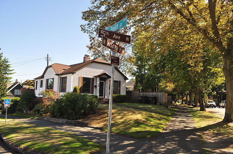
Queen Anne Boulevard street sign, corner of 5th Avenue W, W Smith Street, and W McGraw Place, September 2015
Street sign, corner of 5th Avenue W, W Smith Street, and W McGraw Place, September 2015. The signs for 5th and McGraw are brown because of Queen Anne Boulevard’s status as a parks boulevard; note also the distinctive Queen Anne Boulevard sign beneath that for McGraw. Photograph by Joe Mabel, Wikimedia Commons, licensed under Creative Commons Attribution-ShareAlike 3.0 Unported
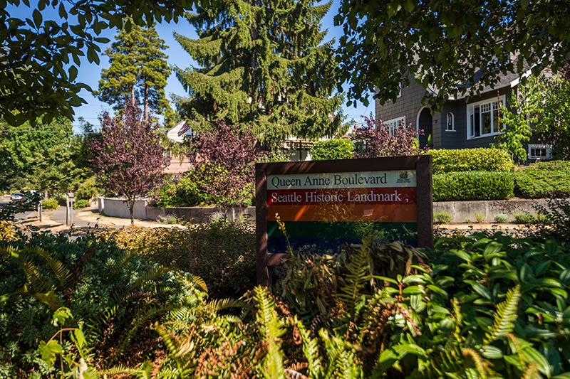
Queen Anne Boulevard Seattle Historic Landmark Parks Department sign, 1st Avenue W and W Smith Street, July 2015
“Queen Anne Boulevard, Seattle Historic Landmark” Parks Department sign, 1st Avenue W and W Smith Street, July 2015. Courtesy of the Seattle Municipal Archives, Identifier 178301
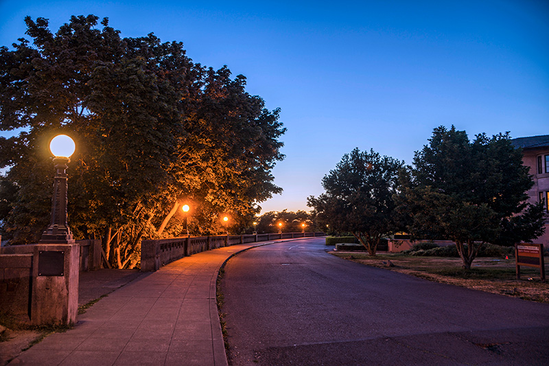
Queen Anne Boulevard at night: 8th Place W just north of Marshall Park, July 2015
Queen Anne Boulevard at night: 8th Place W just north of Marshall Park, July 2015. Note the Wilcox Wall supporting the light fixtures. Courtesy of the Seattle Municipal Archives, Identifier 178303

Bigelow Avenue N

This street was named for developer Isaac Newton Bigelow (1838–1922). The Queen Anne Historic Context Statement, as we quoted in Newton Street, says:

In the early 1870s, the Denny and Mercer families gradually began to systematically subdivide their large land holdings on the south and east slopes of Queen Anne Hill. When a severe windstorm blew down thousands of trees in the north district in 1875, views opened up and land seekers turned their attentions beyond Belltown. Real estate speculators new to the territory arrived and began to buy up property on the crest of Queen Anne Hill. Some of these speculators also became developers, such as George Kinnear, or builder-developers, such as Isaac Bigelow.

Bigelow Avenue N forms a major part of Queen Anne Boulevard, the scenic loop atop Queen Anne Hill. It begins at 2nd Avenue N and Prospect Street and goes 9⁄10 of a mile to Wheeler Street between 4th Avenue N and 5th Avenue N.

Part of the street is lined with chestnut trees — not horse chestnuts, but the edible variety, specifically the Chinese chestnut, Castanea mollissima, according to the city’s records. My family (my mother was Korean) never foraged here, though we have done so elsewhere in the area, both for chestnuts and fiddlehead ferns. But plenty of others have, and continue to do so, as these articles show:

It should be noted that since Bigelow Avenue N is part of Queen Anne Boulevard, the trees belong to the parks department, not to the neighbors. As with similar park boulevards in town, neighbors’ yards often encroach on the public right-of-way.

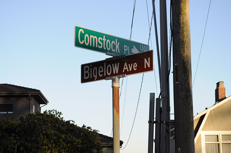
Street sign at corner of Comstock Street and Bigelow Avenue N, February 2010
Street sign at corner of Comstock Place and Bigelow Avenue N, February 2010. Photograph by Joe Mabel, Wikimedia Commons, licensed under Creative Commons Attribution-Share Alike 3.0 Unported
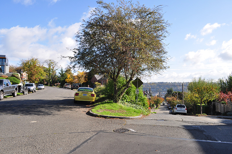
Beginning of Bigelow Avenue N (Queen Anne Boulevard) at 2nd Avenue N and Prospect Street, October 2015. Photograph by Joe Mabel, Wikimedia Commons, licensed under Creative Commons Attribution-Share Alike 3.0 Unported

Frink Place S

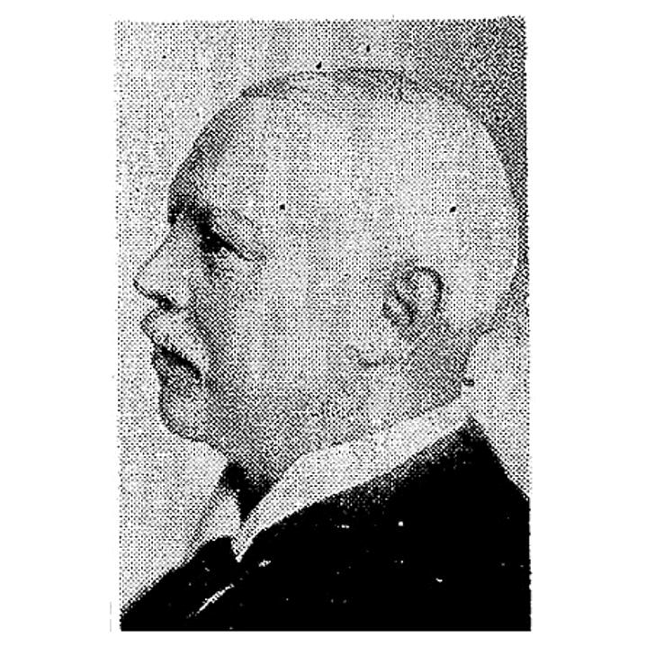
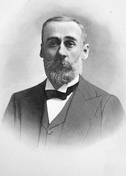
This street, and the park through which it runs, were named for John Melancthon Frink (1855–1914). Born in Pennsylvania but raised in Kansas, he came to Seattle in 1874. At various times he was a teacher, businessman, school board director, city councilman, and state senator. Frink became a parks commissioner in 1906, the same year he bought Washington Park (not to be confused with the park of the same name to the north) and donated it to the city, which renamed it after him. Frink Place was established in 1927; there had been an earlier Frink Boulevard, but it, like University Boulevard, Stixrud Drive, and Blaine Boulevard, among others, had become part of Lake Washington Boulevard by 1920.

John M. Frink
John Melancthon Frink

S Frink Place begins at S Washington Street just east of 32nd Avenue S, and goes ⅙ of a mile through the park to the intersection of S Jackson Street, 34th Avenue S, and Lake Washington Boulevard S.

Bay Terrace Road

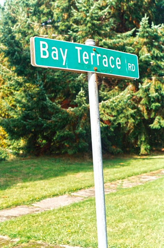
To reach their homes, residents of Bay Terrace — east of Lawtonwood and west of Land’s End at the northern tip of Magnolia — must drive through Discovery Park. Within the park, their street (the narrow neighborhood only has one) is known as Bay Terrace Road, but changes to 42nd Avenue W north of the park boundary. Similarly to Lawtonwood Road, it does not appear to have been officially so designated until 2007, when ordinance 122503 was passed. Also similarly to Lawtonwood Road, it carries no directional designation, since it is a park boulevard.

Bay Terrace Road runs ¼ mile north from Lawtonwood Road just west of 40th Avenue W, and then becomes 42nd Avenue W, which continues on for another ⅕ of a mile to a viewpoint overlooking Shilshole Bay.

Sign for Bay Terrace Road, Discovery Park, October 30, 2011
Sign for Bay Terrace Road, Discovery Park, October 30, 2011. Photograph by Benjamin Lukoff. Copyright © 2011 Benjamin Lukoff. All rights reserved.

Lawtonwood Road

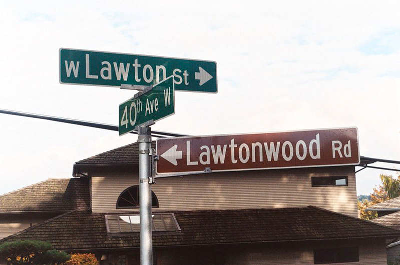
Lawtonwood Road is one of the many Magnolia streets, like W Government Way, W Fort Street, and W Lawton Street, related to Fort Lawton, which was opened by the U.S. Army in 1900 and is now Discovery Park. (The fort itself was named for Major General Henry Ware Lawton [1843–1899]). It runs ⅓ of a mile northwest from 40th Avenue W to the intersection of 45th Avenue W and W Cramer Street.

Street sign at the corner of Lawtonwood Road, W Lawton Street, and 40th Avenue W, October 30, 2011
Street sign at the corner of Lawtonwood Road, W Lawton Street, and 40th Avenue W. Photograph by Benjamin Lukoff, October 30, 2011. Copyright © 2011 Benjamin Lukoff. All rights reserved.

The neighborhood of Lawtonwood, or Lawton Wood — both spellings have been in use over the years — is perched atop Discovery Park north of W Cramer Street. Lawtonwood Road, which goes through the park, is the only way in or out. It would have been a natural part of Fort Lawton, and it certainly would have made a great addition to the park, but as local historian Paul Dorpat explains in his introduction to the neighborhood

Steady white settlement started in 1875 when German immigrant Christian Scheuerman moved to the area, cleared the timber and married a native woman who had ten children before she died in 1884. In 1895 Seattle boosters organized to attract a military post to the area and gathered the acreage that is now Fort Lawton–Discovery Park. The part of it that is now Lawton Wood… is not part of the military holding because Scheuerman withheld it.

It should not be thought that Scheuerman cared nothing at all for the defense of Seattle — he and his family did donate 26.13 acres to the cause — though that made up less than 4% of the 704.21 acres given in total. (The single largest contributors of land were Thomas W. Prosch and his wife, Virginia, who gave 330.97 acres, a full 47%.)

Dorpat continues:

Soon after the military moved in next door, this protected enclave was improved with mansions of a few of Seattle’s elite. In 1952 these neighbors — about 30 houses sparingly distributed about a generous 30 acres – organized the Lawton Wood Improvement Club, waving the motto “To Beautify and Develop Lawton Wood.” By the time that the last of the Scheuermans, Ruby, moved out in the late 1970s, the beautifying had turned more to developing, and the lots got smaller.

The first reference to Lawtonwood Road I was able to find in The Seattle Times or the Seattle Post-Intelligencer is from 1935, but it does not appear to have been officially so designated until 2007. According to ordinance 122503, park roads “are considered ‘private’” — technically residents of Lawtonwood and Bay Terrace had no legal right to transit the park to reach their homes, though of course they had never been prevented from doing so. To rectify this and other issues, and in anticipation of the privatization of the residences on Officers’ Row and Montana Circle, the ordinance made Lawtonwood Road, Bay Terrace Road, Utah Street, Washington Avenue, California Avenue, Iowa Street, Illinois Avenue, Texas Way, Idaho Avenue, and 45th Avenue W “public park boulevards.”

Note, by the way, that none of these streets except 45th Avenue W contain a directional designation. Ordinarily one would expect to see W Lawtonwood Road, or Lawtonwood Road W, but park roads in Seattle carry no directional designation. An exception seems to have been made for 45th Avenue W, presumably because a numbered avenue with no directional designation “belongs” in Madrona or Leschi, seven miles to the southeast.

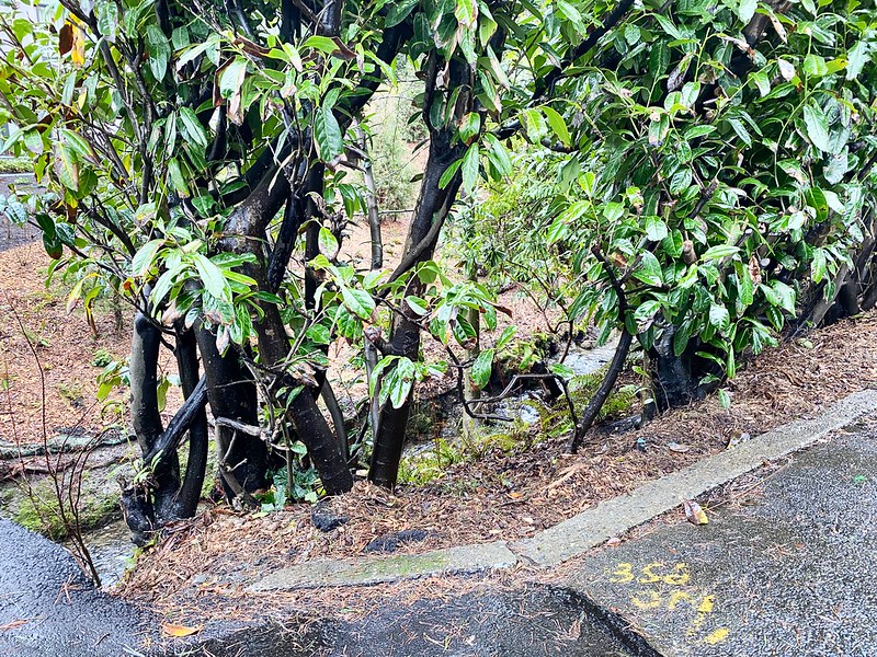
Scheuerman Creek just east of 45th Avenue W in the Lawtonwood neighborhood. 45th Avenue W is part of Discovery Park, but the creek is on private property. Photograph by Benjamin Lukoff, January 31, 2021. Copyright © 2021 Benjamin Lukoff. All rights reserved.
Scheuerman Creek just east of 45th Avenue W in the Lawtonwood neighborhood. As noted above, 45th Avenue W is part of Discovery Park, but the creek is on private property. Photograph by Benjamin Lukoff, January 31, 2021. Copyright © 2021 Benjamin Lukoff. All rights reserved.

Cheasty Boulevard S

This Olmsted boulevard was designed in 1910 as Jefferson Boulevard, the entrance to Jefferson Park. It runs about 1⅕ miles from Beacon Avenue S and S Alaska Street in the southwest to S Winthrop Street in the northeast, which also forms part of the park boulevard. After crossing Martin Luther King Jr. Way S and Rainier Avenue S, it continues on as S Mount Baker Boulevard, ending at Mount Baker Park.

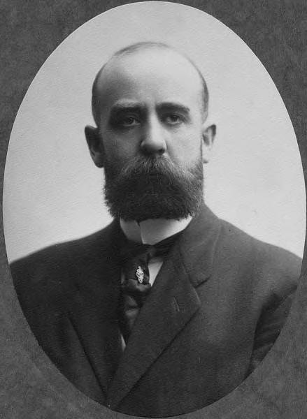
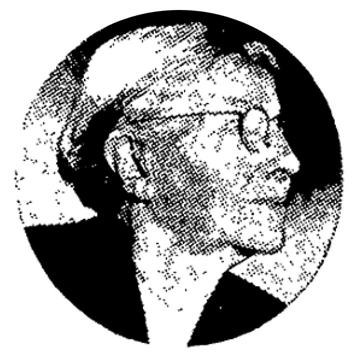
In 1914, it was renamed Cheasty Boulevard after E.C. (Edward) Cheasty (born 1864), who died that year. He had been police commissioner, commissioner of the Alaska–Yukon–Pacific Exposition, and a member of the park board from 1907 to 1910 and 1912 to his death, according to the Don Sherwood Park History Files. He also ran Cheasty’s Store, a downtown haberdashery, from 1888 until his death. 

E.C. Cheasty, photograph by Edward S. Curtis, from the University of Washington Libraries’ Portrait Collection

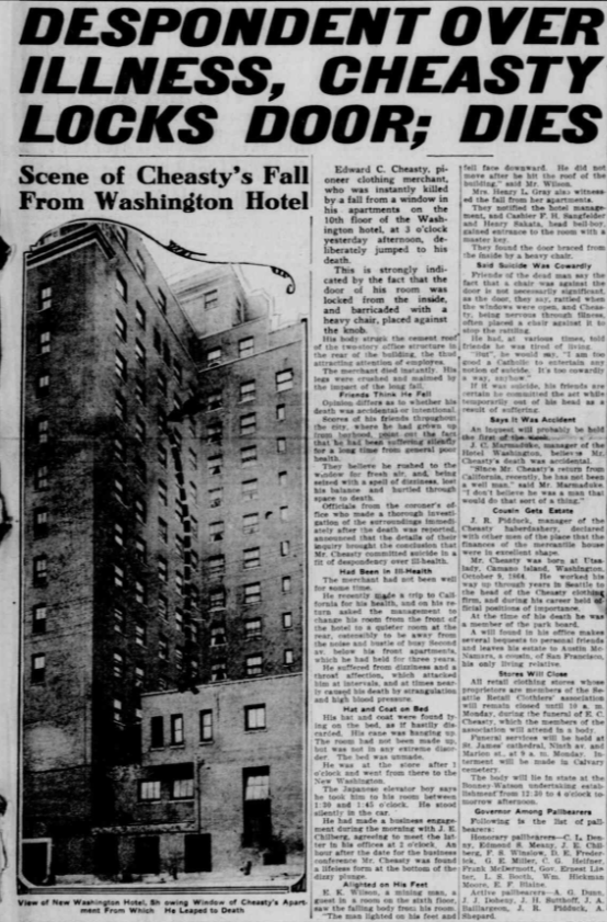
Speaking of his death, it sadly appears that it was due to suicide. He fell from the 10th floor of the Washington Hotel — the same hotel in which fellow businessman Frank B. Hubbell killed himself in 1905.

Seattle Star article on death of E.C. Cheasty
Front-page article on Cheasty’s death, The Seattle Star, June 13, 1914

E Foster Island Road

This street, which runs about ¼ mile from Lake Washington Boulevard E to the beginning of the Foster Point Trail, all within the Washington Park Arboretum, was without a name until 1968, when it was named for the island in Union Bay to which it led. (It remained unsigned until a few decades later, however. There was no sign at the intersection until at least the 1990s, as I know since my parents’ house was at the south end of the Arboretum and I drove or biked by there weekly, if not more often, while I was growing up.)

Foster Island is known by the Duwamish tribe, who once used it as a burial ground, as Stitici, or ‘little island’. It was named by the settlers for Joel Wellington Foster, who came to Washington in the 1870s from St. Joseph, Missouri. He is said to have donated the island to the city in one HistoryLink article, but another says the city bought it in 1917.

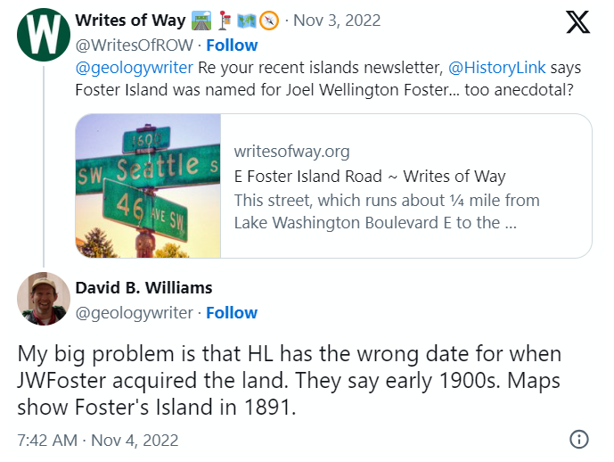
(Note added November 6, 2022: David B. Williams, the “Street Smart Naturalist,” recently posted The Lost Islands of Seattle, in which he wrote that he had seen various sources for the name Foster but none with good documentation. I asked him about the HistoryLink article I cite above:

A screen shot of a tweet by me reading "@geologywriter Re your recent islands newsletter, @HistoryLink says Foster Island was named for Joel Wellington Foster... too anecdotal?" and David B. Williams's reply, "My big problem is that HL has the wrong date for when JWFoster acquired the land. They say early 1900s. Maps show Foster's Island in 1891."

I’m embarrassed to have missed that, but of course he’s right. So if not Joel Wellington Foster, then who? The search continues

[Note: On July 10, 2024, I began converting embedded tweets on this website to screenshots because of issues with how they were integrating with WordPress, which began not too long after Elon Musk purchased Twitter and changed its name to X.]

E Interlaken Boulevard

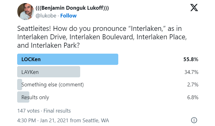
The establishment of E Interlaken Boulevard — the first of Seattle’s Olmsted parks and boulevards we’re covering — was first proposed, according to Seattle parks historian Don Sherwood, in 1903 as Volunteer Hill Parkway. Two years later, the current name was adopted. There is speculation, but no documentation, that it was named for the Swiss resort town of that name. Ask a Seattleite how to pronounce “Interlaken” and you may hear either lake or lock, the latter being more common according to an informal Twitter poll I ran (but the former being the one I grew up with).

Text of a Twitter poll by me, reading "Seattleites! How do you pronounce “Interlaken,” as in Interlaken Drive, Interlaken Boulevard, Interlaken Place, and Interlaken Park?" LOCKen 55.8%, LAYKen 34.7%, something else (comment) 2.7%, results only 6.8%. 147 votes total

Note: On July 10, 2024, I began converting embedded tweets on this website to screenshots because of issues with how they were integrating with WordPress, which began not too long after Elon Musk purchased Twitter and changed its name to X. Here is a screen shot of folks’ comments.

Interlaken Boulevard runs for about 1⅔ miles west to east from Delmar Drive E, by Seattle Preparatory School on Capitol Hill, to Lake Washington Boulevard E, in the Washington Park Arboretum. The middle section, between 19th and 21st Avenues E, is closed to motor vehicles and functions as a pedestrian and bicycle trail. The name also appears on Interlaken Drive E and Interlaken Place E — and should not be confused with Interlake Avenue N, a street in North Seattle.

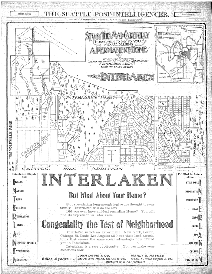
Advertisement for Interlaken in the Seattle Post-Intelligencer, May 30, 1906
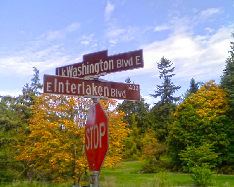
Street sign at corner of Lake Washington Boulevard E and E Interlaken Boulevard, October 11, 2009. Copyright © 2009 Benjamin Lukoff. All rights reserved.
Street sign at corner of Lake Washington Boulevard E and E Interlaken Boulevard. Photograph by Benjamin Lukoff, October 11, 2009. Copyright © 2009 Benjamin Lukoff. All rights reserved.