Cowen Place NE

This street was created as part of the 1906 plat of Cowen’s University Park, filed by the Sylvester-Cowen Investment Company, of which Charles Cowen (1869–1926) was president. Originally Ravenna Place, it received its current name in 1918, according to an article in the January 29 issue of The Seattle Times. (This article also reported that the names of the individual streets that made up Queen Anne Boulevard would be restored and that Oriental Avenue [counterpart of the still-existing Occidental Avenue S] would become Third Avenue S). Whether it honors Cowen or the park named after him, which he donated to the city in 1906, is unclear.
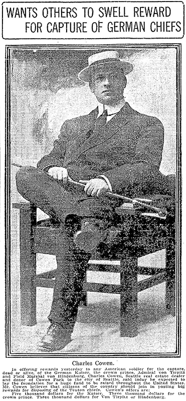
Article in September 22, 1917, issue of The Seattle Times on Charles Cowen and his bounty on German leaders during World War I

Cowen was born in England, moved with his family to South Africa, and came to the United States in 1890, arriving in Seattle in 1900. Dotty DeCoster writes for HistoryLink.org:

Cowen was, by many accounts, a lively and active participant in developing the University District. According to architectural historian Shirley L. Courtois, he was British and had grown up in South Africa, where his family members were diamond miners and merchants. In 1890 he was sent to New York to purchase equipment for the mines. He never returned to South Africa. He apparently broke with his family, changed his name from Cohen to Cowen, and settled first in New York State, then in Florida, and finally in Seattle. Cowen reportedly retained a distinctively English style throughout his life.

The facts that his surname was originally Cohen and that his family was involved in diamond mining in South Africa led me to think he must have been Jewish, but I could find no definitive mention of his ethnicity online. However, in the March 19, 1926, issue of The Seattle Times, I found an article on the probate of his will, which mentioned that $2,000 of his $50,000 estate would go to the Hebrew Benevolent Society (today known as Jewish Family Service). That makes Cowen and Henry Fuhrman (1844–1907) (Fuhrman Avenue E) the only Jews I am aware of who have Seattle streets named after them. (Note added November 9, 2024: Now there’s a third: Sue Bird [born 1980] [Sue Bird Court N]).

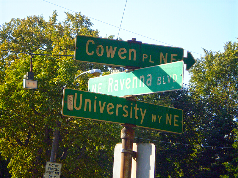
Cowen Place NE begins at NE Ravenna Boulevard and University Way NE and goes just over 325 feet northeast to 15th Avenue NE, at the south end of the Cowen Park Bridge.
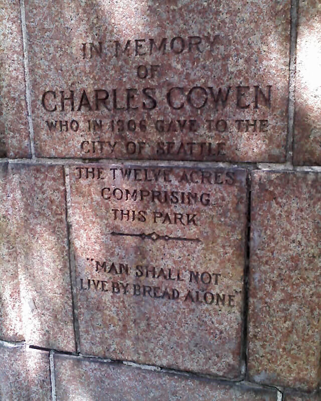
Detail of Charles Cowen memorial at entrance to Cowen Park
Detail of Charles Cowen memorial at entrance to Cowen Park, June 1, 2009. “In memory of Charles Cowen who in 1906 gave to the city of Seattle the twelve acres comprising this park. ‘Man shall not live by bread alone.’” Photograph by Benjamin Lukoff. Copyright © 2009 Benjamin Lukoff. All rights reserved.
Signs at corner of NE Ravenna Boulevard, University Way NE, and Cowen Place NE, August 24, 2009
Signs at corner of NE Ravenna Boulevard, University Way NE, and Cowen Place NE, August 24, 2009. Photograph by Benjamin Lukoff. Copyright © 2009 Benjamin Lukoff. All rights reserved.

Weedin Place NE

Originally Ravenna Avenue in the 1890 plat of the Woodlawn Addition to Green Lake, Weedin Place NE was named for the Weedin brothers, early settlers of the area. (Weedin’s Homestead Addition to the City of Seattle, filed by Robert Weedin, his son, and their wives in 1904, lies to the south; it would seem that when Ravenna Boulevard NE was established slightly to the west, Ravenna Avenue needed a new name, and that of the Weedins was chosen.)

Louis Fiset writes for HistoryLink.org:

In the fall of 1879, 10 years after the first homesteader arrived at Green Lake, a newly erected, simple log cabin schoolhouse opened its doors to 11 pupils.… This was the first Green Lake School.… The children came from four households on the east side of the lake: seven were sons and daughters of the brothers W. L. and Robert Weedin.… Thus began public school education in the territorial School District № 25.

And Valarie Bunn tells us on her blog, Wedgwood in Seattle History, that Robert Joseph Weedin (1842–1910) and William Luther Weedin (1845–1930) were Civil War veterans from Missouri who “did not have to take a full five years to ‘prove up a claim’ and be awarded ownership of land, according to the Homestead Act of 1862,” but could count their time in the service toward that total. Robert’s claim, as noted above, was southeast of Green Lake, while William’s was further east, in Wedgwood and Bryant.

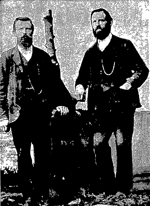
A photograph of brothers W.L. and Robert Weedin that ran in the Seattle Post-Intelligencer, May 23, 1965, in an article about early schools in Green Lake

Today, Weedin Place NE begins at 5th Avenue NE and NE 70th Street and goes ¼ of a mile southeast to just past 8th Avenue NE and NE 66th Street, where the right-of-way becomes a park. It is notable for being the location of the Weedin Place fallout shelter, located under Interstate 5. Read more about it in “‘Lifeboat Ethics’ Under the Interstate: Seattle’s Prototype Highway Fallout Shelter,” by Washington State Department of Transportation historian Craig Holstine, who writes that

…The Weedin Place facility was apparently the first, and only, fallout shelter ever constructed in the U.S. under a public roadway. It was built under what would become Interstate 5 at the height of the Cold War in part as a way to demonstrate more effective uses of public rights-of-way.… The Commissioner of Public Roads… proposed putting shelters under the interstates as a way to save costs by combining needs of the national shelter and federal-aid highway programs and provide shelter for the traveling public.

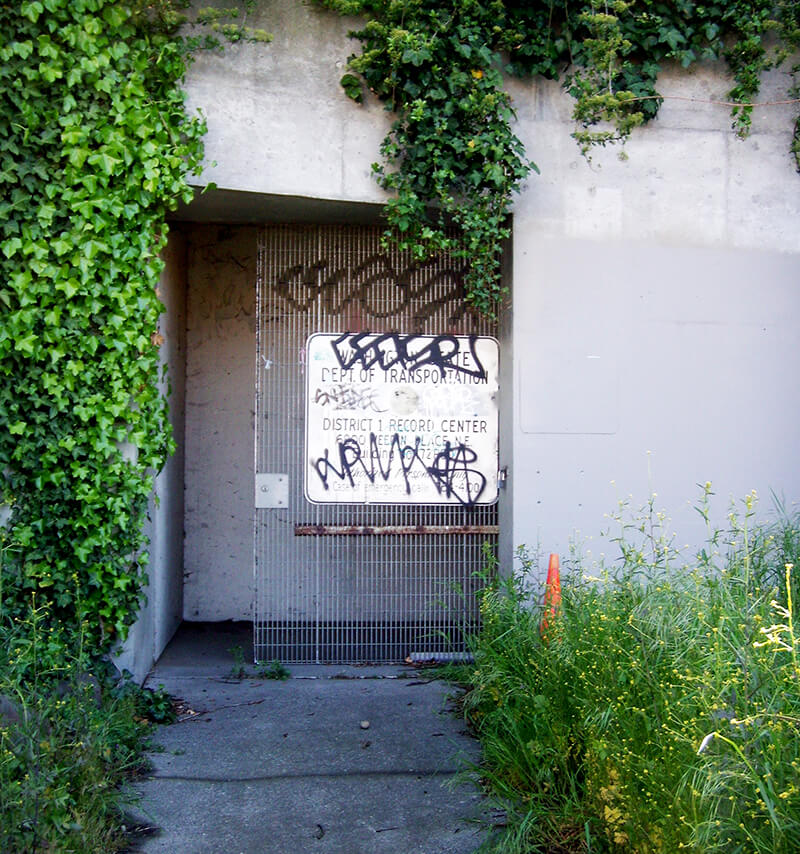
Weedin Place Fallout Shelter
Weedin Place fallout shelter, May 2010. For more photos, see this 2018 article by Feliks Banel. Also see this 2010 blog post by the Washington State Department of Transportation, as well as their Flickr album, featuring 18 more photos of the shelter. Photograph by Flickr user Washington State Department of Transportation, licensed under Creative Commons Attribution-NonCommercial-NoDerivs 2.0 Generic
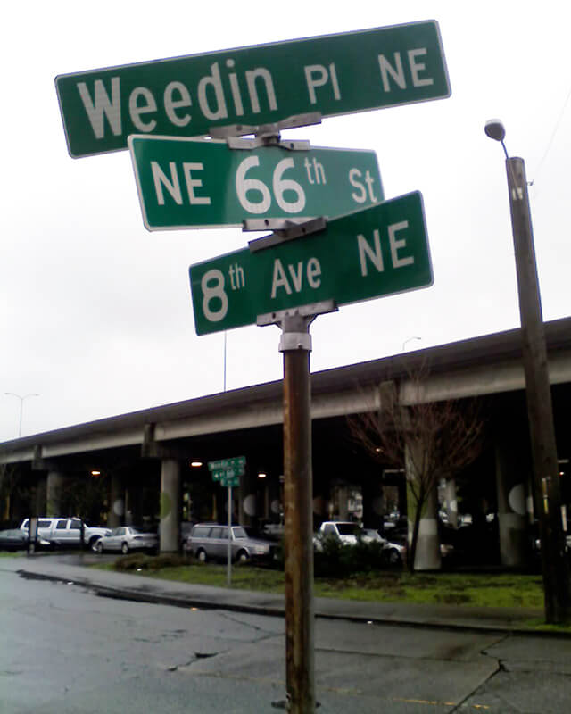
Street sign at corner of Weedin Place NE, NE 66th Street, and 8th Avenue NE, January 30, 2010
Street sign at corner of Weedin Place NE, NE 66th Street, and 8th Avenue NE, January 30, 2010. Photograph by Benjamin Lukoff. Copyright © 2010 Benjamin Lukoff. All rights reserved.

Brooklyn Avenue NE

This street was named after the Brooklyn Addition to Seattle, platted by James Alexander Moore (1861–1929) in 1890. The addition itself was named for Brooklyn, New York (see the history of the University District Paul Dorpat wrote for HistoryLink and this article on his own blog):

[Moore] chose the name because his addition “looked across the water” to Seattle proper like the New York borough of the same name that looks across the East River to Manhattan.

I haven’t been able to find an online source for this assertion, but Dorpat may have been referring to a passage in Roy G. Nielsen’s UniverCity: The Story of the University District in Seattle (1986), which quotes an article in the August 31, 1928, issue of the University Herald in which George F. Cotterill (mayor from 1912–1914) says:

[In 1885], there was no thought of a university and section sixteen was still untouched. J.A. Moore, one of the greatest Seattle real estate promoters of the time, started Brooklyn between 10th Ave. N.E. and the campus. This addition was intended by Mr. Moore to be to Seattle what Brooklyn is to New York.

Today’s Brooklyn Avenue is a block west of Moore’s. Again quoting Paul Dorpat:

None of James Moore’s street names survive. His Tremont Avenue became 15th Avenue. One block west he named University Way — the District’s future “Main Street” — Columbus Avenue. He called the future Brooklyn Avenue, “Broadway,” ­ and this was Moore’s intended “Main Street.” He called 12th Avenue “Brooklyn.”

Brooklyn Avenue NE begins at NE Boat Street just north of Fritz Hedges Waterway Park and goes 1¾ miles north through the University District and Roosevelt neighborhood to NE 66th Street at Roosevelt High School. It resumes at NE 70th Street and goes just short of 300 feet to Froula Playground and the Roosevelt Reservoir. There is another segment between NE 75th Street and NE 77th Street and a final one between NE 80th Street and NE 82nd Street by Maple Leaf Reservoir Park.

NE Elk Place

As requested by Steve Sorbo: what’s the deal with NE Elk Place — a rare named street in the sea of numbered ones that is Roosevelt and Maple Leaf?

It looks like the name originated as Elk Street in Pitner’s Division of Green Lake Addition to Seattle, W.T., filed July 30, 1889, by Levi Carroll Pitner (1824–1911), a Methodist minister from Illinois, and his wife, Arminda Francis Cartwright Pitner (1828–1917). Shortly thereafter, on November 16, 1889, Zenas Upham Dodge (1859–1942) and his wife, Mary Jane Jones Dodge (1861–1902), filed Dodge’s Division of Green Lake Addition to the City of Seattle, Wash. Because streets on the two plats do not change names when they cross from one to the other, it’s possible the Pitners and Dodges came up with the names together, or simply that the Pitners named the streets and the Dodges willingly went along. I am not sure when Seattle began requiring that streets not change names when they cross plat lines, but if it was before 1889, that could have been the case as well. I do know it wasn’t long before Ordinance 4044 — the “Great Renaming” — was passed in 1895, which sought to clean up the mess created by the previous decades’ lack of regulation.

At any rate, Elk is part of a series here including Buffalo and Deer, so someone — I’m not sure who — was apparently a fan of large ungulates. As for why Elk remains when Buffalo and Deer are gone, I’m not entirely sure either, although I do see that it’s in line with NE 82nd Street west of Latona Avenue NE, but between NE 82nd Street and NE 83rd Street as they’re laid out east of Latona. I suppose the choice would have been between something like 82nd Place and Elk Place, and Elk won out.

Roosevelt Way NE

This street runs nearly 6 miles from the north end of the University Bridge in the south (at Eastlake Avenue NE and NE Campus Parkway) to Aurora Avenue N in the north, just shy of Seattle city limits at N 145th Street. It runs north–south for most of its length, but starting at NE 125th Street, its last 1½ miles cut a northwest–southeast diagonal across the street grid, making it Roosevelt Way N once it crosses 1st Avenue NE between N 133rd and N 135th Streets.

Originally 10th Avenue NE south of NE 125th Street, Roosevelt received its current name in 1933. According to local historian Feliks Banel, this was first proposed in 1927 by businesses in the Roosevelt district, itself having taken that name earlier in the decade in honor of President Theodore Roosevelt, who died in 1919. Nothing came of it for six years, but in 1933 they tried again and asked that 10th Avenue be renamed after both Theodore and Franklin Delano Roosevelt, who had been elected president the previous November. As Banel notes in his piece, The Seattle Times had this to say:

This change, we assume, must be pleasing to local Democrats of all sorts and shades. At the same time, due to the incidence of somewhat tenuous family ties, it cannot be at all displeasing to Republicans. The name of Roosevelt has high standing in both political parties, as indeed it has throughout the world. Even now it is quite certain that those who may traverse our Roosevelt Way in years to come will neither know nor particularly care whether it was named for Teddy or for Frank.

As for its diagonal stretch, it appears on old King County maps as M. Roy Sayles Road (County Road 2240), Golf Way, and State Highway 1J (predecessor of today’s SR 513). It ceased to be a state highway in 1991. As for when it, too, became Roosevelt Way, it’s difficult to tell as King County doesn’t have as good a system for looking up ordinances online as Seattle’s. It appears as Roosevelt Way on a 1966 map in local historian Rob Ketcherside’s maps album on Flickr, but as Golf Way in another one from 1947. As the area in question wasn’t annexed into Seattle until 1953, the name must have been changed by the county sometime between 1947 and 1953 in anticipation. (The 1933 Seattle ordinance is the only one on file relating to Roosevelt Way’s name, so this must have been a county change.)

As for M. Roy SaylesThe International Confectioner’s January 1915 issue reports that he, along with Annie B. Sayles, C.M. Sayles, and W.H. Rogers, founded the Rogers Candy Co. in Seattle in 1915; and Golf Way almost certainly comes from the road’s proximity to the public course at Jackson Park, which opened in 1928.

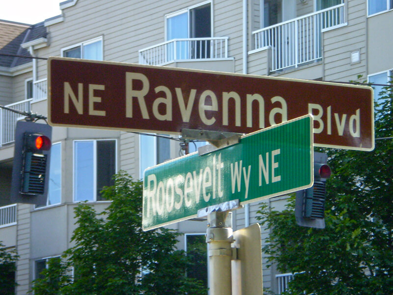
Sign at corner of NE Ravenna Boulevard and Roosevelt Way NE, July 4, 2009
Signs at corner of NE Ravenna Boulevard and Roosevelt Way NE, July 4, 2009. Photograph by Benjamin Lukoff. Copyright © 2009 Benjamin Lukoff. All rights reserved.