S Atlantic Street

As part of the Great Renaming of 1895, Texas Street, Town Street, Fontenelle Street, Flemming Street, Davidson Street, and Canal Street became Atlantic Street, from Elliott Bay to Lake Washington. The name was extended into West Seattle in 1907, when Grant Street and Louisiana Street were combined.

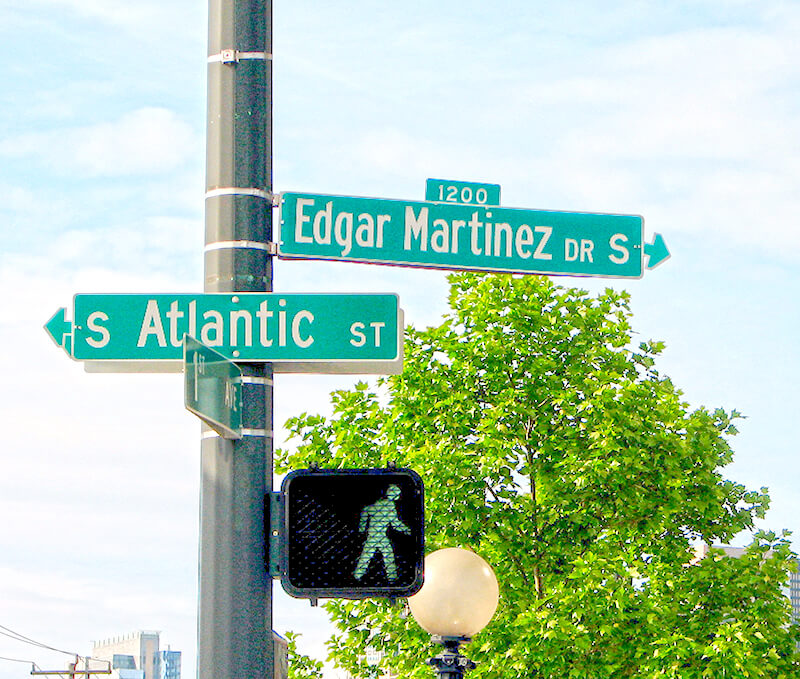
Street sign at 1st Avenue S (incorrectly signed as 1st Avenue), where S Atlantic Street becomes Edgar Martinez Drive S, May 2006
Street sign at 1st Avenue S (incorrectly signed as 1st Avenue), where S Atlantic Street becomes Edgar Martinez Drive S, May 2006. Photograph by Flickr user Dave O, licensed under Creative Commons Attribution-ShareAlike 2.0 Generic

Today, SW Atlantic Street begins in West Seattle at Sunset Avenue SW and goes ¼ of a mile east to Palm Avenue SW. It next appears, as S Atlantic Street, just east of U.S. Coast Guard Base Seattle at Alaskan Way S, and goes around 800 feet east to 1st Avenue S, where it becomes Edgar Martinez Drive S (renamed in honor of the ball player in 2004). Apart from a stub east of Airport Way S that is soon blocked by Interstate 5, the street’s next appearance is on Beacon Hill, where it goes ⅓ of a mile from just west of 11th Avenue S to 17th Avenue S, the portion between 15th Avenue S and 16th Avenue S being a stairway.

After being interrupted for a number of blocks by Interstate 90, S Atlantic Street reappears at 21st Avenue S and goes a block to just east of 22nd Avenue S. (Here, it gives its name to the surrounding Atlantic neighborhood.) It resumes — again having been interrupted by Interstate 90’s Mount Baker Tunnel — at Bradner Place S and goes ⅓ of a mile east to Lake Washington Boulevard S, the portions between 30th Avenue S and 31st Avenue South as well as between 32nd Avenue S and 33rd Avenue S being stairways. The right-of-way begins again at 35th Avenue S and goes around ⅛ of a mile east to Lake Washington, but is either incorporated into adjacent homeowners’ yards or serves as their driveways for most of this distance. Between Lakeside Avenue S and the water, it is one of the city’s shoreline street ends.

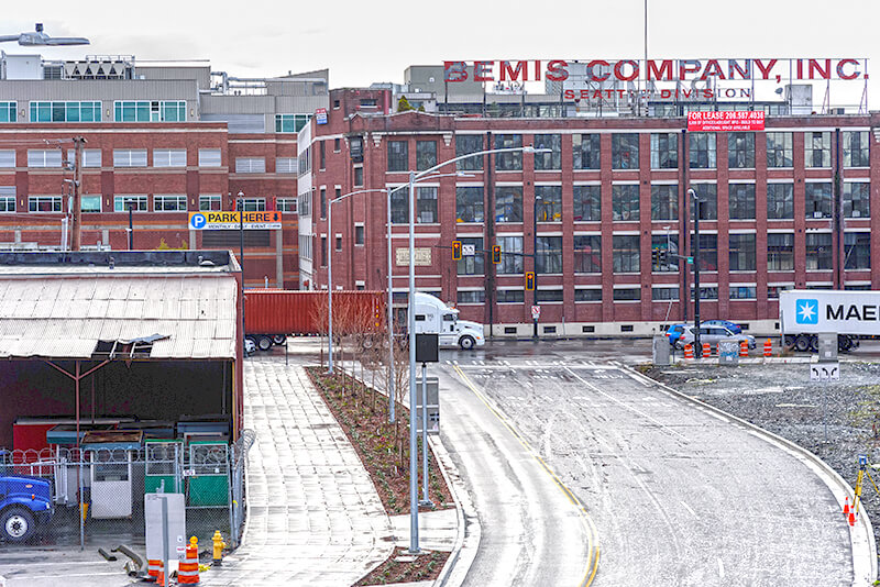
Looking south toward the intersection of Colorado Avenue S and S Atlantic Street, December 2018. The Bemis Building, at 55 S Atlantic Street, housed the local operations of the Bemis Brothers Bag Company from 1905 to 1993.
Looking south toward the intersection of Colorado Avenue S and S Atlantic Street, December 2018. The Bemis Building, at 55 S Atlantic Street, housed the local operations of the Bemis Brothers Bag Company from 1905 to 1993. Renovation began in 1995 and today it houses live/work spaces for artists. Photograph by Flickr user Washington State Department of Transportation, licensed under Creative Commons Attribution-NonCommercial-NoDerivs 2.0 Generic.

S Massachusetts Street

This is another of the many streets created in 1895 as part of the Seattle Tide Lands plat that were named after states, e.g., Utah Avenue SColorado Avenue SS Oregon StreetS Idaho Street, and SW Florida Street.

SW Massachusetts Street begins in West Seattle at the intersection of Bonair Drive SW, 47th Avenue SW, and Sunset Avenue SW, and goes just under ⅓ of a mile east to Palm Avenue SW. It begins again at Ferry Avenue SW and goes just over 450 feet east to Victoria Avenue SW. There is a short segment (just over 400 feet) on Harbor Island east of 13th Avenue SW, and then another one, about the same length, leading from Alaskan Way S to the entrance to U.S. Coast Guard Base Seattle. (Here, the street’s directional designation has changed to S, it being east of the Duwamish Waterway.)

S Massachusetts Street resumes at Colorado Avenue S and goes ⅙ of a mile east to Occidental Avenue S. There is a block-long segment east of 4th Avenue S to just shy of the SODO Busway, and then a longer one — about ¼ of a mile — from the SODO Trail to Airport Avenue S.

East of Interstate 5, on Beacon Hill, S Massachusetts Street begins at 11th Avenue S and goes nearly ¼ of a mile east to just past 15th Avenue S, the portion between 14th Avenue S and 15th Avenue S being pedestrian-only, as the right-of-way between the sidewalks has been turned into the Beacon Bluff P-Patch community garden. It begins again just west of Sturgus Avenue S and goes nearly a mile east to just past 31st Avenue S, the portion that runs for half a block west of 17th Avenue S being a pathway. S Massachusetts Street resumes for the last time at 32nd Avenue S and goes ¼ mile east to Lake Washington, where it is a shoreline street end.

https://www.flickr.com/photos/litlnemo/1354627272
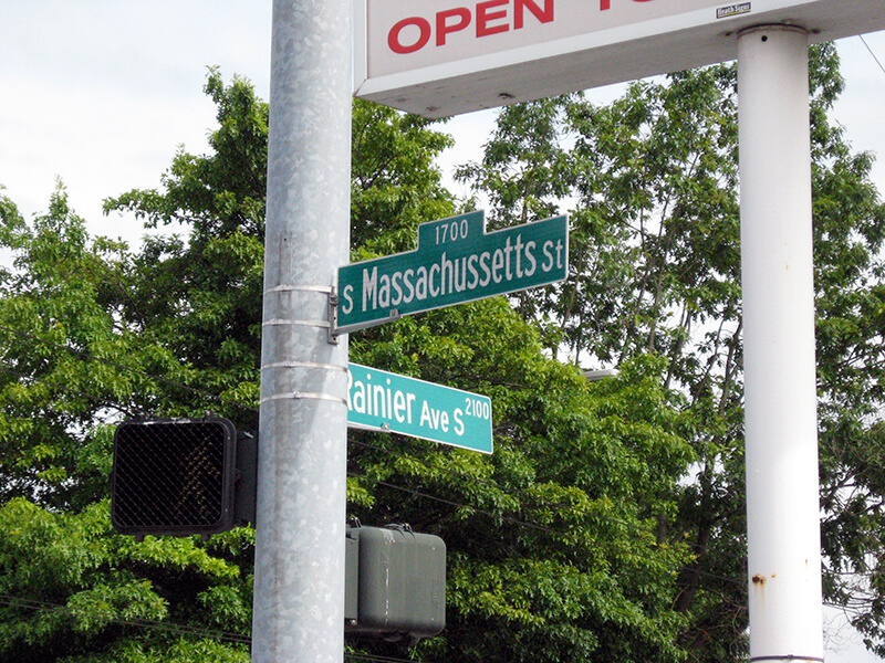
Misspelled street sign at the corner of Rainier Avenue S and S Massachusetts Street, July 2007. Photograph by Flickr user litlnemo (Wendi Dunlap), licensed under Creative Commons Attribution-NonCommercial-ShareAlike 2.0 Generic.

Utah Avenue S

Like Colorado Avenue S, this street was created in 1895 as part of the plat of Seattle’s tide lands. As I wrote in that post,

As Seattle expanded to the south, it became obvious that Commercial Street (1st Avenue S) would not be the westernmost street east of Elliott Bay. Fortunately, instead of using zero or negative numbers, they went with states: the first street west of 1st was named Utah, and the next, Colorado. (Some perpendicular streets were named Alaska, Vermont, Connecticut, Texas, Massachusetts, etc. There doesn’t appear to have been any particular order.)

Utah Avenue S begins at S Atlantic Street and goes 1⅐ miles south to S Hinds Street, the block between S Stacy Street and S Lander Street, in front of the Starbucks Center, being closed to motorized traffic. There is another short segment between Denver Avenue S and S Alaska Street, and a final one that stretches ⅓ of a mile from S Hudson Street to S Findlay Street.

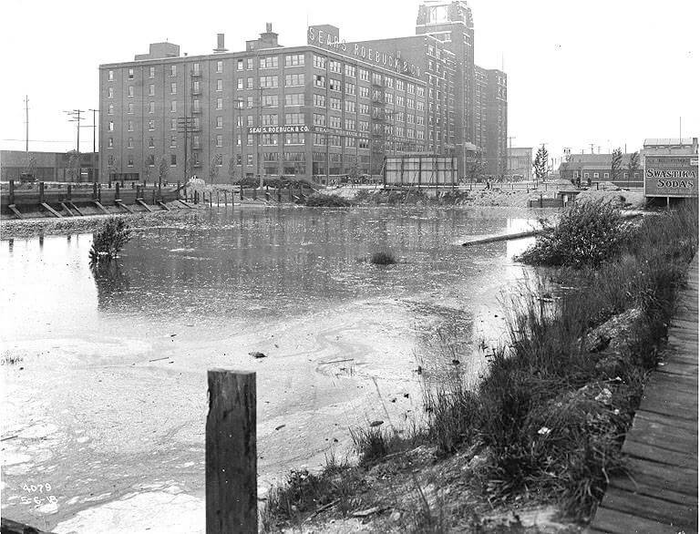
Sears building, 1918
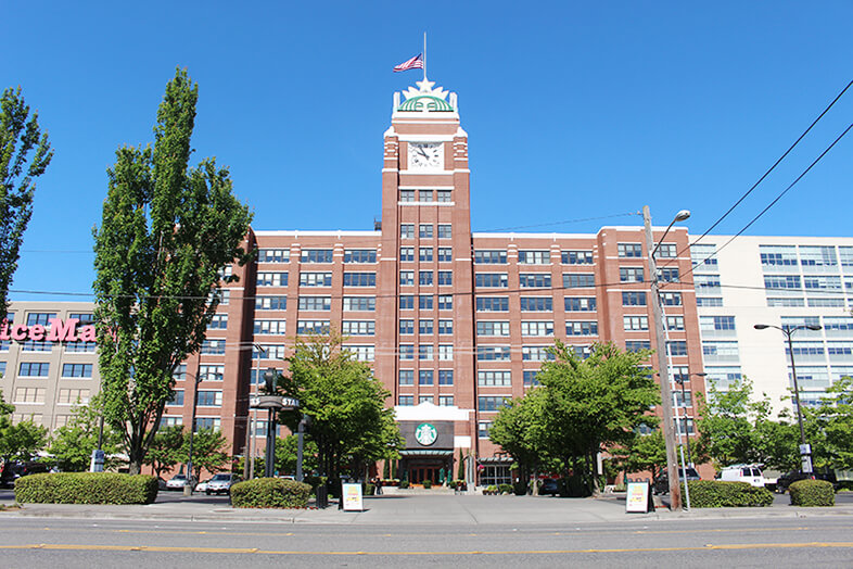
The most famous structure on Utah Avenue S was built between 1912 and 1915 as the West Coast catalog distribution center for Sears, Roebuck and Company. It was once the largest building west of the Mississippi River. This photograph was taken in May 1918.
Starbucks Center, 2016
A Sears retail store opened in the building in 1925. The distribution center closed in 1987; Starbucks made the building its world headquarters in 1997, and the retail store closed in 2014. Photograph by Wikimedia Commons user Coolceasar, licensed under Creative Commons Attribution-ShareAlike 4.0 International

Airport Way S

Airport Way S does not, as one might expect, go from the city to Seattle–Tacoma International Airport (known to locals as Sea–Tac), but rather to King County International Airport (better known as Boeing Field). It got its current name in 1931 at the request of the Georgetown-South Seattle Improvement Club, which, according to an article in the April 12 issue of The Seattle Times,

…asked the City Council to merge portions of Seattle Boulevard, Eighth and Ninth Avenues South and Duwamish Avenue, leading from the central business area to Boeing Field, into a new highway, to be known as Airport Way.… [They contended] that strangers are confused in efforts to find the airport by lack of any specifically designated street leading to it.

Seattle Boulevard originated as

The Beach or River Road… [which] skirted the shore of the bay at the foot of the high Beacon Hill bluff, east of what is now Airport Way, and ran south along the Duwamish.… Built in the early fifties, [it] was a hard road to keep in good condition.… In 1886, a road was built on piling over the mud flats a little west of the Beach Road to avoid the slides and floods. This street became known as the Grant Street Bridge.

Sophie Frye Bass, Pig-Tail Days in Old Seattle

I elaborate in Diagonal Avenue S that

Essentially, there were a series of roads following the semicircular curve of Elliott Bay from Downtown to the Duwamish River before the tideflats were filled in: first Beach Road (or River Road), then the Grant Street Bridge, which in turn became Seattle Boulevard once the fill was complete. Sometime before 1918… the portion of Seattle Boulevard that ran northeast–southwest (the southern third of the semicircle) was renamed Diagonal Avenue. (In 1931, the rest of Seattle Boulevard was renamed Airport Way.)

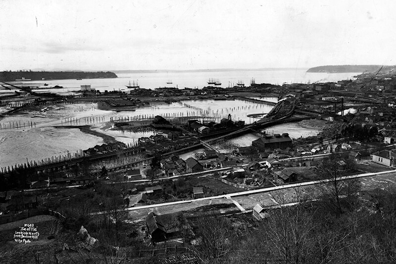
View from Beacon Hill looking northwest over Grant Street Bridge and Elliott Bay tideflats, circa 1900
This photograph, taken circa 1900 by Anders Beer Wilse, looks northwest from Beacon Hill over the Grant Street Bridge and the Elliott Bay tideflats. At upper left is West Seattle; at upper right is Magnolia. From this perspective, Downtown Seattle appears just below Magnolia. Bainbridge Island is in the distance across Puget Sound.

Once Sea–Tac fully opened in 1949, Airport Way S no longer led to the region’s primary airport, which was more directly reached via U.S. 99, but no further name changes took place.

Today, Airport Way S begins at Seattle Boulevard S and 6th Avenue S and goes 6⅗ miles southeast, then south, then southeast again, ending at Boeing Access Road. Its lower 2½ miles parallel the eastern boundary of Boeing Field.

Boeing Field aerial
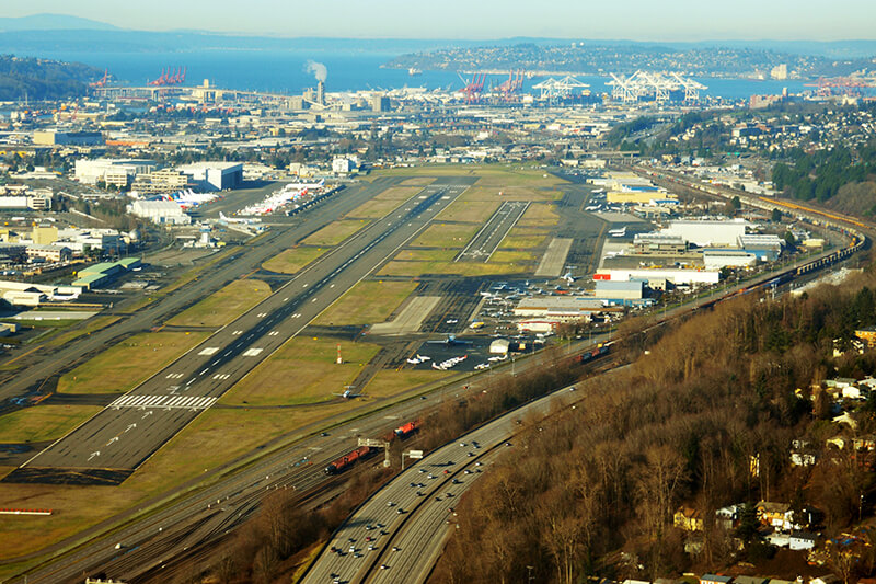
Aerial of Boeing Field, looking northwest, December 2014. In the foreground is Interstate 5; just to the west are the BNSF Railway tracks, then Airport Way S, then Perimeter Road S. Photograph by Wikimedia Commons user Bernstea, licensed under Creative Commons Attribution-Share Alike 4.0 International

Seattle Boulevard S

In 2010, the portion of Airport Way S between 4th Avenue S and 6th Avenue S was renamed Seattle Boulevard S at the request of the adjacent property owners, restoring a name that disappeared from the map in 1931.

As I explain in Diagonal Avenue S,

There were a series of roads following the semicircular curve of Elliott Bay from Downtown to the Duwamish River before the tideflats were filled in: first Beach Road (or River Road), then the Grant Street Bridge, which in turn became Seattle Boulevard once the fill was complete. Sometime before 1918… the portion of Seattle Boulevard that ran northeast–southwest (the southern third of the semicircle) was renamed Diagonal Avenue. (In 1931, the rest of Seattle Boulevard was renamed Airport Way.)

Seattle Boulevard was obviously named for the city, which itself was named after Si’ahl [siʔaɫ], better known in English as Chief Seattle of the Duwamish and Suquamish Tribes.

Since 2010, then, there have been two streets in the city that bear its and siʔaɫ’s name: Seattle Boulevard S and SW Seattle Street.

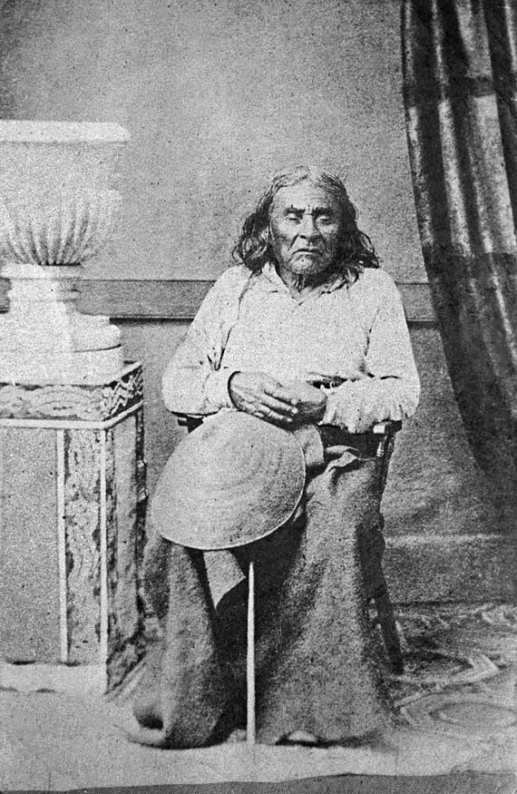
siʔaɫ, or Chief Seattle
The only known photograph of siʔaɫ, or Chief Seattle (1786?–1866), taken by E.M. Sammis in 1864
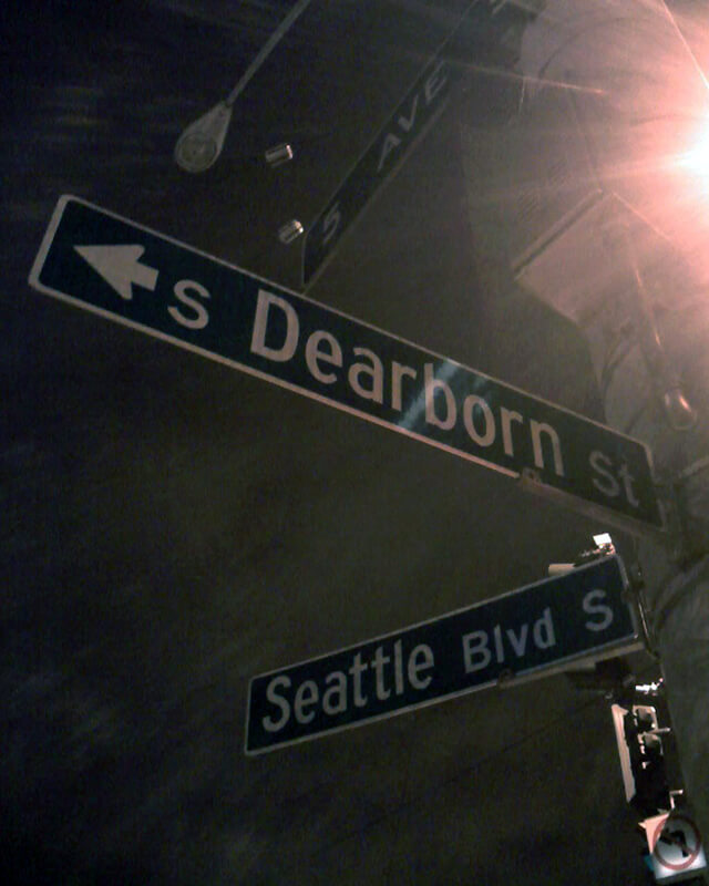
Sign at corner of S Dearborn Street and Seattle Boulevard S, January 30, 2011
Sign at corner of S Dearborn Street and Seattle Boulevard S, January 30, 2011. Photograph by Benjamin Lukoff. Copyright © 2011 Benjamin Lukoff. All rights reserved.

Alaskan Way

Alaskan Way was originally Railroad Avenue. Jennifer Ott writes for HistoryLink.org:

On the central waterfront a web of railroads grew out from the shore in the 1880s and 1890s as various railroads, including the Columbia & Puget Sound, the Seattle, Lake Shore & Eastern, and the Northern Pacific jockeyed for space at the foot of the bluffs that ended at the beach, where Western Avenue is today. In January 1887 the City Council passed an ordinance establishing Railroad Avenue, a street created, according to historian Kurt Armbruster, to provide space for the Seattle, Lake Shore & Eastern franchise to the west of the Northern Pacific’s franchise along the shoreline.

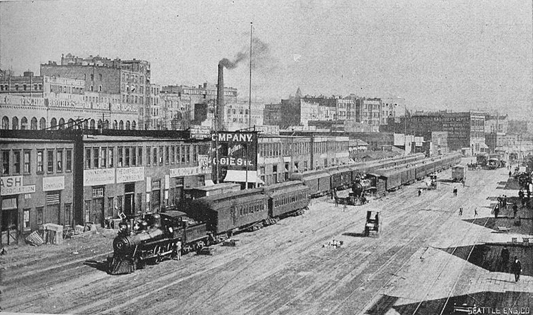
Railroad Avenue looking south from between Madison and Marion Streets, circa 1898

When the tidelands were platted in 1895, Railroad Avenue extended to Harbor Island and West Seattle, but:

  • Sometime between 1912 and 1920 the Harbor Island portion was renamed W Florida Street (SW Florida Street today).
  • In 1907, the West Seattle portion was renamed Alki Avenue.
    • Sometime between 1912 and 1920 the West Seattle portion southeast of Duwamish Head was given its current name, Harbor Avenue.

In an article for Crosscut (now CascadePBS.org), Knute Berger explains why a new name was wanted for the remainder:

Seattle’s waterfront was unpaved — a beat-up plank road ran its length. There was no modern seawall — the street was built over the water. Train tracks were everywhere.… But the waterfront was undergoing a massive renovation. A seawall was being constructed, the shoreline filled in, the road made into a wide, paved boulevard.…

According to Berger and Ott’s articles, names that were proposed but were ultimately rejected included Anchors Way, Artery Way, Battery Way, Bois Boolong, Bread Street, Cargo Way, Chief Seattle Avenue, Cosmos Quay, Dock Street, Export Way, Fleet Way, Gateway Avenue, Golden West Way, Hiak Avenue, Klatawa Avenue, Maritime Avenue, Metropolis Avenue, Olympian Way, Pacific Way, Pier Avenue, Port Strand, Port Way, Port-Haven Drive, Potlatch Avenue, Puget Avenue, Puget Dyke, Puget Portal, Queen City Way, Roadstead Way, Salt Spray Way, Salt Water Avenue, Seawall Avenue, Seven Seas Road, Skookum Way, Steamship Way, Sunset Avenue, Terminal Avenue, Terrebampo Way, The Battery, The Esplanade, Transit Row, Voyage Way, Welcome Way, and Worldways Road. (Those in italics apparently came under serious consideration.)

So how did we end up with Alaskan Way? And why Alaskan instead of Alaska (the already existing S Alaska Street could have been renamed)?

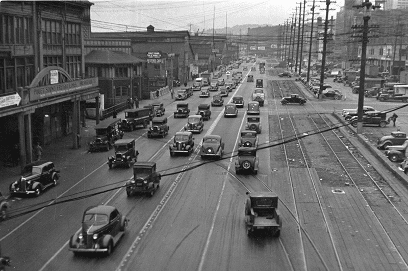
Alaskan Way, July 1939
Alaskan Way between Marion and Madison Streets, Canadian National Dock at left, July 1939. Courtesy of the Seattle Municipal Archives, Identifier 77093

The May 19, 1932, issue of The Seattle Times reports that the Seattle Maritime Association had run a renaming contest which received “more than one thousand letters… some of them contained scores of suggestions.” 4,868 names (including duplications) were received, and the judges selected four finalists, in order of preference: Puget Portal (one submission), Klatawa Avenue (one submission, from Chinook Jargon word meaning ‘to go, to travel’), Hiak Avenue (one submission, from Chinook Jargon word meaning ‘lively, quick and fast’), and Maritime Avenue (49 submissions [Maritime Way received 99 submissions but was not chosen]). The next day, the Times reported that the judges had chosen Maritime Avenue, and awarded the $20 prize to a Mr. B.I. Schwartz, the first to have suggested the name.

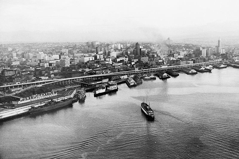
Alaskan Way Viaduct, July 1952
Alaskan Way Viaduct, July 1952, the year before it opened. The double-decker freeway paralleled Alaskan Way as far north as Union Street, where it diverged from the alignment on its approach to Elliott Avenue and the Battery Street Tunnel. Bell Street Pier, with the large Port of Seattle sign, is at left. The Bell Street Overpass can be seen behind the ‘P’ in ‘Port’. The bridge at the southern end of the pier is the Lenora Street Viaduct. Courtesy of the Seattle Municipal Archives, Identifier 43586

However, that July, a George D. Root proposed the name Cosmos Quay. At first, it was met with indifference, and then it seems the entire renaming project was put on the back burner until construction progressed. Somehow, when he restarted his campaign in 1934, Cosmos Quay became a leading candidate, and it was approved unanimously by the city council on January 14, 1935. An ordinance began to be drafted. But, as the Seattle Post-Intelligencer noted the next day, this was only because one councilmember, Frank J. Laube, had been absent… and he was adamantly opposed.

He wasn’t the only one. The Seattle Times published an editorial on January 20 headlined ‘City Locksmith Needed for Pronunciation Key’, which proclaimed that “to burden the waterfront stretch with a name that could be used and understood only through long courses in cosmogony, cosmology, etymology, and articulation would be a sad piece of nonsense for which there is no excuse.” The next day the Times reported that David Levine, city council president, said Cosmos Quay “no longer sounds so good to him. Many citizens have complained its meaning, as well as its pronunciation, mystifies them.” On February 4, according to the P-I, the council killed the ordinance and decided to leave Railroad Avenue as it was.

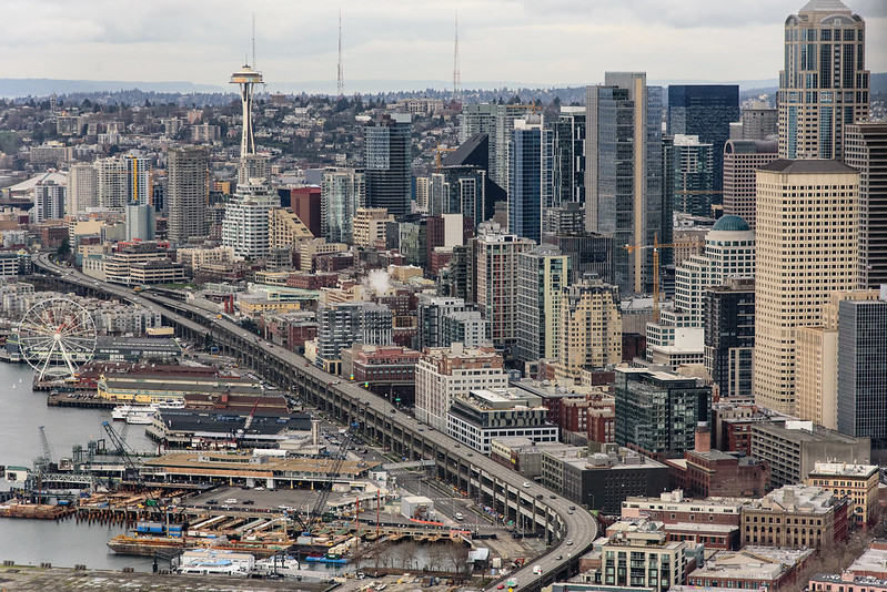
Alaskan Way Viaduct, February 2018
Alaskan Way Viaduct, February 2018. It closed permanently in January 2019; the replacement tunnel opened the next month. and demolition was complete by November of the same year. Photograph by Flickr user Washington State Department of Transportation, licensed under Creative Commons Attribution-NonCommercial-NoDerivs 2.0 Generic

When the new street opened in 1936, the question of renaming came up again. Mayor John F. Dore appointed a committee that chose The Pierway, a suggestion that won a W.C. Denison, Jr., a prize of $50 from the mayor’s own pocket, but the final decision lay with the city council, which was not enthused. Pacific Way emerged as their favorite, according to a Seattle Times article on July 2, 1936, though a July 6 article in the same paper “the public apparently was not in accord with the idea.” On July 7, the Times reported that even though “at least seven votes [were] lined up in advance for the adoption of ‘Pacific Way’… with Council President Austin E. Griffiths contending for ‘Cosmos Quay’ or ‘Cosmos Way’,” an ordinance renaming Railroad Avenue “Alaskan Way” passed unanimously.

Alaska Way had been proposed in 1932 by the Puget Sound Travel Directors, according to an article in the April 13 issue of The Seattle Times. (As an aside, it was also proposed in 1931 by attorney John S. Robinson as an alternate name for Aurora Avenue N and the Aurora Bridge, according to a Times article on June 19.) It was also an entry in the Seattle Maritime Association’s aforementioned naming contest, submitted by Fred E. Pauli, manager of the Alaska Division of the Washington Creamery Company, according to a Times article on April 10, 1932. Then, in 1935, after Cosmos Quay had been rejected by the city council, the Alaska Yukon Pioneers endorsed Alaska Way (The Seattle Times, March 5), followed by the Whittier Heights Improvement Club (Times, March 7) and the Junior Alaska-Yukon Pioneers (Times, July 25). When renaming became a distinct possibility once again in 1936, as discussed above, the Alaska Yukon Pioneers passed a resolution in favor of Alaska Way (Times, July 4): “…It was here that the gold rush activity actually took place… put Seattle on the map and directly made possible the magnificent improvement now about completed.”

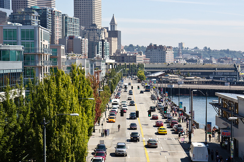
Alaskan Way south from Bell Street
Alaskan Way looking south from the Bell Street pedestrian bridge, August 2011. The Alaskan Way Viaduct is barely visible at center; the Seattle Aquarium is at center right. Photograph by Orange Suede Sofa, Wikimedia Commons, licensed under Creative Commons Attribution-Share Alike 3.0 Unported

It came down to one councilmember, apparently. The Seattle Post-Intelligencer reported on July 7 that, the previous day, Robert H. Harlin proposed that the already-prepared ordinance renaming Railroad Avenue “Pacific Way” be amended to read “Alaskan Way” instead:

Councilman Robert H. Harlin, who offered the motion for adoption of “Alaskan Way,” said he preferred it to “Alaska Way” because it “recognizes the human element, honoring the men and women who pioneered the territory.” Although a majority of the council had informally agreed to support the name “Pacific Way,” sentiment crystallized rapidly in favor of “Alaskan Way” after Harlin’s statement.

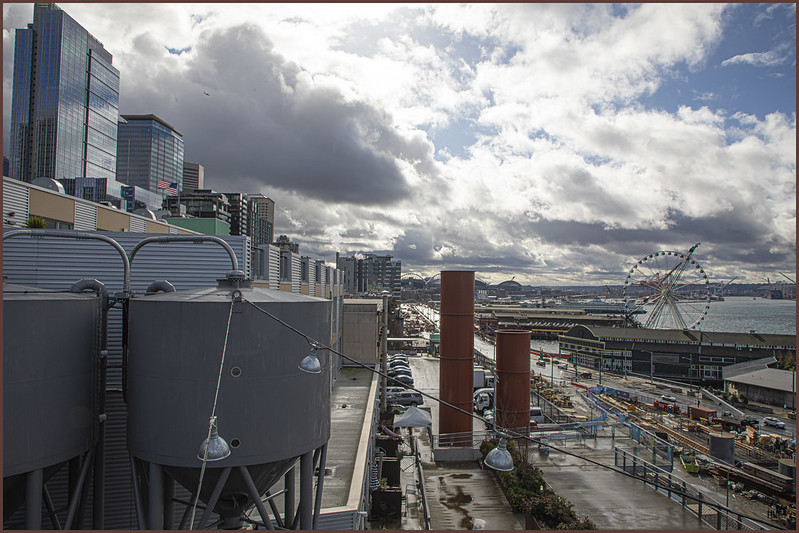
Alaskan Way, March 2021
Alaskan Way from the Pike Place Market’s MarketFront, March 2021. Construction of the street that wasn’t going to be called Elliott Way — but now, as of early 2023, will be — is visible at center right. The Seattle Great Wheel can be seen above the Seattle Aquarium. Photograph by Flickr user Scott Smithson, licensed under Creative Commons Attribution-NonCommercial-NoDerivs 2.0 Generic

Today, Alaskan Way S begins at the north end of E Marginal Way S, at the entrance to the Port of Seattle’s Terminal 30, and goes 2⅓ miles north, then northwest, to Broad Street, having become Alaskan Way on crossing Yesler Way. This is the Alaskan Way most people think of.

But, as they say, wait — there’s more! The right-of-way continues for another 1¾ miles, ending at W Garfield Street under the Magnolia Bridge, at the entrance to the Port of Seattle’s Terminal 91. From the Olympic Sculpture Park, which begins at Broad Street, to Myrtle Edwards Park, the right-of-way is taken up by park land and the tracks of the BNSF Railway — successor to the Columbia & Puget Sound; the Seattle, Lake Shore & Eastern; and the Northern Pacific, the railroads for which Railroad Avenue was originally built. Northwest of Myrtle Edwards, it’s entirely taken up by the tracks that run alongside Centennial Park. It isn’t until W Galer Street that there’s a city street in the right-of-way again, and Alaskan Way W only goes about ⅙ of a mile northwest from there to W Garfield Street. Even less than that is signed Alaskan Way, as the city has put up a sign for Expedia Group Way W where the W Galer Street flyover “touches down.” However, even though southeast of Galer the roadway runs first on Expedia property, then Port of Seattle property, the city appears to still consider it Alaskan Way W between the Expedia campus entrance and the north end of Centennial Park — a distance of just over ⅓ of a mile.

Colorado Avenue S

This street was created in 1895 as part of the plat of Seattle’s tide lands. As Seattle expanded to the south, it became obvious that Commercial Street (1st Avenue S) would not be the westernmost street east of Elliott Bay. Fortunately, instead of using zero or negative numbers, they went with states: the first street west of 1st was named Utah, and the next, Colorado. (Some perpendicular streets were named Alaska, Vermont, Connecticut, Texas, Massachusetts, etc. There doesn’t appear to have been any particular order.)

Colorado Avenue S begins at S Royal Brougham Way and goes ⅓ of a mile south to S Massachusetts Street. It begins again on the back side of the Starbucks Center and goes ⅘ of a mile to just south of S Spokane Street, and its final segment begins just north of Diagonal Avenue S and goes ⅔ of a mile to S Dawson Street.

S Stacy Street

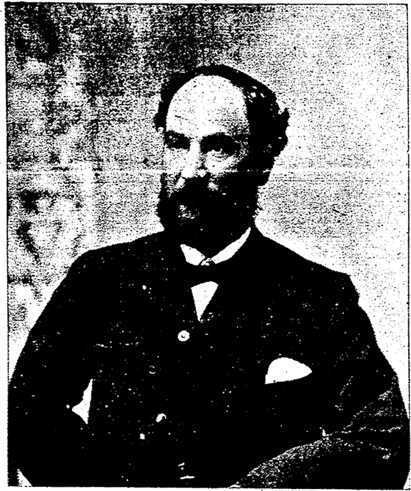
This street is named for Martin Van Buren Stacy (1837–1901), who, according to local historian Paul Dorpat, “brought an inherited wealth to the cash-poor West and bought Seattle land” (and land elsewhere in Western Washington as well). The Northern Pacific Railway’s Stacy Street Yard was named for the street, but was renamed the Seattle International Gateway by Burlington Northern in 1985. His death at Green River Hot Springs apparently came as a shock to many.

Martin Van Buren Stacy, from his obituary in the April 18, 1901 Seattle Post-Intelligencer
Martin Van Buren Stacy, from his obituary in the April 18, 1901, Seattle Post-Intelligencer. He had died at Green River Hot Springs the previous week of “apoplexy.”

S Stacy Street begins at Airport Way S and goes ⅕ of a mile west to 6th Avenue S. There is a block-long segment between 4th Avenue S and 3rd Avenue S, and then on the other side of the former Stacy Yard a two-block–long segment from Occidental Avenue S to Utah Avenue S and the world headquarters of Starbucks.

S Horton Street

I have read that, and until recently assumed that, S Horton Street is named for Dexter Horton (1825–1904), but have come to wonder if it instead is named for Julius, his younger brother (1834–1904), or for the Horton family in general. Julius came to Seattle in 1869, bought land in South Seattle in 1871, and platted Georgetown in 1890, naming it after his son, George (1865–1927), who had recently become a doctor. (Georgetown became a city in 1904 and was annexed by Seattle in 1910.) S Horton Street doesn’t run through Georgetown — it’s around 2 miles north of there — but it does run through South Seattle. It appears to have been named in 1870, after Julius arrived in town but before he bought what is now Georgetown. I am not sure if Dexter had any special connection to South Seattle; he certainly never lived there.

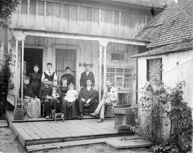
Julius Horton family circa 1890
Julius Horton and family, circa 1890. Back row, left to right: Dora Estelle (Horton) Carle, Mabel Maude (Horton) Edlund, Flora Groover, Elmer Petigoe. Front row, left to right: May Bigelow Boucher, Julius Horton, Howard Dexter Horton, Anna Emily (Bigelow) Horton, Vera Horton Hudson, George Monroe Horton, and Harry Bateman.

S Horton Street begins at E Marginal Way S and goes ⅔ of a mile east to 6th Avenue S, with a brief interruption at the SODO Busway. After a block-long segment between Airport Way S and 10th Avenue S just west of Interstate 5, it resumes on Beacon Hill at 13th Avenue S, where it goes one block east. It begins again at 16th Avenue S and goes ⅖ of a mile to 23rd Avenue S, being a stairway and pathway from just east of 19th Avenue S to 20th Avenue S. Horton resumes east of Kimball Elementary School at 24th Avenue S and goes a block and a half before it ends at the Cheasty Natural Area. Besides a very short segment just west of Martin Luther King Jr. Way S, its next appearance is at 33rd Avenue S and S Walden Street. From here, it goes ½ a mile east to Lake Washington Boulevard S, being a stairway between 36th Avenue S and 37th Place S and a stairway and pathway between Cascadia Avenue S and Sierra Drive S. Between Sierra Drive S and Lake Washington Boulevard S, it is part of Landing Parkway, under the jurisdiction of the parks department.

S Lander Street

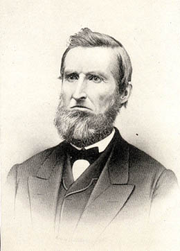
I initially posted that this street was named for Judge Edward Lander (1816–1907), chief justice of the territorial supreme court from 1853 to 1857. In 1855, he, along with Charles Terry, bought Carson Boren’s downtown land claim for $500. They subsequently donated two acres of land, along with Arthur Denny, who donated eight, to form the first campus of the University of Washington, which opened in 1861. The university owns the Metropolitan Tract to this day, though it moved to its present location in 1895. Lander’s name also appears on Lander Hall, a UW dormitory on NE Campus Parkway.

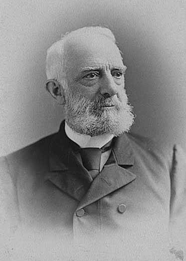
Edward Lander
Edward Lander

However, I recently (April 2022) came across “What’s in a Name?,” a paper by Phillip H. Hoffman, director of the Alki History Project, in which he asserts that the correct namesake is Edward Lander’s brother, Frederick William Lander (1821–1862). I find his argument compelling. The street was named by Edward Hanford (S Hanford Street) when he filed the plat of Hanford’s Addition to South Seattle in 1869. Hanford also named streets for George McClellan and Isaac Stevens. All three men — McClellan, Stevens, and Frederick Lander — were part of the Northern Pacific Railroad Survey (1853–1855), and all three were likewise Union generals in the Civil War. Besides this,

Edward Lander was a political foe of and was jailed by Stevens [then governor of Washington Territory] when Lander opposed Stevens’ 1855 martial law declaration and actions. Stevens and Edward Lander maintained a widely recognized lifelong enmity. It is unlikely that Hanford would have memorialized this hostility.

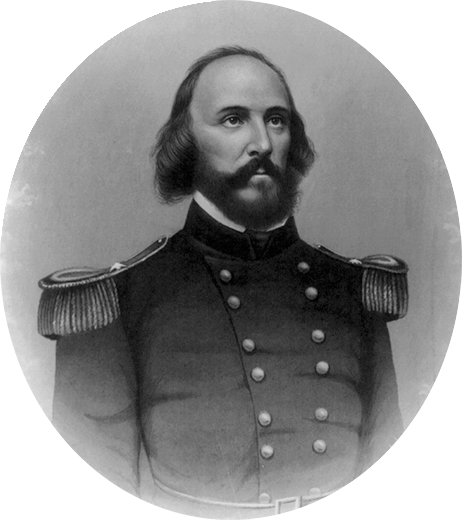
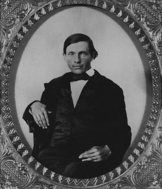
Frederick William Lander
Frederick W. Lander

SW Lander Street begins at 59th Avenue SW in the Alki neighborhood of West Seattle, and goes ⅕ of a mile to 55th Avenue SW. It resumes just to the south at S Lander Place and goes a further ⅛ of a mile to SW Admiral Way. Picking up again at 50th Avenue SW, it makes it ½ a mile to Walnut Avenue SW before being interrupted again, as happens to so many West Seattle streets because of the varying topography. There is a final ¼-mile stretch in West Seattle from 39th Avenue SW to 36th Avenue SW, then a very short segment on Harbor Island before S Lander Street resumes in the Industrial District at Colorado Avenue S and goes ¾ of a mile east to Airport Way S. On Beacon Hill, Lander begins just west of 13th Avenue S and goes ⅔ of a mile to just past 23rd Avenue S, including the block-long stretch that is now known as S Roberto Maestas Festival Street. Lander begins again at 30th Avenue S in Mount Baker and goes a final four blocks to 34th Avenue S.

S Hanford Street

This street is named for Edward Hanford (1807–1884) and his wife, Abigail Jane Holgate (1824–1905), who left Iowa in the early 1850s to settle adjacent to Abigail’s brother, John (namesake of S Holgate Street), on what is today known as Beacon Hill but was known from then until the early 1890s as Holgate and Hanford Hill. Edward and his family were loggers, then orchardists, and unlike John Holgate, he went on to develop his donation claim.

The Hanfords’ son Clarence (1857–1920) founded, with James D. Lowman, the Lowman & Hanford Stationery and Printing Company in 1885. The firm went out of business in the 1960s, but their Pioneer Square building still, the last time I drove by, had a sign painted on it reading “Seattle’s Oldest Retail Company,” which it very well might have been when it closed. Their son Thaddeus (1847–1892) was for a time the owner of the Daily Intelligencer newspaper, predecessor of the Seattle Post-Intelligencer. And their son Cornelius (1849–1926), a federal judge from 1890 to 1912, was earlier a territorial legislator, Seattle city attorney, and chief justice of the Washington Supreme Court. He is the namesake of Hanford, Washington, and by extension the Hanford Site, which produced the plutonium used in the first nuclear explosion and the bombing of Nagasaki. He was also the author of Seattle and Environs, 1852-1924.

Edward Hanford
Edward Hanford

SW Hanford Street begins in West Seattle at SW Admiral Way and 59th Avenue SW and goes ¼ mile east to Schmitz Preserve Park at 56th Avenue SW. It begins again at 51st Avenue SW and goes nearly a mile east to 36th Avenue SW, becoming a stairway for the half-block east of 46th Avenue SW. After serving as little more than a driveway between SW Admiral Way and Fauntleroy Avenue SW, it next appears as S Hanford Street at E Marginal Way S, where it goes for ⅓ of a mile east to Occidental Avenue S. After a few short segments farther east in the Industrial District, Hanford begins again on Beacon Hill at 12th Avenue S and goes nearly a mile east to Rainier Avenue S, the segment between 25th Avenue S and Morse Avenue S being a stairway. It resumes a few blocks east at 30th Avenue S and finishes up ½ a mile east at Cascadia Avenue S.

S Holgate Street

This street is named for John Cornelius Holgate (1828–1868). Born in Ohio, he took the Oregon Trail west in 1847 and explored Elliott Bay and the Duwamish River by canoe in the summer of 1850. (The Seattle Times calls him “the first non-Indian of record to have done so.”) He returned to Oregon afterwards, however, and did not settle in what is now Seattle — specifically, Beacon Hill — until 1853, two years after the Denny Party landed at Alki Point. His mother, Elizabeth; brothers, Lemuel and Milton; and sister, Abigail, along with her husband, Edward Hanford (namesakes of S Hanford Street), soon followed. The Hanfords settled on the hill — known thereafter as Holgate and Hanford Hill until the late 1880s — adjacent to Holgate. (Milton was one of three whites to die in the Battle of Seattle in 1856, and was himself the cause of one of those deaths, having earlier shot Jack Drew, a deserting sailor from the USS Decatur, in a “friendly-fire” incident.)

A gold prospector, Holgate left for Idaho in 1863, and died there in 1868, the first casualty of the War Under the Mountain, a conflict between two rival gold mines in the Owyhee Desert, one of which he was part owner. According to Robert L. Deen, writing for True West magazine, there are conflicting accounts of Holgates death. The Owyhee Avalanche reported that:

Desperate fighting ensued during the charge…. John C. Holgate… one of the foremost in the advance, was shot in the head, and must have died instantaneously.

The Idaho Tri-Weekly Statesman had a slightly different story:

It appears that J.C. Holgate has been killed, some say assassinated, murdered — not killed in a fight, but shot through the head without provocation.

SW Holgate Street begins in West Seattle just west of 47th Avenue SW and goes ¼ of a mile east to California Avenue SW at Palm Avenue SW. There are two more short segments on the peninsula, between 41st Avenue SW and Arch Avenue SW and between Victoria Avenue SW and Brook Avenue SW. S Holgate Street resumes at Utah Avenue S and goes ¾ of a mile east to an overpass over Interstate 5, where it becomes Beacon Avenue S. There is a one-block stretch between 12th Avenue S and 13th Avenue S on top of the hill, and then Holgate goes a mile from the Beacon Hill Playfield at 14th Avenue S to 31st Avenue S at Colman Park, the half-block east of 16th Avenue S being a stairway and the block between 28th Avenue S and 29th Avenue S being unimproved. There is finally a short stretch east of Lakeside Avenue S at 36th Avenue S that essentially serves as a private driveway; it is a shoreline street end, but one not yet accessible to the public.

S Royal Brougham Way

This street begins at Colorado Avenue S in the west, at an onramp to the northbound lanes of the State Route 99 tunnel, and goes ⅔ of a mile east to Airport Way S. Originally S Connecticut Street, it was renamed in 1979 in honor of sportswriter Royal Brougham (1894–1978), who worked for the Seattle Post-Intelligencer newspaper from 1910 until his death. Such a name change was formally proposed by city councilman George Benson following a suggestion by P-I columnist Emmett Watson. Originally it was to be Occidental Avenue S whose name was to be changed, then the 2nd Avenue S Extension when objections were raised. Finally S Connecticut Street was settled upon; it was thought to be particularly appropriate because he “worked so hard to see the Kingdome built… and eventually spent his last day on earth there.”

Lumen Field, built on the former Kingdome site, is on the north side of Royal Brougham between 1st Avenue S and 4th Avenue S; and T-Mobile Park is on the south side between 1st Avenue S and 3rd Avenue S.

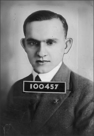
Royal Brougham's ID card for the Seattle Post-Intelligencer newspaper, 1925
Royal Brougham’s Seattle P-I staff ID card, 1925

Edgar Martinez Drive S

This street runs ¼ mile from 1st Avenue S in the west to 4th Avenue S in the east. West of 1st, it’s S Atlantic Street — its original name — and east of 4th, it’s the beginning of Interstate 90. It is part of State Route 519, a short highway that connects I-90 to Washington State Ferries’ Colman Dock.

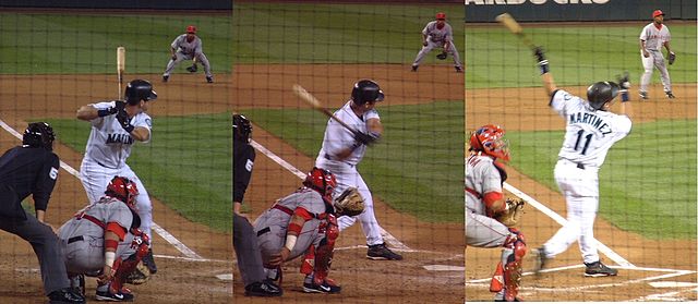
Edgar Martínez was a member of the Seattle Mariners baseball team from 1987 to 2004. This stretch of S Atlantic Street was renamed in his honor the year he retired.

Edgar Martínez at bat, September 15, 2004, licensed under Creative Commons Attribution-Share Alike 3.0 Unported license. https://commons.wikimedia.org/wiki/File:E_Martinez.jpg
Edgar Martínez at bat, September 15, 2004. Photographs by Galaksiafervojo, Wikimedia Commons, licensed under  Creative Commons Attribution-Share Alike 3.0 Unported

Now — why is it Edgar Martinez Drive S instead of S Edgar Martinez Drive, since east–west streets in Seattle have their directional designators at the beginning? I asked Paul Jackson this in 2005. Jackson, who was then the Seattle Department of Transportation’s manager of traffic, signs, and markings, responded:

I appreciate your desire to see our City’s sign system remain consistent.… But ultimately, there is nothing requiring such a naming convention in the Seattle Municipal Code.… In this case, those proposing the street name change wanted to see Edgar Martínez’s name out front. Because this is only a three-block stretch of street (from 1st Avenue S to 4th Avenue S), and does not have any addresses along it, the decision was made to veer slightly from the typical naming convention. The term “drive” was agreed upon to evoke Mr. Martínez’s batting skills at the plate.

Occidental Avenue S

Occidental Avenue S, which begins at Yesler Way in Pioneer Square, is one of those Seattle streets whose names extend into the suburbs. It makes its southernmost appearance at S 197th Street in Des Moines.

It received its name in 1895 as part of the Great Renaming — it had originally been S Second Street. It once had a partner, Oriental Avenue, to the east (originally S Fourth Street), which is today 3rd Avenue S. “Oriental,” of course, means “Eastern,” as “Occidental” means “Western.” (I haven’t been able to determine just when Oriental Avenue became 3rd, but it was last mentioned in The Seattle Times on October 17, 1920.)

And why this particular pairing? The Occidental Hotel, which once overlooked the beginning of Occidental Avenue, is almost certainly the reason, but it’s not spelled out in the ordinance.