Aloha Street

I haven’t posted in two weeks because I recently had the good fortune to visit, and the sad duty to return from, Maui, “the Valley Isle,” second largest of the Hawaiian Islands. That made me think, as I posted about S Spokane Street after traveling there last December, it would be appropriate to post about Aloha Street today.

Napili Bay, Maui, Hawaii
One of my favorite places on Maui is the Napili Kai Beach Resort, located in Napili-Honokowai, on Napili Bay. Photograph taken August 2018 by Flickr user dronepicr, licensed under Creative Commons Attribution 2.0 Generic.
Keawakapu Beach, Maui, Hawaii
A new favorite from this most recent trip to Maui is Keawakapu Beach in south Kihei. Photograph taken January 2018 by Flickr user Jim Mullhaupt, licensed under Creative Commons Attribution-NonCommercial-NoDerivs 2.0 Generic.

Four and a half years ago, local historian Valarie Bunn wrote a post on her Wedgwood in Seattle History blog called “Searching for the Origin of Seattle Street Names.” It begins “There is no resource list of the meanings of Seattle’s street names or how the street names were derived,” and that was certainly true at the time. (One reason I started Writes of Way the next year was to eventually provide such a list — and now I rate a mention at the end of her article!) She continues:

Some street names are apparent in their derivation when honoring an early settler, such as Denny Way for the original homestead claim property of David Denny (Arthur’s younger brother) and Mercer Street for Thomas Mercer, an early, influential settler of Seattle. But for some other street names, such as Aloha Street, we may feel bewildered as we wonder, what is “Aloha” for?

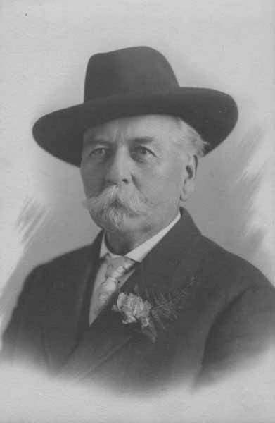
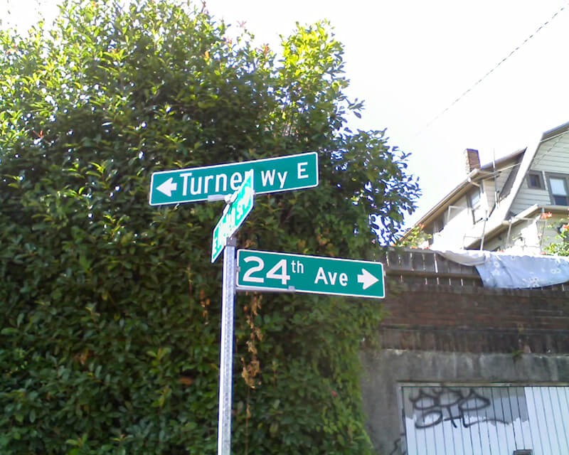
She goes on to give a tutorial in trying to determine street name origins. She first notes that the street name was extended beyond Lower Queen Anne as part of the Great Renaming of 1895, and that its first appearance was as part of the 1875 plat of D.T. Denny’s Second Addition to North Seattle (as this part of South Lake Union then was). David Thomas Denny (1832–1903) and Louisa Boren Denny (1827–1916) were members of the Denny Party, who landed at Alki Point in 1851 and are considered the founders of modern Seattle. Here, though, the trail ends, as

The Dennys’ plat map of 1875 does not tell us why David and Louisa Denny chose the street names that they did, including “Aloha.”

But, she continues,

From earliest days, the Dennys knew that lumber was being shipped out from Seattle to San Francisco and as far as Hawaii, so our best guess is that they chose the word “Aloha” as a reference to Seattle’s trade connections.

Not as definitive an answer as the one she goes on to give for Cleopatra Place NW, but a pretty good one nevertheless, and one I can’t improve upon.

Note: On September 5, my friend, local historian Rob Ketcherside, did a bit of a dive into the matter. He began thus —

Tweet from Rob Ketcherside reading "Curious, I went to Chronicling America and searched for Seattle in Hawaiian papers. First hit was May 27, 1854!  There are a handful of mentions that year of the ships NILE and LUIKA from the port of Rose traveling to Seattle and Puget Sound. Oct 21 mentions NILE with lumber."

— and came to this conclusion:

Tweets by Rob Ketcherside reading "I'm done exploring the early Seattle and Hawaii trade, and now looking at the naming by D T Denny. In your article you link to the 1889 supplemental plat. Here's the original 1875 plat. I wanted the exact day: July 31, 1875" and "My guess: Due to King Kalakaua's visit to SF+DC in early 1875. US-Hawaii treaty Jan 1875 created the sugar trade and allowed US Navy to use Pearl Harbor. Kalakaua 2nd king elected after death of Kamehameha V. Slogan "Hawaii for Hawaiians" (4/10/75 Wa Standard here)"

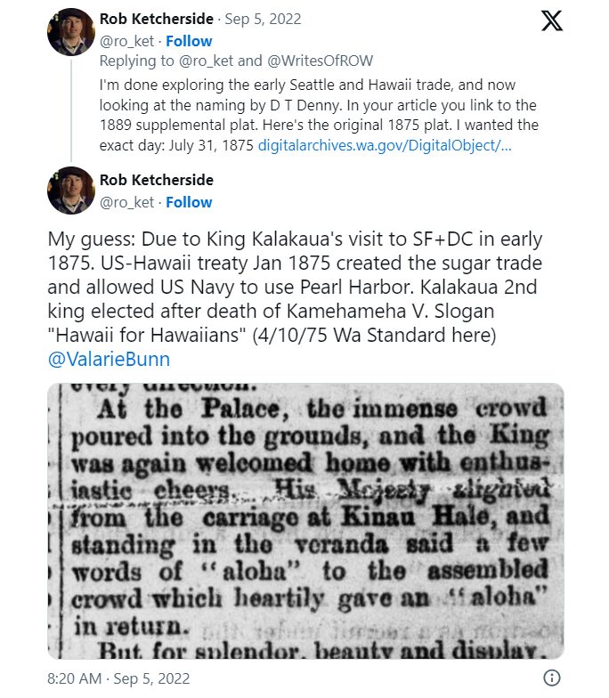
I had come across the Reciprocity Treaty when trying to find any connection between Seattle and Hawaii in 1875, but

Tweet by me reading "I’d seen that… but wasn’t sure it would have notable enough to the Dennys to inspire a street naming. But perhaps it was! Any idea why Aloha instead of Hawaii?" followed by tweet by Rob Ketcherside reading "Maybe we if we consider the other streets in the 1st and 2nd add we can understand D T Denny's influences? Fountain Street became Ward in 1903. Filbert and Morse became Valley in 1895. Together we have Filbert, Morse, Fountain, and Aloha."

So there, for now, the matter lies.

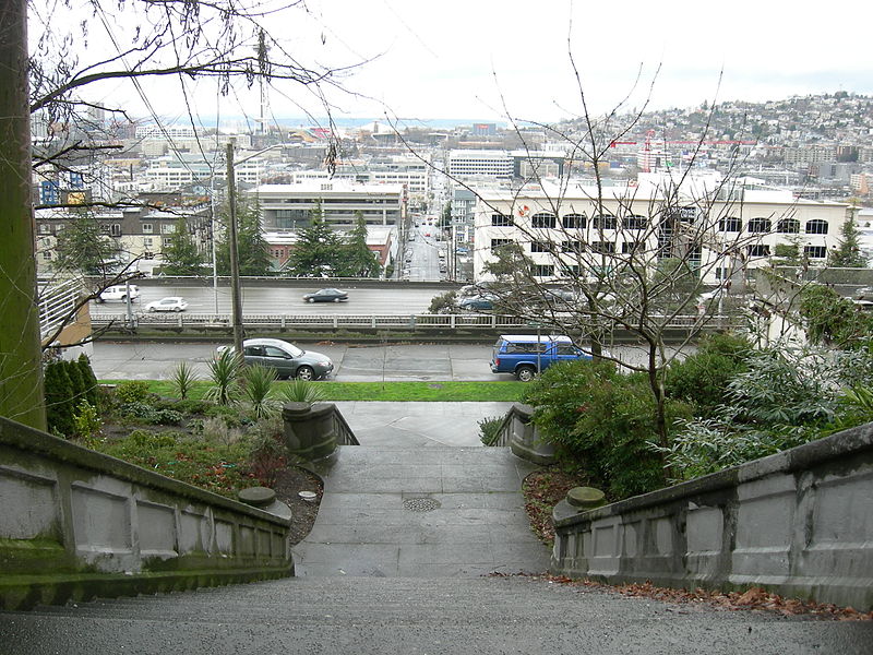
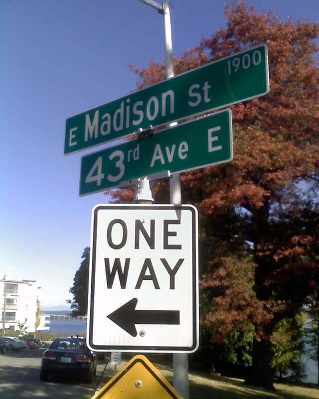
Note added August 13, 2023: The devastating Lāhainā wildfire made me want to re-read this article, and I realized I neglected to discuss the route Aloha Street takes through Seattle. It begins at 1st Avenue W as W Aloha Street, and becomes Aloha Street a block to the east as it crosses Queen Anne Avenue N. From there, it goes ¾ of a mile east to Westlake Avenue N, where it is interrupted by Lake Union. It resumes at Fairview Avenue N and goes ⅙ of a mile east through the Fred Hutch Cancer Center campus to Eastlake Avenue E. On the other side of Interstate 5, it picks up again at Boylston Avenue E and goes an uninterrupted 1⅓ miles east to its end at the intersection of 29th Avenue E and E Ward Street at the west end of the Washington Park Playfield.

Note: On August 20, 2024, I finished converting embedded tweets on this website to screenshots because of issues with how they were integrating with WordPress, which began not too long after Elon Musk purchased Twitter and changed its name to X

E Crescent Drive

This street, created in 1905 as part of the plat of Interlaken, is so named because of its shape. Beginning at the intersection of Interlaken Drive E, 19th Avenue E, and E Galer Street, it goes nearly ⅓ of a mile northeast, then east, then southeast, to the intersection of 24th Avenue E and E Galer Street.

E Olin Place

This street was created in 1925 as part of the O.W. Harris Addition, filed by Olin Whitney Harris (a car dealer) and his wife, Lily Georgine Robson Harris. (Their son, Whitney Robson Harris, a University of Washington graduate, was one of the prosecutors at the Nuremberg Trials as an aide to Robert H. Jackson, chief prosecutor and associate justice of the U.S. Supreme Court. Harris was the last Nuremberg prosecutor to die, in 2010. The Whitney R. Harris World Ecology Center at the University of Missouri–St. Louis and the Whitney R. Harris World Law Institute at the Washington University in St. Louis School of Law are named in his honor.)

E Olin Place, which is shaped like a 7, begins at 15th Avenue E north of E Garfield Street and heads 1⁄10 of a mile northeast, then west, to 15th Avenue E south of E Howe Street. Louisa Boren Park is to its east, and features a grand view of Montlake, Union Bay, Laurelhurst, Lake Washington, the Eastside, and the Cascade mountains.

View of Union Bay and Lake Washington from Louisa Boren Park, March 2013
View of Union Bay and Lake Washington from Louisa Boren Park, March 2013. Photograph by Orange Suede Sofa, Wikimedia Commons, licensed under Creative Commons Attribution-ShareAlike 3.0 Unported

Denny Way

This street is named for David Thomas Denny (1832–1903). He was one of the members of the Denny Party that landed at Alki Point in 1851, led by his older brother, Arthur Armstrong Denny (1822–1899). In 1853, he married his sister-in-law, Louisa Boren (1827–1916). (Louisa’s older sister, Mary Ann Boren [1822–1910], had married Arthur in 1843. She, Louisa, and their brother, Carson Dobbins Boren [1824–1912], were also part of the Denny Party).

The Dennys settled on land in what is now Lower Queen Anne, living in a series of houses in the area until they went bankrupt in the Panic of 1893 and had to leave their mansion for their summer cottage at Licton Springs, where they lived with their oldest child, Emily Inez Denny (1853–1918), until they died.

Denny Park is named for the couple, which had given the land to the city as its first cemetery in 1861; the bodies were moved to the Washelli Cemetery on Capitol Hill in the 1880s, at which time the original cemetery was converted to a park, likewise the city’s first. (Just a few years later, Washelli was also converted to a park, initially known as Lake View Park, then City Park, and finally, in 1901, Volunteer Park. The Dennys’ private burial ground near the no-longer-existent Oak Lake eventually became the Oaklake Cemetery, which, after being sold by their son Victor in 1914, was renamed Washelli after the original cemetery of that name; Evergreen Cemetery, across Aurora Avenue N from Washelli, bought the latter in 1922, and the combined cemetery took its current name, Evergreen Washelli, in 1962.)

David Denny was active in government. According to HistoryLink.org, he was:

…Probate judge, King County commissioner, Seattle City Council member, a director of the Seattle School District, and regent of the Territorial University of Washington.… Denny was an ardent advocate of woman suffrage and helped lead the movement that in the 1880s won Washington women the right to vote. He opposed the expulsion of Chinese immigrants in 1886, which antagonized local nativists.

Denny was also involved in the development of a number of Seattle neighborhoods; in addition to Queen Anne, he developed tracts in South Lake Union, Capitol Hill, and Ravenna, and founded the Rainier Power and Railway Company, which ran the first streetcar from Downtown (Pioneer Square) to the University District (Ravenna Park).

David T. Denny, 1890
David T. Denny, 1890. Courtesy of the Seattle Municipal Archives, Identifier 175313.

Denny Way — originally named Depot Street by Denny after a proposed train station that never materialized — begins as a shoreline street end on Elliott Bay, indistinguishable from the surrounding Myrtle Edwards Park. On the other side of the BNSF Railway tracks, W Denny Way begins as a pathway and stairway from Elliott Avenue to Western Avenue. From here, it is a major arterial, becoming Denny Way as it crosses Queen Anne Avenue N (originally named Temperance Street by Denny), and going 2½ miles east to E Madison Street and 22nd Avenue. (It becomes a neighborhood street on crossing E Olive Way, and the block between Broadway and 10th Avenue E was renamed E Barbara Bailey Way in 2019). E Denny Way begins again at E Madison Street and 23rd Avenue and goes ⅘ of a mile east to Madrona Place E and 38th Avenue, where it turns into Madrona Drive.

Denny Way, which becomes E Denny Way east of Eastlake Avenue E, also divides five of the city’s directional designation zones from each other, similarly to Yesler Way. North of Denny but west of Queen Anne Avenue N, east–west streets carry the W prefix and north–south avenues carry the suffix W. North of Denny between Queen Anne Avenue N and Eastlake Avenue E, east–west streets carry no prefix and north–south avenues carry the suffix N. North of Denny east of Eastlake Avenue E, east–west streets carry the E prefix and north–south avenues carry the suffix E. South of Denny but west of a line that includes Melrose Avenue, Minor Avenue, E Union Street, and Broadway, neither east–west streets nor north–south avenues carry a prefix or suffix. And south of Denny but east of that line, east–west streets carry the E prefix and north–south avenues carry no suffix.

Signs at corner of 34th Avenue and E Denny Way, May 29, 2010
Signs at E Denny Way, where 34th Avenue becomes 34th Avenue E, May 29, 2010. Photograph by Benjamin Lukoff. Copyright © 2010 Benjamin Lukoff. All rights reserved.

Howell Street

This street is said to have been named for Jefferson Davis Howell (1846–1875), the youngest of 11 children of William Burr Howell and Margaret Louisa Kemp. He was himself named after Jefferson Davis, future president of the Confederate States of America, who married his older sister, Varina Anne Banks Howell, in 1845. He joined the Confederate Navy in 1862, having earlier been a midshipman at Annapolis, and served until being captured in 1865.

Howell was captain of the SS Pacific, en route from Victoria to San Francisco, when it sank off Cape Flattery the evening of November 4, 1875. Only one passenger and one crew member survived of nearly 275 aboard, making it the worst maritime disaster on the West Coast to date. As Daryl C. McClary writes for HistoryLink.org:

Although lost at sea, Jefferson Davis Howell was not forgotten by his many friends in Puget Sound. They had a 10-foot-tall sandstone obelisk erected in his memory at the Seattle Masonic Cemetery, established in 1872 and renamed the Lake View Cemetery in 1890. On the base of the monument is chiseled the simple epitaph: “Captain J. D. Howell, perished at sea on the steamship Pacific, November 4, 1875, aged 34 years.”

The Plat of the Second Addition to the Town of Seattle as Laid Off by the Heirs of Sarah A. Bell (Deceased), on which Howell Street was first laid out, was filed on December 14, 1875, so the timing certainly fits the story.

Howell Street begins at 8th Avenue and Olive Way and goes ⅓ of a mile northwest to Eastlake Avenue, just west of Interstate 5. On the other side of the freeway, it resumes at Bellevue Avenue as E Howell Street and goes ⅕ of a mile east to Harvard Avenue, where it is blocked by Seattle Central College. After a very short segment between Broadway and Nagle Place, it begins again east of Cal Anderson Park at 11th Avenue and goes ½ a mile east to 19th Avenue. E Howell Street resumes at Homer Harris Park at 24th Avenue and goes ¾ of a mile east to 38th Avenue, being a stairway and pathway between the alley east of 25th Avenue and 26th Avenue. It begins again at Madrona Drive and goes ⅒ of a mile east to 39th Avenue E and Evergreen Place. Its last segment is just over 100 feet long, from Lake Washington Boulevard to Howell Place and Howell Park beach.

John Street

“A street of good intentions but easily thwarted,” as Sophie Frye Bass puts it in Pig-Tail Days in Old Seattle, John Street is “named for two Johns,” she writes — “For John Denny [1793–1875], the father of Arthur and David, and John B. [1862–1913], the son of David.”

Today, W John Street begins at Western Avenue W and goes ⅓ of a mile east to 2nd Avenue N and the Pacific Science Center campus. John Street resumes just east of the Space Needle at Broad Street and goes ½ a mile to Terry Avenue N. Picking up half a block to the east, it makes it a further ⅓ of a mile before being blocked by Interstate 5 at Stewart Street and Eastlake Avenue E. Resuming at Melrose Avenue E, it goes ⅙ of a mile to E Olive Way, which itself becomes E John Street a few blocks to the east at Broadway E. From there, it’s ⅓ of a mile to the Kaiser Permanente Capitol Hill Medical Center at 15th Avenue E. After beginning again at 16th Avenue E, E John makes it nearly a mile before being stopped by the Harrison Ridge Greenbelt at 32nd Avenue E. Its final stretch is ⅓ of a mile from the 33rd Avenue E right-of-way to 39th Avenue E at Viretta Park.

Mercer Street

This street is named for Thomas Dickerson Mercer (1813–1898), who came to Seattle in 1853 and homesteaded 160 acres in what is now Lower Queen Anne, living at what is now Roy Street and Taylor Avenue N. He became a King County commissioner and probate judge, and named Lake Washington and Lake Union, whose Lushootseed names are x̌ačuʔ and xáx̌əʔčuʔ (‘lake’ and its diminutive, respectively). Mercer Island is named for him, as are three of its main streets, W Mercer Way, N Mercer Way, and E Mercer Way. Mercer Slough in Bellevue is named for his brother Aaron (1826-1902), and his brother Asa (1839–1917) is known for being the first instructor at, and first president of, the Territorial University of Washington (being the only college graduate in Seattle in 1861); and for bringing the “Mercer Girls” to Seattle to address the settlement’s severe gender imbalance (thereby inspiring the 1960s TV show Here Come the Brides).

Thomas Mercer
Thomas Dickerson Mercer

Today, W Mercer Street begins at Elliott Avenue W and goes a block east to 6th Avenue W, where it becomes a stairway. At the top of the stairway, the street becomes a major arterial (connecting directly to Elliott via W Mercer Place) and goes 1⅔ miles east to Eastlake Avenue E and Lakeview Boulevard E, where it is blocked by Interstate 5. (It is, incidentally, laid out on the boundary between the donation land claims of Mercer and David Thomas Denny. Mercer’s claim is today bounded by Queen Anne Avenue N on the west, Lake Union on the east, Highland Drive on the north, and Mercer Street on the south.) Connecting Interbay, Lower Queen Anne, Seattle Center, State Route 99, South Lake Union, Interstate 5, and Capitol Hill, Mercer Street is a linchpin of Seattle’s transportation system — but not a beloved one, having earned the name “Mercer Mess” decades ago.

East of Interstate 5, E Mercer Street begins again at Melrose Avenue E and goes nearly 1½ miles to 28th Avenue E, interrupted only once, at 17th Avenue E, where it is pedestrian-only for half a block. Mercer resumes briefly at Dewey Place E but after a couple hundred feet becomes a stairway connecting to Lake Washington Boulevard E and 31st Avenue E. A block east of that, at 32nd Avenue E, E Mercer Street resumes as another stairway, and becomes a street again just west of 33rd Avenue E. This segment goes about ⅛ of a mile to 36th Avenue E. There is one final 200-foot-long segment of E Mercer Street east of 39th Avenue E. Platted into Lake Washington, this is a shoreline street end, but not, unfortunately, one open to the public. (It was this particular street end that first got me involved with Friends of Street Ends, as I grew up just ¼ of a mile up the hill.)

Street sign at corner of Lake Washington Boulevard E, 31st Avenue E, and E Mercer Street, October 11, 2009
Street sign at corner of Lake Washington Boulevard E, 31st Avenue E, and E Mercer Street. Both 31st and Mercer are pathways leading to stairways here, as noted by the🚶 icon. Photograph by Benjamin Lukoff, October 11, 2009. Copyright © 2009 Benjamin Lukoff. All rights reserved.

Ward Street

This street is named for Dillis B. Ward (1838-1922). In Pig-Tail Days in Old Seattle, Sophie Frye Bass writes:

Dillis Ward, when a young man, did his part in building the old University for he drove a team that hauled stone and lime for the foundation. After the building was finished, he entered as a pupil into the first class. He taught school later on, and many an old-timer can recall the genial, kindly school teacher.

According to this biography, Ward, who came to Seattle in 1859, also had a hand in founding both The Post (a predecessor of the Seattle Post-Intelligencer) and The Seattle Daily Chronicle (a predecessor of The Seattle Times). However, his name does not appear in Professor Edmond S. Meany’s Newspapers of Washington Territory, in this article on the Post Building from the Pacific Coast Architecture Database, or in this HistoryLink article on the history of the P-I. All of them do mention brothers Kirk C. and Mark Ward, but Dillis’s entry at FamilySearch mentions no siblings, and Mark and Kirk’s entries do not mention Dillis. However, they do appear to have the same father, Jesse Ward. It looks as if Dillis was Jesse’s son from his first marriage, to Elizabeth Raley. As she died the same year Dillis was born, it may have been in childbirth. Kirk and Mark appear to be Jesse’s sons from his subsequent marriage to Exeline Cason. Exactly what part he may have played in the founding of the papers, and why this is missing from the articles above (and, incidentally, from Pig-Tail Days, which one would think might have mentioned this fact) is unclear.

Ward Street begins at Queen Anne Avenue N and goes ⅗ of a mile east to Aurora Avenue N. There is a short segment of E Ward Street on Capitol Hill between 14th Avenue E and 15th Avenue E, followed by another one, ⅓ of a mile long, from 23rd Avenue E and Turner Way E down the hill to 29th Avenue E and E Aloha Street, at the west end of Washington Park Playfield. There follows another one-block segment on the other side of the park, between 31st Avenue E and 32nd Avenue E, and a final segment from 34th Avenue E to 37th Avenue E.

Dillis B. Ward
Dillis B. Ward

Republican Street

This street, platted in 1889 as part of D.T. Denny’s Home Addition to the City of Seattle, was named for the Republican Party, of which David Thomas Denny (1832–1903), a member of the Denny Party that landed at Alki Point in 1851, was a member. The plat was so named because Denny and his wife, Louisa Boren Denny (1827–1916), lived at what is now Dexter Avenue N and Republican Street from 1871 until 1890. (Adam S. Alsobrook considers it instead “a nod to [their earlier] homestead” of 1860–1871, located on what is now the Seattle Center campus, which is also plausible. [He gives a different date and location on his blog, but the Seattle Times article he cites gives the information above.])

E Republican Street Stairway, looking west, January 2008
E Republican Street Stairway, looking west from above Melrose Avenue E, January 2008. When built in 1910, it went all the way down to Eastlake Avenue E, but its lower two-thirds were removed in the 1960s to make way for Interstate 5. Photograph by Joe Mabel, Wikimedia Commons, licensed under Creative Commons Attribution-Share Alike 3.0 Unported.

Today, W Republican Street begins a block west of 4th Avenue W and goes ⅖ of a mile east to Warren Avenue N, where it becomes Seattle Center’s pedestrian August Wilson Way. On the east side of Seattle Center, there is a one-block segment of Republican Street between 4th Avenue N and 5th Avenue N; the street then resumes at Dexter Avenue N at the northbound exit from the State Route 99 Tunnel. From there, it runs ⅔ of a mile east to Eastlake Avenue E, where it is blocked by Interstate 5. Resuming east of I-5 as a stairway at Melrose Avenue E, it becomes a street again after half a block and goes another 1⅕ miles from Bellevue Avenue E to 23rd Avenue E, interrupted only once at 17th Avenue E, which can only be crossed by pedestrians and bicycles. After a substantial gap, E Republican Street begins again at 29th Avenue E and E Arthur Place in Madison Valley, and goes ⅖ east to its end at Lake Washington Boulevard E.

(From 33rd Avenue E to Lake Washington Boulevard E, it forms the northern boundary of the Bush School campus; when I went there in the 1980s and 1990s, people from out of town thought I was joking when I told them I went to Bush School on Republican Street. The school, of course, wasn’t named for a member of the Bush political dynasty, but rather for its founder, Helen Taylor Bush.)

Street sign at corner of Lake Washington Boulevard E and E Republican Street, July 30, 2010
Street sign at corner of Lake Washington Boulevard E and E Republican Street, just north of the Bush School campus. Photograph by Benjamin Lukoff, July 30, 2010. Copyright © 2010 Benjamin Lukoff. All rights reserved.

Turner Way E

This 275-foot-long diagonal street connects 23rd Avenue E to 24th Avenue E between E Ward Street and E Helen Street, allowing the arterial that begins at Jefferson Park on Beacon Hill to have “an easy grade to the Boulevard and Washington Park,” as the advertisement below for the Capitol Hill Addition, Division No. 6 in the October 28, 1905, issue of The Seattle Times explains. (The prediction that “in the near future there is almost sure to be a street car direct to the University” along this route was an accurate one.”

Advertisement for Capitol Hill Addition Division No. 6 in October 28, 1905, issue of The Seattle Times

The plat was filed at the request of H.S. Turner on May 25, 1905. Herbert S. Turner (1866–1941) was also involved in developing parts of Montlake, the International District, and the University District.

This was a route I took often as a child, and my working theory then was that it was called Turner because, well, you turned onto it when going from 23rd to 24th, or vice versa. Now, 40 years later, I know better.

Street sign at corner of Turner Way E, E Helen Street, and 24th Avenue E, August 24, 2009
Street sign at corner of Turner Way E, E Helen Street, and 24th Avenue E, August 24, 2009. Note that 24th Avenue E is incorrectly labelled 24th Avenue. Photograph by Benjamin Lukoff. Copyright © 2009 Benjamin Lukoff. All rights reserved.

Madison Street

Madison Street — another of Seattle’s “first streets” — was named for James Madison, president of the United States from 1809 to 1817. It is the only street in town that stretches, uninterrupted, from the salt water of Elliott Bay and Puget Sound to the fresh water of Lake Washington.

Originating as the McGilvra Road in 1861, Madison Street begins on the Elliott Bay waterfront at Alaskan Way and ends 3¾ miles northeast of there at a small fishing pier, just east of 43rd Avenue E and north of Madison Park Beach. Apart from a slight bend to the northeast at 22nd Avenue, it is as straight as an arrow from beginning to end.

Signs at corner of E Madison Street and 43rd Avenue E, October 11, 2009
Signs at corner of E Madison Street and 43rd Avenue E, October 11, 2009. Photograph by Benjamin Lukoff. Copyright © 2009 Benjamin Lukoff. All rights reserved.

E Jansen Court

When I saw that E Jansen Court fell within Jansen’s Addition to the City of Seattle, filed in 1889 by Mary Jansen, I thought “Ah, another case of a landowner naming a street after themselves,” though I did note it was rare to see a single woman’s, and no one else’s, name on such a plat. But once I got a good look at the plat map I realized that, as is often the case, things weren’t quite that simple.

There’s no Jansen Court on this map — instead, John Street keeps its name as it crosses Mulford Street (now 20th Avenue E). So what happened?

In 1954, E John Street — the arterial east of 21st Avenue E — and E Thomas Street — the arterial west of 20th — were connected directly to each other by lopping off a small part of Miller Playfield (creating Miller Triangle in the process). As part of this, a one-way extension of John was built east of 20th, connecting with the arterial just before 21st. But this meant what is now Jansen Court needed a new name (remember, it originally remained John Street after crossing 20th). The powers that be decided to simply name it after Mary Jansen (or her subdivision). So even though she hadn’t named it after herself, 65 years after she filed her plat Jansen finally had her name on a street sign.

E Interlaken Boulevard

The establishment of E Interlaken Boulevard — the first of Seattle’s Olmsted parks and boulevards we’re covering — was first proposed, according to Seattle parks historian Don Sherwood, in 1903 as Volunteer Hill Parkway. Two years later, the current name was adopted. There is speculation, but no documentation, that it was named for the Swiss resort town of that name. Ask a Seattleite how to pronounce “Interlaken” and you may hear either lake or lock, the latter being more common according to an informal Twitter poll I ran (but the former being the one I grew up with).

Text of a Twitter poll by me, reading "Seattleites! How do you pronounce “Interlaken,” as in Interlaken Drive, Interlaken Boulevard, Interlaken Place, and Interlaken Park?" LOCKen 55.8%, LAYKen 34.7%, something else (comment) 2.7%, results only 6.8%. 147 votes total

Note: On July 10, 2024, I began converting embedded tweets on this website to screenshots because of issues with how they were integrating with WordPress, which began not too long after Elon Musk purchased Twitter and changed its name to X. Here is a screen shot of folks’ comments.

Interlaken Boulevard runs for about 1⅔ miles west to east from Delmar Drive E, by Seattle Preparatory School on Capitol Hill, to Lake Washington Boulevard E, in the Washington Park Arboretum. The middle section, between 19th and 21st Avenues E, is closed to motor vehicles and functions as a pedestrian and bicycle trail. The name also appears on Interlaken Drive E and Interlaken Place E — and should not be confused with Interlake Avenue N, a street in North Seattle.

Advertisement for Interlaken in the Seattle Post-Intelligencer, May 30, 1906
Street sign at corner of Lake Washington Boulevard E and E Interlaken Boulevard, October 11, 2009. Copyright © 2009 Benjamin Lukoff. All rights reserved.
Street sign at corner of Lake Washington Boulevard E and E Interlaken Boulevard. Photograph by Benjamin Lukoff, October 11, 2009. Copyright © 2009 Benjamin Lukoff. All rights reserved.