Ward Place

This block-long Queen Anne street is named for Ward Street, itself named after Dillis B. Ward (1838-1922). It was established in 1903 by Ordinance 9310 as East Queen Anne Drive. It may have been renamed later that year by Ordinance 10261, but as the latter ordinance has not yet been scanned by the city, we know it amends the section of the earlier ordinance dealing with the street — but not exactly how.

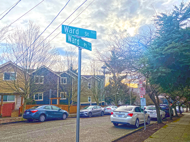
Ward Place begins at Taylor Avenue N just north of Aloha Street and goes 330 feet northeast to Ward Street just west of 6th Avenue N (intersection pictured below).

Street sign at corner of Ward Street and Ward Place
Photograph by Benjamin Lukoff, February 2024. Copyright © 2024 Benjamin Lukoff. All rights reserved.

Incidentally, Seattle City Councilman Hiram C. Gill (1866–1919), who would go on to become mayor from 1910–1911 and 1914–1918, was adamantly against its construction, and was no fan of the residents of East Queen Anne, either:

Just a few nights ago those yellers up there held a meeting and denounced this council as a lot of grafters that were into all kinds of corruption, and now they come right down here and demand that we give them something that nobody else would have the gall to ask for. It is time that bunch should be set back a little. There are only about two dozen people living up there anyway and there is no reason why a lot of money should be spent for improvements for a handful of people when no other part of the city can get anything in the way of special favors. That crowd up there has been getting one thing after another just because they holler for it. They are just a lot of cheeky grafters anyway. I wouldn’t care if there was any kind of decent people living up there but if those fellows had to walk up hill every day and then were put in jail and kept there until Hades froze over they would be getting just about what they want.

Article in the December 22, 1903, issue of the Seattle Post-Intelligencer regarding East Queen Anne Drive, now Ward Place
Article in the December 22, 1903, issue of the Seattle Post-Intelligencer

Fairview Place N

This street was created in 1988 as part of the development of Chandler’s Cove, now being redeveloped as Lake Union Piers. Beginning at Fairview Avenue N between Valley Street and Aloha Street and going just over 125 feet north to Waterway 5 on Lake Union, it was presumably named after the avenue.

Fairview Avenue N was itself established as Lake Street in the 1875 plat of the Fairview Homestead Association for the Benefit of Mechanics and Laborers, and received its current name during the Great Renaming of 1895. The name likely references the view of Lake Union and Wallingford that was once visible from most of the Cascade neighborhood.

S Ferdinand Street

Like its neighbors S Hudson Street and S Americus Street, S Ferdinand Street was created in 1891 as part of the plat of Columbia. (The town incorporated in 1893 and was annexed to Seattle in 1907, becoming the neighborhood of Columbia City.) Along with Columbus Street, which no longer exists, they were part a of series of streets named after explorers — in this case, Ferdinand Magellan (born Fernão de Magalhães, also known as Fernando de Magallanes) (1480–1521), the first explorer to sail from Europe to Asia via the Atlantic and Pacific Oceans.

S Ferdinand Street begins at Lake Washington Boulevard S and goes a block west to just past 55th Avenue S. It is a stairway between 54th Avenue S and 53rd Avenue S, then begins again at 52nd Avenue S. After a half block as roadway and another half block as stairway, it begins in earnest at 51st Avenue S by Lakewood Park and goes just over a mile west to 31st Avenue S. It is another stairway for the next block, and then a stub off 30th Avenue S.

On Beacon Hill, S Ferdinand Street begins again at 28th Avenue S and goes ½ a mile west to 20th Avenue S, then resumes at 19th Avenue S and goes a further ⅖ to 13th Avenue S. It finishes up as a short connector from 12th Avenue S to Corson Avenue S by Maple Wood Playfield.

Panorama of the intersection of S Ferdinand Street and Rainier Avenue S in Columbia City, May 2012. Photograph by Todd McNaught, Wikimedia Commons, licensed under Creative Commons Attribution-ShareAlike 3.0 Unported

S Hudson Street

This street was created in 1891 as part of the plat of Columbia, which incorporated in 1893 and was annexed to Seattle in 1907, becoming the neighborhood of Columbia City. Part of a series of streets named after explorers — (Christopher) Columbus Street (subsequently changed to Edmunds Street), Ferdinand (Magellan) Street, and Americus (Vespucci) Street — it was named for English explorer Henry Hudson (c. 1565–disappeared 1611), namesake of Hudson Bay in Canada and the Hudson River in New York and New Jersey.

After a false start as a dead-end road west of 57th Avenue S, S Hudson Street begins at 53rd Avenue S and goes ⅓ of a mile west to 47th Avenue S, becoming a stairway between 50th Avenue S and 49th Avenue S. It resumes at 46th Avenue S and goes ¾ of a mile west to Martin Luther King Jr. Way S. After another couple of short segments, it begins again at 28th Avenue S and goes ¼ mile west to 24th Avenue S. There are two more short segments on Beacon Hill, and then Hudson Street resumes in Georgetown, going ⅖ of a mile from 4th Avenue S to E Marginal Way S.

In West Seattle, SW Hudson Street begins as a service road and footpath within Puget Park off 18th Avenue SW. Its first appearance as a residential street is at Puget Boulevard SW, where it goes ⅕ of a mile to the West Seattle Golf Course. It then picks up again at 35th Avenue SW, where it goes just over a mile to SW Jacobsen Road, becoming a stairway three separate times along the way.

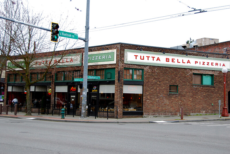
Tuta Bella pizzeria at corner of S Hudson Street and Rainier Avenue S
Tutta Bella Pizzeria at the corner of S Hudson Street and Rainier Avenue S in Columbia City, March 2012. Photograph by Flickr user Adam Fagen, licensed under Creative Commons Attribution-NonCommercial-ShareAlike 2.0 Generic

S Americus Street

This street was created in 1891 as part of the plat of Columbia, which incorporated in 1893 and was annexed to Seattle in 1907, becoming the neighborhood of Columbia City. It was part of a series of streets named after explorers. Columbus Street, named for Christopher Columbus, is no more, but Ferdinand Street (Ferdinand Magellan), Hudson Street (Henry Hudson), and Americus Street (named for Amerigo Vespucci [1451–1512]) still exist. (Vespucci, of course, is the namesake of the Americas).

S Americus Street exists in two short segments: the Columbia City one begins at 42nd Avenue S and goes a block west to 39th Avenue S, and the Beacon Hill one begins at 26th Avenue S and goes a block west to S Columbian Way.

S Kenny Street

This street was created in 1903 as part of the plat of Hillman City Division № 5, filed by real estate developer Clarence Dayton Hillman (1870–1935) and his wife, Bessie Olive Kenny (1879–1947). Hillman also named the Renton neighborhood of Kennydale after his wife’s maiden name.

S Kenny Street begins on Beacon Hill at 21st Avenue S and goes two blocks east to 23rd Avenue S. It resumes in Hillman City at 42nd Avenue S and goes ¼ mile east to a dead end east of Rainier Avenue S. Its final segment, just under 400 feet long, lies west of 51st Avenue S and dead-ends at some private driveways.

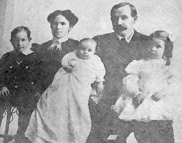
C.D. Hillman, Bessie Kenny Hillman, and family
Bessie and C.D. Hillman and family, from a 1910 abstract of title for C.D. Hillman’s Birmingham Water Front Addition to the City of Everett
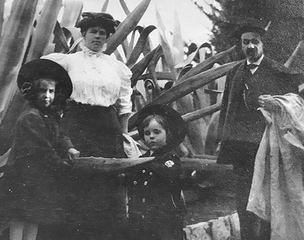
Bessie and C.D. Hillman
Bessie and C.D. Hillman and children, n.d., courtesy of his great-granddaughter

Marginal Place SW

This street, created in 1919 by Ordinance 39638, is named for W Marginal Way SW. It begins there and goes just under 800 feet northwest to a dead end underneath the West Seattle Bridge. The Duwamish Trail continues on from there to the West Seattle Bridge Trail, while the 18th Avenue SW stairway heads south up the hill to SW Charlestown Street in Pigeon Point.