Sunset Avenue SW

I enjoy writing posts on streets like W Commodore Way (I believe I am the first to have accurately identified its namesake), Division Avenue NW (I show that, even though it doesn’t divide anything from anything else today, it once served as Ballard’s eastern city limit for a few blocks), Loyal Avenue NW (I discover that it’s named not for the concept of loyalty, but for a baby girl whose first name was Loyal), and sluʔwiɫ (the University of Washington’s new Lushootseed-language name for Whitman Court). But sometimes I just like knocking something out quickly (I’m looking at you, W View Place and View Avenue NW). Sunset Avenue SW is another one of those. It originated in the 1888 First Plat of West Seattle by the West Seattle Land and Improvement Company, and the name simply refers to the street’s western view of Puget Sound; Vashon, Blake, and Bainbridge Islands; the Kitsap Peninsula; and the Olympic Mountains.

Sunset Avenue SW begins as a stairway at California Avenue SW, just across the street from Hamilton Viewpoint Park. Once the roadway begins up the hill, it goes ⅘ of a mile southwest to a dead end at the College Street Ravine southwest of 50th Avenue SW.

Montlake Boulevard E

This street originated as University Boulevard. Opening on June 1, 1909, it connected Washington Park Boulevard (now E Lake Washington Boulevard) to the entrance to the Alaska–Yukon–Pacific Exposition (now the campus of the University of Washington). The plan was for it to continue through campus and connect via 17th Avenue NE to Ravenna Boulevard, but this was not done due to opposition from the Board of Regents. Instead, the road was extended along what was then Union Bay shoreline to NE 45th Street. It has been part of the state highway system since 1937.

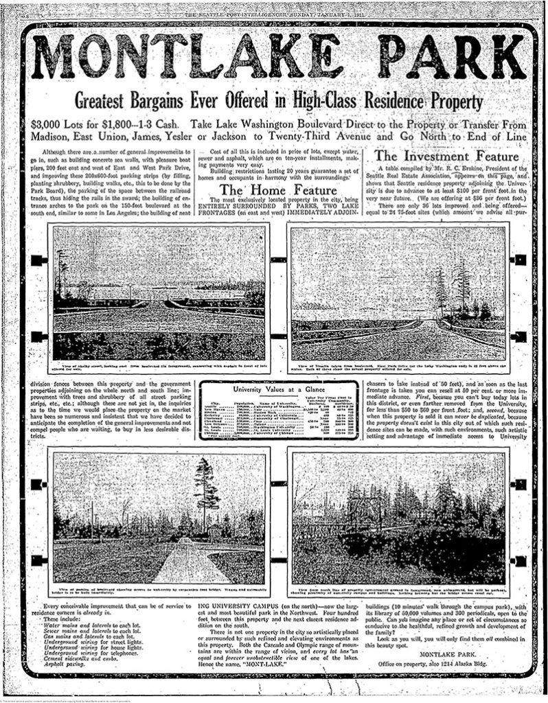
Montlake Boulevard was named after Montlake Park, an Addition to the City of Seattle, filed in 1908, which later gave its name to the entire neighborhood. Most of the street, however, is on the other side of the Lake Washington Ship Canal.

Montlake Park Ad, Seattle P-I, January 1, 1911
Montlake Park ad, Seattle P-I, January 1, 1911. “Both the Cascade and Olympic range of mountains are within the range of vision, and every lot has an equal and forever unobstructible view of one of the lakes [Lake Union and Lake Washington]. Hence the name, ‘MONT-LAKE.’”

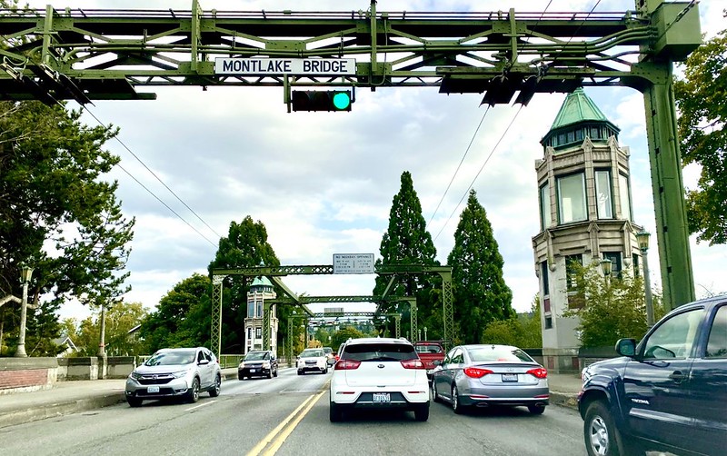
Today, Montlake Boulevard E (as well as Washington State Route 513) begins at the intersection of E Lake Washington Boulevard and E Montlake Place E, just south of the Washington State Route 520 freeway, and goes 1⅓ miles north, then northeast, to NE 45th Street, just south of University Village. It becomes Montlake Boulevard NE as it crosses the Montlake Cut of the Lake Washington Ship Canal. (State Route 513 continues for another 2 miles along NE 45th Street and Sand Point Way NE, ending at NE 65th Street just west of Magnuson Park.)

Montlake Bridge, looking southbound, August 2021
Montlake Bridge, looking southbound, August 2021. The bridge opened in 1925 and is the easternmost bridge over the Lake Washington Ship Canal. Photograph by Flickr user Seattle Department of Transportation, licensed under Creative Commons Attribution-NonCommercial 2.0 Generic
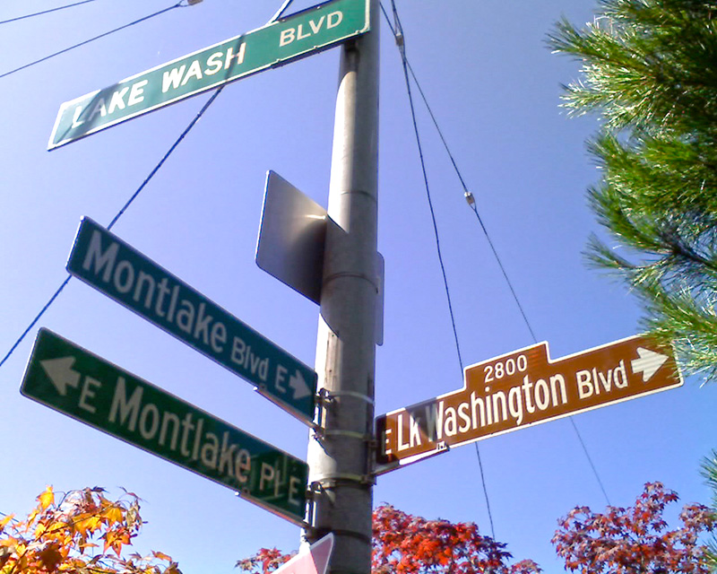
Street sign at corner of E Montlake Place E, E Lake Washington Boulevard, and Montlake Boulevard E, August 24, 2009
Street sign at corner of E Montlake Place E, E Lake Washington Boulevard, and Montlake Boulevard E. Photograph by Benjamin Lukoff, August 24, 2009. Copyright © 2009 Benjamin Lukoff. All rights reserved.
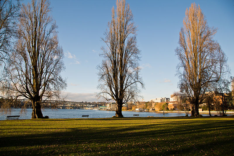
West Montlake Park, January 2013
West Montlake Park, January 2013. The body of water is Portage Bay (Lake Union); South Campus of the University of Washington is at right, across the Montlake Cut, and the University Bridge and Ship Canal Bridge are visible in the distance. Photograph by Orange Suede Sofa, Wikimedia Commons, licensed under Creative Commons Attribution-ShareAlike 3.0

Viewmont Way W

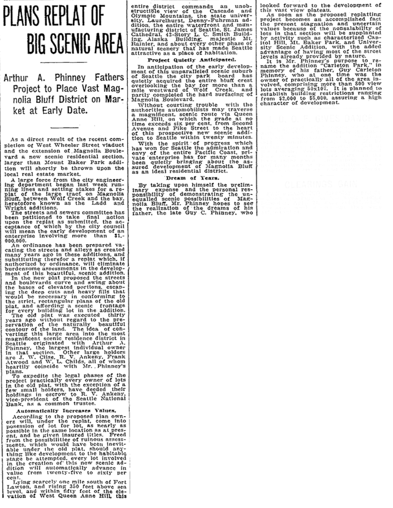
This street was created in 1915 as part of the plat of Carleton Park, a replat of much of southwest Magnolia (basically a triangle formed by W Raye Street, 34th Avenue W, and Magnolia Boulevard W). Arthur A. Phinney (1885–1941) led the project, named after his father, Guy Carleton Phinney (1851–1893) (Phinney Avenue N, Phinney Ridge). As The Seattle Times reported:

The old plat was executed thirty years ago without regard to the preservation of the naturally beautiful contour of the land.… In the new plat the streets and boulevards curve and swing about the bases of elevated portions, escaping the deep cuts and heavy fills that would be necessary in conforming to the strict, rectangular plans of the old plat, and affording a scenic frontage for every building lot in the addition.… This entire district commands an unobstructible view of the Cascade and Olympic Mountains, the state university, Laurelhurst, Denny-Fuhrman addition, the entire waterfront and manufacturing district of Seattle, St. James Cathedral, 42-story L.C. Smith Building, Alaska Building, majestic Mt. Rainier, and about every other phase of natural scenery that has made Seattle attractive as a place of habitation.

Article on Carleton Park, Seattle Times, April 25, 1915

Viewmont Way was obviously named after its view of the mountains, and is of a piece with other Carleton Park streets like Montavista Place, Westmont Way, Eastmont Way, Altavista Place, and the like.

Viewmont Way W begins at the intersection of 34th Avenue W, W Lynn Street, and Montvale Place W in Magnolia Village, and goes ¼ mile southwest to Constance Drive W, where it becomes W Viewmont Way W. The name initially continued about the same distance northwestwards, where the street became 41st Avenue W, but this portion and the rest of 41st Avenue as far north as Fort Lawton (now Discovery Park) were apparently changed at some point to W Viewmont Way. In 1961, the streets became Viewmont Way W and W Viewmont Way W.

W View Place

W View Place, formerly an unnamed block-long alley between 28th Avenue W and 29th Avenue W just south of W Elmore Place, was named in 1950 at the request of Norman E. Boor, et al. The houses at 2805, 2815, and 2829 were all built in 1947, according to county records; I suppose this necessitated that the street be named, and for some reason no one could come up with anything more interesting than “View,” for the view of Ballard residents were able to enjoy.

Given the choice between W Boor Place and W View Place, I’d take the latter, but really… I’m surprised this was approved, especially given the existence of View Avenue NW near Golden Gardens Park.

View Avenue NW

It’s reasonable to name a street for its view: Lakeview Boulevard E, Fairview Avenue N, University View Place NE, Seaview Avenue NW, SW City View Street, and S Bayview Street are some examples in Seattle. Better, to my mind, is naming a street after the thing being viewed: Constance Drive W, Sunset Avenue SW, Cascadia Avenue S, to name a few. Worse? Those faux-French or faux-Spanish names like Viewmont Way W, Montavista Place W, Lakemont Drive NE, etc.

But given the power of naming bestowed on platters of subdivisions, why would Edward B. Cox and Harry Whitney Treat, and Treat’s wife, Olive Marion Graef Treat, name something simply “View Avenue,” as was done in the 1907 plat of Loyal Heights? I think it and W View Place must be tied for the most boring street name in Seattle, but am willing to consider other contenders for the title.

Lakeview Boulevard E

Lakeview Boulevard E, which originated in David and Louisa Denny’s 1886 East Park Addition to the City of Seattle, is named for its view of Lake Union to the west. For a time part of the Pacific Highway (now routed onto Aurora Avenue N), it begins today at an overpass over Interstate 5 at Eastlake Avenue E and Mercer Street and goes a mile north to Boylston Avenue E and E Newton Street.

Interstate 5 blocks the view of the lake from much of the northern section of the street, but the southern section’s view is still more or less intact.

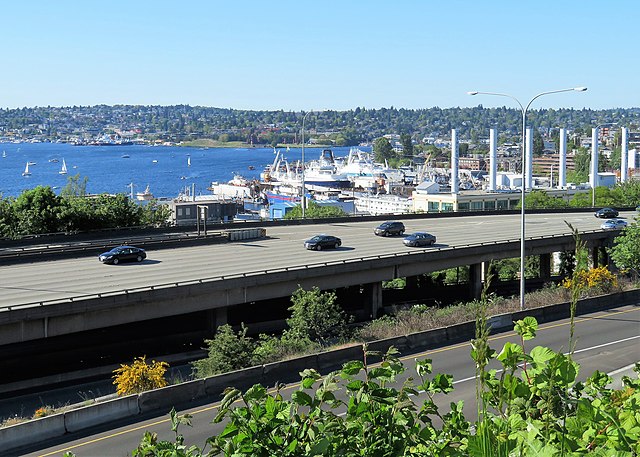
View of Lake Union looking northwest from Lakeview Boulevard overpass at Belmont Avenue E, May 12, 2018
View of Lake Union, Eastlake, and Wallingford, looking northwest from Lakeview Boulevard overpass at Belmont Avenue E, May 12, 2018. Photograph by Flickr user GabboT, licensed under Creative Commons Attribution-ShareAlike 2.0 Generic
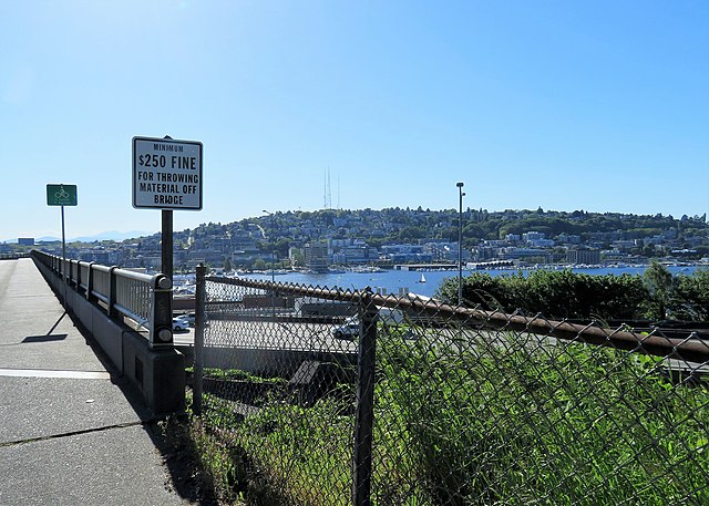
View of Lake Union looking southwest from Lakeview Boulevard overpass at Belmont Avenue E, May 12, 2018
View of Lake Union, Westlake, and Queen Anne looking southwest from Lakeview Boulevard overpass at Belmont Avenue E, May 12, 2018. Photograph by Flickr user GabboT, licensed under Creative Commons Attribution-ShareAlike 2.0 Generic

Fairview Avenue N

Fairview Avenue is one of a handful in the city that changes directional designations twice along a continuous stretch. The street begins in the south at Virginia Street as Fairview Avenue, but becomes Fairview Avenue N a block and a half to the north as it crosses Denny Way, and a mile north and east of that becomes Fairview Avenue E at E Galer Street and Eastlake Avenue E. It continues to E Roanoke Street, two miles from its origin, where it is interrupted by the Mallard Cove houseboat community. Picking up a block to the north, it then runs half a mile from E Hamlin Street to Fuhrman Avenue E and Eastlake Avenue E, just south of the University Bridge.

Originally Lake Street in Rezin and Margaret Pontius’s 1875 plat of the Fairview Homestead Association for the Benefit of Mechanics and Laborers, it received its current name during the Great Renaming of 1895. (Before 1875, it had been known as Prohibition Street.)

The Fairview Homestead Association, according to Paul Dorpat, was intended to “help working families stop paying rents and start investing in their own homes. Innovative installment payments made the lots affordable and many of the homes were built by those who lived in them.”

I assume Fairview took its name from the view of Lake Union and what is now Wallingford that is still barely visible today from what is now the Cascade neighborhood.

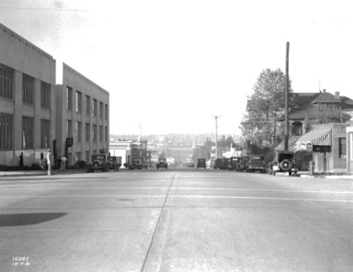
1931 view looking north toward Lake Union along Fairview Avenue N, Courtesy of the Seattle Municipal Archives, Identifier 5265

University View Place NE

This short street, which runs from NE 50th Street just south of Calvary Cemetery to NE 45th Place, is named for its view of the University of Washington campus to the southwest. It was laid out in 1907 as part of the Exposition Heights addition, which was named after the upcoming Alaska–Yukon–Pacific Exposition on the UW campus.

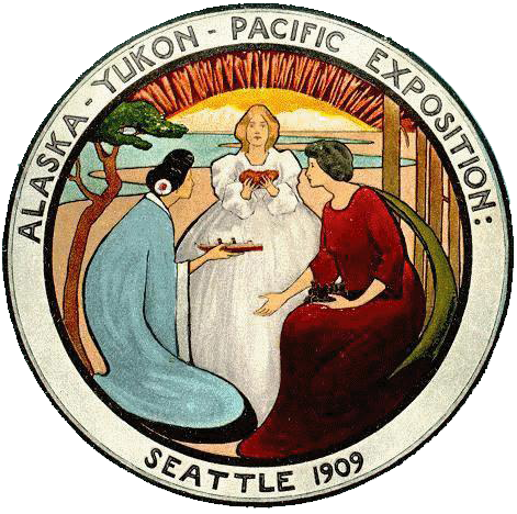
Alaska–Yukon–Pacific Exposition Seattle 1909

Constance Drive W

This ⅔-mile–long Magnolia street is named for Mount Constance in the Olympic Mountains. Constance was the older sister of Ellinor Fauntleroy, namesake of Mount Ellinor and Ellinor Drive W. (There are no Magnolia streets named Edward, Arthur, or The Brothers.)

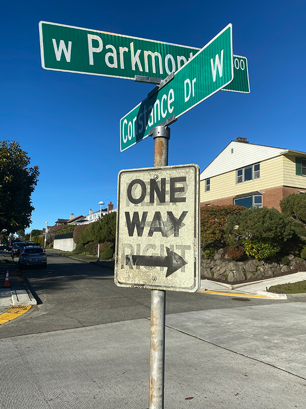
W Parkmont Drive and Constance Drive W street sign above One Way sign with Keep Right ghost sign underneath
Street sign at corner of W Parkmont Place and Constance Drive W, with One Way sign over Keep Right ghost sign, January 9, 2022. Photograph by Benjamin Lukoff. Copyright © 2022 Benjamin Lukoff. All rights reserved.

Ellinor Drive W

This short street in Magnolia’s Carleton Park subdivision is named for Mount Ellinor in the Olympic Mountains, which was itself named for Ellinor Fauntleroy, the fiancée of George Davidson of the U.S. Coast Survey, who named the peak in 1853. Nearby Constance Drive W is named for Mount Constance, itself named for Ellinor’s older sister.

Most of Magnolia’s streets follow Seattle’s cardinal-direction grid. Here, however, in the southwest corner of the neighborhood, they are laid out to follow the contour of the steep bluff that affords many streets a view of the Olympic Mountains, the Cascade Range, or both.