Marginal Place SW

This street, created in 1919 by Ordinance 39638, is named for W Marginal Way SW. It begins there and goes just under 800 feet northwest to a dead end underneath the West Seattle Bridge. The Duwamish Trail continues on from there to the West Seattle Bridge Trail, while the 18th Avenue SW stairway heads south up the hill to SW Charlestown Street in Pigeon Point.

E Superior Street

This street, along with E Huron Street and Erie Avenue, was created in 1890 as part of Yesler’s Third Addition to the City of Seattle. It was named for Lake Superior, the largest of the Great Lakes, and the largest freshwater lake in the world by surface area.

E Superior Street begins at Euclid Avenue and goes 1⁄10 of a mile east to Erie Avenue.

E Huron Street

This street, along with E Superior Street and Erie Avenue, was created in 1890 as part of Yesler’s Third Addition to the City of Seattle. It was named for Lake Huron, second largest of the Great Lakes by surface area.

E Huron Street begins at Euclid Avenue and goes 1⁄10 of a mile east to Lake Washington Boulevard.

Erie Avenue

This street, along with E Superior Street and E Huron Street, was created in 1890 as part of Yesler’s Third Addition to the City of Seattle. It was named for Lake Erie, fourth largest of the Great Lakes by surface area.

Erie Avenue begins at Leschi Park south of Lake Washington boulevard and goes ⅓ of a mile north to E Jefferson Street.

Elliott Avenue

Elliott Avenue, which originated as Water Street in A.A. Denny’s 6th Addition to the City of Seattle, filed in 1873, received its current name in 1895 as part of the Great Renaming. It was named for Elliott Bay, which was itself named for Midshipman Samuel Bonnyman Elliott (1822–1876), part of the United States Exploring Expedition, otherwise known as the Wilkes Expedition. (Even though for years people thought the bay had been named for Chaplain J.L. Elliott, Howard Hanson makes a convincing argument in “The Naming of Elliott Bay: Shall We Honor the Chaplain or the Midshipman?”, an article in the January 1954 issue of The Pacific Northwest Quarterly, that the honor belongs to the midshipman.)

Elliott Avenue begins at Western Avenue and Lenora Street and goes 2⅕ miles northwest to halfway between W Galer Street and W Garfield Street, where it becomes 15th Avenue W.

Looking south down Elliott Avenue W at W Mercer Place, August 1921, from https://archives.seattle.gov/digital-collections/index.php/Detail/objects/25558
Looking south down Elliott Avenue W at W Mercer Place, August 1921. Courtesy of the Seattle Municipal Archives, Identifier 1862
Looking northwest up Elliott Avenue W from the W Thomas Street pedestrian bridge, August 2015. From https://commons.wikimedia.org/wiki/File:Elliott_Ave,_at_3rd_Ave_and_Thomas_Street,_Seattle.JPG
Looking northwest up Elliott Avenue W from the W Thomas Street pedestrian bridge, August 2015. Photograph by Dllu, Wikimedia Commons, licensed under Creative Commons Attribution-ShareAlike 4.0 International

Montlake Boulevard E

This street originated as University Boulevard. Opening on June 1, 1909, it connected Washington Park Boulevard (now E Lake Washington Boulevard) to the entrance to the Alaska–Yukon–Pacific Exposition (now the campus of the University of Washington). The plan was for it to continue through campus and connect via 17th Avenue NE to Ravenna Boulevard, but this was not done due to opposition from the Board of Regents. Instead, the road was extended along what was then Union Bay shoreline to NE 45th Street. It has been part of the state highway system since 1937.

Montlake Boulevard was named after Montlake Park, an Addition to the City of Seattle, filed in 1908, which later gave its name to the entire neighborhood. Most of the street, however, is on the other side of the Lake Washington Ship Canal.

Montlake Park Ad, Seattle P-I, January 1, 1911
Montlake Park ad, Seattle P-I, January 1, 1911. “Both the Cascade and Olympic range of mountains are within the range of vision, and every lot has an equal and forever unobstructible view of one of the lakes [Lake Union and Lake Washington]. Hence the name, ‘MONT-LAKE.’”

Today, Montlake Boulevard E (as well as Washington State Route 513) begins at the intersection of E Lake Washington Boulevard and E Montlake Place E, just south of the Washington State Route 520 freeway, and goes 1⅓ miles north, then northeast, to NE 45th Street, just south of University Village. It becomes Montlake Boulevard NE as it crosses the Montlake Cut of the Lake Washington Ship Canal. (State Route 513 continues for another 2 miles along NE 45th Street and Sand Point Way NE, ending at NE 65th Street just west of Magnuson Park.)

Montlake Bridge, looking southbound, August 2021
Montlake Bridge, looking southbound, August 2021. The bridge opened in 1925 and is the easternmost bridge over the Lake Washington Ship Canal. Photograph by Flickr user Seattle Department of Transportation, licensed under Creative Commons Attribution-NonCommercial 2.0 Generic
Street sign at corner of E Montlake Place E, E Lake Washington Boulevard, and Montlake Boulevard E, August 24, 2009
Street sign at corner of E Montlake Place E, E Lake Washington Boulevard, and Montlake Boulevard E. Photograph by Benjamin Lukoff, August 24, 2009. Copyright © 2009 Benjamin Lukoff. All rights reserved.
West Montlake Park, January 2013
West Montlake Park, January 2013. The body of water is Portage Bay (Lake Union); South Campus of the University of Washington is at right, across the Montlake Cut, and the University Bridge and Ship Canal Bridge are visible in the distance. Photograph by Orange Suede Sofa, Wikimedia Commons, licensed under Creative Commons Attribution-ShareAlike 3.0

Puget Boulevard SW

Puget Boulevard is a curious street, for a number of reasons:

  • The paved portions are only a few blocks long — hardly comparable to, say, Lake Washington Boulevard or Magnolia Boulevard;
  • Both east–west and north–south portions are called Puget Boulevard SW, contrary to the rule that directional designations precede street names for east–west streets (this is why Lake Washington Boulevard E becomes E Lake Washington Boulevard when it curves west on its approach to Montlake Boulevard E);
  • Despite its name, it has no view of Puget Sound, sitting as it does in the Longfellow Creek valley in the Delridge neighborhood of West Seattle;
  • And, as it turns out, it isn’t even named for Puget Sound, as might be expected, but rather for the Puget Mill Company (later part of Pope & Talbot and today part of Rayonier).

The Puget Mill Company, which once owned large swaths of land in the city (including what became the Washington Park Arboretum and the Broadmoor Golf Club), made two donations to the city in 1912, according to the Ninth Annual Report of the Board of Park Commissioners:

  • “A rugged tract of logged-off land south of Pigeon Point and Youngstown in the large unplatted area” (20.5 acres — this became Puget Park); and
  • “A strip of land 160 feet in width extending from Sixteenth Avenue Southwest and Edmonds Street (sic) to Thirty-fifth Avenue Southwest and Genessee Street, a distance of 8,500 feet, and comprising an area of about fifteen acres for parkway purposes. Under the conditions of this gift improvement work must be undertaken within five years. This acquisition forms an important link in the contemplated boulevard to West Seattle.”

This strip is today’s Puget Boulevard SW. Two things become apparent when looking at the King County Parcel Viewer map of West Seattle:

Map of Puget Boulevard, from King County Parcel Viewer

Once past the present site of West Seattle Stadium, the “contemplated boulevard to West Seattle” was to have run, as the Friends of Seattle’s Olmsted Parks puts it,

[Across] California Avenue a few blocks north of [the] present-day Alaska Junction, at that time part of the “Boston Subdivision.” It would have then headed northwest and down a ravine, eventually turning southwest to terminate at Alki Point.

Map of proposed West Seattle Parkway, cropped from a 1928 map of Seattle's park system
Map of proposed West Seattle Parkway, cropped from a 1928 map showing both existing (red) and proposed (red hatched) park features. Puget Park and Boulevard are at lower right. Courtesy of the Seattle Municipal Archives, Identifier 2333.

Returning to the question of the name — the Puget Mill Company was, of course, named after Puget Sound, which itself was named in 1792 by Captain George Vancouver of HMS Discovery for Lieutenant Peter Puget (1765–1822).

Today, the paved portion of Puget Boulevard SW begins at 23rd Avenue SW, about 1⁄10 of a mile north of SW Hudson Street, and goes ⅕ of a mile south to a dead end. After a very short section — not more than 150 feet long — east of Delridge Way SW, which serves as a driveway for a complex of townhouses, it resumes west of a foot path off Delridge and goes about 1⁄10 of a mile west to 26th Avenue SW. Along this stretch, there are houses to the north and the Delridge P-Patch and Puget Boulevard Commons to the south.

Beach Drive SW

Like Harbor Avenue SW, Beach Drive SW was once part of Alki Avenue SW. It became Beach Drive sometime between 1912 and 1920. In contrast to Alki and Harbor Avenues, most of Beach Drive’s beaches are private, though there is a long public stretch at the Emma Schmitz Memorial Outlook, as well as Lowman Beach Park at the south end.

Puget Sound shore looking northwest along Beach Drive with Alki Point in distance, August 2007
Puget Sound shore looking northwest along Beach Drive toward Alki Point, August 2007. Photograph by Joe Mabel, Wikimedia Commons, licensed under Creative Commons Attribution-ShareAlike 3.0 Unported

Beach Drive SW begins at Alki Avenue SW just south of Alki Point and goes just over 3 miles southeast to Trail #1 at Lincoln Park.

Signs at Beach Drive SW road end, March 2013
Signs along Beach Drive SW a little under 1,000 feet north of Lincoln Park. The park boundary sign is unofficial. Its placement appears to imply that the tail end of Beach Drive is private, which it’s not. Nor is the driveway (SW Othello Street) on the left. Photograph by Benjamin Lukoff, March 10, 2013. Copyright © 2013 Benjamin Lukoff. All rights reserved.

Harbor Avenue SW

As noted in Alaskan Way, Harbor Avenue SW was once part of Railroad Avenue. When the Elliott Bay tidelands were platted in 1895, Railroad Avenue stretched from (using current landmarks) the Magnolia Bridge along the waterfront to the Industrial District, then across Harbor Island to West Seattle, ending southwest of Duwamish Head. In 1907 the West Seattle portion was renamed Alki Avenue, and sometime between 1912 and 1920 it was given its current name.

Looking northwest up what is now Harbor Avenue SW toward Duwamish Head, April 1902

Today, Harbor Avenue SW begins at SW Avalon Way and SW Spokane Street at the west end of the West Seattle Bridge and goes 1¾ miles northwest to Duwamish Head, where it becomes Alki Avenue SW.

Street sign at corner of Harbor Avenue SW and Alki Avenue SW, October 2017
Street sign at corner of Harbor Avenue SW and Alki Avenue SW, Duwamish Head, with Elliott Bay and downtown Seattle in background, October 2017. Photograph by Ron Clausen, Wikimedia Commons, licensed under Creative Commons Attribution-ShareAlike 4.0 International

NE Pacific Street

What is now Pacific Street was Harrison Avenue in the 1889 Latona Addition and Railroad Avenue in the 1890 Brooklyn Addition, corresponding to the eastern part of Northlake and to the University District, respectively. The road was built on either side of railroad tracks that were originally part of the independent Seattle, Lake Shore and Eastern Railway, but which were soon thereafter taken over by the Northern Pacific Railway. (The route of the SLS&E through and east of Seattle is now the Burke–Gilman Trail, the Sammamish River Trail, and the East Lake Sammamish Trail.)

In 1906, Harrison Avenue became Pacific Place and Railroad Avenue became Brintnall Place. (Why the opportunity wasn’t taken to match the names is unclear. Brintnall Place may have been named for Burgess W. Brintnall, who, according to the September 1912 issue of the Northwest Journal of Education, had been school superintendent for Olympia and Thurston County, founded the journal itself, and, after moving to Seattle in 1899, founded the Pacific Teachers Agency. He was murdered on July 3, 1912.)

At some point both streets became Pacific Street. Brintnall Place appears for the last time in The Seattle Times in October 1920, and Pacific Street for the first time in July 1921. The 1920 Kroll atlas shows all three names, including Pacific Place, indicating the change must have been planned at the time of its publication.

I haven’t seen any indication of why the Pacific name was chosen. Seattle got an Atlantic Street in 1895 — maybe it was thought the other major ocean deserved a street as well. But I wonder if it wasn’t named for the Northern Pacific, whose tracks the street ran along?

Street sign where NE Pacific Street becomes N Pacific Street on crossing 1st Avenue NE, August 2011. Photograph by Flickr user Panegyrics of Granovetter (Sarah C. Murray), licensed under Creative Commons Attribution-ShareAlike 2.0 Generic

Today, NE Pacific Street begins at Montlake Boulevard NE, at the north end of the Montlake Bridge and the southeastern corner of the University of Washington campus, and goes ¾ of a mile to Eastlake Place NE, underneath the University Bridge, where it becomes NE Northlake Way. It begins again at NE 40th Street just west of the Ship Canal Bridge and goes another ¾ of a mile to N 34th Street just east of Meridian Avenue N.

Pacific Street’s current configuration is the result of a realignment that took place in the 1970s; originally, instead of turning west at University Way NE, it kept going northwest, cutting through what is now the University of Washington’s West Campus, and there was no interruption between the University and Ship Canal Bridges. The Burke–Gilman Trail follows the original railroad alignment, though, as does, for a few blocks, the campus road Cowlitz Road NE.

N Canal Street

This street appears to have been built sometime between 1908 and 1912. (It was established by ordinance in 1906, but that was legislation, not construction. [It was also originally named Ewing Street, the original name of N 34th Street, which still exists on the Queen Anne side of the Ship Canal.]) When the plat of Denny & Hoyt’s Addition to the City of Seattle, W.T., was filed in 1888, no such street was needed, because there was no canal. Instead, Ross Creek connected Lake Union to Salmon Bay. However, as work on the Lake Washington Ship Canal progressed, the Fremont Cut came into being, and it must have been felt a street paralleling the canal to the north was needed, since the original plat took no notice of the creek or any future canal route. (One to the south was needed, too, which is why Nickerson Street was extended from 3rd Avenue W to 4th Avenue N, at the southern end of the Fremont Bridge.)

Why, then, is Canal Street so short — not quite ⅓ of a mile from N 34th Street and Phinney Avenue N in the east to 2nd Avenue NW in the west?

As it turns out, even though Canal Street was to run to what was then the boundary between the cities of Seattle and Ballard at 8th Avenue NW, shortly after Seattle annexed Ballard in 1907 another street was laid out parallel to the canal connecting Fremont to the new neighborhood of Ballard: Leary Way NW (then simply Leary Avenue, all the way from Market Street to Fremont Avenue). Leary became the main arterial, and in 1951 NW Canal Street was vacated between 3rd Avenue NW and 8th Avenue NW, reducing it to its present length. (Until 2016, there was a slight discontinuity in the vicinity of 1st Avenue NW and N 35th Street where the built street deviated from its right-of-way, making it even shorter.)

So this isn’t quite the same as our trio of S Front Street, S River Street, and S Riverside Drive literally being cut short by the rechanneling of the Duwamish River into the Duwamish Waterway — more one of Canal Street being supplanted by Leary Way and becoming more valuable to the city as industrial land than as roadway.

S Riverside Drive

As you might expect, this street is so named because it runs along the west bank of the Duwamish Waterway. However, it only does so for about ⅖ of a mile, from S Webster Street east of 5th Avenue S to a dead end on the river just north of a path to t̓ałt̓ałucid Park and Shoreline Habitat (formerly the 8th Avenue S street end, just north of S Portland Street). It is by no means a prominent street, contrary to what such a name usually implies (Los Angeles, Manhattan, Ottawa, Spokane). In this way it is similar to Seattle’s S Front Street and S River Street. Why is this?

Also as you might expect, it’s for the same reason Front and River Streets are relatively unimportant: the rechanneling of the Duwamish River that started in 1913. Originally Duwamish Avenue in the 1891 plat of River Park, as seen in the image below, Riverside Drive used to curve around a bend in the river. When the river was straightened, the road was cut off right in the middle and became a Riverside Drive to nowhere.

Portion of River Park addition showing Duwamish Avenue (now Riverside Drive)
Sign at corner of S Holden Street, S Riverside Drive, and 7th Avenue S, May 20, 2013
Signs at corner of S Holden Street, S Riverside Drive, and 7th Avenue S, May 20, 2013. Photograph by Benjamin Lukoff. Copyright © 2013 Benjamin Lukoff. All rights reserved.

Lake Shore Boulevard NE

This street, created in 1906 as part of the Lake Shore View Addition to Seattle, begins in the north at NE 105th Street and Exeter Avenue NE, and curves south for a mile along the Burke-Gilman Trail, which parallels the Lake Washington shoreline, to a dead end at the north boundary of Matthews Beach Park. Unlike most, though not all, boulevards in Seattle, this one is not one of the Olmsted boulevards designed by John Charles Olmsted in 1903.

Riviera Place NE

This narrow street, created in 1926 as part of Riviera Beach, an Addition to King County, Washington, Divisions № 1, 2, 3, and 4, and situated between the shoreline of Lake Washington and the right-of-way of the Northern Pacific Railway, appears on the plats simply as “Road” — it first appears in The Seattle Times on July 20, 1930, as “Riviera Beach Road,” and then on July 2, 1932, with its current name. The name simply means ‘coastline’ in Italian.

Today, Riviera Place NE begins at the north city limits, where Seattle meets Lake Forest Park at the NE 145th Street right-of-way, and goes nearly a mile south along the Lake Washington shoreline to a spot a few houses north of NE 125th Street, where it ends at one house and picks up again on the other side of its neighbor. From there, it runs 1¼ miles south to its end at Lake Shore Boulevard NE between NE 100th Street and NE 103rd Street. The portions between the NE 135th Street right-of-way and NE 125th Street are private.

Riviera Place NE is probably most notable to the city at large for being the location of the NE 130th Street End park, which became an official park in 2019 after years of controversy. It’s not, strictly speaking, a shoreline street end, because it’s owned by Seattle Parks and Recreation, rather than being a right-of-way under the jurisdiction of the Seattle Department of Transportation. This is because it was never properly dedicated to the public in 1932 (see background and court filings). For years, it had been treated as just another shoreline street end, but in 2012, when the city announced its intention to make improvements to the beach to improve public access, the neighbors on either side filed suit, and ended up having their ownership of the lot confirmed. The city ended up having to exercise its right of eminent domain, condemned the property, and paid the neighbors $400,000 each. (As unfortunate as it was to have to pay $800,000 for the street end, I’d say it was worth it, as NE 130th is the only accessible shoreline street end north of NE 43rd Street, and the only public lake access, period, north of Matthews Beach [around where NE 95th Street would be if it had been platted into the water].)

View of NE 130th Street park on Lake Washington east of Burke-Gilman Trail and Riviera Place NE, June 18, 2019.
View of NE 130th Street End park on Lake Washington east of Riviera Place NE, June 18, 2019. Photograph by Flickr user Seattle Parks and Recreation, licensed under Creative Commons Attribution 2.0 Generic

NW North Beach Drive

This short street runs just over 750 feet from Triton Drive NW in the west to NE 98th Street in the east, just west of 24th Avenue NW. It was established in 1926 as part of North Beach, an Addition to the City of Seattle; at the time, it extended farther south, but that section is now 26th Avenue NW. The beach being referred to is on Puget Sound, across the BNSF Railway tracks from what is now NW Esplanade.

Although it bears the neighborhood’s name, houses along North Beach Drive are actually only eligible for associate, not full, membership in the North Beach Club, as the community boundary map shows. This is because the club, which originated in 1927 as the Golden View Improvement Club, was formed by and for residents of the Golden View and Golden View Division № 2 subdivisions, platted in 1924 and 1926, respectively. (According to state records, the GVIC was administratively dissolved in 1982 and merged into the North Beach Club [founded 1990] in 2006. [No word on what entity managed affairs from 1982 to 1990.]) In 1930, the club took over responsibility for the subdivisions’ water system from the developer, who as part of the deal deeded 1,500 feet of Puget Sound beach to the organization. It is this private beach, accessible via a short path from NW Esplanade at 28th Avenue NW, that is the North Beach Club’s primary raison d’être today, the water system having been hooked into the city supply long ago. Today’s associate members are the “descendants” of those who were interested in the Golden View additions’ water system 91 years ago but lived outside the subdivision boundaries — including residents of NW North Beach Drive.

NE Windermere Road

This semicircular street in Seattle’s Windermere neighborhood runs just over a mile from Sand Point Way NE between NE 55th Street and NE 58th Street in the west to just north of NE 61st Street in the east, at the southern end of Magnuson Park. The street and neighborhood itself were named after Windermere, the largest lake in England.

Plat of Windermere, an Addition to the City of Seattle, 1937
Plat of Windermere, an Addition to the City of Seattle, 1937. Courtesy of the Seattle Municipal Archives, Identifier 1628.

Windermere was developed in the late 1920s by Laurence James Colman (1859–1935) and his son, Kenneth Burwell Colman (1896–1982). Their J.M. Colman Company, founded by Laurence and his brother, George Arnot Colman (1861–1933), was named for Laurence and George’s father, James Murray Colman (1832–1906), namesake of Colman Dock and the Colman Building. (Colman Pool was established by Kenneth and named after Laurence.)

Unfortunately, as with far too many Seattle subdivisions, Windermere deeds came with racial restrictive covenants. The relevant part of this deed reads as follows:

Said property shall not be conveyed, sold, rented, or otherwise disposed of, in whole or in part, to, or be occupied by, any person or persons except of a white and Gentile race, except, however, in the case of a servant actually employed by the lawful owner or occupant thereof.

Notably, although membership in the Windermere Corporation does come with access to the private Windermere Park and Beach Club, all streets in the neighborhood are public — it is a gated community only in spirit.

Lakeview Boulevard E

Lakeview Boulevard E, which originated in David and Louisa Denny’s 1886 East Park Addition to the City of Seattle, is named for its view of Lake Union to the west. For a time part of the Pacific Highway (now routed onto Aurora Avenue N), it begins today at an overpass over Interstate 5 at Eastlake Avenue E and Mercer Street and goes a mile north to Boylston Avenue E and E Newton Street.

Interstate 5 blocks the view of the lake from much of the northern section of the street, but the southern section’s view is still more or less intact.

View of Lake Union looking northwest from Lakeview Boulevard overpass at Belmont Avenue E, May 12, 2018
View of Lake Union, Eastlake, and Wallingford, looking northwest from Lakeview Boulevard overpass at Belmont Avenue E, May 12, 2018. Photograph by Flickr user GabboT, licensed under Creative Commons Attribution-ShareAlike 2.0 Generic
View of Lake Union looking southwest from Lakeview Boulevard overpass at Belmont Avenue E, May 12, 2018
View of Lake Union, Westlake, and Queen Anne looking southwest from Lakeview Boulevard overpass at Belmont Avenue E, May 12, 2018. Photograph by Flickr user GabboT, licensed under Creative Commons Attribution-ShareAlike 2.0 Generic

Westlake Avenue

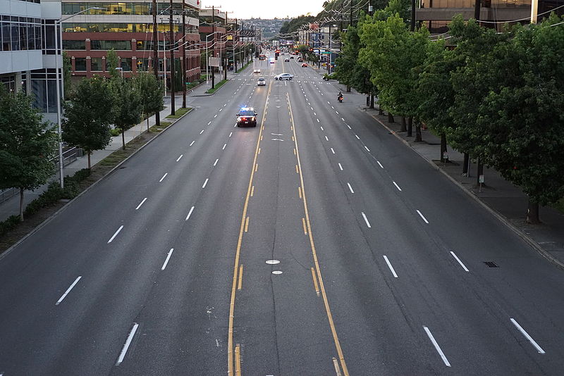
Forming a trio with Eastlake Avenue and Northlake Way, Westlake Avenue is so named for running along the western shore of Lake Union. Beginning today at Stewart Street between 5th Avenue and 6th Avenue, just north of McGraw Square, it runs 2½ miles north to 4th Avenue N between Nickerson Street and Florentia Street — the south end of the Fremont Bridge.

Westlake neighborhood and Mount Rainier from the Aurora Bridge, June 23, 2006
Westlake neighborhood and Mount Rainier from the Aurora Bridge, June 23, 2006. Photograph by Flickr user Steve Voght, licensed under Creative Commons Attribution-ShareAlike 2.0 Generic

Westlake Avenue once started a couple of blocks to the south, at 4th Avenue and Pike Street, and based on the quarter section map, it appears that its former route through Westlake Park between Pike Street and Pine Street is still public right-of-way as opposed to park land. (The portion between Pine Street and Olive Way was vacated in 1986 to make way for the Westlake Center mall, which opened in 1988, and the portion between Olive Way and Stewart Street was closed in 2010 to allow for the expansion of McGraw Square.)

Monorail and streetcar, corner of Westlake Avenue and Olive Way, in 2008
Monorail and streetcar, corner of Westlake Avenue and Olive Way, in 2008. Photograph by Flickr user Oran Viriyincy, licensed under Creative Commons Attribution-ShareAlike 2.0 Generic

Westlake was extended south to 4th and Pike from Denny Way in 1902 (one former mayor has called for that extension to be closed to cars); the original Westlake Avenue (now, properly, Westlake Avenue N) was created in 1895 as part of the Great Renaming ordinance, Section 5 of which reads

That the names of Rollin Street, Lake Union Boulevard and Lake Avenue from Depot Street [changed by the same ordinance to Denny Way] to Florentia Street, be and the same are hereby changed to Westlake Avenue.

Rollin Street, the southernmost portion, was named for Rolland Herschel Denny (1851–1939), the youngest member of the Denny Party at just six weeks old. In its honor, an apartment complex that opened at the corner of Westlake and Denny in 2008 is named Rollin Street Flats.

Rollin Street Flats, northeast corner of Westlake Avenue N and Denny Way, South Lake Union
Rollin Street Flats, northeast corner of Westlake Avenue N and Denny Way, South Lake Union, October 22, 2017. Photograph by Joe Mabel, Wikimedia Commons, licensed under Creative Commons Attribution-ShareAlike 4.0 International

Northlake, Eastlake, Westlake… why no Southlake?

Having covered Northlake, Eastlake, and Westlake so far, one might ask: why is there no Southlake?

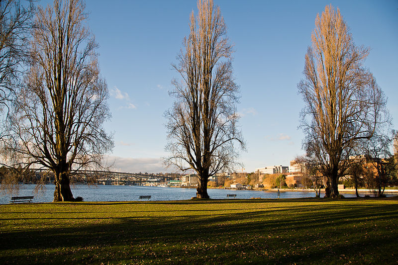
There does appear to have been a Southlake Avenue for a time — 1909 to 1924 or so, based on the last mention of it I could find in Seattle newspapers, an article in the August 8, 1924, edition of The Seattle Times on a car crash that had taken place a number of weeks earlier. Now the northern section of Fairview Avenue N, it extended from the intersection of Valley Street northwest to E Galer Street and Eastlake Avenue E, “thus eliminating the present grade on Eastlake for University traffic” in the words of a real estate advertisement in the August 23, 1914, edition of the Seattle Post-Intelligencer. But why the Southlake name disappeared seems clear: once it was decided to extend the Fairview name along the shore lands, there was no other appropriate road to carry it. The northern and eastern shores of Lake Union are just shy of 2 miles long each, but since the lake is shaped like a ? (and, surprisingly, like a uterus if Portage Bay is included) there is hardly any southern shore to speak of — only about ¼ mile.

As for the neighborhood name, I’m not sure why South Lake Union came to be used instead of Southlake. Perhaps it’s as simple as the lack of a similarly named street to “anchor” the neighborhood.

Eastlake Avenue E

Like NE Northlake Way, Eastlake Avenue E is so named because it runs along the shore of Lake Union — in this case, obviously, the eastern one. It, too, was earlier named Lake Avenue (in part), but this was changed as part of the Great Renaming of 1895. Ordinance 4044, Section 6 reads

That the names of Albert Street, Waterton Street, Lake Avenue and Green Street from Depot Street [changed by the same ordinance to Denny Way] to the shore of Lake Union at the northerly point of the Denny–Fuhrman addition, be and the same are hereby changed to Eastlake Avenue.

Today, Eastlake, at 2⁹⁄₁₀ miles in length, extends slightly farther north and south than the roadway mentioned in the ordinance. It starts in the south at the intersection of Court Place and Howell Street as Eastlake Avenue, then becomes Eastlake Avenue E a block north as it crosses Denny Way. From here to just south of E Galer Street it divides the Avenue: E; Street: E section of town from the Avenue: N; Street section. Just north of Portage Bay Place E it crosses Lake Union as the University Bridge, then continues on as the one-way–northbound Eastlake Avenue NE to 11th Avenue NE just north of NE 41st Street. (Southbound, it is fed by Roosevelt Way NE at NE Campus Parkway.)

Eastlake, like Fairview and Boren Avenues, is one of the few north–south streets in Seattle to have three different directional designations.

Looking northeast at the University Bridge from the Ship Canal Bridge in Seattle, July 2018
Looking northeast at the University Bridge from the Ship Canal Bridge, July 2018. Photograph by SounderBruce, Wikimedia Commons, licensed under Creative Commons Attribution-Share Alike 4.0 International

NE Northlake Way

As explained in NE Boat Street, NE Northlake Way was originally Lake Avenue in the 1890 Brooklyn Addition to Seattle, so named because it ran along the northern shore of Lake Union. I couldn’t find an ordinance changing its name from Lake Avenue (used elsewhere, notably for what are now Westlake Avenue and Fremont Avenue N and for part of Eastlake Avenue E) to Northlake Avenue, but the latter name begins to appear in local newspapers in 1901. (Complicating matters slightly, the street appears as North Lake Avenue in the state’s 1907 plat of Lake Union Shore Lands.) Northlake Avenue began being referred to as Northlake Way in 1935, and this was made official in 1956.

Today, NE Northlake Way begins at the west end of NE Pacific Street under the University Bridge at Eastlake Place NE, and continues 1½ miles west to just shy of the Aurora Bridge, where it becomes a private road through formerly industrial land developed by the Fremont Dock Company into a business park. (The Puget Sound Business Journal and The Seattle Times have good articles on how over the years Suzie Burke transformed her father’s Burke Millwork Co., which opened in 1939, into what is today home to local offices for Google and Adobe and corporate headquarters for Tableau and Brooks Sports, among other tenants.) This private roadway continues for ⅖ of a mile beyond the end of the public right-of-way to the intersection of N Canal Street, N 34th Street, and Phinney Avenue N.

NE Northlake Way once began ⅖ of a mile further east, at NE Columbia Road on the University of Washington South Campus, but this stretch was changed to NE Boat Street in 1962, not without some controversy.