Bay Terrace Road

To reach their homes, residents of Bay Terrace — east of Lawtonwood and west of Land’s End at the northern tip of Magnolia — must drive through Discovery Park. Within the park, their street (the narrow neighborhood only has one) is known as Bay Terrace Road, but changes to 42nd Avenue W north of the park boundary. Similarly to Lawtonwood Road, it does not appear to have been officially so designated until 2007, when ordinance 122503 was passed. Also similarly to Lawtonwood Road, it carries no directional designation, since it is a park boulevard.

Bay Terrace Road runs ¼ mile north from Lawtonwood Road just west of 40th Avenue W, and then becomes 42nd Avenue W, which continues on for another ⅕ of a mile to a viewpoint overlooking Shilshole Bay.

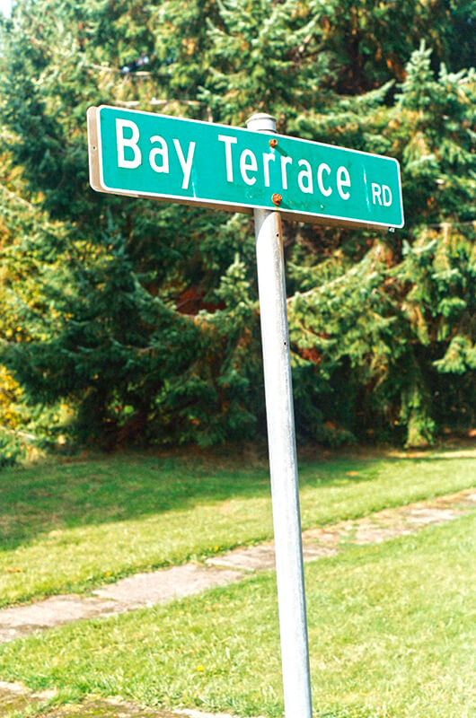
Sign for Bay Terrace Road, Discovery Park, October 30, 2011
Sign for Bay Terrace Road, Discovery Park, October 30, 2011. Photograph by Benjamin Lukoff. Copyright © 2011 Benjamin Lukoff. All rights reserved.

W Marginal Way SW

W Marginal Way SW, like its twin across the water, E Marginal Way S, began literally as a “marginal way” to “give railroads, street cars and other transportation facilities access to the Duwamish waterway.”

W Marginal Way SW begins at 26th Avenue SW at the Port of Seattle’s Terminal 5. From there, it’s 3 miles southeast to 2nd Avenue SW, by the south end of the 1st Avenue S Bridge. It resumes on the east side of the bridge as W Marginal Way S, an extension of Highland Park Way SW, and runs 4⅖ miles from there to the southern city limits. (For all but the first few blocks of this stretch, it is a limited-access highway carrying Washington State Route 99.) Beyond there it runs 3½ miles more to the vicinity of an interchange with Tukwila International Boulevard. The name is dropped at this point (and does not appear on signs south of the initial few blocks); the highway continues 1¾ miles as Washington State Route 599 to Interstate 5.

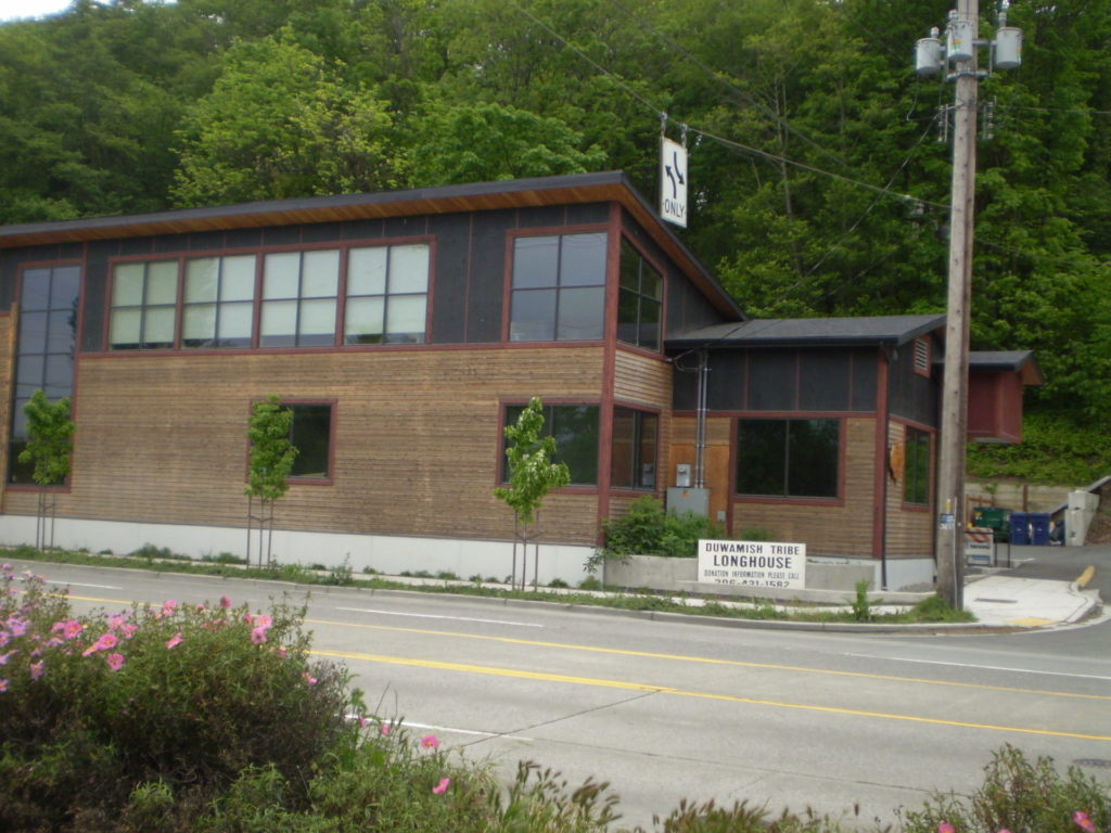
Duwamish Longhouse and Cultural Center, 4705 W Marginal Way SW, May 2010
Duwamish Longhouse and Cultural Center, 4705 W Marginal Way SW, May 2010. Photograph by Benjamin Lukoff, originally appearing in Seattle Then and Now.
Copyright © 2010 Benjamin Lukoff. All rights reserved.

W Marginal Way S is the location of the Duwamish Longhouse and Cultural Center, across the street from həʔapus Village Park and Shoreline Habitat (formerly Terminal 107 Park). həʔapus, or x̌əʔapus, was the name of a Duwamish village that was burned down by settlers in 1895. The new longhouse became the first one within city limits in 114 years. Notably, descendants of settlers Charles Terry and David Denny participated in fundraising and advocacy, without which the project would have been impossible, as the Duwamish were forced to purchase back the land. (A good article for more detail is “On the Duwamish River, a longhouse rises,” which appeared in Real Change in March 2009.)

E Marginal Way S

E Marginal Way S and its twin across the Duwamish Waterway, W Marginal Way SW, are good examples of purely descriptive Seattle street names. In fact, they are first mentioned in the press as adjective + noun, not name + type:

  • “Marginal ways are urged for both sides of Duwamish waterway.” Seattle Post-Intelligencer, October 27, 1911, in reference to the Bogue Plan
  • “Coincident with the completion of the Duwamish waterway and the wide marginal streets on each side, a publicly owned railway should be built along these marginal ways…” C.C. Closson, realtor and the Port of Seattle’s first paid employee, in a letter to the editor, Seattle P-I, July 8, 1912
  • “East and west marginal ways, planned by Bogue to parallel the waterway to give railroads, street cars and other transportation facilities access to the Duwamish waterway, will both pass through Oxbow.“ The Seattle Times, March 26, 1914
  • “Marginal ways parallel the new waterway for the whole distance, connecting with the main streets of the city running to the south.” Seattle P-I, August 13, 1914 

A longer excerpt, from an article in the April 19, 1914, issue of The Seattle Times, explains the reason for their creation:

Second only in importance to the waterway are the projected traffic streets, east and west marginal ways, laid out on both sides of the waterway about 1,000 feet back to give railways and street car lines the opportunity to parallel the waterway on both sides for its entire length, to give service to the industries locating along the waterway. As an allowance of $175,000 was made for East Marginal Way in the $3,000,000 county bond issue for roads, that street is now being condemned by the city and will be constructed 130 feet wide to the south city limits, where it will join a county road. West Marginal Way is also being promoted by interested property owners. As the existing railways are already but a short distance east of the Duwamish River, spurs can be thrown into East Marginal Way at slight expense. Also the port commission is considering a plan for port district terminal tracks on the Marginal Ways to serve the waterway.

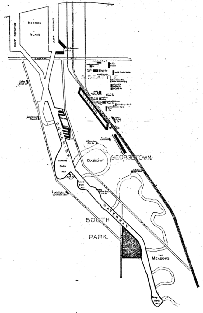
The Duwamish Waterway, whose construction began on October 14, 1913, was a straightening and deepening of the last 6 miles of the formerly meandering river. Construction of the waterway, with Harbor Island at its mouth (the largest artificial island in the world from 1909 to 1938), plus the filling of the Elliott Bay tidelands, are what give Seattle’s harbor its modern shape.

Plan of the Duwamish Waterway, Seattle Post-Intelligencer, August 31, 1913, page 44
Plan of the Duwamish Waterway, from the August 31, 1913, issue of the Seattle Post-Intelligencer, page 44

E Marginal Way S begins as an extension of Alaskan Way S — originally Railroad Avenue, which served much the same function for the central waterfront — at the Port of Seattle’s Terminal 30, and stretches 4⅖ miles from there to the southern city limits. (From the southern end of the Alaskan Freeway to the northern end of the 1st Avenue South Bridge, it carries Washington State Route 99.) Beyond there it runs 3½ miles more to S 133rd Street in Tukwila.

Union Bay Place NE

This street, which runs ⅕ of a mile from 30th Avenue NE in the northwest to the “five corners” intersection with NE 45th Street, NE 45th Place, and Mary Gates Memorial Drive NE, was created in 1907 as part of the Exposition Heights addition. Four years later, the street was extended southeast of NE 45th Street through University of Washington property to NE 41st Street. However, in 1995 that portion was renamed Mary Gates Memorial Drive NE.

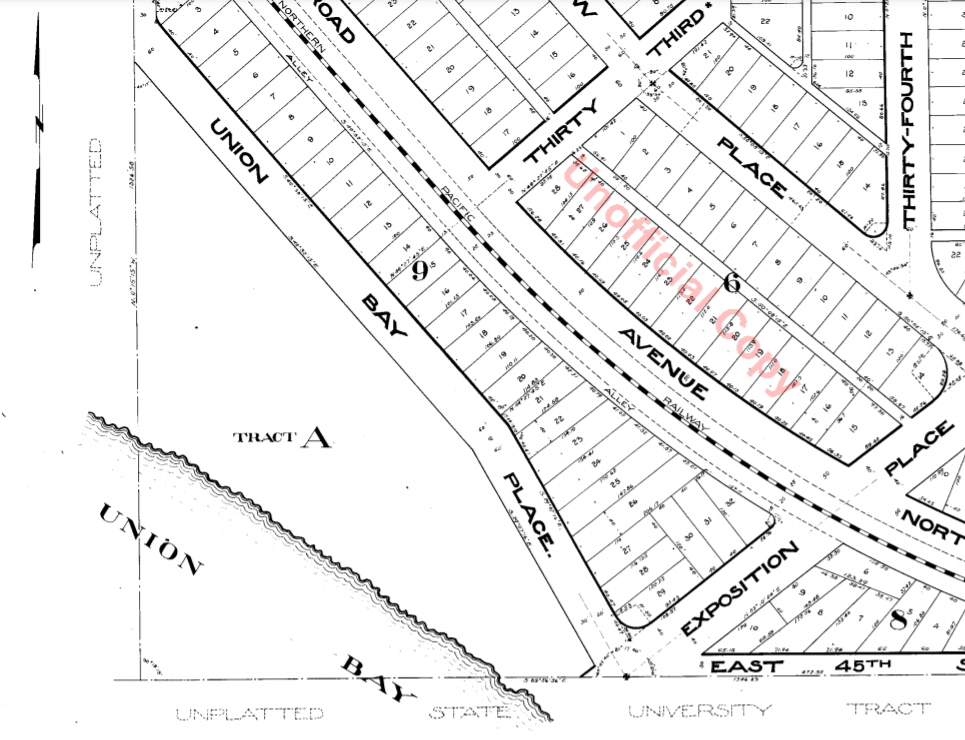
As can be seen in the map below, it did once parallel Union Bay; however, when the Montlake Cut of the Lake Washington Ship Canal opened in 1916, the lake and bay dropped by 8.8 feet to match the level of Lake Union and this was no longer waterfront property. The southwest corner of this map is now entirely devoted to commercial and residential use.

Portion of plat map of Exposition Heights showing Union Bay and Union Bay Place

Union Bay itself was named in 1854 by settler Thomas Mercer, with the idea that it and Lake Union, which he also named, would one day be part of a connection from Lake Washington to Puget Sound. As mentioned above, this did end up happening 62 years later.

Dravus Street

This street was created in 1888 as part of Denny & Hoyt’s Addition to the City of Seattle, Washington Territory by Edward Blewett and his wife, Carrie, of Fremont, Nebraska, who had purchased the land a few months earlier from Arthur Denny and John Hoyt. According to Valarie Bunn in her article “Fremont in Seattle: Street Names and Neighborhood Boundaries,” Edward Corliss Kilbourne may have done much of the actual naming of streets as attorney-in-fact for the Blewetts.

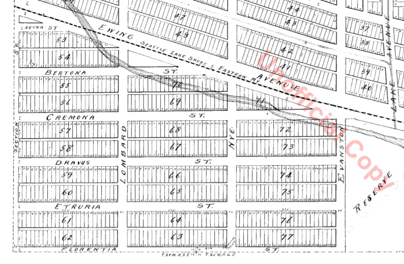
Portion of plat map of Denny and Hoyt's Addition to the City of Seattle, Washington Territory (1888) showing Aetna, Bertona, Cremona, Dravus, Etruria, and Florentia Streets
Portion of plat map of Denny and Hoyt’s Addition to the City of Seattle, Washington Territory (1888) showing Aetna, Bertona, Cremona, Dravus, Etruria, and Florentia Streets

As can be seen in the plat map above, Dravus is part of a series of streets — Aetna, Bertona, Cremona, Dravus, Etruria, and Florentia — that appear in alphabetical order and have the common theme of being locations in Italy, which had been unified 17 years earlier. I have yet to find a connection between Denny, Hoyt, the Blewetts, or Kilbourne and Italy. The closest I’ve come is an item in the February 28, 1903, issue of The Seattle Mail and Herald, which reports that “on February 27, the Woman’s Century Club met and discussed the subject ‘Italian Art and Literature.’ Mrs. Bessie L. Savage and Mrs. E.C. Kilbourne [Leilla Shorey] prepared papers relating to these subjects.” I would love to find out if there’s anything more solid!

The Drava River, which originates in the Italian region of the South Tyrol, flows from there through Austria, Slovenia, and Croatia, forming much of the border between that country and Hungary, and joining the Danube on the Croatia–Serbia border. It was known as Dravus in Latin and Δράβος in Greek.

Dravus Street begins in the east at Nickerson Street and goes ⅗ of a mile west to 8th Avenue W and Conkling Place W. It resumes for half a block at 10th Avenue W, is briefly a foot path and stairway, and then is an arterial connecting Queen Anne and Magnolia via Interbay, going just over a mile from 11th Avenue W to 30th Avenue W. (This section was originally known as Grand Boulevard, and indeed W Dravus is double the width of the other streets in the area, though it features wide planting strips instead of a central median.) It’s ⅓ of a mile from 31st Avenue W to 36th Avenue W, where it becomes a stairway for a block, and then ½ a mile more from 37th Avenue W to just west of Magnolia Boulevard W, where the roadway ends. (There is a shoreline street end off Perkins Lane W, but it is currently inaccessible.)

S River Street

S River Street is just ½ a mile long, and none of it parallels the Duwamish River. The reason behind this is the same reason S Front Street is perpendicular to the waterway — the rechanneling of the Duwamish River that began in 1913. In Joseph R. McLaughlin’s Water Front Addition to the City of Seattle, filed in 1906, Front Street had a horseshoe shape. North Front Street is today’s Front Street, and South Front Street was changed to River Street in 1907, when West Seattle was annexed to Seattle. The Baist Atlas depiction of the Oxbow, below left, is from 1912, so has the modern name.

Portion of index page of Baist's Real Estate Atlas of Seattle, 1912, showing Duwamish River oxbowPortion of King County Parcel Viewer map and aerial view of Seattle showing former location of Duwamish River oxbow

Today’s S River Street begins at 7th Avenue S and goes ½ a mile west, ending at 1st Avenue S, below the 1st Avenue S Bridge. 

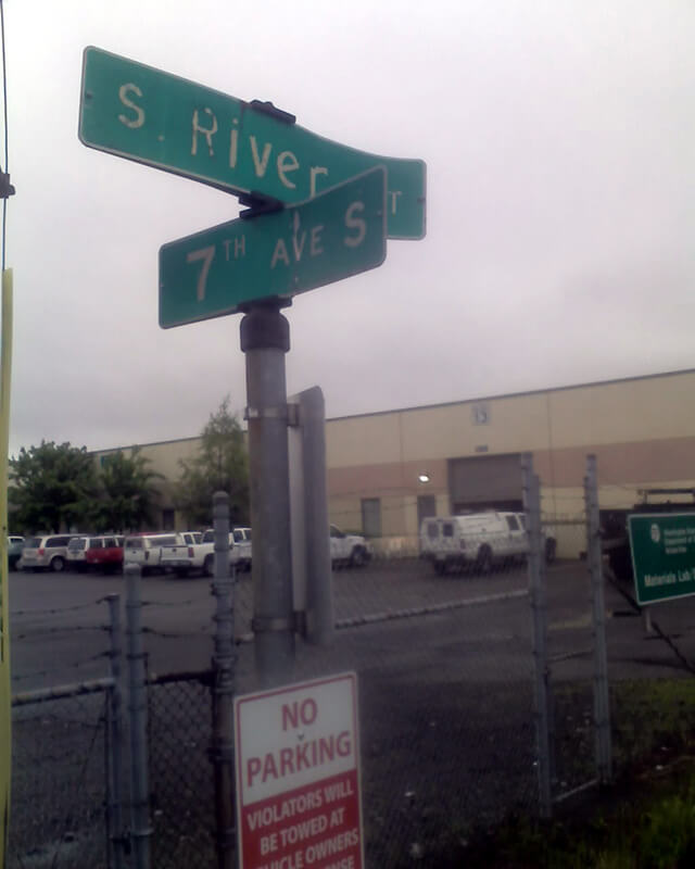
Sign at corner of S River Street and 7th Avenue S, May 22, 2013
Signs at corner of S River Street and 7th Avenue S, May 22, 2013. Photograph by Benjamin Lukoff. Copyright © 2013 Benjamin Lukoff. All rights reserved.

S Front Street

Usually, a Front Street designates a city’s waterfront. Front Street in Philadelphia parallels the Delaware River; NW Front Avenue in Portland, Oregon, goes up the Willamette River; Front Street in Toronto runs along Lake Ontario. Seattle once had a prominent Front Street alongside Elliott Bay, but it was renamed 1st Avenue in 1895. The Front Street we do have runs a grand total of ⅖ of a mile split among three segments, and it runs east–west, while the nearby Duwamish River runs north–south. Why is this?

As it turns out, S Front Street — established as part of Joseph R. McLaughlin’s Water Front Addition to the City of Seattle in 1906 — did use to run along the river, before it was rechanneled beginning in 1913. (Here is an excellent post from the Burke Museum on the Duwamish meanders, with some great maps and aerials.) The maps below show its course along the Duwamish River Oxbow in 1912 (left) and its current landlocked state (right). You can still make out its former location, as well as small remnants in the form of the Slip 2 and Slip 3 inlets. (Incidentally, Front Street originally was shaped like a horseshoe — today’s S Front Street was originally North Front Street, and South Front Street is today S River Street.)

Portion of index page of Baist's Real Estate Atlas of Seattle, 1912, showing Duwamish River oxbowPortion of King County Parcel Viewer map and aerial view of Seattle showing former location of Duwamish River oxbow

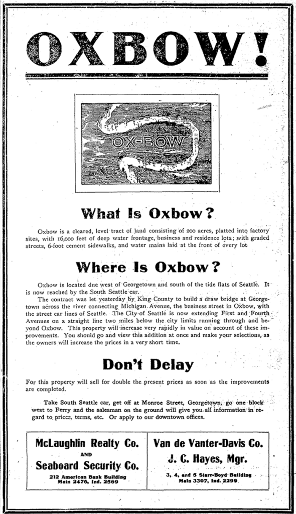
Speaking of the Oxbow, here’s an advertisement for it. So much for that “16,000 feet of deep water frontage.”

Advertisement for Oxbow in June 1, 1906, issue of The Seattle Times

Today’s S Front Street begins at 6th Avenue S and goes ¼ of a mile west, ending just beyond 4th Avenue S. There is another 400-foot-long section between E Marginal Way S and 1st Avenue S, below the approach to the 1st Avenue S Bridge. And then there is one last 200-foot-long section on the west side of the Duwamish River — SW Front Street starts at W Marginal Way SW and ends at the entrance to the Port of Seattle’s Terminal 115 (which used to be Boeing Plant 1, the airplane manufacturer’s first production facility).

Incidentally, here’s a great article on the one in New Orleans I came across while looking up various Front Streets. It’s hard to beat a lede like this: “In a city replete with famed streets, scenic avenues and poetic street names, one particular artery excels at being obscure, nominally insipid, marvelously intermittent, and sometimes barely even a street.”

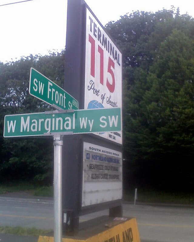
Sign at corner of SW Front Street and W Marginal Way SW, May 20, 2013
Sign at corner of SW Front Street and W Marginal Way SW, May 20, 2013. Photograph by Benjamin Lukoff. Copyright © 2013 Benjamin Lukoff. All rights reserved.

Yukon Avenue S

This very short street (375 feet long) in the Dunlap neighborhood runs from Spear Place S in the south to S Henderson Street in the north. Like Valdez Avenue S, which it intersects, it was established in 1905 as part of Dunlap’s Supplemental to the City of Seattle, and was named after the Yukon River, likely due to the recent Klondike Gold Rush (ended 1899).

Yukon Avenue S, incidentally, holds the distinction of being the at the very end of the list of Seattle streets taken in alphabetical order — hence the tagline for Streets of Seattle, a blog from 2012 that sadly never seems to have gotten off the ground: “Seattle street names, from Adams to Yukon.”

Spring Street

Spring Street was another of Seattle’s “first streets.” Sophie Frye Bass writes in Pig-Tail Days in Old Seattle:

Where springs of clear water bubbled from the earth and the beach was sandy and free from rocks, there the Indians camped. Such a choice spot was Tzee-tzee-lal-litch [dzidzəlalič], which Arthur Denny called Spring Street.

Spring Street begins at Alaskan Way and runs nearly a mile, to Harvard Avenue, before it is interrupted. A few more segments run through the Central District and Madrona. The last is from 38th Avenue to Grand Avenue, at which point it continues to Lake Washington Boulevard as a footpath and stairway.

NW Esplanade

More common in older cities like London (Aldgate, Cheapside, Crosswall, Eastcheap, Houndsditch, Lothbury, Minories, Moorgate, Poultry, Queenhithe, and Walbrook, just to name those that merit a Wikipedia article of their own), single-word street names are a rarity in Seattle. NW Esplanade is one of them. It was platted in 1924 as part of the Golden View Addition, and its extension in 1927 as part of the Loyal Heights Annex.

NW Esplanade runs just over half a mile along the Puget Sound shoreline from Triton Drive NW in the northeast to just shy of the northern boundary of Golden Gardens Park in the southwest. For those who might not know, the word means “a long, open, level area, usually next to a river or large body of water where people may walk.”

NE Boat Street

This street runs just shy of 2,000 feet from NE Pacific Street in the west, just east of the University Bridge, to NE Columbia Road in the east, on the University of Washington South Campus.

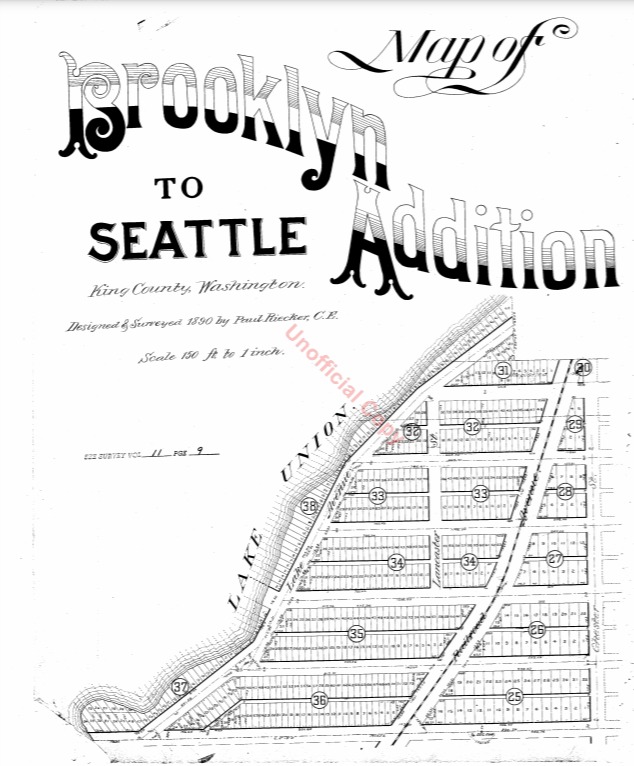
Originally Lake Avenue in the 1890 Brooklyn Addition to Seattle, as it ran along the north shore of Lake Union, it became Northlake Avenue at some point between then and 1901, based on my search of Seattle Times, Seattle Star, and Seattle Post-Intelligencer archives. It starts being referred to as Northlake Way in 1935, though it seems this wasn’t formalized until 1956.

Portion of Map of Brooklyn Addition to Seattle, 1890, showing Lake Avenue (now NE Boat Street) and Railroad Avenue (now NE Pacific Street)

In 1960, Jerry Bryant of Bryant’s Marina proposed that all of Northlake Way — beginning far to the west, at the Fremont Bridge — receive the new name of Boat Street, but the 1962 ordinance establishing Boat Street only changes the name of the few blocks between the University Bridge and the UW campus. The Seattle P-I reports on December 22, 1960, that the Street Naming Committee of the Board of Public works rejected the proposal “because the present name is more descriptive,” but Bryant went ahead and filed his proposal with the City Council anyway in 1961.

According to The Seattle Times on May 24, 1962, the Board of Public Works once again asked the City Council to reject the proposal, which was “backed by more than 50 marine firms or individuals… [and] the University Commercial Club,” but on June 20, the Times reported that the City Council Streets and Sewers Committee approved the change. This met with much opposition. On July 2, the Times published a letter from Vince Lieb, 668 NE Northlake Way, that read, in part, that “numerous business firms… are more than a little chagrined at the City Council’s recent move… to please a minority of merchants who hawk their wares along the way,” and wondered if this might set a precedent:

We can think of such dandies as “Chop Suey Street,” “Gas and Oil Street,” “Beer Street,” and “Fish Street.” How about “Sand and Gravel Street” for a paved thoroughfare?

That same day, according to the P-I, the City Council postponed the implementation of the name change, sending it back to committee, and on July 10, according to the Times, the committee said it would give proponents and opponents two weeks to gather signatures, as the original petition had somehow been lost. Finally, on the 24th, they came up with a compromise: The name would be changed between the University Bridge and 15th Avenue NE only. This is where Bryant’s Marina was located, as well as the Jensen Motor Boat Company, which lasted until 2019 and was the last shipyard left on NE Boat Street.

Headline regarding Boat Street naming controversy, Seattle Times, July 25, 1962
From The Seattle Times, July 25, 1962

Today, Fritz Hedges Waterway Park — built on the former site of the marina — occupies most of the Boat Street waterfront.

Bitter Place N

This street runs a tenth of a mile along the Bitter Lake waterfront from N 134th Street to the grounds of Broadview-Thomson K-8 School and Bitter Lake Playground. It was established in 1923 as part of Bitter Lake Villa Tracts.

Bitter Lake itself was so named because, as HistoryLink puts it, “A small, lake-bound sawmill operation at the southwest corner of Bitter Lake contracted with the Puget Mill and Brown Bay Logging Company to process their lumber cut from nearby forests. The tannic acid from logs dumped into the lake was so bitter that horses refused to drink from it, thus giving the 20-acre pond its name.” Its native name is čʼalqʼʷadiʔ, meaning ‘blackcaps on the sides’.

W Marina Place

This street, established in 1991 as part of the development of the Elliott Bay Marina at the southern foot of Magnolia Bluff, runs ⅖ of a mile west from 23rd Avenue W to just shy of the 30th Avenue W street end beach.

While the origin of its name may not be interesting, the story of its establishment is a bit more so:

  • The marina itself began the permitting process in 1983, but lawsuits delayed its creation for nearly a decade. The Muckleshoot Indian Tribe and Suquamish Tribe sued to block its construction on the basis that “construction of the Marina would eliminate a portion of one of their usual and accustomed fishing areas in Elliott Bay and thus would interfere with their treaty right to fish at the Marina site.” Homeowners on the bluff above intervened on the side of the developers, as “the area has had numerous major landslides that have left several homes at the crest of the bluff at risk and have repeatedly caused breaks in a trunk sewer line located at the base of the bluff.… The Marina construction includes the placement of 500,000 cubic yards of fill at the toe of the bluff, which would stabilize the area.” Eventually, a settlement was reached, which “calls for ongoing fisheries-related expenses paid to the tribe, which will be funded by a percentage of the moorage income.… [the] ‘Indian Treaty Surcharge.’”
  • I believe this was the last major fill operation within Seattle city limits. Such a development would be all but unthinkable today.
  • The marina was built on tidelands where W Lee Street and Puget Avenue W were platted but never built. They were vacated and W Marina Place was established. When it came to naming the access road, the developers originally proposed W Marina Boulevard, contending that as the road fell between the W Oakes Street right-of-way and the former W Lee Street right-of-way, it wasn’t a violation of the city’s principle of maintaining street grid names as much as possible. This was initially rejected by the city, which preferred W Lee Street, but after further discussion, W Marina Place was settled on. An interesting point the developers made was that as W Lee Street had never physically existed in Magnolia, though it had been platted there, calling the access road W Lee Street could actually be confusing, as “people familiar with Seattle streets know that there is no W Lee Street on Magnolia. Rather, they know W Lee Street as being on Queen Anne Hill.” Still, though, I have to believe they were more interested in their own vanity — Marina Boulevard? — than any particular concern for folks’ ability to navigate.
  • For some reason, the public street ends just feet from the 30th Avenue W street end beach. I’m not entirely sure why that is; I don’t think the marina is opposed to public access to the beach; otherwise, they wouldn’t be in favor of the Magnolia Trail project, which would connect W Marina Place to W Galer Street, 32nd Avenue W, and thence to Magnolia Village.
Aerial photograph of Elliott Bay Marina area in the 1930sAerial photograph of Elliott Bay Marina area, present day
Elliott Bay Marina site, 1930s and today

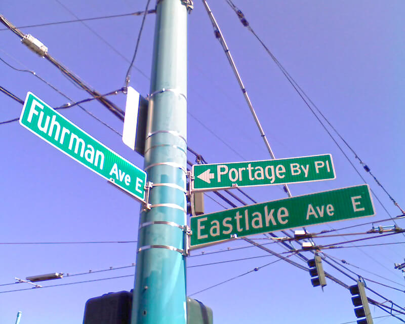
Portage Bay Place E

This street, which runs ³⁄₁₀ of a mile from Fuhrman Avenue E to E Allison Street, was established as an alley in 1890 as part of the Denny–Fuhrman Addition to the City of Seattle, but only received a name in 1936. It was named for Portage Bay, the eastern arm of Lake Union, which it parallels. Portage Bay was in turn named for the portage from Union Bay (part of Lake Washington) to Lake Union over the Montlake Isthmus, which is today the Montlake Cut of the Lake Washington Ship Canal.

Sign at corner of Fuhrman Avenue E, Eastlake Avenue E, and Portage Bay Place E, August 24, 2009
Sign at corner of Fuhrman Avenue E, Eastlake Avenue E, and Portage Bay Place E, August 24, 2009. Portage By Pl is an error; it should read Portage Bay Pl E, as it’s [[Portage Bay] [Place]], not [[Portage] [Bay Place]]. The original Red Robin restaurant was founded at this intersection in 1940. It has since been demolished, but I’ve seen imagery of this sign — including the error — on the walls of other Red Robin locations. Photograph by Benjamin Lukoff. Copyright © 2009 Benjamin Lukoff. All rights reserved.

Bay Street

This street, which runs for a little over a tenth of a mile from Elliott to 1st Avenues, was originally named Grant Street by William Nathaniel Bell in 1881. 14 years later, it was one of the many streets caught up in the Great Renaming of 1895. Per ordinance 4044, it was “ordained… that the name of Grant Street from Elliott Bay to Depot Street, be and the same are hereby changed to Bay Street.” I can’t imagine it took its name from anywhere other than Elliott Bay.

Fauntleroy Way SW

This 4-mile-long thoroughfare runs from the west end of the West Seattle Bridge to Brace Point, passing Morgan Junction, Lincoln Park, and the Fauntleroy Ferry Terminal on the way. It was named for Fauntleroy Cove, location of that terminal, from which riders depart for Vashon Island and Southworth, on the Kitsap Peninsula.

Fauntleroy Cove was itself named after Robert Henry Fauntleroy by George Davidson, Fauntleroy’s future son-in-law. They were both members of the U.S. Coast Survey. He is one of three Fauntleroys whose names appear on Seattle street signs — Ellinor Drive W and Constance Drive W are named for Mounts Ellinor and Constance in the Olympic Mountains, themselves named by Davidson after his future wife and sister-in-law, respectively.

“Elliott Way” just a placeholder name

A new street connecting Elliott Avenue to Alaskan Way as part of the viaduct replacement project is currently under construction. When I first heard in 2016 that they were planning to call it Elliott Way, I thought it was a wasted opportunity. I wrote on my personal Facebook page “This is an opportunity to commemorate someone, or something, new, rather than Jared, George, Samuel, or Jesse Elliott (apparently no one is sure just which Elliott the bay is named after)!”

However, as it turns out, “Elliott Way” is just a placeholder name, just as “E Frontage Road S” was for what is now Colorado Avenue S at the south end of the new 99 tunnel.

On Boxing Day 2020 I finally wrote to the Seattle City Council and the Waterfront Seattle Program letting them know how I felt:

“The bay, and its namesake (most likely midshipman Samuel Elliott of the Wilkes expedition that explored Puget Sound in 1841) already has Elliott Avenue named in its honor. Elliott was, of course, a white man. I don’t know what percentage of Seattle streets are named for white men (although I would be fascinated to find out, and may undertake that as a project for my blog on Seattle street names), but I’m sure it’s very high.

“I urge you instead to take this opportunity to name this street something else. The Duwamish people, for example, have Duwamish Avenue S named for them (actually more likely for the river, as Elliott Avenue was named for the bay, not directly for the sailor), but it is an insignificant street 2/10 of a mile long hidden under the Spokane Street Viaduct and the Alaskan Freeway. Perhaps Duwamish Avenue would be a better choice, if the tribe approved? Or perhaps the street could honor a non-white person associated with the history of Seattle’s waterfront? Frank Jenkins, perhaps?”

I honestly didn’t expect to hear back from anyone, but to my surprise Marshall Foster, director of the Office of the Waterfront and Civic Projects, wrote me himself on January 5, saying:

We completely agree that the naming of this new street is an exciting opportunity. “Elliott Way” has simply been a placeholder until we are closer to its opening. The Coast Salish tribes are an incredibly important part of Seattle’s history and culture today. We have actually been thinking along similar lines about how this naming could help to elevate their presence here, and have been in discussions with our partners in the tribal community about ideas very similar to yours. We expect to have a proposal for public discussion later this year.

I have to say, I’m pretty happy about this.

Update as of January 11, 2022: I wrote Foster and his team over the weekend asking if there were any updates, and heard back today from Lauren Stensland:

We agree that this is a great opportunity and we continue to coordinate with the tribes and other partners on a proposed name. It is definitely high on our list for this year. We do not have any new updates at this time; we expect to have more to share in the next few months. Stay tuned and keep an eye on our website.

Update as of September 21, 2022: I recently wrote back to Stensland to check on the status of the street and its name, and she replied today that:

The elevated roadway is planned to open in early 2023. As for the roadway name, we are continuing to work toward this and will share updates as soon as we have them. Keep staying tuned!

Update as of February 2, 2023: I posted an article last month “Dzidzilalich” to be honorary name for Elliott Way, Alaskan Waynoting that, in fact, the roadway will be known as Elliott Waybut will carry the honorary name “Dzidzilalich.” So it seems “Elliott Way,” after all, is unfortunately not just a placeholder name.

NW Locks Place

Seattle’s newest street name is no longer E Barbara Bailey Way but NW Locks Place — formerly the block of NW 54th Street that ran between NW Market Street and the entrance to the Hiram M. Chittenden Locks, more commonly known as the Ballard Locks.

Ordinance 125947, passed by the city council in late September, was signed by the mayor the next week and went into effect a few days ago. As the Seattle Department of Transportation explained this summer, the name change stemmed from a request by emergency dispatchers: previously, there were two locations in which NW Market Street and NW 54th Street intersected; once in front of the locks and once over a mile to the east, where Market descends from Phinney Ridge. This name change will serve to eliminate any confusion about what is meant by “the intersection of 54th and Market.”

A similar change was made to Green Lake street names in 1961, when the various segments of Green Lake Way north of NE Ravenna Boulevard and N 72nd Street were changed to Green Lake Drive — previously, Latona Avenue NE, Sunnyside Avenue N, and Ashworth Avenue N (to name a few) had intersected Green Lake Way twice.

Interestingly, only the Lockspot Cafe’s address (3005) is affected by this name change. The other buildings fronting NW Locks Place have addresses on NW Market Street, and the address of the Ballard Locks remains 3015 NW 54th Street.