Alaskan Way

Alaskan Way was originally Railroad Avenue. Jennifer Ott writes for HistoryLink.org:

On the central waterfront a web of railroads grew out from the shore in the 1880s and 1890s as various railroads, including the Columbia & Puget Sound, the Seattle, Lake Shore & Eastern, and the Northern Pacific jockeyed for space at the foot of the bluffs that ended at the beach, where Western Avenue is today. In January 1887 the City Council passed an ordinance establishing Railroad Avenue, a street created, according to historian Kurt Armbruster, to provide space for the Seattle, Lake Shore & Eastern franchise to the west of the Northern Pacific’s franchise along the shoreline.
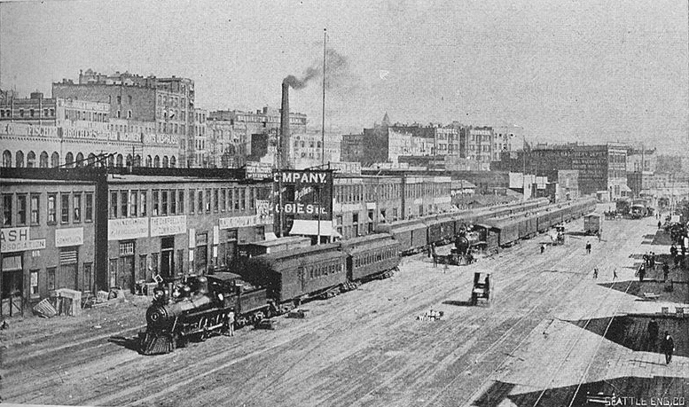
Railroad Avenue looking south from between Madison and Marion Streets, circa 1898

When the tidelands were platted in 1895, Railroad Avenue extended to Harbor Island and West Seattle, but:

  • Sometime between 1912 and 1920 the Harbor Island portion was renamed W Florida Street (SW Florida Street today).
  • In 1907, the West Seattle portion was renamed Alki Avenue.
    • Sometime between 1912 and 1920 the West Seattle portion southeast of Duwamish Head was given its current name, Harbor Avenue.

In an article for Crosscut (now CascadePBS.org), Knute Berger explains why a new name was wanted for the remainder:

Seattle’s waterfront was unpaved — a beat-up plank road ran its length. There was no modern seawall — the street was built over the water. Train tracks were everywhere.… But the waterfront was undergoing a massive renovation. A seawall was being constructed, the shoreline filled in, the road made into a wide, paved boulevard.…

According to Berger and Ott’s articles, names that were proposed but were ultimately rejected included Anchors Way, Artery Way, Battery Way, Bois Boolong, Bread Street, Cargo Way, Chief Seattle Avenue, Cosmos Quay, Dock Street, Export Way, Fleet Way, Gateway Avenue, Golden West Way, Hiak Avenue, Klatawa Avenue, Maritime Avenue, Metropolis Avenue, Olympian Way, Pacific Way, Pier Avenue, Port Strand, Port Way, Port-Haven Drive, Potlatch Avenue, Puget Avenue, Puget Dyke, Puget Portal, Queen City Way, Roadstead Way, Salt Spray Way, Salt Water Avenue, Seawall Avenue, Seven Seas Road, Skookum Way, Steamship Way, Sunset Avenue, Terminal Avenue, Terrebampo Way, The Battery, The Esplanade, Transit Row, Voyage Way, Welcome Way, and Worldways Road. (Those in italics apparently came under serious consideration.)

So how did we end up with Alaskan Way? And why Alaskan instead of Alaska (the already existing S Alaska Street could have been renamed)?
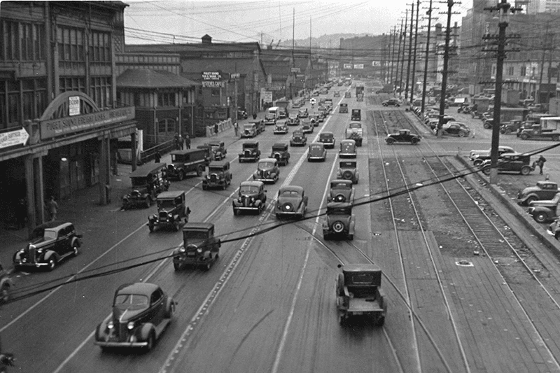
Alaskan Way, July 1939
Alaskan Way between Marion and Madison Streets, Canadian National Dock at left, July 1939. Courtesy of the Seattle Municipal Archives, Identifier 77093

The May 19, 1932, issue of The Seattle Times reports that the Seattle Maritime Association had run a renaming contest which received “more than one thousand letters… some of them contained scores of suggestions.” 4,868 names (including duplications) were received, and the judges selected four finalists, in order of preference: Puget Portal (one submission), Klatawa Avenue (one submission, from Chinook Jargon word meaning ‘to go, to travel’), Hiak Avenue (one submission, from Chinook Jargon word meaning ‘lively, quick and fast’), and Maritime Avenue (49 submissions [Maritime Way received 99 submissions but was not chosen]). The next day, the Times reported that the judges had chosen Maritime Avenue, and awarded the $20 prize to a Mr. B.I. Schwartz, the first to have suggested the name.
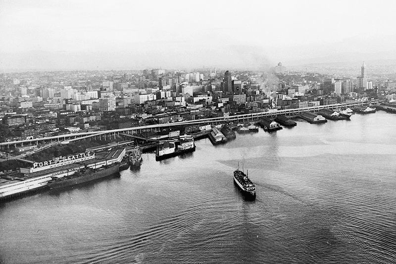
Alaskan Way Viaduct, July 1952
Alaskan Way Viaduct, July 1952, the year before it opened. The double-decker freeway paralleled Alaskan Way as far north as Union Street, where it diverged from the alignment on its approach to Elliott Avenue and the Battery Street Tunnel. Bell Street Pier, with the large Port of Seattle sign, is at left. The Bell Street Overpass can be seen behind the ‘P’ in ‘Port’. The bridge at the southern end of the pier is the Lenora Street Viaduct. Courtesy of the Seattle Municipal Archives, Identifier 43586

However, that July, a George D. Root proposed the name Cosmos Quay. At first, it was met with indifference, and then it seems the entire renaming project was put on the back burner until construction progressed. Somehow, when he restarted his campaign in 1934, Cosmos Quay became a leading candidate, and it was approved unanimously by the city council on January 14, 1935. An ordinance began to be drafted. But, as the Seattle Post-Intelligencer noted the next day, this was only because one councilmember, Frank J. Laube, had been absent… and he was adamantly opposed.

He wasn’t the only one. The Seattle Times published an editorial on January 20 headlined ‘City Locksmith Needed for Pronunciation Key’, which proclaimed that “to burden the waterfront stretch with a name that could be used and understood only through long courses in cosmogony, cosmology, etymology, and articulation would be a sad piece of nonsense for which there is no excuse.” The next day the Times reported that David Levine, city council president, said Cosmos Quay “no longer sounds so good to him. Many citizens have complained its meaning, as well as its pronunciation, mystifies them.” On February 4, according to the P-I, the council killed the ordinance and decided to leave Railroad Avenue as it was.
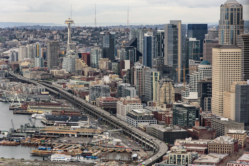
Alaskan Way Viaduct, February 2018
Alaskan Way Viaduct, February 2018. It closed permanently in January 2019; the replacement tunnel opened the next month. and demolition was complete by November of the same year. Photograph by Flickr user Washington State Department of Transportation, licensed under Creative Commons Attribution-NonCommercial-NoDerivs 2.0 Generic

When the new street opened in 1936, the question of renaming came up again. Mayor John F. Dore appointed a committee that chose The Pierway, a suggestion that won a W.C. Denison, Jr., a prize of $50 from the mayor’s own pocket, but the final decision lay with the city council, which was not enthused. Pacific Way emerged as their favorite, according to a Seattle Times article on July 2, 1936, though a July 6 article in the same paper “the public apparently was not in accord with the idea.” On July 7, the Times reported that even though “at least seven votes [were] lined up in advance for the adoption of ‘Pacific Way’… with Council President Austin E. Griffiths contending for ‘Cosmos Quay’ or ‘Cosmos Way’,” an ordinance renaming Railroad Avenue “Alaskan Way” passed unanimously.

Alaska Way had been proposed in 1932 by the Puget Sound Travel Directors, according to an article in the April 13 issue of The Seattle Times. (As an aside, it was also proposed in 1931 by attorney John S. Robinson as an alternate name for Aurora Avenue N and the Aurora Bridge, according to a Times article on June 19.) It was also an entry in the Seattle Maritime Association’s aforementioned naming contest, submitted by Fred E. Pauli, manager of the Alaska Division of the Washington Creamery Company, according to a Times article on April 10, 1932. Then, in 1935, after Cosmos Quay had been rejected by the city council, the Alaska Yukon Pioneers endorsed Alaska Way (The Seattle Times, March 5), followed by the Whittier Heights Improvement Club (Times, March 7) and the Junior Alaska-Yukon Pioneers (Times, July 25). When renaming became a distinct possibility once again in 1936, as discussed above, the Alaska Yukon Pioneers passed a resolution in favor of Alaska Way (Times, July 4): “…It was here that the gold rush activity actually took place… put Seattle on the map and directly made possible the magnificent improvement now about completed.”
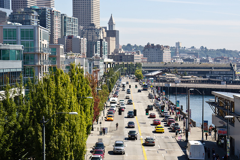
Alaskan Way south from Bell Street
Alaskan Way looking south from the Bell Street pedestrian bridge, August 2011. The Alaskan Way Viaduct is barely visible at center; the Seattle Aquarium is at center right. Photograph by Orange Suede Sofa, Wikimedia Commons, licensed under Creative Commons Attribution-Share Alike 3.0 Unported

It came down to one councilmember, apparently. The Seattle Post-Intelligencer reported on July 7 that, the previous day, Robert H. Harlin proposed that the already-prepared ordinance renaming Railroad Avenue “Pacific Way” be amended to read “Alaskan Way” instead:

Councilman Robert H. Harlin, who offered the motion for adoption of “Alaskan Way,” said he preferred it to “Alaska Way” because it “recognizes the human element, honoring the men and women who pioneered the territory.” Although a majority of the council had informally agreed to support the name “Pacific Way,” sentiment crystallized rapidly in favor of “Alaskan Way” after Harlin’s statement.
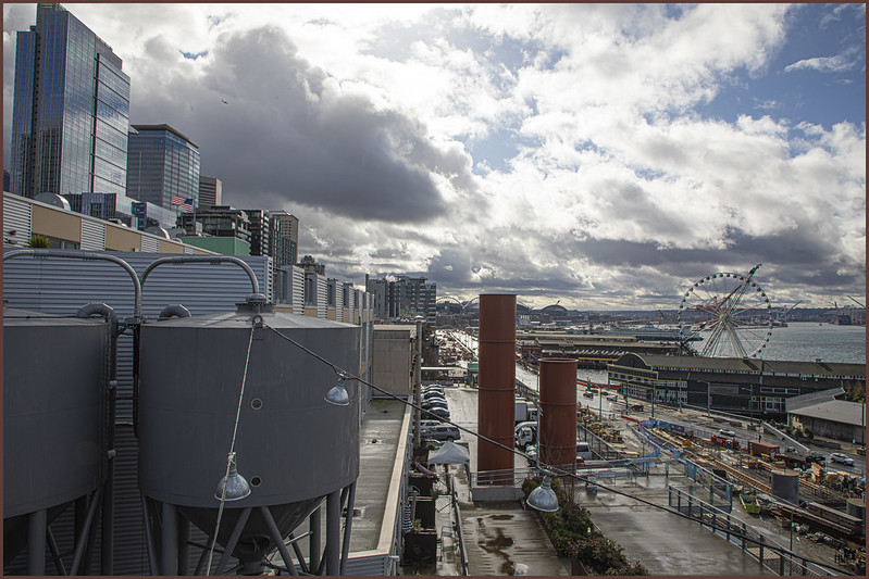
Alaskan Way, March 2021
Alaskan Way from the Pike Place Market’s MarketFront, March 2021. Construction of the street that wasn’t going to be called Elliott Way — but now, as of early 2023, will be — is visible at center right. The Seattle Great Wheel can be seen above the Seattle Aquarium. Photograph by Flickr user Scott Smithson, licensed under Creative Commons Attribution-NonCommercial-NoDerivs 2.0 Generic

Today, Alaskan Way S begins at the north end of E Marginal Way S, at the entrance to the Port of Seattle’s Terminal 30, and goes 2⅓ miles north, then northwest, to Broad Street, having become Alaskan Way on crossing Yesler Way. This is the Alaskan Way most people think of.

But, as they say, wait — there’s more! The right-of-way continues for another 1¾ miles, ending at W Garfield Street under the Magnolia Bridge, at the entrance to the Port of Seattle’s Terminal 91. From the Olympic Sculpture Park, which begins at Broad Street, to Myrtle Edwards Park, the right-of-way is taken up by park land and the tracks of the BNSF Railway — successor to the Columbia & Puget Sound; the Seattle, Lake Shore & Eastern; and the Northern Pacific, the railroads for which Railroad Avenue was originally built. Northwest of Myrtle Edwards, it’s entirely taken up by the tracks that run alongside Centennial Park. It isn’t until W Galer Street that there’s a city street in the right-of-way again, and Alaskan Way W only goes about ⅙ of a mile northwest from there to W Garfield Street. Even less than that is signed Alaskan Way, as the city has put up a sign for Expedia Group Way W where the W Galer Street flyover “touches down.” However, even though southeast of Galer the roadway runs first on Expedia property, then Port of Seattle property, the city appears to still consider it Alaskan Way W between the Expedia campus entrance and the north end of Centennial Park — a distance of just over ⅓ of a mile.

S Industrial Way

In 1930, Seattle City Light acquired a number of transmission line rights-of-way. The one immediately concerning us approaches the utility’s South Service Center from the southeast. East of Interstate 5, the Chief Sealth Trail runs along the right-of-way from Beacon Hill to Kubota Garden. West of the freeway, a road was built in the late 1960s as part of the South Seattle Redevelopment Project, or South Seattle Industrial Park, as it came to be known. This street was designated Industrial Way in 1969, and runs from Airport Way S in the southeast to 4th Avenue S and Diagonal Avenue S in the northwest, a distance of about ⅓ of a mile.

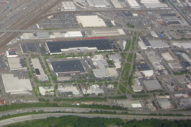
Aerial view of Industrial District with S Industrial Way at center right
Aerial view of Industrial District, May 2009. S Industrial Way is the boulevard with the grassy median at center right, leading to the City Light South Service Center. The diagonal street at its end is, appropriately, Diagonal Avenue S, and the arterial it stops at is 4th Avenue S. The Union Pacific Railroad’s Argo Yard is in the upper-left-hand corner, and Airport Way S and Interstate 5 run along the bottom. Photograph by Flickr user J Brew, licensed under Creative Commons Attribution-ShareAlike 2.0 Generic

Viewmont Way W

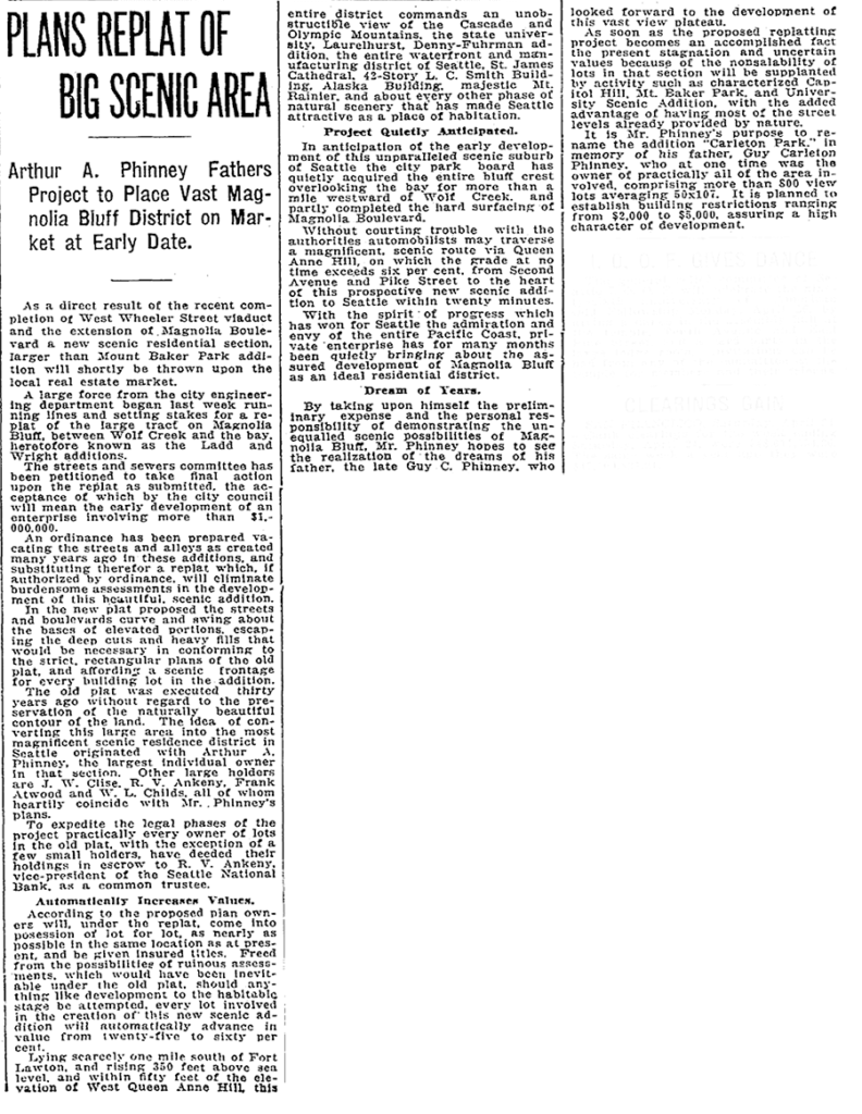
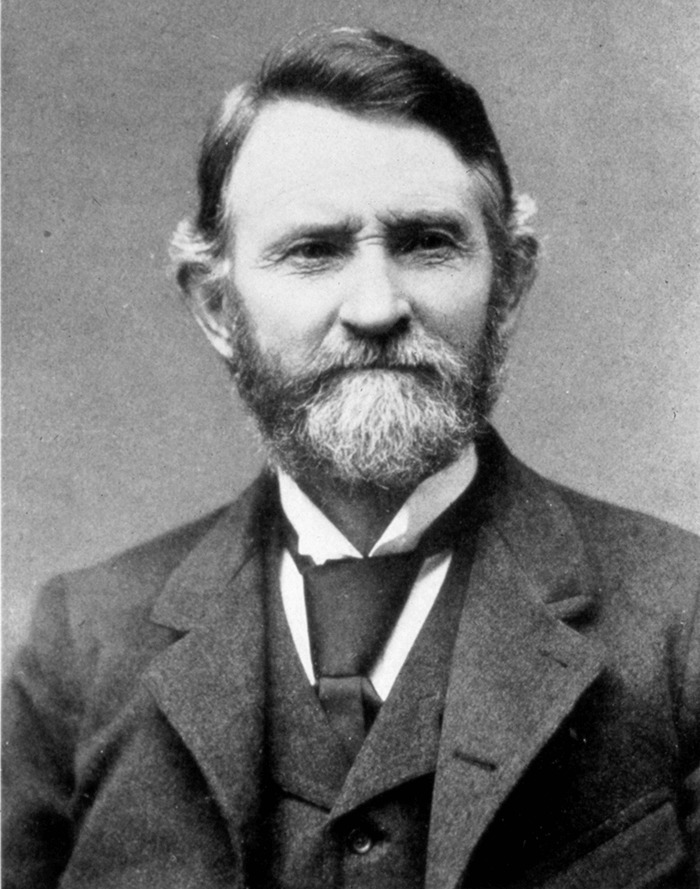
This street was created in 1915 as part of the plat of Carleton Park, a replat of much of southwest Magnolia (basically a triangle formed by W Raye Street, 34th Avenue W, and Magnolia Boulevard W). Arthur A. Phinney (1885–1941) led the project, named after his father, Guy Carleton Phinney (1851–1893) (Phinney Avenue N, Phinney Ridge). As The Seattle Times reported:

The old plat was executed thirty years ago without regard to the preservation of the naturally beautiful contour of the land.… In the new plat the streets and boulevards curve and swing about the bases of elevated portions, escaping the deep cuts and heavy fills that would be necessary in conforming to the strict, rectangular plans of the old plat, and affording a scenic frontage for every building lot in the addition.… This entire district commands an unobstructible view of the Cascade and Olympic Mountains, the state university, Laurelhurst, Denny-Fuhrman addition, the entire waterfront and manufacturing district of Seattle, St. James Cathedral, 42-story L.C. Smith Building, Alaska Building, majestic Mt. Rainier, and about every other phase of natural scenery that has made Seattle attractive as a place of habitation.

Article on Carleton Park, Seattle Times, April 25, 1915

Viewmont Way was obviously named after its view of the mountains, and is of a piece with other Carleton Park streets like Montavista Place, Westmont Way, Eastmont Way, Altavista Place, and the like.

Viewmont Way W begins at the intersection of 34th Avenue W, W Lynn Street, and Montvale Place W in Magnolia Village, and goes ¼ mile southwest to Constance Drive W, where it becomes W Viewmont Way W. The name initially continued about the same distance northwestwards, where the street became 41st Avenue W, but this portion and the rest of 41st Avenue as far north as Fort Lawton (now Discovery Park) were apparently changed at some point to W Viewmont Way. In 1961, the streets became Viewmont Way W and W Viewmont Way W.

W Blewett Way

This street is named for Edward Blewett (1848–1929), one of the developers of the Fremont neighborhood (named after his hometown, Fremont, Nebraska).

“But,” you might say, “if he developed Fremont, why is W Blewett Way in Queen Anne?”

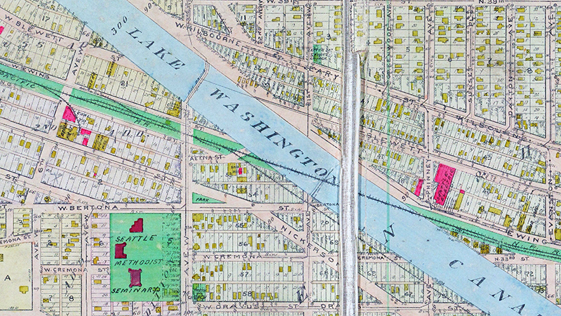
As you can see in the map below, and in this plat he filed in 1888 of what is now Fremont and North Queen Anne before the Fremont Cut was dug, Ewing and Blewett Streets used to be part of both neighborhods. When they became separated, the names were left alone on the Queen Anne side; in Fremont, they were changed as follows: Kilbourne to N 36th Street, Blewett to N 35th Street, and Ewing to N 34th Street.

Portion of 1912 Baist Atlas Showing Fremont Cut
Portion of 1912 Baist Atlas showing Fremont Cut

It’s not quite that simple, though — Blewett never reached quite as far as 13th Avenue W. What appears to have happened is that a name was needed when what is now W Blewett Way was created in 1907, and because the street to the south was still Ewing, Blewett presented itself as a natural choice. The rest of Blewett south of the canal was vacated over the years, so this is all that’s left of the name.

Today, W Blewett Way begins at the north end of 13th Avenue W and goes east just about ⅒ of a mile before it becomes a private driveway.

Denny Way

This street is named for David Thomas Denny (1832–1903). He was one of the members of the Denny Party that landed at Alki Point in 1851, led by his older brother, Arthur Armstrong Denny (1822–1899). In 1853, he married his sister-in-law, Louisa Boren (1827–1916). (Louisa’s older sister, Mary Ann Boren [1822–1910], had married Arthur in 1843. She, Louisa, and their brother, Carson Dobbins Boren [1824–1912], were also part of the Denny Party).

The Dennys settled on land in what is now Lower Queen Anne, living in a series of houses in the area until they went bankrupt in the Panic of 1893 and had to leave their mansion for their summer cottage at Licton Springs, where they lived with their oldest child, Emily Inez Denny (1853–1918), until they died.

Denny Park is named for the couple, which had given the land to the city as its first cemetery in 1861; the bodies were moved to the Washelli Cemetery on Capitol Hill in the 1880s, at which time the original cemetery was converted to a park, likewise the city’s first. (Just a few years later, Washelli was also converted to a park, initially known as Lake View Park, then City Park, and finally, in 1901, Volunteer Park. The Dennys’ private burial ground near the no-longer-existent Oak Lake eventually became the Oaklake Cemetery, which, after being sold by their son Victor in 1914, was renamed Washelli after the original cemetery of that name; Evergreen Cemetery, across Aurora Avenue N from Washelli, bought the latter in 1922, and the combined cemetery took its current name, Evergreen Washelli, in 1962.)

David Denny was active in government. According to HistoryLink.org, he was:

…Probate judge, King County commissioner, Seattle City Council member, a director of the Seattle School District, and regent of the Territorial University of Washington.… Denny was an ardent advocate of woman suffrage and helped lead the movement that in the 1880s won Washington women the right to vote. He opposed the expulsion of Chinese immigrants in 1886, which antagonized local nativists.

Denny was also involved in the development of a number of Seattle neighborhoods; in addition to Queen Anne, he developed tracts in South Lake Union, Capitol Hill, and Ravenna, and founded the Rainier Power and Railway Company, which ran the first streetcar from Downtown (Pioneer Square) to the University District (Ravenna Park).

David T. Denny, 1890
David T. Denny, 1890. Courtesy of the Seattle Municipal Archives, Identifier 175313.

Denny Way — originally named Depot Street by Denny after a proposed train station that never materialized — begins as a shoreline street end on Elliott Bay, indistinguishable from the surrounding Myrtle Edwards Park. On the other side of the BNSF Railway tracks, W Denny Way begins as a pathway and stairway from Elliott Avenue to Western Avenue. From here, it is a major arterial, becoming Denny Way as it crosses Queen Anne Avenue N (originally named Temperance Street by Denny), and going 2½ miles east to E Madison Street and 22nd Avenue. (It becomes a neighborhood street on crossing E Olive Way, and the block between Broadway and 10th Avenue E was renamed E Barbara Bailey Way in 2019). E Denny Way begins again at E Madison Street and 23rd Avenue and goes ⅘ of a mile east to Madrona Place E and 38th Avenue, where it turns into Madrona Drive.

Denny Way, which becomes E Denny Way east of Eastlake Avenue E, also divides five of the city’s directional designation zones from each other, similarly to Yesler Way. North of Denny but west of Queen Anne Avenue N, east–west streets carry the W prefix and north–south avenues carry the suffix W. North of Denny between Queen Anne Avenue N and Eastlake Avenue E, east–west streets carry no prefix and north–south avenues carry the suffix N. North of Denny east of Eastlake Avenue E, east–west streets carry the E prefix and north–south avenues carry the suffix E. South of Denny but west of a line that includes Melrose Avenue, Minor Avenue, E Union Street, and Broadway, neither east–west streets nor north–south avenues carry a prefix or suffix. And south of Denny but east of that line, east–west streets carry the E prefix and north–south avenues carry no suffix.

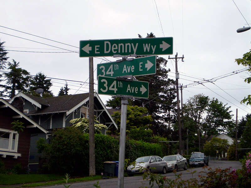
Signs at corner of 34th Avenue and E Denny Way, May 29, 2010
Signs at E Denny Way, where 34th Avenue becomes 34th Avenue E, May 29, 2010. Photograph by Benjamin Lukoff. Copyright © 2010 Benjamin Lukoff. All rights reserved.

Yesler Way

This street is named after Henry Leiter Yesler (1810–1892). Originally from Leitersburg, Maryland, which was founded by his great-grandfather, and living in Massillon, Ohio, before coming west, he moved to Seattle from Portland, Oregon, in 1852. As John Caldbick writes for HistoryLink.org:

…[Yesler] quickly established himself as the most important resident of the rain-swept little spot that would soon become Seattle. He had the first steam-powered sawmill on Puget Sound up and running within months, and for several years he employed almost every male settler in Seattle and a considerable number of Native Americans. His mill was early Seattle’s only industry, and without it the town’s development would have been greatly delayed.

Carson Dobbins Boren and David Swinson “Doc” Maynard had already claimed land on Elliott Bay either side of what is today Pioneer Square, but they gave him part of their claims so he could access the water from the claim he made farther up First Hill. Yesler’s mill was built at the foot of what is now Yesler Way but was originally Mill Street, also known as Skid Road — and yes, Seattle may be where the term originated, referring to a neighborhood largely inhabited by the “down and out.”

Yesler was also King County auditor in 1852, and Seattle mayor from 1874 to 1875 and 1885 to 1886.

Yesler had two children: a son, Henry George Yesler (1845–1859), by his wife, Sarah Burgert Yesler (1822–1887); and a daughter, Julia Benson Intermela (1855–1907). Her mother wasn’t Sarah, who didn’t come to Seattle until 1858, but rather a Duwamish woman named Susan, daughter of Salmon Bay Curley (Su-quardle), who had worked at Yesler’s mill. When Sarah finally joined her husband, he sent Susan and Julia to live with Jeremiah S. Benson, a cook at the mill. In the 1870 territorial census, Julia is listed as living with the Bensons, but the next year she is listed as a HB (“half-breed”) house servant for the Yeslers. Unlike Rebecca Lena Graham, who successfully sued the relatives of Franklin Matthias to be recognized as his rightful heir, Julia inherited nothing when her father died in 1892. Even so,

…The settlement of Henry Yesler’s estate was an imbroglio of epic proportions. It pitted Minnie Gagle Yesler [a younger cousin whom he married a few years before his death] and her mother against James Lowman [his nephew] and municipal authorities, who believed that Yesler had made a will that left most of his fortune, by then worth more than $1,000,000, to the city, hoping thereby to cement his reputation as the “Father of Seattle.”

Yesler is also quoted as anticipating “Strange Fruit” by 55 years… though it’s by no means a sentiment Abel Meeropol or Billie Holiday would have shared. In January 1882, a mob lynched James Sullivan, William Howard, and Benjamin Paynes between two of his maple trees. Harper’s Weekly reported Yesler’s reaction: “That was the first fruit them trees ever bore, but it was the finest.”

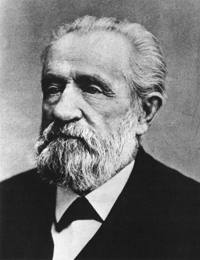
Henry L. Yesler
Henry L. Yesler. Courtesy of the Seattle Municipal Archives, Identifier 12257

Yesler Way begins on the Elliott Bay waterfront at Alaskan Way and goes 2⅙ miles east to Leschi Park, just past 32nd Avenue. It also appears just west of Lake Washington Boulevard, where it goes about 200 feet west and essentially serves as a driveway for a couple of houses.

Yesler Way, which becomes E Yesler Way east of Broadway, also divides three of the city’s directional designation zones from each other. South of Yesler, east–west streets carry the S prefix and north–south avenues carry the suffix S. North of Yesler, north–south avenues carry no suffix; east–west streets carry the E prefix east of Broadway and no prefix west of Broadway.

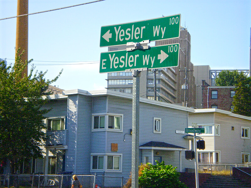
Street sign at corner of Yesler Way and Broadway, August 25, 2009
Street signs at corner of Yesler Way and Broadway, August 25, 2009. Photograph by Benjamin Lukoff. Copyright © 2009 Benjamin Lukoff. All rights reserved.

Goodwin Way NE

This street, originally named Columbian Way in the 1920 plat of Victory Heights, was given its current name sometime during or before 1936, the first time I find it mentioned in the archives of The Seattle Times. I presume this was to avoid confusion with the Columbian Way in South Seattle, even though Victory Heights wasn’t annexed to Seattle until 1953.

The plat was filed by the Goodwin Real Estate Company and the Squire Investment Company. The Goodwin Real Estate Company at that time had Ervin Shirley Goodwin (1869–1937) as its president and his nephew, Arthur Eliot Goodwin (1887–1960), as its secretary. (Ervin and his brothers were instrumental in the development of Pike Place Market.) I presume the renaming was to honor Erwin rather than Arthur, though explicit explanations are rarely given for street naming. It may very well have been to honor the company. (Incidentally, Erwin’s wife, Eda, was a founder of the Seattle Fruit and Flower Mission in 1907; this organization became the Seattle Milk Fund in 1935 and Goodwin Connections in 2019.)

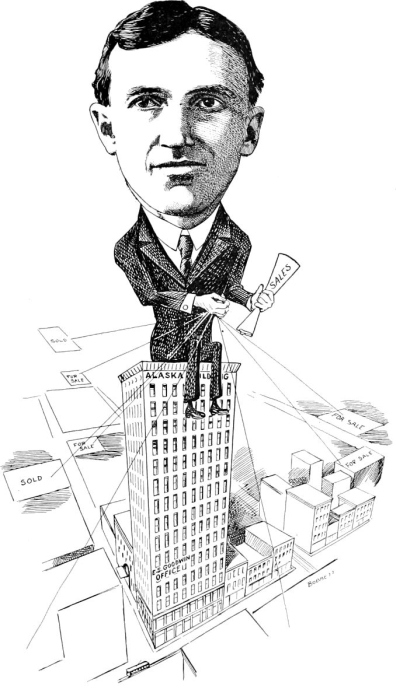
E.S. Goodwin
Ervin Shirley Goodwin

Unfortunately, in addition to being major developers (in addition to Victory Heights, they were behind Lakeridge, Hawthorne Hills, and subdivisions in Northgate, Lake City, and Windermere), the Goodwin Real Estate Company were pioneers in imposing racial restrictive covenants on their developments. As the Seattle Civil Rights & Labor History Project writes,

Seattle’s first known racial restrictive covenant was written in 1924 by the Goodwin Company and applied to three tracts of land and one block of the company’s development in the Victory Heights neighborhood in north Seattle.

It read:

Said tract shall not be sold, leased, or rented to any person or persons other than of Caucasian race nor shall any person or persons other than of Caucasian race use or occupy said tract.

Goodwin Way NE begins at 19th Avenue NE just north of NE Northgate Way and goes ¼ mile northwest to 15th Avenue NE between NE 113th Street and NE 115th Street.

Stone Way N

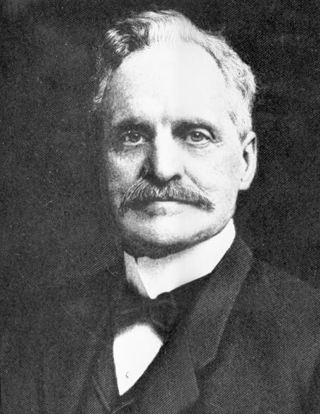
This street is named for Corliss P. Stone (1838–1906), a member of the Seattle City Council from 1869 to 1872 and mayor of Seattle from 1872 to 1873, who was involved in the development of Fremont and Wallingford. The standard story is that he embezzled $15,000 from his real estate development firm and abandoned his office — and the state — but the truth of the matter is unclear. He returned at some point to Seattle and helped found the Seattle Chamber of Commerce in 1882. His name also appears on Corliss Avenue N.

Corliss P. Stone
Corliss P. Stone

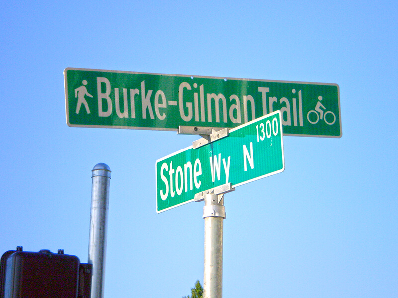
Stone Way N begins on the north shore of Lake Union at N Northlake Way and Waterway 22, and goes 1⅕ miles north to N 50th Street and Green Lake Way N. It forms an unofficial boundary between the Fremont and Wallingford neighborhoods.

Signs at corner of Burke-Gilman Trail and Stone Way N, August 24, 2009
Signs at corner of Burke-Gilman Trail and Stone Way N, just south of N 34th Street and north of N Northlake Way, August 24, 2009. Photograph by Benjamin Lukoff. Copyright © 2009 Benjamin Lukoff. All rights reserved.

NE Northlake Way

As explained in NE Boat Street, NE Northlake Way was originally Lake Avenue in the 1890 Brooklyn Addition to Seattle, so named because it ran along the northern shore of Lake Union. I couldn’t find an ordinance changing its name from Lake Avenue (used elsewhere, notably for what are now Westlake Avenue and Fremont Avenue N and for part of Eastlake Avenue E) to Northlake Avenue, but the latter name begins to appear in local newspapers in 1901. (Complicating matters slightly, the street appears as North Lake Avenue in the state’s 1907 plat of Lake Union Shore Lands.) Northlake Avenue began being referred to as Northlake Way in 1935, and this was made official in 1956.

Today, NE Northlake Way begins at the west end of NE Pacific Street under the University Bridge at Eastlake Place NE, and continues 1½ miles west to just shy of the Aurora Bridge, where it becomes a private road through formerly industrial land developed by the Fremont Dock Company into a business park. (The Puget Sound Business Journal and The Seattle Times have good articles on how over the years Suzie Burke transformed her father’s Burke Millwork Co., which opened in 1939, into what is today home to local offices for Google and Adobe and corporate headquarters for Tableau and Brooks Sports, among other tenants.) This private roadway continues for ⅖ of a mile beyond the end of the public right-of-way to the intersection of N Canal Street, N 34th Street, and Phinney Avenue N.

NE Northlake Way once began ⅖ of a mile further east, at NE Columbia Road on the University of Washington South Campus, but this stretch was changed to NE Boat Street in 1962, not without some controversy.

W Government Way

In 1897 a number of Magnolia landowners deeded to the federal government land for “a government roadway leading from the east boundary of the military reservation of Fort Lawton,” which was to open in 1900, to a wharf at what is now 27th Avenue W and W Commodore Way. At some point between then and 1907, when it appears in in the plat of Lawton Heights, an Addition to the City of Seattle, filed by Anna S. Brygger (see Brygger Drive W and NW Brygger Place), it became known as Government Way. (There are similarly named streets in Spokane leading to the former Fort George Wright and in Coeur D’Alene, Idaho, leading to the former Fort Sherman.)  

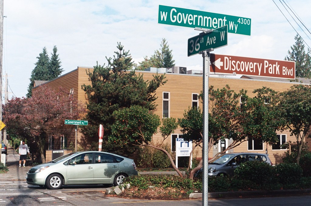
The street was initially known as Government Way only from 32nd Avenue W to the east gate of the fort at 36th Avenue W (now the main entrance to Discovery Park), but in 1961 the name was extended to cover 32nd Avenue W north to W Fort Street as well as W Fort Street east to Gilman Avenue W, so today its length is about ½ a mile in total.

Street sign at the corner of W Government Way, 36th Avenue W, and Discovery Park Boulevard, October 30, 2011. Photograph by Benjamin Lukoff. Copyright © 2011 Benjamin Lukoff. All rights reserved.

W Marginal Way SW

W Marginal Way SW, like its twin across the water, E Marginal Way S, began literally as a “marginal way” to “give railroads, street cars and other transportation facilities access to the Duwamish waterway.”

W Marginal Way SW begins at 26th Avenue SW at the Port of Seattle’s Terminal 5. From there, it’s 3 miles southeast to 2nd Avenue SW, by the south end of the 1st Avenue S Bridge. It resumes on the east side of the bridge as W Marginal Way S, an extension of Highland Park Way SW, and runs 4⅖ miles from there to the southern city limits. (For all but the first few blocks of this stretch, it is a limited-access highway carrying Washington State Route 99.) Beyond there it runs 3½ miles more to the vicinity of an interchange with Tukwila International Boulevard. The name is dropped at this point (and does not appear on signs south of the initial few blocks); the highway continues 1¾ miles as Washington State Route 599 to Interstate 5.

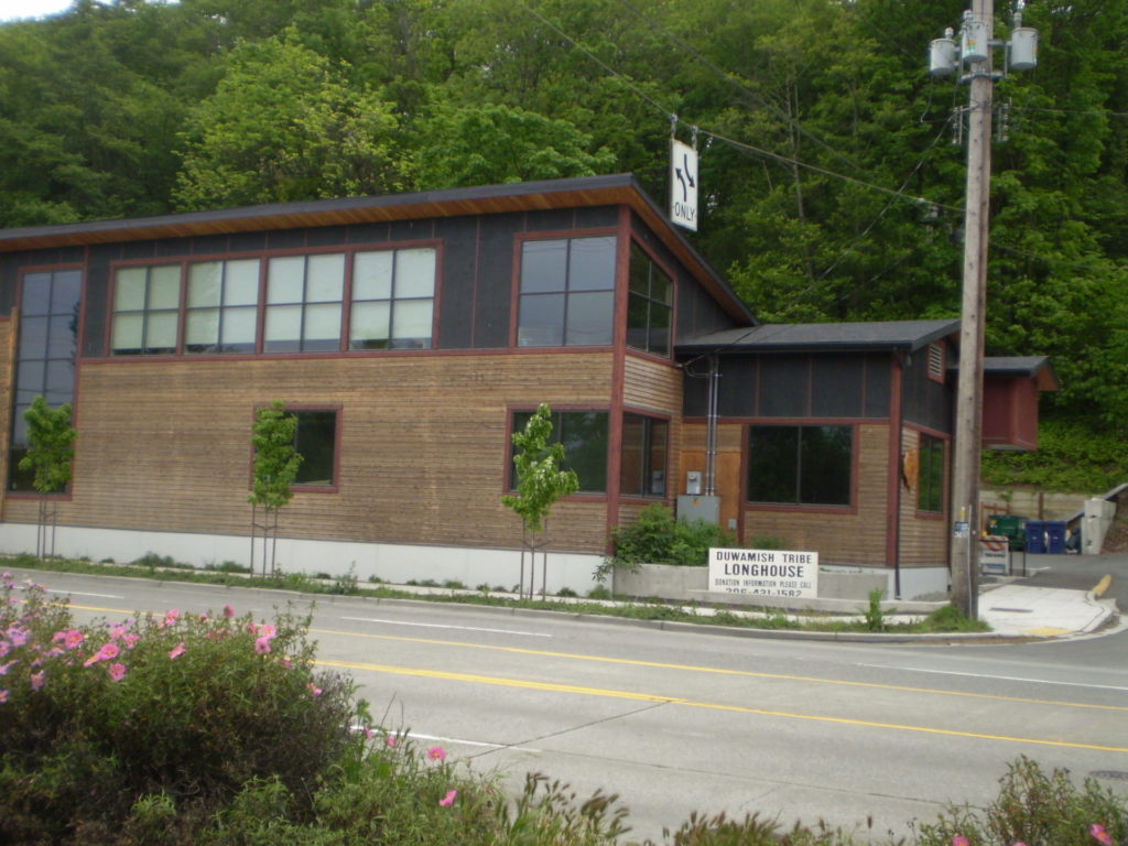
Duwamish Longhouse and Cultural Center, 4705 W Marginal Way SW, May 2010
Duwamish Longhouse and Cultural Center, 4705 W Marginal Way SW, May 2010. Photograph by Benjamin Lukoff, originally appearing in Seattle Then and Now.
Copyright © 2010 Benjamin Lukoff. All rights reserved.

W Marginal Way S is the location of the Duwamish Longhouse and Cultural Center, across the street from həʔapus Village Park and Shoreline Habitat (formerly Terminal 107 Park). həʔapus, or x̌əʔapus, was the name of a Duwamish village that was burned down by settlers in 1895. The new longhouse became the first one within city limits in 114 years. Notably, descendants of settlers Charles Terry and David Denny participated in fundraising and advocacy, without which the project would have been impossible, as the Duwamish were forced to purchase back the land. (A good article for more detail is “On the Duwamish River, a longhouse rises,” which appeared in Real Change in March 2009.)

E Marginal Way S

E Marginal Way S and its twin across the Duwamish Waterway, W Marginal Way SW, are good examples of purely descriptive Seattle street names. In fact, they are first mentioned in the press as adjective + noun, not name + type:

  • “Marginal ways are urged for both sides of Duwamish waterway.” Seattle Post-Intelligencer, October 27, 1911, in reference to the Bogue Plan
  • “Coincident with the completion of the Duwamish waterway and the wide marginal streets on each side, a publicly owned railway should be built along these marginal ways…” C.C. Closson, realtor and the Port of Seattle’s first paid employee, in a letter to the editor, Seattle P-I, July 8, 1912
  • “East and west marginal ways, planned by Bogue to parallel the waterway to give railroads, street cars and other transportation facilities access to the Duwamish waterway, will both pass through Oxbow.“ The Seattle Times, March 26, 1914
  • “Marginal ways parallel the new waterway for the whole distance, connecting with the main streets of the city running to the south.” Seattle P-I, August 13, 1914 

A longer excerpt, from an article in the April 19, 1914, issue of The Seattle Times, explains the reason for their creation:

Second only in importance to the waterway are the projected traffic streets, east and west marginal ways, laid out on both sides of the waterway about 1,000 feet back to give railways and street car lines the opportunity to parallel the waterway on both sides for its entire length, to give service to the industries locating along the waterway. As an allowance of $175,000 was made for East Marginal Way in the $3,000,000 county bond issue for roads, that street is now being condemned by the city and will be constructed 130 feet wide to the south city limits, where it will join a county road. West Marginal Way is also being promoted by interested property owners. As the existing railways are already but a short distance east of the Duwamish River, spurs can be thrown into East Marginal Way at slight expense. Also the port commission is considering a plan for port district terminal tracks on the Marginal Ways to serve the waterway.

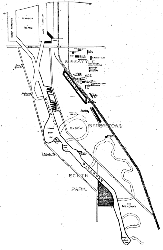
The Duwamish Waterway, whose construction began on October 14, 1913, was a straightening and deepening of the last 6 miles of the formerly meandering river. Construction of the waterway, with Harbor Island at its mouth (the largest artificial island in the world from 1909 to 1938), plus the filling of the Elliott Bay tidelands, are what give Seattle’s harbor its modern shape.

Plan of the Duwamish Waterway, Seattle Post-Intelligencer, August 31, 1913, page 44
Plan of the Duwamish Waterway, from the August 31, 1913, issue of the Seattle Post-Intelligencer, page 44

E Marginal Way S begins as an extension of Alaskan Way S — originally Railroad Avenue, which served much the same function for the central waterfront — at the Port of Seattle’s Terminal 30, and stretches 4⅖ miles from there to the southern city limits. (From the southern end of the Alaskan Freeway to the northern end of the 1st Avenue South Bridge, it carries Washington State Route 99.) Beyond there it runs 3½ miles more to S 133rd Street in Tukwila.

S Royal Brougham Way

This street begins at Colorado Avenue S in the west, at an onramp to the northbound lanes of the State Route 99 tunnel, and goes ⅔ of a mile east to Airport Way S. Originally S Connecticut Street, it was renamed in 1979 in honor of sportswriter Royal Brougham (1894–1978), who worked for the Seattle Post-Intelligencer newspaper from 1910 until his death. Such a name change was formally proposed by city councilman George Benson following a suggestion by P-I columnist Emmett Watson. Originally it was to be Occidental Avenue S whose name was to be changed, then the 2nd Avenue S Extension when objections were raised. Finally S Connecticut Street was settled upon; it was thought to be particularly appropriate because he “worked so hard to see the Kingdome built… and eventually spent his last day on earth there.”

Lumen Field, built on the former Kingdome site, is on the north side of Royal Brougham between 1st Avenue S and 4th Avenue S; and T-Mobile Park is on the south side between 1st Avenue S and 3rd Avenue S.

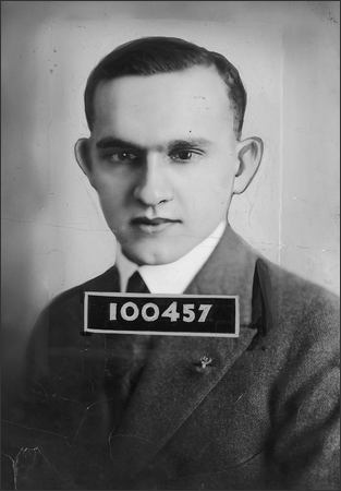
Royal Brougham's ID card for the Seattle Post-Intelligencer newspaper, 1925
Royal Brougham’s Seattle P-I staff ID card, 1925

Wellesley Way NE

Wellesley Way NE is another one of the “university” streets in the Hawthorne Hills subdivision, created in 1928. It was named for Wellesley College in Wellesley, Massachusetts, and runs around ⅕ of a mile from NE 65th Street in the north to NE 60th Street and Ann Arbor Avenue NE in the south.

Turner Way E

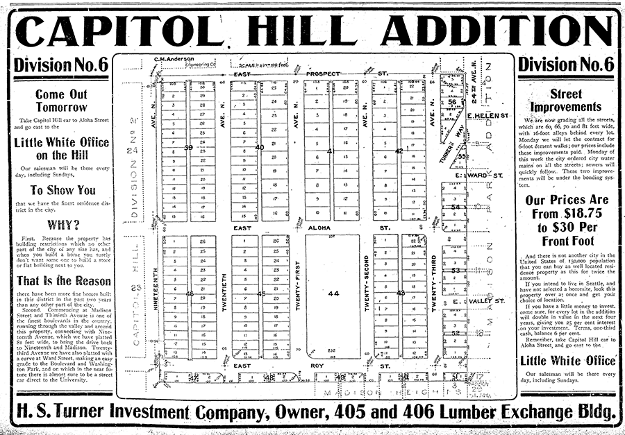
This 275-foot-long diagonal street connects 23rd Avenue E to 24th Avenue E between E Ward Street and E Helen Street, allowing the arterial that begins at Jefferson Park on Beacon Hill to have “an easy grade to the Boulevard and Washington Park,” as the advertisement below for the Capitol Hill Addition, Division No. 6 in the October 28, 1905, issue of The Seattle Times explains. (The prediction that “in the near future there is almost sure to be a street car direct to the University” along this route was an accurate one.”

Advertisement for Capitol Hill Addition Division No. 6 in October 28, 1905, issue of The Seattle Times

The plat was filed at the request of H.S. Turner on May 25, 1905. Herbert S. Turner (1866–1941) was also involved in developing parts of Montlake, the International District, and the University District.

This was a route I took often as a child, and my working theory then was that it was called Turner because, well, you turned onto it when going from 23rd to 24th, or vice versa. Now, 40 years later, I know better.

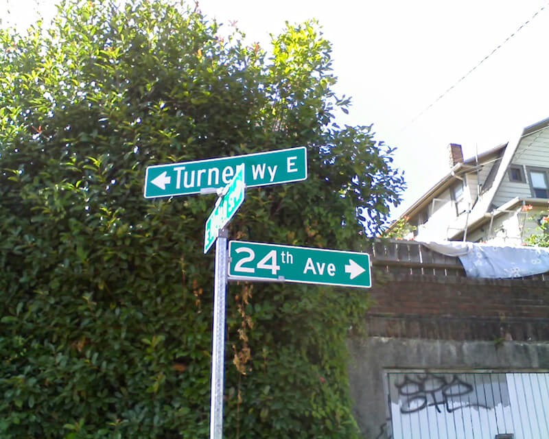
Street sign at corner of Turner Way E, E Helen Street, and 24th Avenue E, August 24, 2009
Street sign at corner of Turner Way E, E Helen Street, and 24th Avenue E, August 24, 2009. Note that 24th Avenue E is incorrectly labelled 24th Avenue. Photograph by Benjamin Lukoff. Copyright © 2009 Benjamin Lukoff. All rights reserved.

W Commodore Way

W Commodore Way, which runs 1⅓ miles along Salmon Bay from 21st Avenue W to 40th Avenue W, obviously has a nautical name, but is its backstory as simple as that, like NE Boat Street along Portage Bay? Or does it honor a particular person?

The only online mention I’ve seen of a possible specific referent of Commodore is in the Don Sherwood Parks History file for Commodore Park:

Who was particularly in mind when the street was named Commodore Way is not recorded. However, the choice of Commodore Peary’s flagship [the SS Roosevelt]… to participate in the dedication of the [Ballard] Locks is significant. Peary must have sailed from Seattle as the port nearest Alaska and the Arctic.

It’s a reasonable theory on its face, but there are some major flaws. The street was named in 1890 as part of Gilman’s Addition to the City of Seattle, when Peary was a lieutenant — 19 years before he reached the North Pole (supposedly) and 27 years before the Ballard Locks were dedicated. In addition, Peary’s port of departure was New York, not Seattle. It doesn’t seem possible Commodore Way was named for Robert E. Peary.

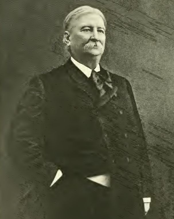
Rather, I think there’s good evidence it was named for James Dickinson Smith (1829–1909), commodore of the New York Yacht Club in 1882 and 1883 and president of the New York Stock Exchange in 1885 and 1886. In Men of Progress: Biographical Sketches and Portraits of Leaders in Business and Professional Life in and of the State of Connecticut (1898), they write that he “has a national and international reputation as a yachtsman, and is best known all over the world as Commodore James D. Smith.” But where is the connection to Seattle? And why Commodore Way instead of Smith Way?

James Dickinson Smith

I first became aware of Smith’s connection to Seattle when I came across this line in the March 30, 1890, issue of the Seattle Post-Intelligencer, while looking for a connection between Commodore and the Seattle, Lake Shore and Eastern Railway: “Mr. J.S. Dunham, treasurer of the Seattle, Lake Shore & Eastern, and Commodore Smith visited Snohomish yesterday.”

Portion of article mentioning Commodore Smith in March 30, 1890, issue of Seattle Post-Intelligencer
Item mentioning Commodore Smith in March 30, 1890, issue of Seattle Post-Intelligencer

Before I go too much farther, I should note that the landowners in the plat of Gilman’s Addition were listed as Dr. Henry A. Smith and Franklin M. Jones and his wife, Carrie B. Jones. Franklin was a member of the New York banking firm Jameson, Smith and Cotting, financiers of the business ventures of Daniel Hunt Gilman, including the Seattle, Lake Shore and Eastern Railway (SLS&E). Hence the search terms I’d been using at Washington Digital Newspapers

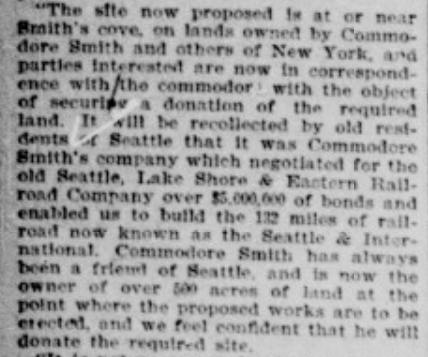
This article from the June 17, 1897, issue of the P-I also came up, further associating Commodore Smith (to distinguish him from Dr. Smith) with the SLS&E and with New York:

Portion of article mentioning Commodore Smith in June 17, 1897, issue of Seattle Post-Intelligencer

I then did some reading on Commodore Smith… but still wasn’t quite sure until I found this passage in Men of Mark in Connecticut: Ideals of American Life Told in Biographies and Autobiographies of Eminent Living Americans (1904): “Among his successful performances was the establishment, in 1865, of the banking firm of Jameson, Smith & Cotting, now the banking house of James D. Smith & Company.” So Commodore Smith was the Smith in Jameson, Smith and Cotting! If J.A. Jameson merited a street (W Jameson Street), surely so did Commodore Smith. And why Commodore Way instead of Smith Way? Because there was another Smith to be honored — Dr. Henry A. Smith (Smith Street, as well as Smith Cove).

It may not have been one of the great mysteries of the ages, but I do think I may have solved this one.

Olive Way

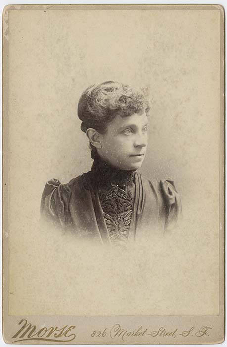
This street is named for Olive Julia Bell Stewart (1846–1921), daughter of William Nathaniel Bell and Sarah Ann Peter Bell. Belltown and Bell Street were named for her father, Virginia Street for her sister, and Stewart Street for her husband, Joseph. She was one of the younger members of the Denny Party, being five years old when they initially settled at Alki Point in 1851.

Olive Julia Bell Stewart, circa 1860
Olive Bell, circa 1860

Originally called Olive Street in the Plat of an Addition to the Town of Seattle, Washington Territory, Laid Off by the Heirs of Sarah A. Bell, Deceased in 1872, it begins at Stewart Street just east of 3rd Avenue and goes one mile northeast, then east, to Broadway E and E John Street.

On September 3, 1920, The Seattle Times reported that:

Extension of Olive Street, by the establishment of a diagonal thoroughfare to be known as Olive Way, running from the intersection of Olive Street in a northeasterly direction to Boylston Avenue North and East Denny Way, is provided in an ordinance completed yesterday afternoon by the city engineer’s office…. The purpose of the whole improvement is to afford an east and west arterial highway, leading from the business district into the residence section of the city, supplementary to Pike Street and Pine Street.

According to the Seattle Post-Intelligencer’s June 24, 1923, issue, it “formally opened to traffic yesterday… a public improvement for which a fight extending over a period of fifteen years was waged,” so this 1920 ordinance was certainly not the first time an improved connection between Downtown and Capitol Hill was proposed. I’m not entirely sure what happened in 1908 the writer might have been referring to, but perhaps it was the Bogue Plan and he was off by a few years?

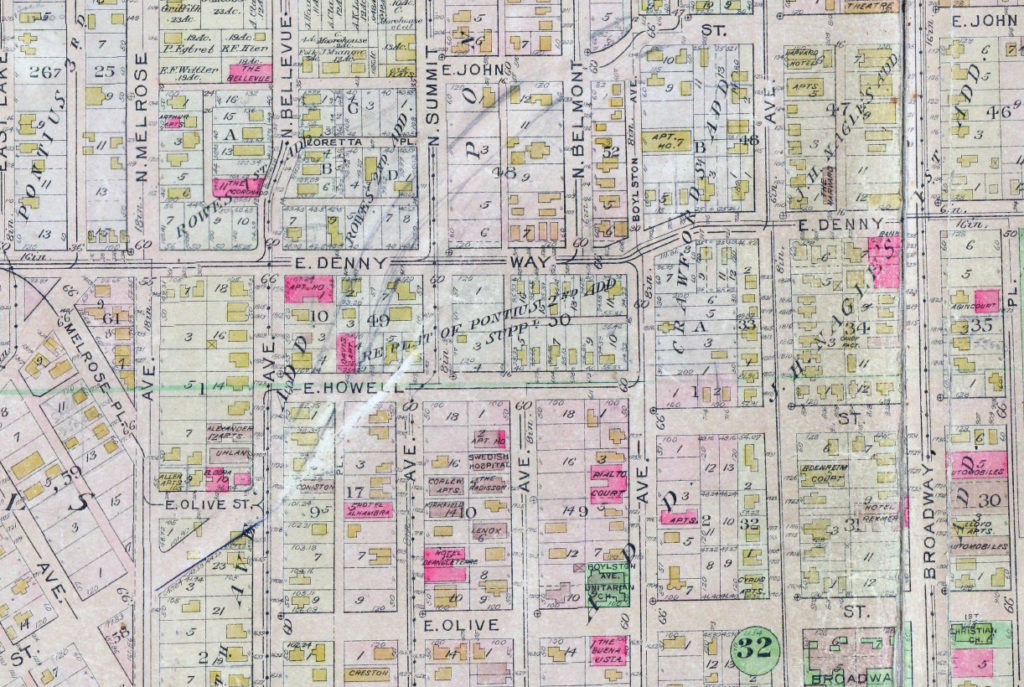
Route of Olive Way drawn on 1912 Baist Atlas plate of Capitol Hill
Portion of plate 7, Baist’s Real Estate Atlas of Seattle (1912), planned route of E Olive Way drawn in pencil. The portion of E Olive St between Melrose and Bellevue Avenues is now E Olive Place.

It appears from the 1921 ordinance establishing the extension that the Olive Way name was originally only applied to the street east of Bellevue Avenue; it wasn’t until 1926 that it was extended west to the street’s origin.

One curiosity about E Olive Way addresses: the block numbers are out of sync with other east–west streets in the area. For example, the block east of Melrose Avenue is the 300 block, east of Bellevue Avenue the 400 block, east of Summit 500, east of Belmont 600, east of Boylston 700, etc. — for other streets. For E Olive Way, east of Melrose is 1300, east of Bellevue 1400 and 1500, east of Summit and Belmont 1600, east of Boylston 1700, etc. — essentially continuing on from Downtown, not starting over at what is now the route of Interstate 5, as the other streets do. 

N Clogston Way

N Clogston Way, which runs a mere 200 feet east from Green Lake Way N to a dead end, between N 54th and N 55th Streets, was named after a Union veteran of the Civil War, as Valarie Bunn of Wedgwood in Seattle History notified me tonight.

John D. Clogston served “with the 9th Regiment, New Hampshire Infantry. On the 13th of December, 1862, Clogston was wounded in battle at Fredericksburg, Virginia, losing part of his right hand. His injury was so severe that he was discharged on February 6, 1863.” He and his bride, Lucinda, moved to Seattle in 1889, just a few months after the Great Seattle Fire; he died 20 years later at the age of 71.

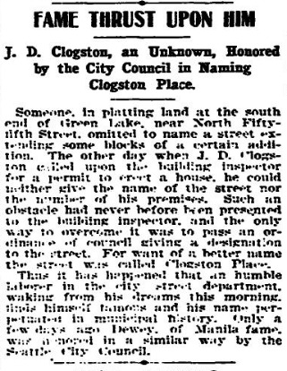
Seattle Times article, January 27, 1903, on naming of what was then Clogston Place, now Clogston Way

Bunn also pointed me in the direction of this Seattle Times article that appeared January 27, 1903, which explains how the street got its name:

Someone, in platting land at the south end of Green Lake, near North Fifty-fifth street, omitted to name a street extending some blocks of a certain addition. The other day when J.D. Clogston called upon the building inspector for a permit to erect a house, he could neither give the name of the street nor the number of his premises. Such an obstacle had never been presented to the building inspector, and the only way to overcome it was to pass an ordinance of council giving a designation to the street. For want of a better name the street was called Clogston Place. Thus it has happened that an humble laborer in the city street department, waking from his dreams this morning, finds himself famous and his name perpetuated in municipal history. Only a few days ago Dewey, of Manila fame, was honored in a similar way by the Seattle City Council.

Delridge Way SW

This street runs nearly four miles from Chelan Avenue SW, SW Spokane Street, and W Marginal Way SW in the north to 16th Avenue SW and SW Roxbury Street in the south — all the way from the Duwamish Waterway to the southern city limits. It was given its current name in 1940 — before then, it had carried the names of Youngstown Place, 21st Avenue SW, 22nd Avenue SW, McKinnon Place SW, 23rd Avenue SW, and 24th Avenue SW. As The Seattle Times explained on May 14, 1940, “Delridge” came from “the dells and ridges through which the thoroughfare runs,” and had been “suggested by West Seattle community organizations.”

Roosevelt Way NE

This street runs nearly 6 miles from the north end of the University Bridge in the south (at Eastlake Avenue NE and NE Campus Parkway) to Aurora Avenue N in the north, just shy of Seattle city limits at N 145th Street. It runs north–south for most of its length, but starting at NE 125th Street, its last 1½ miles cut a northwest–southeast diagonal across the street grid, making it Roosevelt Way N once it crosses 1st Avenue NE between N 133rd and N 135th Streets.

Originally 10th Avenue NE south of NE 125th Street, Roosevelt received its current name in 1933. According to local historian Feliks Banel, this was first proposed in 1927 by businesses in the Roosevelt district, itself having taken that name earlier in the decade in honor of President Theodore Roosevelt, who died in 1919. Nothing came of it for six years, but in 1933 they tried again and asked that 10th Avenue be renamed after both Theodore and Franklin Delano Roosevelt, who had been elected president the previous November. As Banel notes in his piece, The Seattle Times had this to say:

This change, we assume, must be pleasing to local Democrats of all sorts and shades. At the same time, due to the incidence of somewhat tenuous family ties, it cannot be at all displeasing to Republicans. The name of Roosevelt has high standing in both political parties, as indeed it has throughout the world. Even now it is quite certain that those who may traverse our Roosevelt Way in years to come will neither know nor particularly care whether it was named for Teddy or for Frank.

As for its diagonal stretch, it appears on old King County maps as M. Roy Sayles Road (County Road 2240), Golf Way, and State Highway 1J (predecessor of today’s SR 513). It ceased to be a state highway in 1991. As for when it, too, became Roosevelt Way, it’s difficult to tell as King County doesn’t have as good a system for looking up ordinances online as Seattle’s. It appears as Roosevelt Way on a 1966 map in local historian Rob Ketcherside’s maps album on Flickr, but as Golf Way in another one from 1947. As the area in question wasn’t annexed into Seattle until 1953, the name must have been changed by the county sometime between 1947 and 1953 in anticipation. (The 1933 Seattle ordinance is the only one on file relating to Roosevelt Way’s name, so this must have been a county change.)

As for M. Roy SaylesThe International Confectioner’s January 1915 issue reports that he, along with Annie B. Sayles, C.M. Sayles, and W.H. Rogers, founded the Rogers Candy Co. in Seattle in 1915; and Golf Way almost certainly comes from the road’s proximity to the public course at Jackson Park, which opened in 1928.

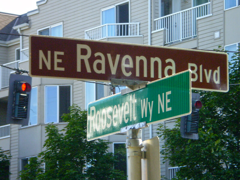
Sign at corner of NE Ravenna Boulevard and Roosevelt Way NE, July 4, 2009
Signs at corner of NE Ravenna Boulevard and Roosevelt Way NE, July 4, 2009. Photograph by Benjamin Lukoff. Copyright © 2009 Benjamin Lukoff. All rights reserved.